I am a noob and I have questions. Lots of em.

roadrunner

Bronze Member
Jan 28, 2012
1,230
520
Pinal Mountains,Arizona
Detector(s) used
Garrett Groundhog-2012-1st MD.
White's Goldmaster V/Sat-2nd-MD-2013
Tesoro Lobo-2015-3rd
Primary Interest:
Prospecting
That's what the 3 dudes from Utah had between the 3 of them.rest their souls. A gallon a day minimum is what ya need so a 3 day hike puts ya 25 lbs in the hole from the start.

I have no idea what shape they where in, or how much water they had.
If they got lost, no water, what. But, any inexperienced person in an unfamiliar terrain, better know what they are doing, and how to survive in an emergency.
They better have a map and compass, know something about orienteering, and how to triangulate just using a map and compass.
Better have one of those emergency drinking filters also.

Back to the map, a map with spring and Tank locations. Places that hold water, and even places in a dry wash where there is water 2-5 feet below the surface from sight.
I will post a photo tomorrow of my water ration I will call it for my day out in the sun, installing solar panels on a roof for 8 hours.
I do not know what anyone else can do, only what I can do and do it on a daily basis all year round.
I would suggest people practice and see what your limitations are before you go out wandering around the supes.
And take an orienteering course. Or get a book from the library and practice at home in your neck of the woods first.
 

sgtfda

Bronze Member
Feb 5, 2004
2,351
3,887
Mesa Arizona
There are water holes with plenty of water along the stone map trail. Looks good but nasty stinky stuff. Usually something fell in and drown. I carry a very good emergency filter but would not drink that stuff unless in a very bad way.
 

OP
OP
ConceptualizedNetherlandr
Apr 17, 2014
2,037
1,339
Tartarus Dorsa mountains
Primary Interest:
Other
1) If I were you, I would not be planning my hike off something I saw on GE. What you see on GE is likely at least two years old.

2) Why are you putting the cart way ahead of the horse? My suggestion is that for your first visit to the Supes, go on a few easy hikes, stay on the trails, and get a feel for what it's like out there.

That particular image is (date actually shown on it ) Feb 2013. I had already paged through the historical imagery and the site hasn't changed much. I am not sure what the issue is with 'old' images anyway. The topography doesn't move around much over there does it???

If I do go, I will be visiting particular locations, my only trail time will be to get to and from and between locations. Not planning a hike, getting to destinations.

How do you figure 'putting the cart way ahead of the horse?'???
 

deducer

Bronze Member
Jan 7, 2014
2,281
4,360
Primary Interest:
Other
That particular image is (date actually shown on it ) Feb 2013. I had already paged through the historical imagery and the site hasn't changed much. I am not sure what the issue is with 'old' images anyway. The topography doesn't move around much over there does it???

If I do go, I will be visiting particular locations, my only trail time will be to get to and from and between locations. Not planning a hike, getting to destinations.

How do you figure 'putting the cart way ahead of the horse?'???

"Likely" is the word I used.

The topography may not move so much, but it is very easily misinterpreted from GE, as you would know, if you read through some of the threads which compare pictures from GE to what is actually there.

Being hell-bent on getting to a destination is what gets people in trouble, IMO, especially when it involves going off the trail.

I think you'll get more reward by just hiking and seeing the mountains for what they are. There's much more to the Supes than trying to find mines.

IIRC, the Ajax mine is on private land.
 

Nov 8, 2004
14,582
11,942
Alamos,Sonora,Mexico
Primary Interest:
All Treasure Hunting
Geeze sgt, ya mean ya never drank out of a cow track ??

Sheesh once in the Bacatetes (Yaqui land ) we lost track of one of our team because he thought that he could second guess us. Since the only known water was over 20 kilometers away, a with a very, very rough toad, and he had been without water for 48 hrs, temp 45 C ( 110 -115 F )we gave up any idea of getting fresh water over there we settled for a small earthen dam which contained water for the wild stock..

After watching a big bull walk out to belly deep water, then slurping it in on one ennd and eliminationg it from the other, we decided to boil it. I boiled and did every other d--- thing that I could think of, but it still tasted and smelled like urine, but since it was all we had it had to do, we were trying to save a lost team member's life.

We never found our guy, he had been so scared that he had walked 45 kiometers on the other side of the Bacatetes and caught a ride into Guaymass, then back to Obregon by bus, where he collared his brother to load up a pick up with food and water.

When we returned to camp, disocuraged, tired, and a bit sad it was to find him smiling and with nice dinner ready, No, I didn't kill him, but a vague thought of that type did float across my mind.

Personally,, the longest that I have been without water on the trail was starting on the third day when we stumbled upon a nice small river. We were packing 65 pound packs.

Don Jose de La Mancha

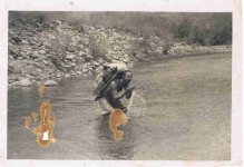
P.s. that is my partner.

.Third.jpg


Don Jose de La Mancha
 

Last edited:

roadrunner

Bronze Member
Jan 28, 2012
1,230
520
Pinal Mountains,Arizona
Detector(s) used
Garrett Groundhog-2012-1st MD.
White's Goldmaster V/Sat-2nd-MD-2013
Tesoro Lobo-2015-3rd
Primary Interest:
Prospecting
@ iamthehorse.
Look on topo ,maps,some are listed,then go to the link below.
Look through the site also.

Here is a list of all the tanks or water sources from the Superstition SAR.

Water Sources

Might look through the site also.
While you are there.
 

Springfield

Silver Member
Apr 19, 2003
2,850
1,383
New Mexico
Detector(s) used
BS
@ iamthehorse.
Look on topo ,maps,some are listed,then go to the link below.
Look through the site also.

Here is a list of all the tanks or water sources from the Superstition SAR.

Water Sources

Might look through the site also.
While you are there.

Great post - plot these sites on a topo and enter them in your GPS as waypoints.
 

OP
OP
ConceptualizedNetherlandr
Apr 17, 2014
2,037
1,339
Tartarus Dorsa mountains
Primary Interest:
Other
@ iamthehorse.
Look on topo ,maps,some are listed,then go to the link below.
Look through the site also.

Here is a list of all the tanks or water sources from the Superstition SAR.

Water Sources

Might look through the site also.
While you are there.

Now that is some good stuff :)

About Ajax, given what it says at minedat and the huge construction seen on GE, Seems like someone wasted a lot of money on developing nothing, or is there conflicting info that it actually produced to make that worth while? Also, it seems that place is accessible by 4 wheeler - see the peeps in the image. And it looks to be close to the forest boundary , but for some reason GE shows dual lines there - one on either side.
 

roadrunner

Bronze Member
Jan 28, 2012
1,230
520
Pinal Mountains,Arizona
Detector(s) used
Garrett Groundhog-2012-1st MD.
White's Goldmaster V/Sat-2nd-MD-2013
Tesoro Lobo-2015-3rd
Primary Interest:
Prospecting
From your mine (ajax).go exactly east,2.06 miles and what do you see next to a natural water tank.
Also on Ajax mine road.
That is where I went first.
 

roadrunner

Bronze Member
Jan 28, 2012
1,230
520
Pinal Mountains,Arizona
Detector(s) used
Garrett Groundhog-2012-1st MD.
White's Goldmaster V/Sat-2nd-MD-2013
Tesoro Lobo-2015-3rd
Primary Interest:
Prospecting
If it is,maybe that is why I went there first, but it is not the same spot as in post #50.
I am looking in that area.
 

OP
OP
ConceptualizedNetherlandr
Apr 17, 2014
2,037
1,339
Tartarus Dorsa mountains
Primary Interest:
Other
I just came across it in a notepad doc where I have been cutting and pasting things, but no reference, and I can't find it on google so far, perhaps the site it is on has the search crawlers blocked. Could have been this site for all I know.

Here it is, item 7 in the list of clues "7. The Dutchman and Wiser were seen coming out of the

mountains by way of the Whitlow Stage Road with six heavily

laden burros accompanied by two Mexicans on at least five

occasions."

Here is the entire list if it helps find the reference:

Was this an iffy source?

I just ran across this http://www.treasurenet.com/forums/l...-really-lost-dutchman-mine-3.html#post3948373 Post 95 in that thread, that is probably where I got it from. So the question is: where did you get if from road runner?
 

roadrunner

Bronze Member
Jan 28, 2012
1,230
520
Pinal Mountains,Arizona
Detector(s) used
Garrett Groundhog-2012-1st MD.
White's Goldmaster V/Sat-2nd-MD-2013
Tesoro Lobo-2015-3rd
Primary Interest:
Prospecting
I got all the clues from a post or 2 here in the forum.
Also from bits and pices of what people have said they saw in books.
I have no idea if any of it is true or not.
What I am going to do is read 2 more books, then take the clues. match ones up that are the same, or close.
Then go from there.
I might just quit this whole thing tomorrow, and go look for my own gold or something else.
I have no idea.
 

Top Member Reactions

Users who are viewing this thread

Top