I love Google Maps!

idowa

Full Member
Jan 21, 2012
165
74
Palouse, WA
Detector(s) used
Tesoro Lobo SuperTraq
Primary Interest:
Prospecting
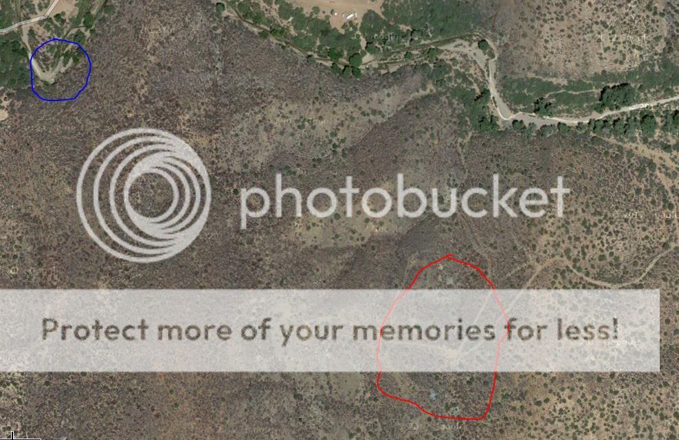
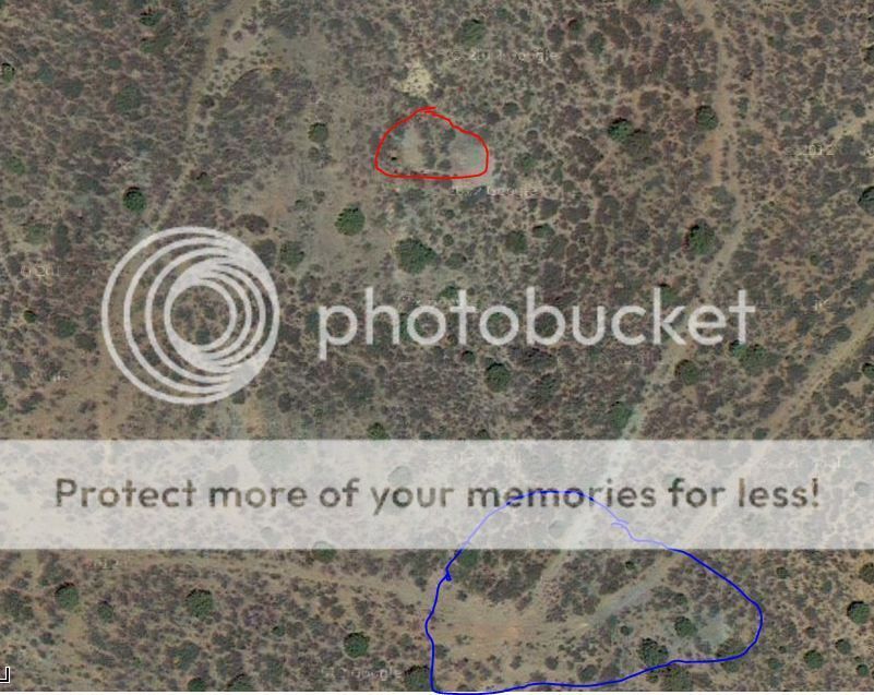
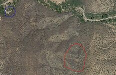
I was thinking about doing some more exploring of old mine sites and bring my metal detector to search around the miner's camp for artifacts. I decided to check out the mines I found last month on Google Maps to see if I use the satellite image to see any indication of where buildings might have been.

I found the mines, but couldn't see any indication of structures.

Then I realized I could check out the whole area for signs of mines... Unbelievable how many mines I found in the area by using the satellite imagery...:laughing7:

Just a half-mile from where I was panning in the Agua Fria there was a cluster of about a half-dozen mines up in the hills in a remote area with no roads nearby, which hopefully means not explored for a long time...

I'd love to find a cache, but would be happy to find a site that hasn't been molested...

On a side note, I'm on my brand new laptop with Windows 8 and I haven't figured out how to save a screen shot of the satellite image to share the image or print it out to take with me into the field...???
 

MT_Joe

Hero Member
Feb 22, 2013
747
309
Ferndale, Montana
Detector(s) used
Bounty Hunter Tracker IV
Primary Interest:
Other
Yes I agree, Google Maps is the best! I have at least 30 places I need to search after doing an overlay of an 1895 map on my area showing all the cabins existing there at the time (now on state land).

As for the Print Screen in Windows 8 I found this:

"In Windows 8, you can capture an image of the desktop by pressing the Windows and Print Screen keys at the same time. The screen briefly dims when you press the keys. The resulting image automatically lands in the computer’s Pictures folder, inside a subfolder there called Screenshots."
 

HutSiteDigger

Silver Member
Nov 26, 2012
2,849
1,283
Stafford,Virginia
Detector(s) used
Fisher 1266x and a shovel
Primary Interest:
All Treasure Hunting
I have had some A+ hunts all thanks too google maps I can tell yah that!
 

Tnmountains

Super Moderator
Staff member
Jan 27, 2009
18,717
11,709
South East Tennessee on Ga, Ala line
🥇 Banner finds
1
Detector(s) used
Tesoro Conquistador freq shift
Fisher F75
Garrett AT-Pro
Garet carrot
Neodymium magnets
5' Probe
Primary Interest:
All Treasure Hunting
Hutsitedigger is a map reading kinda guy. I studied topography and he taught me something the other day. Good luck with the mines I hope you find a lot as well.
 

LinkHylian

Sr. Member
Dec 21, 2012
393
107
WA State
Detector(s) used
Garrett AT Pro + ProPointer
Primary Interest:
Prospecting
It's not just Windows 8, that's been around for YEARS. PrtScn Button. Works on DOS, MAC, LINUX and Windows.
Yes I agree, Google Maps is the best! I have at least 30 places I need to search after doing an overlay of an 1895 map on my area showing all the cabins existing there at the time (now on state land).

As for the Print Screen in Windows 8 I found this:

"In Windows 8, you can capture an image of the desktop by pressing the Windows and Print Screen keys at the same time. The screen briefly dims when you press the keys. The resulting image automatically lands in the computer’s Pictures folder, inside a subfolder there called Screenshots."
 

OP
OP
idowa

idowa

Full Member
Jan 21, 2012
165
74
Palouse, WA
Detector(s) used
Tesoro Lobo SuperTraq
Primary Interest:
Prospecting
Thanks for the info! I couldn't find the print screen button on my laptop last night; I'll have to look closer when I get home tonight...
 

Kascus

Jr. Member
Dec 27, 2012
20
7
Pensacola, Fl.
Primary Interest:
All Treasure Hunting
Look for a program that should already be installed in Windows 8 called Snipping Tool. It will let you draw a square around anything on your screen and then save or email it.
Here is a video of how to find it and pin it to the desktop for easier use later. It also shows you how it works.


OP
OP
idowa

idowa

Full Member
Jan 21, 2012
165
74
Palouse, WA
Detector(s) used
Tesoro Lobo SuperTraq
Primary Interest:
Prospecting
Thanks for the help! I think I figured it out...

This is a shot of the area I want to explore. The blue circled area is where I sluiced in the Agua Fria and the red circled area is a cluster of mine activity nearby that I'd like to check out...

meyermine2_zpsa8ad487f.jpg


This is the area of interest magnified.

The red area is a fairly large mine that appears to be a vertical shaft mine. There are indications of other possible mines in the immediate area or perhaps just other areas near the mine that were used for processing.

The blue circled area looks to me like a main area where perhaps the ore was loaded onto wagons and taken to the smelter in Mayer, AZ about 5 miles away...

meyermine1_zps410018ca.jpg
 

Attachments

  • meyermine2.JPG
    meyermine2.JPG
    161 KB · Views: 106

Top Member Reactions

Users who are viewing this thread

Latest Discussions

Top