Latitude and Longitude in Google Earth

AzViper

Bronze Member
Sep 30, 2012
2,038
2,250
Arizona - Is there any other state worth visiting
Detector(s) used
Fisher Gold Bug Pro, Nokta FORS Gold, Garrett ATX, Sun Ray Gold Pro Headphones, Royal Pick, Etc.
Primary Interest:
Prospecting
Anybody know what format Google is using on Google Earth in regards to the Latitude and Longitude? Google Earth will convert decimal coordinates and put you correctly on earth in the correct spot but the coordinates at the bottom of the page what format are they. The do not match up with my Garmin XL12. Maybe the XL being really old but very accurate with its 12 channels is nolonger up to par.
 

Last edited:
Upvote 0

kazcoro

Hero Member
Feb 11, 2013
876
357
Glendale
Detector(s) used
Gold Bug Pro, Gold Buddy drywasher, Black Magic, Pro Gold recirc, Custom highbanker/2.5" dredge, Roadrunner Member
Primary Interest:
Prospecting
You know how I first remembered which is which? Of course you don't. I imagined the earth being alittle "longer" north to south. Helps to this day.
 

OP
OP
AzViper

AzViper

Bronze Member
Sep 30, 2012
2,038
2,250
Arizona - Is there any other state worth visiting
Detector(s) used
Fisher Gold Bug Pro, Nokta FORS Gold, Garrett ATX, Sun Ray Gold Pro Headphones, Royal Pick, Etc.
Primary Interest:
Prospecting
Our local club has maps of all the clubs claims but they are all in decimal coordinates. I would like to convert these decimals coordinates to something I can use in the field.
 

Rutnbuck

Full Member
Jun 26, 2005
110
18
No. Utah
Detector(s) used
whites xlt, Goldbug2,
You should be able to change your gps datum. There are 100's of different datems. Some are very similar but might be off by quite a distance on google I forget which one google uses. However there are several sites that will convert your lat/lon location to different format. Just google lat/lon conversions. then worse case you can punch in your degrees or Township location and convert them to the format you need. Not sure but maybe wgs84, nad27, or nad83 just a guess.
 

kazcoro

Hero Member
Feb 11, 2013
876
357
Glendale
Detector(s) used
Gold Bug Pro, Gold Buddy drywasher, Black Magic, Pro Gold recirc, Custom highbanker/2.5" dredge, Roadrunner Member
Primary Interest:
Prospecting
Do you have a handheld GPS? I have a Rhino. Made by Garmin. Admittedly, I never use it, as I have hunted all over the state, and have a really good sense of direction. We have mostly desert here anyways, so no forests to get lost in. Anyways, you can put in the cords as waypoints. Label them, SW,NW corners? The Rhino is pretty cool, in that it is a GRMS radio, too. Two way walkie talkie.
 

Rutnbuck

Full Member
Jun 26, 2005
110
18
No. Utah
Detector(s) used
whites xlt, Goldbug2,
I do have several The bad thing about google is unless you pay to upgrade you are unable to download the kmz waypoints to your gps and vice verca unless you upgrade google to the pay version. Once you start using you gps you will enjoy it. The thing about a gps I can find a spot 10 years from now or in the dark. Your truck/camp is parked over a hill it gets dark or stom rolls in the gps will take you back and you won't come out on the road 100-200 yds away. Thing about a gps if your dumb enough to get lost your probably not smart enough to run it LOL joking. But do this get proficiant practice practice. So you know what it is doing. Then use a secondary like a map. Giving time a monkey could run a GPS.... Just give him a banana.
 

Rutnbuck

Full Member
Jun 26, 2005
110
18
No. Utah
Detector(s) used
whites xlt, Goldbug2,
One thing I like. I have both magellan and garmin map topo soft ware. I am able to study the map at home to a place I plan on going say like mine sites hunting or points of intrest. I place a waypoint on the say trail head or mine site. Then I download it to my gps and when I get to the area I am going I might know where all the mines, springs, trailheads, camps are. My gps knows the distance, elevation, direction, speed, and the way to camp or what ever I choose. I save all my prospecting sites to the gps then when I get home I down load them to my map software and years later I can go back. Best of luck
 

PYRATE

Full Member
Jun 24, 2012
239
98
Cackalacky
Detector(s) used
arrr, just need me nose
Primary Interest:
Prospecting
I can't access google earth right now so I don't know the format they use, but....

You can convert decimal coords to degree minute (DM) or degree minute second (DMS) by doing the following: (will use 12.3456789 as an example)

12 is the degrees, remove this and used the multiply the remainder (0.3456789) by 60 for the minutes
60 x 0.3456789 = 20.740734 minutes
To get seconds, remove the 20 and multiply the remainder by 60
60 x 0.740734 = 44.44404 seconds

DM coords are 12 20.740734
DMS coords are 12 20 44.44404

To convert DMS to decimal, divide the seconds by 60 then add the minutes and divide again by 60 and then add the degrees
Seconds: 44.44404 / 60 = 0.740734
+ Minutes = 20.740734 / 60 = 0.3456789
+ Degrees = 12.3456789

If you've got a lot to convert, you can set up an excel spreadsheet to rapidly make these calculations
 

OP
OP
AzViper

AzViper

Bronze Member
Sep 30, 2012
2,038
2,250
Arizona - Is there any other state worth visiting
Detector(s) used
Fisher Gold Bug Pro, Nokta FORS Gold, Garrett ATX, Sun Ray Gold Pro Headphones, Royal Pick, Etc.
Primary Interest:
Prospecting
You should be able to change your gps datum. There are 100's of different datems. Some are very similar but might be off by quite a distance on google I forget which one google uses. However there are several sites that will convert your lat/lon location to different format. Just google lat/lon conversions. then worse case you can punch in your degrees or Township location and convert them to the format you need. Not sure but maybe wgs84, nad27, or nad83 just a guess.

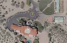
Rutnbuck, thank you, you got my head thinking that made me pull out the manual of my GPS. Made some changes in settings on my GPS and bingo bango the GPS is displaying in decimals. Decided to use the decimal settings as the local club has all threir maps coords in decimals. I stepped outside and got the coordinates and then went inside and entered the coordinates in Google Earth and the result are below. Has the accuracy of GPS gotten better with newer units and the US allowing for better accuracy?


readings.jpg

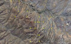
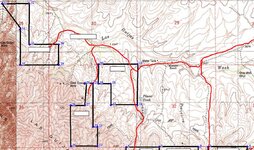
Claims that I can plot in Google Earth. This is just 3 of the claims of 7 in the area.

threeclaims.jpg

claims3.jpg
 

Last edited:

Top Member Reactions

Users who are viewing this thread

Top