Looking for help/pointers/advice

Just_curious

Sr. Member
Aug 27, 2017
332
273
Georgia/Alabama
Detector(s) used
Minelab GM1000
White's GMZ
White's Spectrum XLT
Primary Interest:
All Treasure Hunting
Hey everybody. I just got back from my third or fourth try at my buddies property in search of gold. I have the coordinates to all mines within the area (13 total I think). They all run NE to SW in a generally straight line, and the line cuts right through his property. All of these mines were vein/underground mines which leads me to believe that he is potentially sitting on a vein. I took some screen shots of the plotted mines, stuff I pulled out of the ground today (the bag is just one shovel full!), the creek, and topo view of the general area (blocked out names to protect his plot). The kicker? I haven't found any gold. To be fair, I have just swung a nugget detector for the most part every time I've gone. But today I pulled out quartz, magnetite, hematite, and garnets from the same hole. There's bedrock cutting through the small creek, and what I believe to be old prospect holes. I'm hoping somebody can look at these photos and confirm that I'm not crazy for thinking that there's a vein somewhere near by. There's large red/black stained quartz, pyrite, and all the other tell tale signs that tells me this is a promising area...i just can't find it! Thanks in advance for the help.

(Blue pins are mines, red star is his property) Screenshot_20171217-223748.jpg

(Red star is his property and the creek that runs through it)

Screenshot_20171217-223651.jpg

The creek

20171217_135118.jpg
20171217_135123.jpg

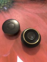
And lastly, the 1 shovel full of minerals (sorry for the crappy pics. Darn artificial lighting)
20171217_220309.jpg 20171217_220340.jpg
 

Terry Soloman

Gold Member
May 28, 2010
19,425
30,113
White Plains, New York
🥇 Banner finds
1
🏆 Honorable Mentions:
1
Detector(s) used
Nokta Makro Legend// Pulsedive// Minelab GPZ 7000// Vanquish 540// Minelab Pro Find 35// Dune Kraken Sandscoop// Grave Digger Tools Tombstone shovel & Sidekick digger// Bunk's Hermit Pick
Primary Interest:
Metal Detecting
Gold is where you find it. A vein "could" be there, or not. Sample, Sample, Sample. :skullflag:
 

OP
OP
J

Just_curious

Sr. Member
Aug 27, 2017
332
273
Georgia/Alabama
Detector(s) used
Minelab GM1000
White's GMZ
White's Spectrum XLT
Primary Interest:
All Treasure Hunting
So in the spring, we want to try to tear the land up a bit and explore possibilities. In the mean time, I'm trying to gather data/research. If there are any legitimate prospectors, metallurgists, geologists, hard rock miners in georgoa that do this full time, and would like to contribute, I can talk to my buddy and let him know the deal. The land is his, the history is good, and the area around the immediate area is a past producer. Any credentialed person/person's that think they might be able to hone in and also keep things cost effective, I'm sure it wouldn't be an issue. When I told him I wanted to prospect his land, he didn't even know people did that any more. He attempted to call his neighbor to see if I could get on his creek, the neighbor said "sorry, I can't. I've literally turned away hundreds of people". After his neighbor said that, my buddy realized maybe I wasn't so crazy and is all about it!
 

rockbar

Full Member
Oct 19, 2015
110
175
AZ
Primary Interest:
Prospecting
Tearing up the land isn't the language I would use for prospecting. Easiest place to start is find some color by placering.
Looks like enough water flow to put in a little dam and throw in a suction dredge (probably not power jet type) at the furthest downstream spot on the property. Try to dredge several cubic yards worth of gravels and clean as much bedrock as possible. If you find color, you could then try the same thing further and further up the drainage. See if the color gets better or worse. Based on the quantity and type of gold particles, you may be able to determine whether you are getting closer to a nearby source. Perhaps there isn't one and you just end up with some placer gold. That's fun, too.
The old timers would follow colors from the creeks up the hills to prospect for the lodes. You could try the same method. There are other more sophisticated prospecting methods you can try, but there's nothing wrong with starting with the simplest.
 

ToastedWheatie

Hero Member
Jun 30, 2013
532
759
Hudson Valley, NY
🥇 Banner finds
1
Detector(s) used
800
Infinium
Whites M6
Primary Interest:
Relic Hunting
I have zero experience in your issue, but do have a thought.
Your wuestions involved the possibility of a vein between two mines.
If those two mines followed the vein under his property, it's gone.
 

OP
OP
J

Just_curious

Sr. Member
Aug 27, 2017
332
273
Georgia/Alabama
Detector(s) used
Minelab GM1000
White's GMZ
White's Spectrum XLT
Primary Interest:
All Treasure Hunting
I like the idea of the dredge. Especially given its location. His house sits on top of a large hill neighboring the water. What's weird is, in between his house and the waterway is an old road (this is pretty obvious), a couple of old prospect holes, and then a very steep drop to the creek. Honestly, I don't even think the creek is natural. The whole thing looks like an old cut. When you consider all the mines around it. It's not too hard to believe. The Spanish, Indians, old timers, and who knows how many ancient others did a pretty good job turning these areas upside down chasing what they were looking for.
 

SaltwaterServr

Sr. Member
Mar 20, 2015
471
642
Texas
Primary Interest:
Other
I like the idea of the dredge. Especially given its location. His house sits on top of a large hill neighboring the water. What's weird is, in between his house and the waterway is an old road (this is pretty obvious), a couple of old prospect holes, and then a very steep drop to the creek. Honestly, I don't even think the creek is natural. The whole thing looks like an old cut. When you consider all the mines around it. It's not too hard to believe. The Spanish, Indians, old timers, and who knows how many ancient others did a pretty good job turning these areas upside down chasing what they were looking for.

The photos of the creek with the leaf litter doesn't give me anything to work with.

Best bet, find out what the strike and dip of each of those mines were by researching all you can on them. See if there was a trend they followed.

If you can't find an outcrop, your only other choice is to drill. A Winkie drill can be had fairly inexpensively, figure on about $20,000. If you know the strike and dip, you can put together a rudimentary drilling plan. If there's a trend there, you can refine it further. You might spend a few months or a few years boring holes before you hit a vein. If you're lucky, you're set for life. Being on private property will save you a **** ton of headaches.
 

Buckshotnc

Sr. Member
Nov 5, 2012
382
402
Western North Carolina
Detector(s) used
Fisher GBII
Primary Interest:
Prospecting
Didn't see where you actually talked about panning, just metal detecting. First pan along creek and find some color before bringing in a dredge. From the size of stream it would certainly have to be a very small dredge at that.
 

Clay Diggins

Silver Member
Nov 14, 2010
4,901
14,290
The Great Southwest
Primary Interest:
Prospecting
First question. Were those mines originally gold mines? Most mines are not gold mines. You might be prospecting a mica or lead district.

Second question. IF those were gold mines was the ore free milling?

If the answer to either of those questions is no you are unlikely to find gold in that area.
First things first. Do the research before you dig. You are much more likely to be successful in your prospecting. :thumbsup:

Neither the Spanish nor the Indians mined in your area. Limit your historical research to the actual mining period in your region and you will get better quality information more quickly.

Heavy Pans
 

Last edited:
OP
OP
J

Just_curious

Sr. Member
Aug 27, 2017
332
273
Georgia/Alabama
Detector(s) used
Minelab GM1000
White's GMZ
White's Spectrum XLT
Primary Interest:
All Treasure Hunting
First question. Were those mines originally gold mines? Most mines are not gold mines. You might be prospecting a mica or lead district.

Second question. IF those were gold mines was the ore free milling?

If the answer to either of those questions is no you are unlikely to find gold in that area.
First things first. Do the research before you dig. You are much more likely to be successful in your prospecting. [emoji106]

Neither the Spanish nor the Indians mined in your area. Limit your historical research to the actual mining period in your region and you will get better quality information more quickly.

Heavy Pans
They were absolutely gold mines. One of them has produced a whole lot of gold and it's probably less than 3 miles away. Also, I have to debate the comment about no Spanish or Indians mind in the area. I would say that they absolutely did. When I get home I'll post the data about the mines that are in the very near vicinity
 

OP
OP
J

Just_curious

Sr. Member
Aug 27, 2017
332
273
Georgia/Alabama
Detector(s) used
Minelab GM1000
White's GMZ
White's Spectrum XLT
Primary Interest:
All Treasure Hunting
Okay. From my buddies house, 2.5 miles away, at a 50 degree azimuth, is the northern-most immediate-area gold mine. It's primary commodity was gold (also contained cobalt, copper as tertiary, and then Chalcopyrite and Pyrite Ores, along with Muscovite, calcite and Quartz Gangues), It was/is a
Low-sulfide Au-quartz vein, Host: Metamorphic Gneiss. The structure description: Mica Schist And Amphibole Gneiss, Chlorite Schist And Banded Iron Formation, Univeter Fm. General Form: Tabular. Strike: N-50, E-80. Dip: 40-50 SE. Width: 1M, Length: 37M. Comments on the Geologic Formation: Two Zones With the Ranging From 15 To 27 M Long and Averaging?1m Thick.
TWO LODES, PARALLEL TO FOLIATION (N 50-80E, DIP 40-50 SE); LODES PITCH TOuTHE NORTHEAST. TWO LODES, PARALLEL TO FOLIATION(N. 50-80 DEG. E., DIP 40-50 DEG. SE.). Deposit size: Medium. Years of operation: <1841-1909. Past Producer.

The next mine just south west of that, still in line with my buddies property at a distance of 1.5 miles, is another mine on the same azimuth. Again, it's primary commodity was gold. Same data as above.

South of that Mine, was a prospect. .5 miles away from my buddies house, at a 45 degree azimuth. My assumption is it was Placer Gold from the 2 northern Veins.

2 more mines south of my buddies. One at 1.8 miles away at 245 degree azimuth, and the other 1.75 miles away at a 230 degree azimuth.

Except for the 1 prospect listed above, all primary commodities were gold, all low-sulfide AU Quartz vein, medium deposit size, and all surface/underground.

I hope this helps a little bit. From what I gather out of all of this, is he is sitting right smack-dab in the middle of a perfect line of 4 medium sized veins.
 

StreamlineGold

Sr. Member
Apr 21, 2013
330
205
Primary Interest:
All Treasure Hunting
Lode gold is very different from placer. While you might very well be in a gold bearing area that does not mean you can find it by panning..while many times you can find macroscopic (visible) free gold near a lode.. not finding it by panning means it may be be 1. Locked in sulfides aka gold trapped in pyrites, galena etc.. or 2. Might be microscopic

Neither of which are bad things..I have ore sitting in my garage running ounces per ton that you will never see with the naked eye..

It means you need to understand the area better, and what the character of the ore, and keep looking! Look for heavily mineralized quartz. Hematite and Limonite are good leads and can both be gold bearing but microscopic.
 

Last edited:

StreamlineGold

Sr. Member
Apr 21, 2013
330
205
Primary Interest:
All Treasure Hunting
Look for outcrops of iron or quartz thats heavily stained.. they can be very inconspicuous and blend in easily.. you can soil test from near them by panning but a fire assay of ore is the best bet to look for at least the presence of gold.
 

StreamlineGold

Sr. Member
Apr 21, 2013
330
205
Primary Interest:
All Treasure Hunting
Another great tool is google earth..you can usually see a contact zone near mine sites i/e reddish iron stained bands..if you have 2 mines they could be along a trend. Look for similar soil..etc
 

Top Member Reactions

Users who are viewing this thread

Top