- Oct 26, 2004
- 24,212
- 23,128
- 🏆 Honorable Mentions:
- 2
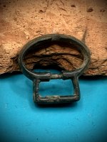
- Detector(s) used
- Minelab Explorer
- Primary Interest:
- Shipwrecks
The smaller coin on the left appears to be the reverse side of a Castillian dinero, billon coin minted during the reign of Alfonso X of Castile (1252-1284). The coin has no mint sign.The reverse we see shows the coat of arms of the Crown of Castile and Leon. If the obverse were shown, you would see a six line legend “ALF / ONSVS / REXCAS / TELLEE / TLEGIO / NIS", which in Latin means "Alfonso king of Castile and Leon". This coin is called "six-line dinero" because the legend is spread over six lines.
Don...
PS: I see nothing that would suggest they are fakes, but I am no expert.
Don...
PS: I see nothing that would suggest they are fakes, but I am no expert.


 I just had two minor surgeries yesterday, and am taking meds, so hope for the best.
 There are many diehards who believe that it actually stands or represents the Gila River...lol...Then again gila could mean any darned thing...Then again there are those who believe Apache represents an Indian and Sonora is well...Sonora...
")