New Bathymetry for 1715 contractors coming 01/2008

signumops

Hero Member
Feb 28, 2007
756
226
U.S.
Detector(s) used
Garrett, Minelab, Aqua-Pulse
Primary Interest:
All Treasure Hunting
Heads up Tom:
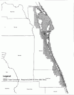
In January of 2008, Florida and the Fed are going to fly LIDAR of the east coast of Florida, and produce maps with 2 foot elevations UNDERWATER, near shore and inland a few miles.

LIDAR is a form of radar sensing, and the data is going to be served several ways, including typical depth outlines. This is being done mostly for hurricane preparation and floodplane adjustment, but, salvors on the nearshore wrecks might see some new blurbs and piles that they did not see before. Who knows, but, the new elevations will certainly be superior to what we have now, especially near the shorebreak. I only have info on Brevard and Indian River County(s), but I believe the whole east coast is being done.
 

Attachments

  • Brevard5000FtLidarTiles.gif
    Brevard5000FtLidarTiles.gif
    61.5 KB · Views: 371

pcolaboy

Hero Member
Sep 5, 2006
916
14
Pensacola, Fl
Detector(s) used
Minelab Explorer XS
Very interesting indeed. Did you get the schedule from NOAA? I'm just curious because I'd like to find out if any LIDAR tiles will be imaged over my part of the Gulf.

Thanks,

Pcola

"Extra territorium jus dicenti impune non paretur"
 

G.I.B.

Gold Member
Feb 23, 2007
7,187
8,537
North Central Florida
🏆 Honorable Mentions:
1
Detector(s) used
CTX 3030 / GTI 2500 / Infinium LS / Tesoro Sand Shark / 1 Garrett Pro-pointer / 1 Carrot / Vibra Probe 580 (out on loan) / Lesche M85 / Mark1 MOD1 EyeBall
Primary Interest:
Other
Pcola,

Here is a link to my area. The LiDAR data sets are generally 5 meter resolution for Bathymetry. The site should help answer some questions. You will see a Mobile Bay tab on the left. There are some datasets of Perdido bay, from 2003 or so. I think that was shot at +5 meters as well. The more accurate datasets are very expensive and not widely available.

http://gulfsci.usgs.gov/tampabay/data/1_lidar/index.html

The datasets along the east coast (original post above) appear to be primarily land (ALTM) swaths.

Bathymetry LiDAR can give you a resolution in the 1-2 cm range, but it's costly and I've not seen any publicly available. You could see cannons easily in that range, assuming the depth is not to great. But, that would take all the sport out of it...
 

ivan salis

Gold Member
Feb 5, 2007
16,794
3,809
callahan,fl
🏆 Honorable Mentions:
1
Detector(s) used
delta 4000 / ace 250 - used BH and many others too
pro's do it for the money not "sport" --- as W.C. said "never give a "sucker" a even break" pro's use every trick in the book and even some that ain't to find wrecks --- Ivan
 

pcolaboy

Hero Member
Sep 5, 2006
916
14
Pensacola, Fl
Detector(s) used
Minelab Explorer XS
Thanks for the reply. I've already seen the images from 2001-2003 but we've had 3 major hurricanes in our area since then that obviously reshaped much of our coastline and shoals. I was mainly wondering if anyone was aware of how to know if and when new data sets were scheduled to be created and publicly released for a given area.

Thanks,

Pcola

GuyInBack said:
Pcola,

Here is a link to my area. The LiDAR data sets are generally 5 meter resolution for Bathymetry. The site should help answer some questions. You will see a Mobile Bay tab on the left. There are some datasets of Perdido bay, from 2003 or so. I think that was shot at +5 meters as well. The more accurate datasets are very expensive and not widely available.

http://gulfsci.usgs.gov/tampabay/data/1_lidar/index.html

The datasets along the east coast (original post above) appear to be primarily land (ALTM) swaths.

Bathymetry LiDAR can give you a resolution in the 1-2 cm range, but it's costly and I've not seen any publicly available. You could see cannons easily in that range, assuming the depth is not to great. But, that would take all the sport out of it...
 

OP
OP
signumops

signumops

Hero Member
Feb 28, 2007
756
226
U.S.
Detector(s) used
Garrett, Minelab, Aqua-Pulse
Primary Interest:
All Treasure Hunting
pcolaboy:
This data is going to be provided by Florida, not the USGS. The flight plan now is Hillsborough through Charlotte County(s) on the West coast of Florida, and then Duval through Indian River on the East coast of Florida.

Some notes on the specs...

"Introduction
A coalition of GIS practitioners, including the Florida Division of Emergency Management,
Florida Water Management Districts, Florida Fish and Wildlife Conservation Commission,
Florida Department of Environmental Protection, Army Corp of Engineers Jacksonville District,
and other state and federal agencies, have come together to develop baseline specifications for
orthophotography and LiDAR data collection for publicly funded projects within Florida.
Interest in acquiring orthophotography and LiDAR has risen significantly as beneficiaries of the
data learn about the many uses of remote-sensing technologies. These uses range from floodplain
mapping to homeland security planning. As interest in remote sensing technologies has grown so
has the understanding of the need to coordinate data collection. Growth management, map
modernization/floodplain mapping, natural lands stewardship, and disaster preparedness are
statewide issues with statewide impacts.


4.6 Coordinate System and Projection
Terrestrial LiDAR data shall be projected to the appropriate Florida State Plane Coordinate
System Zone, Units in US Survey Feet. A second set of deliverables may be delivered in a
Geographic Coordinate System.


• Data shall be acquired during aerial flights at times that minimize heavy sea states
and water turbidities.

• LiDAR data should be free of any condition which may obscure terrestrial features or
sea-bottom feature detection to a water depth of 50 meters (or laser extinction),
including, but not limited to clouds, sun glint, haze, smoke, smog, rain, heavy seas,
suspended sediment, etc."

Not to worry about State Plane. Easily converted to Geographic coordinates for your GPS...

You want more info about the tiles, ect. ??...

"2 Project Area
Project areas are to be made up of a collection of 5000-ft-by-5000-ft cells that serve as the tiling
scheme for LiDAR and bathymetric data deliverables. Please visit
http://floridadisaster.org/gis/specifications to download shapefiles for this grid."

The data is being paid for by tax payers, and will be public information by Statute 119 standards.

They are going to use IHO standard 2 models for submerged elevations in most places, which translates to about .5 meter, or 1.6 feet with horozontal accuracy of about 15 feet (it will be higher near shore. The land elevations are going to be about 1 foot, or extremely detailed.
 

G.I.B.

Gold Member
Feb 23, 2007
7,187
8,537
North Central Florida
🏆 Honorable Mentions:
1
Detector(s) used
CTX 3030 / GTI 2500 / Infinium LS / Tesoro Sand Shark / 1 Garrett Pro-pointer / 1 Carrot / Vibra Probe 580 (out on loan) / Lesche M85 / Mark1 MOD1 EyeBall
Primary Interest:
Other

mad4wrecks

Bronze Member
Dec 20, 2004
2,263
107
Detector(s) used
Aquapulse, DetectorPro Headhunter, Fisher F75
Primary Interest:
Shipwrecks
Terry: thanks for keeping me updated on this. Hopefully we won't all be rushing out to the same spots. ;)
 

Top Member Reactions

Users who are viewing this thread

Top