Oregon Stage Line maps

eyemustdigtreasure

Silver Member
Mar 2, 2013
3,602
5,582
California
Detector(s) used
Fisher Gold Bug Pro
Tesoro Cibola
Nokta Pointer; Phillips SHS5200 phones
Nokta Macro SIMPLEX +
Primary Interest:
Metal Detecting
I've located a true stage line with a fellow employee, and followed it out a couple miles, and over the years, there was enough evidence of the road - but the map I had didn't help much locating it. Govt. Land Office (GLO) maps were used.
We had to connect the dots between historic sites, and metal detectors were essential...!
Welcome to TeasureNet...!
Good luck and happy hunting!
 

ToddsPoint

Gold Member
Mar 2, 2018
5,541
13,753
Todds Point, IL
Primary Interest:
Metal Detecting
The stage line from Terre Haute, IN to Decatur, IL runs right past my house. Without knowing where the stops are, there is not much use trying to detect along the line. There is a creek near my house and I’ve tried to figure out where a stage could cross it with no luck. I guess there could have been a long gone bridge but I’ve found no sign of it. The mystery continues!
 

🧭🧭🧭

Tenderfoot
Nov 1, 2023
5
10
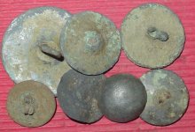
Ive been looking for sources of old Oregon stagecoach lines late 1800’s - A lot of the maps I see for sale on line are a little fuzzy on the descriptions - Anybody have any suggestions for reliable sources of old Oregon maps that might get me some info
What Part of Oregon? This is as of 1846 so there is no Applegate Trail yet on this map. Here is a map not too blurry.
default (1).jpg
Idk if this helps but if you're looking to identify a possible cutoff trail that you found, sometimes alternate routes, or attempted shortcuts were never mapped but passed on by word of mouth... Cool finds though, I'm currently trying to identify a cutoff part of the Applegate trail.
 

eyemustdigtreasure

Silver Member
Mar 2, 2013
3,602
5,582
California
Detector(s) used
Fisher Gold Bug Pro
Tesoro Cibola
Nokta Pointer; Phillips SHS5200 phones
Nokta Macro SIMPLEX +
Primary Interest:
Metal Detecting
What Part of Oregon? This is as of 1846 so there is no Applegate Trail yet on this map. Here is a map not too blurry. View attachment 2112991 Idk if this helps but if you're looking to identify a possible cutoff trail that you found, sometimes alternate routes, or attempted shortcuts were never mapped but passed on by word of mouth... Cool finds though, I'm currently trying to identify a cutoff part of the Applegate trail.
I’m presently reading Wagons to the Willamette a book about the Southern route to the valley,
Levi Scott explored the route with minor amount of help from Jessie Applegate,
Ironic that the trail is now named the Applegate Trail,,,!
 

eyemustdigtreasure

Silver Member
Mar 2, 2013
3,602
5,582
California
Detector(s) used
Fisher Gold Bug Pro
Tesoro Cibola
Nokta Pointer; Phillips SHS5200 phones
Nokta Macro SIMPLEX +
Primary Interest:
Metal Detecting
I’m presently reading Wagons to the Willamette a book about the Southern route to the valley,
Levi Scott explored the route with minor amount of help from Jessie Applegate,
Ironic that the trail is now named the Applegate Trail,,,!
The editor actually traveled most of the route. Maps and some pictures accompany the text that should be very useful in finding the true wagon road
 

eyemustdigtreasure

Silver Member
Mar 2, 2013
3,602
5,582
California
Detector(s) used
Fisher Gold Bug Pro
Tesoro Cibola
Nokta Pointer; Phillips SHS5200 phones
Nokta Macro SIMPLEX +
Primary Interest:
Metal Detecting
We have one Stage Road that was a "wagon road" as well.
Established trails and roads are free to share the traffic...!
Often, very little options would be available for the route....!
Like good fords along the way, ....,
So, yeah, maps that show stage stops (connect the dots), even travelers diaries can shed light on your stage road you are looking for,
Sounds like a good read th
 

Top Member Reactions

Users who are viewing this thread

Top