Pine Creek Document (CLINTON COUNTY)

jeff of pa

Super Moderator
Staff member
Dec 19, 2003
86,126
59,874
🥇 Banner finds
1
🏆 Honorable Mentions:
1
Primary Interest:
All Treasure Hunting
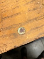
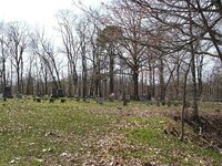
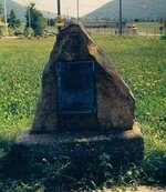
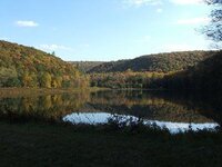
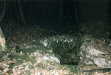
Somewhere where fort Horn stood,

is said to be an IRON BOX
in this box is a document placed there in 1776.

this was a Decleration of independence from the Crown of England.
stating that the citizens of the settlement were free and indipendent.

it was written at the same time as the famous decleration.

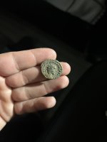
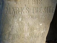
Pine Creek was destroyed by the Six Nations with help from the British in 1778.

the settlers wern't able to return till 1779

by then FORT HORN & PINE CREEK was burned to the ground.
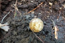
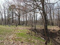
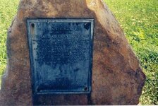
 

kiddrock33

Hero Member
Jun 14, 2003
688
12
Massachusetts
hmmm very interesting.hmmm these towns located here were named or incorporated in 1776 by the founding fathers. town names in berkshire county massachusetts are definitly named after themselves. such as washington,hancock, adams, franklin county , i believe one of the last areas to sign the declarations was where this box lies. do you have any more info on this subject ? location of fort? near a river possibly? does anyone live near that site?would anyone be willing to locate stone carvings at the site? if so i can probally show you where to look for them . and proceed from there. if one can be located which im sure it can be ill be looking for it online thanks for the huge input on the other thread and this one in particular. kiddrock33
 

OP
OP
jeff of pa

jeff of pa

Super Moderator
Staff member
Dec 19, 2003
86,126
59,874
🥇 Banner finds
1
🏆 Honorable Mentions:
1
Primary Interest:
All Treasure Hunting
Horn's Fort
(1776 ?), Wayne Township, Clinton County
A settlers' fort.

WARNING VERY LONG
From

REPORT OF THE COMMISSION TO LOCATE THE SITE OF THE FRONTIER FORTS OF PENNSYLVANIA.​

1896​

FORT HORN.
Pages 405-416.


"Pine Creek Declaration of Independence." HIGHLIGHTED in RED

Some other Intresting Notes in GREEN

Fort Horn was erected on a high flat extending out to the river and commanding a good view of the river up and down, as well as the north side of the river; is about midway between Pine and McElhattan Stations on the P. & E. R. R., west of Fort Antes. It was a place of refuge for those hardy settlers on the Indian lands on the north side of the river, as well as the residents on the Pennsylvania lands on which it was built. The river lands on the north side were outside the purchase of 1768, from the Lycoming creek up the river westward. These settlers were adventurous, hardy, brave. When I say they were mostly Scotch-Irish it will be understood they were also law abiding. As they were outside the limits of the laws of the Province, they had formed a code of their own and administered it impartially. In troublous times now upon these communities they all stood shoulder to shoulder, proving the saying that blood is thicker than water.

A few soldiers are said to have been stationed here and the settlers on both sides the river joined them in scouting duty, sending word to those below of approaching danger; several light skirmishes took place between the men of the fort and the Indians, in which several lives were lost. On an alarm, the inhabitants of the north side placed their families in canoes and paddled to Antes, Horn and Reid's forts; when danger passed over their families would return.

Accompanied by John F. Meginness, the historian, J. H. MacMinn, a great-grandson of Col. Antes, and quite an antiquarian, we visited the sites of these upper West Branch forts. A Mr. Quiggle, of Pine, accompanied us to Fort Horn. The old gentleman pointed out to us the depression where, in his younger days, had stood up the remains of the stockades. The P. & E. R. R. at this point has cut away about one-half the ground enclosed by the fort.

This stockaded fortification was situated on a commanding point of land on the West Branch of the Susquehanna river, in what is now the township of Wayne, Clinton county, one mile west of the post village of Pine. At this point the river describes a great bend, affording a commanding view for about one mile up and down the stream from the elevation or point on which Samuel Horn chose to erect his stockade. Looking across the river to the north, which, at this point flows to the east, a magnificent view of the rich, alluvial valley is afforded; in the rear, not more than one-fourth of a mile away, is the dark and sombre range of the Bald Eagle mountain, varying in altitude from five to seven hundred feet.

At the time Samuel Horn settled here the river was the Indian boundary line, according to the provisions of the treaty of 1768, therefore, he was on the northern boundary of the Province of Pennsylvania. From the point where he built his cabin he could look over the Indian possessions for miles and plainly see the cabins of a dozen or more sturdy Scotch Irish squatters on the "forbidden land." The tract on which Horn settled was warranted in the name of John L. Webster in 1769. Since that time it has passed through a number of hands, and is now owned by a Mr. Quiggle, whose ancestors were among the early settlers in this part of Wayne township.

Horn, when the Indians became threatening in 1777, with the assistance of his neighbors, enclosed his primitive log dwelling with stockades, and it became a rallying point as well as a haven of safety, in the perilous times which followed. The line of stockades can be pretty clearly traced to this day by the depression in the ground and the vegetation and underbrush. The enclosure probably embraced a quarter of an acre by affording ample room for a number of families. A small stream of pure mountain water ran along the west side of the enclosure, and it is probable that there was a way constructed so that it could be reached from within safety from the prowling foe. When the Philadelphia and Erie railroad was built the line cut through the northern end of what has been the stockaded enclosure, and the discolored earth showed very plainly where the timber had decayed.

Horn's Fort and the others of the upper West Branch we recognized by the authorities as defensive positions, and most of them, if not all, furnished with troops, either militia or Continental, when troops could be procured for that purpose when not garrisoned by militia, these forts on this flank, were held by the inhabitants of the Province of the south side of the river, assisted by their neighbors of the Indian lands the north side.

Colonel Antes was furnished militia to strengthen Antes Fort whenever Colonel Hunter, the commander of Northumberland county, could procure them. Moses Van Campen tells us Colonel Kelly's regiment of militia garrisoned Fort Reid at now Lock Haven, a few miles above Horn's, the most of the summer of 1777.

Tradition says that Horn's was a defensive work of no mean importance at that time, and was of great value to the pioneers who had pushed their way up the river in the advance guard, as it were. There was but one defensive work (Reid's) few miles west, and as it was on the extreme limits of the frontier there a company of county militia was stationed for sometime. Its location was admirably chosen. In all that region no more eligible position could have been formed. Standing on its ramparts, the eye swept the river right and left and the Indian lands to the north, for several miles. As the current bore immediately under its lea an Indian canoe could scarcely have glided past in the night without having been detected by a vigilant sentinel.

One of the most remarkable incidents of Revolutionary times—an incident which stands, so far as known, without its counterpart in the history of the struggle of any people for liberty and independence, occurred within sight of Horn's fort, but across the river on the Indian land. This was what was known as the "Pine Creek Declaration of Independence." The question of the colonies throwing off the yoke of Great Britain and setting up business for themselves, had been much discussed, both in and out of Congress. The hardy Scotch Irish settlers on both sides of the river, in the vicinity of Horns, bore little love for the mother country. The majority of them had been forced to leave their native land and to seek a home where they would be free from religious oppression—where they could worship God according to the dictates of their own conscience. They were all patriots in the broadest sense of the term, and a loyalist or Tory would not have been tolerated in their midst. They yearned for independence, and when the discussion of the subject waxed warm they resolved on calling a public meeting to give formal expression to their views. Accordingly, on the 4th day of July, 1776, the meeting, assembled on the Pine creek plains and a resolution was passed, declaring themselves free and independent of Great Britain. The remarkable feature of this meeting was that the Pine creek resolution was passed on the same day that a similar resolution was passed by the Continental Congress sitting in Philadelphia, more than two hundred miles away, and between whom there could be no communication for concert of action. It was, indeed, a remarkable coincidence—remarkable in the fact that the Continental Congress and the squatter sovereigns on the West Branch should declare for freedom and independence about the same time.

It is regretted that no written record of the meeting was preserved, showing who the officers were and giving the names of all those present. All that is known is what has been handed down by tradition. The following names of the participants have been preserved: Thomas, Francis and John Clark, Alexander Donaldson, William Campbell, Alexander Hamilton, John Jackson, Adam Carson, Henry McCracken, Adam DeWitt, Robert Love and Hugh Nichols. The meeting might have been held at the cabins of either John Jackson or Alexander Hamilton, as both were representative and patriotic men of the period. Several of these men afterwards perished at the hands of the savages; others fought in the revolutionary army and assisted in achieving the independence which they had resolved the country should have.

The majority of these men lived across the river from the fort on the Indian land, and they all received patents for the land they had pre-empted after the treaty and purchase of 1784, in consideration of their loyalty, patriotism and devotion to the struggling colonies. The name of Samuel Horn is not found among those that have been handed down to us, but it may be safely inferred that the man who was sufficiently patriotic to build a stockade fort for the protection of the neighborhood in which these men lived, was a sympathizer, if not a participant, in the Pine creek movement for independence.

There is nothing on record to show that the fort was ever supplied with small cannon. Its only armament was muskets and rifles in the hands of the hardy settlers when they had collected there in times of danger. That the savages regarded it with displeasure, and sought more than one opportunity to attack the occupants, there is abundant proof. They prowled about in small bands or laid concealed in the surrounding thickets ready to shoot down and scalp any thoughtless occupant who might venture a few hundred yards from the enclosure. Among the thrilling escapes that have been preserved is that of the young woman named Ann Carson , just before the flight known in history as the Big Runaway. She ventured out of the fort one day and was fired upon by a concealed savage. The bullet cut through the folds of her dress, making fourteen holes in its flight, but left her uninjured. About the same time another young woman named Jane Anesley, while engaged in milking a cow one evening outside the enclosure, was fired at by a lurking Indian several times. One bullet passed through her dress, grazing her body so closely that she felt the stinging sensation so severely that she was sure she was shot. ANN CARSON WAS A KNOWN COUNTERFEITER
who supposedly Buried alot of caches around her home


At the time Colonel Hunter sent up word from Fort Augusta for the settlers to abandon the valley and flee to places of safety down the river, as he was informed that a large body of savages was preparing to descend from the Seneca country to devastate the valley and wipe out the settlements, that fearless scout and intrepid soldier, Robert Covenhoven, bore the unwelcome news from Fort Muncy to Antes Fort and had a messenger dispatched from the latter place to warn the inmates of Fort Horn that they must fly if they valued their lives. The meagre records informs us that all the settlers within a radius of several miles were collected at Horn's and that a great state of excitement prevailed. Those living on the Indian lands across the river were gathered at the fort, anxiously awaiting news from below. Judging from the extent of the settlements at the time, a hundred or more fugitives must have been collected there.

The order to evacuate the fort was received with feelings of alarm, well nigh bordering on despair. The frenzied settlers at once set about making preparations to abandon their humble homes, their growing crops—for it was in early June— and fly. Many of them buried chinaware and other household effects that they could not well carry with them in places that they could recognize if they were ever permitted to return.

Soon after receiving Colonel Hunter's message four men, Robert Fleming, Robert Donaldson, James McMichael and John Hamilton started down the river in canoes for Antes Fort to secure a flat in which to transport their families below. They were squatters on the Indian land across the river from Horn's and they knew that the savages had a grudge against them for trespassing on their territory, and that they would fare badly if they fell in their hands. The dread of impending danger had driven them across the river with their families to seek the protection of the fort.

They reached Antes Fort in safety, engaged a flat and started on their return. But the eye of the wily savage was on them. They had pushed their canoes up through the Pine creek riffles, when they pushed over to the south side of the river for the purpose of resting and to await for other parties who were following them with the flat. At this point the mountain comes down almost to the edge of the river, and at that time it presented an exceedingly wild and forbidding appearance. As they were about to land, and not suspecting danger, they were suddenly fired on by a small band of savages concealed in the bushes. Donaldson jumped out of his canoe, rushed up the bank and cried to the others, "Come on, boys." Hamilton saw the Indians rise up, and at the same time noticed the blood spurting from a wound in Donaldson's back as he was trying to reload his gun. He soon fell from exhaustion and died. Fleming and McMichael were also killed. Hamilton, who was untouched, gave his canoe a powerful shove into the stream and, jumping into the water fell flat on the other side. Then, holding the canoe with one hand between the Indians and himself, he managed to paddle across the river with the other. Several bullets flew around his frail craft, but he escaped without a scratch. When he landed his woolen clothes were so heavy, from being saturated with water, as to impede his flight. He, therefore, stripped himself of everything but his shirt and ran swiftly up the river. His route was by the Indian path to the Great Island. He ran for life. Fear lent wings to his flight. The flutter of a bird stimulated him to increase his speed, and if a bush came in his way he cleared it with a bound. In this way he ran for nearly three miles, passing the place where his father had settled, until he came opposite Horn's fort, when he was discovered and a canoe was sent to rescue him.

The men in the flat being behind and hearing the firing and, divining the cause, hurriedly pushed to the north shore, below the mouth of Pine creek, which they hurriedly forded and ran up the path which Hamilton had so swiftly traveled. James Jackson, who was one of the party on the flat, found a horse pasturing on the Pine creek clearing which he caught, mounted and rode up to the point opposite Horn's fort, when he was discovered and brought over in a canoe. The other men made their way to the fort and escaped.

An armed body of men, as soon as the news was received at Horn's, made their way down to the place of ambuscade. Here the dead and scalped bodies of Donaldson, McMichael and Fleming were found, but the Indians had departed. They knew that they would be punished and hurried away as quickly as possible. The rescuing party secured the three dead bodies of their neighbors and carried them to Antes Fort, where they were buried in the little graveyard which had been started outside of the enclosure. Nearly all of these men left families, and the cruel manner in which they had been slain caused great excitement at the fort, as well as intense grief on the part of their wives and children. It was a sad day at Horn's. But no time was to be lost. Activity was the demand of the hour. The savages were emerging from the forests on every hand bent on murder and pillage, and the settlers collected at the fort saw that if they were to escape their relentless fury they must fly at once.

The same day the bloody affair occurred at Pine creek, a party of men were driving a lot of cattle down the river from the vicinity of the Great Island—the thickest part of the settlement on the Indian land—when they were fired on by a small body of skulking savages, almost in sight of Fort Horn. The whites, who were well armed, returned the fire, when an Indian was observed to fall and was quickly removed by his companions. This mishap seemed to strike terror into the ranks of the survivors and they fled precipitately into the forest, abandoning a lot of plunder, consisting largely of blankets, which fell into the hands of the whites. A member of the cattle party named Samuel Fleming, was shot through the shoulder and severely wounded. The Fleming family was one of the earliest to settle in this neighborhood, and as the head thereof had several sons, it is probable that Samuel was a brother of Robert, who was killed in the ambuscade at Pine Creek.

The firing was heard at Horn's and added to the alarm of the women and children assembled there, which only subsided when they found the party approaching on the other side of the river with their cattle. Fleming was ferried over to the fort, where he had his wound dressed. The cattle drivers continued on down the river in search of a place of greater security for their stock.

Such were some of the incidents preceding the Big Runaway in the latter part of June, 1778, when all of that part of the valley of the Wrest Branch, west of the Muncy hills, was abandoned by the white settlers to escape the fury of the savages. The stockade forts, like the humble log cabins, were dismantled and burned, so far as the remorseless foe was capable of carrying out their intentions.

A description of the Big Runaway, which has no parallel in frontier history, is not out of place in this connection. The best account is found in Sherman Days Historical Collections of Pennsylvania, p. 451. Mr. Day obtained it from the lips of Covenhoven himself in 1842, more than fifty years ago, when the thrilling incidents were comparatively fresh in his mind. After delivering the order of Colonel Hunter to the commander of Antes Fort, and seeing that the message was conveyed to Horn's, Covenhoven hastily returned to Fort Muncy and removed his wife to Sunbury for safety. He then started up the river in a keel boat for the purpose of securing his scanty household furniture and to aid the panic stricken inhabitants to escape. Day reports his story in these thrilling words:

"As he was rounding a point above Derrstown (now Lewisburg) he met the whole convoy from all the forts above (Muncy, Antes, Horn's and Reid's) and such a sight he never saw in his life. Boats, canoes, hog troughs, rafts hastily made of dry sticks—every sort of floating article had been put in requisition and were crowded with women and children and ‘plunder' —there were several hundred people in all. Whenever any obstruction occurred at a shoal or riffle, the women would leap out and put their shoulders, not, indeed, to the wheel, but to the flat boat or raft, and launch it again into deep water. The men of the settlement came down in single file on each side of the river to guard the women and children. The whole convoy arrived safely at Sunbury, leaving the entire line of farms along the West Branch to the ravages of the Indians. They did not penetrate in any force near Sunbury, their attention having been soon after diverted to the memorable descent on Wyoming. * * * After Covenhoven had got his bedding and furniture in his boat (at Loyal-sock), and was proceeding down the river just below Fort Menninger (at the mouth of White Deer creek), he saw a woman on the shore fleeing from an Indian. She jumped down time river bank and fell, perhaps, wounded by his gun. The Indian scalped her, but in his haste neglected to tomahawk her. She survived the scalping, was picked up by the men from the fort (Freeland) and lived on Warrior run until about the year 1840. Her name was Mrs. Durham."

Strange as it may seem, nothing has been preserved to show who Samuel Horn was, whence he came or whither he went after abandoning his fort. Neither do the records show that he ever warranted any land in that vicinity. That he had a family is reasonably certain, else it is not likely he would have gone to the trouble and expense of building a stockade around his cabin for protection and the protection of his neighbors, who made it a rallying point in time of great danger. All that has been preserved about him is what has been handed down in the form of tradition. It is probable that he never returned after the Big Runaway, but settled in some of the lower counties. His name, however, has been perpetuated in connection with the fort, and, although one hundred and sixteen years have rolled away since he hurriedly bade it adieu forever, the site where it stood is still proudly pointed out by the people in the neighborhood, who hold his name in grateful remembrance.

This report would be incomplete if no further reference was made to the fearless scout—Robert Covenhoven—who bore the last message up the river warning the settlers to fly to Fort Augusta to escape the wrath of the red-handed Ishmaelites who were bearing down on them from the north incited to commit the most atrocious deeds by the promise of British gold.

Who was Robert Covenhoven? He was of Hollandish descent, and came with his father s family from Monmouth county, New Jersey, where he was born December 7, 1755, and settled near the mouth of Loyalsock creek in 1772. A number of relatives accompanied them. Our subject—the name has since been corrupted in Crownover—was first employed as a hunter and axeman by the surveyors, and early became acquainted with the paths of the wilderness and inured to the dangers and hardships of pioneer life. This knowledge and service eminently fitted him to perform the duties of a scout, and as he was fearless, strong and sagacious and well acquainted with the wiles of the Indian, he became very successful in his dangerous calling.

On the breaking out of the Revolution he joined Washington's army and participated in the battles of Trenton and Princeton. In the spring of 1777 he was sent to his home on the West Branch to aid in protecting the frontiers, and few men in those stirring times endured greater hardships or had more hairbreadth escapes. He married Miss Mercy Kelsey Cutter (also a native of New Jersey), February 22, 1778, so that it will be seen that she was little more than a bride at the time of the Big Runaway.

To give a history of his life in full would require the space of a moderate sized volume. He was the principal guide for Colonel Hartley when he made his famous expedition up Lycoming creek in September, 1778, by direction of Congress for the purpose of chastising the Indians at Tioga Point (now Athens), and was the first man to apply the torch to the wigwam of Queen Esther at the Point.

He had a brother killed in a fight with Indians on Loyalsock, near where his father settled, and had another taken prisoner. He was himself chased for some distance along the creek, dodging up and down the bank alternately, that his savage pursuers might get no aim at him. Doubtless, his swiftness of foot and power of endurance saved him. He escaped to Fort Muncy and gave an account of the fight. On the close of the war he purchased a farm in Level Corner, Lycoming county, almost in sight of Antes Fort, and settled down to the quiet pursuits of agriculture.

He had a family of five sons and three daughters, all of whom are deceased. His wife died November 27, 1843, aged 88 years, 10 months and 8 days, and was buried in a cemetery on what is now West Fourth street, Williamsport. Her grave has been obliterated by a church, which stands on the spot where it was made.

When the veteran grew old and was borne down by the weight of years, he went to stay with a daughter who lived near Northumberland. There he died October 29, 1846, at the ripe and mellow age of 90 years, 10 months and 22 days, and was laid at rest in the old Presbyterian graveyard in the borough of Northumberland. A plain marble headstone marks his grave, and the inscription, now almost illegible, tells who he was and what he did to help achieve our independence. For years the old burial ground where his ashes repose has been a common, and cattle graze on its green sward in summer time, pigs root among fallen tombstones and listless vandals amuse themselves by defacing memorial tablets reared by loving hands to perpetuate the name of a father or mother. The old patriot left a request in his will to be buried by the side of his wife, but his executor failed to carry it out, and from appearances his humble grave will soon be obliterated, the corroding tooth of time will soon destroy his plain marble tablet, and his numerous descendants will no longer be able to tell where his bones were laid.
 

OP
OP
jeff of pa

jeff of pa

Super Moderator
Staff member
Dec 19, 2003
86,126
59,874
🥇 Banner finds
1
🏆 Honorable Mentions:
1
Primary Interest:
All Treasure Hunting
There is a HISTORICAL MARKER

on U.S. 220 4 Mile S.E. of Lock Haven

Which Reads :

a Stockaded log house used as a frontier refuge in 1777-78.
it was on the Susquehanna's south bank opposite here.
in 1778 it was abandond.
 

coalfire

Full Member
Dec 16, 2006
122
3
East Coast
I have believed that the document being spoke of here is an actual printed copy of the original. Simple coincidence is something I don't really believe in. Meaning, I doubt this community in and around Ft. Horn wrote and signed a similar document to the Declaration Of Indepence. I have been told by a historian that it was more than likely that the Congress in Philadelphia sent a printed copy that was signed to the Forts at the furthest reaches of the Colonies boundary. Basically it was a protected document that designated America's self dedicated borders that would protect it if attacked by enemies.

The Historical Society of Pennsylvania website states on it's "Research & Documents" page
"The Historical Society of Pennsylvania is one of the largest family history libraries in the nation, has excellent collections on local and regional history, and offers a manuscript collection renowned for its 17th-, 18th-, and 19th-century holdings. With the Balch Institute’s merger into the HSP in 2002, the Society is now also one of the nation’s leading repositories of ethnic and immigrant studies materials. The Society houses nearly 600,000 books, pamphlets, serials, and microfilm reels; 20 million manuscripts; and over 300,000 graphics items, making it one of the nation’s largest non-governmental repositories of documentary materials.

The Society holds many national treasures, such as the first draft of the United States Constitution, an original printer’s proof of the Declaration of Independence, and the earliest surviving American photograph. But the true strength of our collection is the overall breadth and depth of materials that together offer a rich, complex portrait of U.S. history and society from the 17th century to the present."

http://www.hsp.org/default.aspx?id=2
But then I may be wrong.
Just my 2 cents.
~Z~
 

TeddyB1967

Hero Member
Feb 23, 2007
641
3
Pennsylvania
Hi, I am new to the site. I actually just registered so I could post on this thread. I live in Wayne Township, (McElhattan) and have heard the story of this metal box. To my knowledge it has never been found (that is if the story/legend is even true that it existed). There have been a few people through the times that have searched for the box and also archeologist have done some excavating in the area and found many Indian artifacts.
I have a few pictures of some of the Indian monuments/markers from around the township if anyone like to see them I will be happy to post them.
I have never seen the historical marker about the stockaded house, but will have to go out now and search for it ;D 
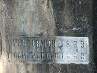
My husband says he knows where it’s at so he will take me to it. It’s at the site of Fort Horn so my hubby say’s, but that wouldn’t be 4 miles from Lock Haven. I think it would be a little further than 4 miles but I can check that out to make sure.
Also, there was a Colonial Shoemaker that was very prominent in the times that lived not to far from US 220, just off the exit a little way’s. His homestead (Mansion) still stands and is now owned by the Maguire family and they run it as a Bed & Breakfast. Shoemaker also had two other places that he built but they were much smaller and known as shacks by the locals now. All that remains of the one place is part of the stone foundation.
There is a really cool house that has been abandoned for some time now that I believe was also owned by Shoemaker that I have been too and took pictures of on Reservoir road. (I’m not sure the name is Reservoir Rd but it's on the road that leads to the reservoir on top of the mountain... I walked to the reservoir ONCE!!! very long but beautiful hike ;D) The house sets on the land that's now called Zendell Park and is owned by the city of Lock Haven. There are NO TRESPASSING signs posted around the house. I guess mostly because of the younger crowed hanging out and "partying" there and the house itself is not safe. There is no floor, or not much left of the main floor.
There is also the legend of Chief Logan that passed through here as well but I’m not familiar with any info on him.

I would love any other information anyone could find on this area so I can add it to our website. I don’t seem to have the knack for researching and always come up empty.

Thanks a bunch for the info given so far,
Tammy (Teddy)

Forgot to mention the Quiggle Cemetery. It's named after Mr. Quiggle and he and his family are buried there. There are other people buried there as well (some recent) as well as many young military men. It's a small cemetery and I have pictures of it too.
 

OP
OP
jeff of pa

jeff of pa

Super Moderator
Staff member
Dec 19, 2003
86,126
59,874
🥇 Banner finds
1
🏆 Honorable Mentions:
1
Primary Interest:
All Treasure Hunting
Welcome Ted

We love Pictures.
& if your Website is Public & Historical in nature,
Please add it.

not sure if it's mentioned above, it's been awhile since
that info was posted, But the Box is supposed to be in the Parade Ground for the fort.

---------------------------------------------------
 

Attachments

  • z.jpg
    z.jpg
    55.4 KB · Views: 1,448
  • z1.jpg
    z1.jpg
    43.8 KB · Views: 1,403
  • z2.jpg
    z2.jpg
    36.5 KB · Views: 1,343
  • z3.jpg
    z3.jpg
    61.1 KB · Views: 1,316
  • z4.jpg
    z4.jpg
    41.7 KB · Views: 1,313
  • z5.jpg
    z5.jpg
    55.8 KB · Views: 1,269
  • z6.jpg
    z6.jpg
    35 KB · Views: 1,293
  • z7.jpg
    z7.jpg
    35.9 KB · Views: 1,285
  • z8.jpg
    z8.jpg
    37 KB · Views: 1,292

TeddyB1967

Hero Member
Feb 23, 2007
641
3
Pennsylvania
Thanks for the welcome ;D
Our website the I been working on is for the Fire Company, it's all Fire Co. related. It's for pics of their calls, members, activities they do and things like that. I do want to add the history of the township from as far back as we can and the info I have gotten off this thread is a great start. I did find some other info lastnight, (I was pumped up after reading thru all of this and went searching for info) It is a very long article on Wayne Twp. and I will post it in another post below this one.
Here is some other info from someone named Leslie M. Miller ...
A copy of the Declaration of Independence is known to have been buried on or near Fort Horn, but has never been recovered.
More information can be found in
Guide to Treasure in Pennsylvania
http://www.therockerbox.net/productcart/pc/viewPrd.asp?idcategory=3&idproduct=175

"Your indication that a "copy of the Declaration of Independence" is buried in the Clinton County area is misleading. Only coincidently, on July 4, 1776, a group of residents of what is now Clinton County--a group called the fair men--wrote their own statement protesting taxation without representation as well as the salubrious administration of a nation by an absent regent.
It is said that a pair of riders were dispatched to Philadelphia to deliver the document. En route, they encountered hostile Indians, but eventually reached Philadelphia only to discover that another document of protestation had been signed and that Revolution was in full swing.
A Lock Haven University professor wrote extensively in the 1980s in an effort to discount the existence of the "Tiadaughton Elm" document, but oral tradition is rather too strong and too exact for something at least near this truth to have occurred. Tradition holds that the original document, as well as other papers of the region, were buried on the parade grounds of the fort. However, the fort and all surrounding communities were burned to the ground later in the 1700s."
Leslie M. Miller


Here are the pictures I was able to find off of my CD's ...

Quiggle Cemetery
 

Attachments

  • DSCF1578.jpg
    DSCF1578.jpg
    48.7 KB · Views: 1,244
  • DSCF1577.jpg
    DSCF1577.jpg
    56.6 KB · Views: 1,243
  • DSCF1495.jpg
    DSCF1495.jpg
    50.3 KB · Views: 1,252
  • Dscf1494.jpg
    Dscf1494.jpg
    57.2 KB · Views: 1,251
  • Dscf1493.jpg
    Dscf1493.jpg
    60.1 KB · Views: 1,267

TeddyB1967

Hero Member
Feb 23, 2007
641
3
Pennsylvania
Rock Marker (the writting isnt clear enough in the pic to read, But I can get better pics if you want)
 

Attachments

  • IndianStone03b.jpg
    IndianStone03b.jpg
    22.6 KB · Views: 2,655
  • 09.jpg
    09.jpg
    32.4 KB · Views: 1,301

TeddyB1967

Hero Member
Feb 23, 2007
641
3
Pennsylvania
Monument (Reads ... This marks the site of an Indian town the Ancient Capitol of the Lenni Lenape. Erected 1913)
 

Attachments

  • DSCF5691.jpg
    DSCF5691.jpg
    37.5 KB · Views: 1,404
  • DSCF5839.jpg
    DSCF5839.jpg
    21.1 KB · Views: 1,257

TeddyB1967

Hero Member
Feb 23, 2007
641
3
Pennsylvania
1. Reservoir
2. & 3. are of what's left of the Quiggle place that I mentioned in my first post. (these 2 pics are about 12yrs old.)
 

Attachments

  • Dscf8189.jpg
    Dscf8189.jpg
    24.3 KB · Views: 1,218
  • 01_brightened.JPG
    01_brightened.JPG
    32.4 KB · Views: 1,179
  • 02.jpg
    02.jpg
    30.9 KB · Views: 1,224

TeddyB1967

Hero Member
Feb 23, 2007
641
3
Pennsylvania
Last of the pics ... (you did say you loved pics ;D)

Zendell Park
Entrance path to the property
Dscf8180.jpg


House
Dscf8139.jpg
Dscf8137.jpg

Dscf8135s.jpg
Dscf8151.jpg

Dscf8154.jpg
Dscf8159.jpg


Not sure what this arrangement is for. I forget what the writting reads (have a pic of it if I can find it)
Dscf8141s.jpg


Waterfall
Dscf8152s.jpg
 

TeddyB1967

Hero Member
Feb 23, 2007
641
3
Pennsylvania
Ok, last post of the history of Wayne Township that I came across ...

WAYNE TOWNSHIP
Wayne township is one of the original twelve townships of Clinton county. It was taken from Nippenose township, Northumberland county, in 1795, when Lycoming county was organized. It was named in honor of General Anthony Wayne, or "Mad Anthony," as he was called.
The township is located on the south side of the West Branch of the Susquehanna. It is bounded on the north by Pine Creek and Dunnstable, east by Lycoming county and Crawford township, west by Castanea, and south by Lamar township. Part of the township is several hundred feet above the river. It is well supplied with small streams and possesses considerable mineral wealth.
The first white man to settle in what is now Wayne township was William McElhattan, an Irishman, who, about 1760, settled about one mile west from where the McElhattan creek empties into the river. McElhattan never received a title to his land.
The next settler was Richard McCafferty, who settled on the river bank about one mile east of McElhattan creek. He died in 1770. He was the first white person buried in the township.
The third settler was Robert Love, who settled on what is now called Love’s run, a short distance below Pine station. He built a mill, which was kept in operation for many years.
Robert Love was one of the "Fair Play" men who passed the "Pine Creek Declaration of Independence" during the summer of 1776.
Horn’s Fort, a famous resort of the early settlers, was built in 1774-’75. It was located on a high bluff a little west of Kurtz’s run, at which place there is a short curve in the river, giving a view of both banks, east and west, for over a mile. No doubt it was built there so that the approach of the wily Indian could be more easily seen, and give the settlers, in time of danger, time to flee to the fort for safety.
Horn’s Fort was only a stockade fort, and was not supplied with any arms but the muskets and rifles of the settlers; it was the most advanced on the frontier, save Reed’s Fort, near where Lock Haven now is. The remains of Horn’s Fort could be seen till 1856-’58, when, by the building of the Philadelphia and Erie railroad, the last vestiges of it were destroyed.
The mountain land was not much looked after till about 1804 or 1805. Among the permanent settlers who bought land and improved it were the Quiggles, who came from Lancaster in 1788, and the Montgomerys in 1790. The original Montgomery farm is now owned by Wilson, James and Andrew Montgomery. The Quiggle farm was owned by S. N. Quiggle till within a few years, when it was bought by Charles S. Gallauher. The last payment on this farm by the Quiggles is acknowledged by the following receipt, now in the hands of S. N. Quiggle:
June the 27th, 1807. — Receivt by the Hand of George Quickle the Sum of Sixty-Two Pounts for John Quickle to the Yuse of Adam and George Wilt, I Say Receivt by "Henry Shearman."
There were two Indian towns of considerable note within the limits of the township. On the Montgomery farm, about a half-mile northeast of Wayne station, was a town called "Patterson," over which a chief of that name of the Shawanee tribe ruled. In this town lived the famous Chinklacamoose, prior to going to "Chinklacamoose’s old town," now Clearfield. The other was called "Tucquamingy," and was on the farm now owned by Major Sour.
PIONEER SCHOOLS AND TEACHERS. — The first school in the township was taught by Walter S. Chatham, father of ex-Sheriff Chatham, in an old, abandoned dwelling house near Kurtz’s run, which was prepared for school purposes. This school was opened in 1807-’8, and soon gained such a reputation that it was attended by students from Jersey Shore, Pine Creek and Nippenose, among whom were Robert G. White, afterwards judge, John and Isaac Brown, men of character and distinction. Though Chatham made no pretensions to teach anything but reading, writing, arithmetic and a little grammar, he was for many years considered the best teacher in this section. He continued to teach in this old house till 1813, at which time a new house was built on the Quiggle (now Gallauher) farm. This house was burned in 1827, on account of a man having, in a state of mental derangement, committed suicide within it.
In 1830 a school house was built on the road leading to Sugar Valley. This house was used for school purposes until 1861, and was also used as a church from the time of its erection until the building of the union church, in 1853.
Hon. James Chatham, Hon. G. O. Deise, Hon. J. W. Quiggle and James M. Deise received their early education in this school house. Wayne township has now four schools, with an average term of six months.
Among her early and prominent citizens, were the following; Hon. G. O. Deise, attorney at law, who served as District Attorney of Clinton county from 1859 to 1865, and as representative for two terms. He died in 1873 at the age of thirty-six years; and James M. Deise, a brother of G. O. Deise, also a lawyer, who served three terms as District Attorney of Clinton county. He died in 1879 at the age of thirty-nine years.
Hon. James W. Quiggle, father of Hon. Jas. C. Quiggle, who was a prominent lawyer and politician, was the first commissioners’ clerk of Clinton county. He was for several years associated with Allison White in the legal profession. He was Deputy Attorney General for four terms by appointment, and when the office became an elective one, he was elected by a large majority. He was elected State Senator in 1852, for the district composed of Clinton, Centre, Lycoming and Sullivan counties. Hon. C. A. Mayer read law with him, and for a time they were partners, practicing under the firm name of Quiggle & Mayer. In 1856 he removed to Philadelphia, where he was engaged in banking and real estate business until appointed by President Buchanan as United States Consul to Antwerp, Belgium, in 1859. He held the position three years, then, after a season spent in travel, returned to his home, where he died.
Hon. James Chatham, who was born in Wayne township in 1814, received the rudiments of his education in the old school house before mentioned; was a shoemaker by trade, and followed that occupation for seven years. For about twenty years he acted as river pilot between Lock Haven and Marietta. In 1848 he was elected sheriff of Clinton county. At the age of forty years he began the study of law with Hon. C. A. Mayer, and was admitted to the bar two years later. In 1861 he was elected to the Legislature, and afterwards twice received the nomination of his party for State Senator and once for Congress. For several years he was United states Commissioner for Clinton county in the Western District of Pennsylvania. The Chatham family came from near Milton, Pa. Colonel John Chatham owned land and erected a mill on "Chatham’s run" (still standing and in use as a Feed Mill now) at a very early day. His daughter, Susan, Married Judge John Fleming, who died in 1817. Colonel Chatham was grandfather of Hon. James Chatham.
Wayne township is the seat of the West Branch camp meeting association grounds. (pic of camp meeting spot posted above) These grounds were located on the banks of the McElhattan. The place was built up and greatly improved. Hundreds of tents and cottages were built. The grounds were laid out in streets and avenues, which were kept in the best of condition by the association. The place became quite popular as a summer resort. The June flood of 1889 swept away nearly every vestige of improvement, and damaged the grounds to such an extent that they were abandoned. The stock of the Association was held by members of the Methodist church, and the grounds were under their control.
The township is also the seat of the Pine Station camp meeting association grounds, which are located on Love’s run, three-fourths of a mile from the Philadelphia & Erie railroad. The stock of this association is nearly all held by members of the Evangelical association, and the meetings held each year are under their control. The grounds are beautifully located and well supplied with pure water. They are becoming quite popular as a place to spend the hot months of summer. Numerous and expensive improvements have been made to the place, and the association is at present in a very flourishing condition.
 

OP
OP
jeff of pa

jeff of pa

Super Moderator
Staff member
Dec 19, 2003
86,126
59,874
🥇 Banner finds
1
🏆 Honorable Mentions:
1
Primary Interest:
All Treasure Hunting
WOW, Alot of Great Pics & info to Take in there ;D

You have A great history in your area.

What is it Like where the fort stood ?
is the site of the fort Known or just Speculated ?
Is it open to Detecting ?
and if yes, is it With or without Permission ?


Mcelhattan is over 2 hours away, But, If you'd ever want
to give it a Search & want company, I'd enjoy the try 8)

I'm the type that thinks Positive & do Believe the Box is still there.
If made of Iron, it would be very hard to get a Positive signal
with a detector, but probably easy to get a Negative Response ;)
Of course if the area is trashed, then you got other problems.

Anyway, Very Intresting Info.
Thanks for Posting it.

P.S.

Are you Going to be at the Winfield Hunt April 21st. & 22nd. ?
there will be a Few of us coming up to spend both days B.S.'ng
 

TeddyB1967

Hero Member
Feb 23, 2007
641
3
Pennsylvania
I'm not sure about the Winfield event, I'm really brand new to the MD'ing stuff ;) I actually stumbled across this forum while searching for places in PA close to home to fossil hunt with my kids this summer. We never done that either but I was searching for things we can do with my kids this summer that will get us out of the house and spend some quality time together. I gotta tell ya tho, after reading thru a lot of different threads in this forum, im becoming hooked already on metal detecting and already asked my hubby for an early B'day gift ;D

Anyway's, I had my hubby take me over to the Fort Horn area and took some pictures today to show you what it now looks like. You must have read my mind while I was gone lol
The land is private owned now and the sad part is that a lot of the land where the fort actually stood has been a junk yard for over the past 20+ yrs. MD'ing would be very difficult in that area if not impossible. However, closer to the point at the rivers edge near where the stone markers are wouldn't be bad to check out. My husband know's the people and might be able to get permission to MD there, I'll have to ask him about it.

Here are new photo's taken today .... (Sorry for some poor quality but took some of the pics out the dirty window shield of my husbands truck)
forthornarea1.jpg
forthornarea2.jpg
forthornarea3.jpg

forthornarea4.jpg
forthornarea5.jpg


Stone marker (& maybe grave markers headstones but not sure)
Image4.jpg
Image5.jpg
Image3.jpg


Point, Looking up river and looking down river
forthornpoint.jpg
rivernorth.jpg
riversouth.jpg


Mansion Bed & Breakfast (The white building in background)
Image2.jpg
 

OP
OP
jeff of pa

jeff of pa

Super Moderator
Staff member
Dec 19, 2003
86,126
59,874
🥇 Banner finds
1
🏆 Honorable Mentions:
1
Primary Interest:
All Treasure Hunting
That's a shame how some of it is Messed up, But with all the action the
area has seen, I'm sure yous will Have fun and
find some intresting Relics & coins there.
IF we ever get spring :P

Here is the info on the Winfield Hunt.

http://forum.treasurenet.com/index.php/topic,50397.0.html

It's a Seeded hunt in the Winfield Fire Companies Park
For paid Participents, However it is Free to attend.
There will be a dealer stand set up, Raffles, Etc.
Your whole family would Enjoy it.
 

TeddyB1967

Hero Member
Feb 23, 2007
641
3
Pennsylvania
Thanks for the Winfield info, my husband knows that Fire Co. well. He is actually the prsident and Deputy Chief at our fire company and does a lot of trainings with other companies.
My husband is going to check about MD'ing around that area and if he can get permission I will let you know. It prolly wouldnt be until Spring when the ground dries up somewhat. It's really muddy under the snow. Also, the Quiggla is open to the public and not far at all from the Point. Actually in the one photo above of the river looking north up stream you can see a black railroad bridge, to the left of the photo is where the cemetery is. You have to drive up a little hill and park and then cross those railroad tracks to get to it. For the Zendell Park house, the city of Lock Haven would be the ones to contact about MD'ing there I would guess and also they have the access rights of the road that leads up the mountain to the reservoir so they could even grant access to those areas as well.
This whole township is very rich in history and lots of places to hunt but Im sure permission would be needed for most (not all). The area is not a very big area at all. If anyone is interested in just coming up to have a look around and scope things out, that wouldnt be a problem for myself and my husband to be tour guides for a day ;D
 

TeddyB1967

Hero Member
Feb 23, 2007
641
3
Pennsylvania
I found some picture's that show where the Tiadaghton Elm tree once stood and figured I would post them. My husband and I went for a drive to the hang glider site on top of the mountain and you can actually see so much from up there. It's an awesome view, very windy but a great view.

I resized these pics down pretty small, but if anyone would like the full sized pics just let me know and I can email them to ya.

Look at the white car, follow that road back towards the river and where the road curves to the right is where the Elm Tree used to be. There are site markers there about the tree and the document and all that but they are not noticable in the pics.
Image2_480x360.jpg

Also, just behind the white car right before the bridge it sorta looks like a parking lot area, there used to be a house that stood there. It was really really old and officials became concerned for the saftey of the people living there so they condemed the house and eventually tore it down and made a parking area. It was probably one of the first houses built in that area.


Another view of the same area that shows that road going back to a farm house.
Image13_483x290.jpg


Thought I would throw in picture's of Jersey Steel while I was at it.
The JS Steel Company is the long building in the lower left of the pic.
Image8_480x360.jpg

The building mid right is Avis America and all the white buildings around it are the prefab homes they make. Just above all the white buildings is a little white roof building. This is one of the Old Railroad Station Stops. The building is still in use by Grand Central Beer Distributor.

Another view of the same area
Image12_549x357.jpg
 

Top Member Reactions

Users who are viewing this thread

Latest Discussions

Top