Suggesting a Location Other than the Money Pit

OP
OP
G

gjb

Sr. Member
Apr 21, 2016
255
323
UK
Detector(s) used
Garrett Ace 300i
Garrett EuroAce
Primary Interest:
All Treasure Hunting
As mentioned earlier, the suggestion is that closer inspection of Maps D and F may indicate that the trail to the deposit location could lead north of the Rocks on magnetic bearings. The possible impact of this on the ground plan is investigated here.

A full discussion will not be provided, but it becomes apparent that a slightly smaller pattern upon a similar extended rhombus can be described on magnetic bearings between the suggested Locators and that the derived map points when transferred to this figure then result in greater accuracy.

OIMaps240.gif

Above is the preferred of two mechanisms to extend the plan northwards. It is suggested that the ‘X’ at centre of the northern rhombus is perhaps more likely to be the location of a deposit than that of the lower. It can be noted that this northerly point could be reached by a tunnel running magnetic east from the Money Pit and then another tunnel off this running magnetic north.

This may be why the seeker has to be aware of the angle of magnetic variation operating at the time. The point marked is 334.2 feet from the Money Pit at a bearing of 61.3 degrees north of east. It would not have been at all easy to identify it this way. It would be far easier to determine where the Locators would be positioned by reference to the Drilled Rocks.
OIMaps250.gif

The two rhombus rectangles when superimposed are shown above. This illustrates the minor differences in location with reference to the respective rock centre points. The final variances from target are shown in the figure below.

OIMaps262.gif


However, as the starting point of the instructions for Map D suggest, the ground plan appears to extend westwards along the Roadway and continuation of the geometry in this direction may lead to a suggestion that the northern rhombus could be associated with the centre of the swamp.
 

OP
OP
G

gjb

Sr. Member
Apr 21, 2016
255
323
UK
Detector(s) used
Garrett Ace 300i
Garrett EuroAce
Primary Interest:
All Treasure Hunting
Although there are suggestions in Oak Island literature that the Roadway is likely to be contemporary with the original workings I have seen no suggestion that it could have been a functioning survey baseline or part of one. The possibility is explored here.

In the diagram below, the line representing the Roadway and its extension beyond the swamp is set at 250 rods in length (just over three-quarters of a mile) and is shown divided into three sections of 75 rods (just over 400 yards) from southeast to northwest. This has an extension of 25 rods reaching to the shore at west, this being judged to be the start of the Roadway and is labelled point zero. As drawn here, the bearing is 30 degrees south of magnetic east.
OIOverlay9a.jpg

Point 1, also labelled DXV, is 25 rods from the beginning of the Roadway and would be significant as the starting point of the instructions on Map D. It is 3091.7 feet from a point due south of the Welling Triangle this being the distance of ‘515 [fathoms] SE’ specified in the instructions. The point reached below the Welling Triangle is 300.8 feet south of the Money Pit giving rise to the ‘50 [fathoms] N’ also as indicated by the instructions.

It could therefore be that the DXV Point was once marked in some way, though construction of the modern Roadway (track) would doubtless have destroyed all trace of this. Nevertheless, it might still be worthwhile looking. The Roadway proper appears to end at or near Point 5.

As shown, the three sections of 75 rods might be labelled Northwest, Central and Southeast. The Southeast Section features the Money Pit and Rhombus Rectangles while the Central Section features Nolan’s Cross. This has been positioned with the mid-point between the Head Stone and Cone D being 75 rods from the centre of the southern rhombus on a line parallel to the Roadway.
OIOverlay9c.jpg

Should the relationship between Nolan’s Cross and the Rhombus Rectangle be correct then it would be possible to recreate the eastern geometry should a succession of treasure-crazed vandals have obliterated all the ground markers at the east of the island, as now. Perhaps this could have been one of its functions.

Nolan’s Cross is assumed here to be genuine, if not original, and in tune with the ground plan as presented is further assumed to be a pure geometrical construction. This may be based on the length of the ‘body’ between the Head Stone and Cone D this being precisely 429 feet (29 rods). This is also the distance bearing magnetic east from the Money Pit to the north-south line through the East Rock.

The suggested construction was well know to the ancient geometers and in Renaissance architecture combining the square (ad quadratum) and the triangle (ad triangulum) in a single design having the same centre. The prominent angles are 90 degrees and 60 degrees these being fundamental to the ground plan.
OIMaps304.gif


Setting the ‘body’ length to 429 feet results in the Cross dimensions found by two professional surveys (Nolan and Crooker), the Arms being calculated at 359.5 feet rather than 360 feet.
OIMaps302.gif

It should be appreciated that the three sections defined on the Roadway could be interchangeable, that is, the Central section could be overlaid at the Southeast and vice-versa. This would mean that the Southeast Section could have an overlay of Nolan’s Cross and the Central Section could have its own Money Pit and Rhombus equivalents.
 

OP
OP
G

gjb

Sr. Member
Apr 21, 2016
255
323
UK
Detector(s) used
Garrett Ace 300i
Garrett EuroAce
Primary Interest:
All Treasure Hunting
Emerging from the development of this reconstruction is the possibility of the existence of a Geometrical Swamp. This is shown in the diagram below with two points potentially marking documented features of the island: a Drilled Rock just offshore at Joudrey’s Cove and three large piles of Stones in the form of an isosceles triangle pointing into the middle of the swamp. All efforts over the years to obtain information about these features from the owners have failed, so their positions are highly speculative.
OIOverlay9b.jpg

The centre of the Geometrical Swamp as suggested here doesn’t coincide with the so-called ‘Eye of the Swamp’, but could be pertinent to the deposit. This is simply an observation that emerged some years ago, bearing in mind that the ground plan here was first published some fifteen years ago showing both the Geometrical Swamp and an assumed deposit location.

This illustrated a suggestion, presented at the time on Jo Atherton’s Oak Island forum, that had there been a treasure then it may have been deposited by tunnel from the centre of the swamp. The thought was that a huge treasure wouldn’t have been carried down the Money Pit and along low and narrow tunnels on the backs of the diggers.

It would have been better to excavate a large tunnel, preferably level with a down-slope at point of entry, but as there was no trace of such then this may have been obliterated by creating the swamp so that the entrance couldn’t be found and used as a back door. However, it was appreciated that this would have required a very long tunnel, perhaps militating against the idea.

The distance from the centre of the swamp to the assumed deposit point can be calculated as the sum of 60 rods magnetic east and then 5 rods magnetic south for a total of 65 rods or 1073 feet (actually 1072.5). Initially, I postulated the presence of a square chamber perhaps with sides of one rod (16.5 feet) centred on the ‘X’ as at top left below. However, I also considered a variation that wouldn’t result in crashing through the roof onto the treasure by aligning the south wall on the ‘X’, as at top right in the figure.

La Formule Chamber1.gif

I didn’t calculate the distance to the deposit at the time, but this would be 1065 feet. Although I have my suspicions about the encryption and the French language of the La Formule cipher it seemed strange that this is the length of the passageway described in the plaintext. The text is reported to read: “The [corridor] at 1065 feet reaches the chamber.” Note that this would not be the French foot of 12.8 inches but the British foot.

The distance on the ground plan as above is actually 64.5 rods or 1064.25 feet. This could well be coincidence, but then I thought to investigate the first part of the plaintext which is reported to read: “Dig at 40 feet with the angle 45 degrees. The shaft at 522 feet at your entry.”

It so happens that should the deposit lie 40 feet below the surface (or 60 links), digging a tunnel at 45 degrees from the midpoint of the first stretch of the passageway (30 rods from the start, that is, point B in the lower diagram above) would cause the searcher to break into the tunnel (at point C) the reported 522 feet from the assumed chamber entrance (point E). The distance on the ground plan would be 790 links or 521.4 feet.

The options seem to be that this could also be coincidence, or that the cipher could have been devised with knowledge of this ground plan, or that it matches the ground plan because it’s part of the original documentation that includes the maps. The second would be out of the question should the cipher have been in the McGinnis family for generations, as is reported (see Oak Island Connection by Kerrin Margiano).

In the event the plaintext is based on an original document, this could be yet another case of someone using genuine documentation in a hoax. That is, the basis of the plaintext is original but has been manipulated, perhaps thereby losing some context, to make it appear to apply to Oak Island by using the Kempton cipher (as on the stone reported to be at 90 feet) and also to appear to be of French origin.

The plaintext said to be on the stone, the earliest publication of which I’ve seen being 1947, could simply have been deduced from the original Formule document.

Needless to say, I’m still sceptical, but also intrigued. I don’t find the Formule plaintext particularly convincing as a means to recover a deposit (a slope of 45 degrees?), but it could simply be a way to provide conformation that the ground plan is correct. There may be no actual tunnel, just as there would likely be no treasure at the map points.
 

freeman

Sr. Member
Apr 5, 2003
346
665
You really need to acknowledge that your whole idea is based on using alignments, points and positions that don't actually exist other than in your imagination.

Proposing that 'this point' connects to 'this alignment' to produce 'this shape' when they are imagined points, imagined alignments and subjectively perceived shapes, you sort of understand that's not 'research', that's just making things up?

OIOverlay9b.jpg
 

OP
OP
G

gjb

Sr. Member
Apr 21, 2016
255
323
UK
Detector(s) used
Garrett Ace 300i
Garrett EuroAce
Primary Interest:
All Treasure Hunting
The aim of this thread has been to respond to a challenge by naysayers to present an argument in favour of a deposit other than in the Money Pit - not that they ever intended to listen. The overall objective of the exercise was to present a hypothesis that combines as much of the published ground evidence on the island as is possible into a geometrical whole that might indicate intent.

Of the Six Honest Serving Men, it’s considered that ‘where’ would be the most productive as a focus from which ‘what’ would emerge - perhaps then providing clues at to ‘when’, ‘who’, ‘why’ and maybe even ‘how’.

The major problem in achieving this aim is the inability to test on the ground and the unlikelihood of this ever happening. The days of "show me an 'X' and I’ll dig it" are long gone, particularly if ‘Templar’ doesn’t feature prominently in the suggestion. However, this has never been a proposal to dig, but to test initially by inspection.

In approaches to the owners over the years, my suggestion has been that plotting the ground plan on the island itself might reveal ground markers not yet identified or may make sense of others that are known or suspected. Advances in surveying technology over the years in laser measurement and sub-metre GPS would have simplified the task since my earliest approaches forty years ago.

From the plan below it’s not suggested that all lines would have originally been surveyed or would need to be surveyed now. Many are simply illustrative construction lines. Someone knowledgeable about the island, such as Fred Nolan, might have been able to spot likely points to investigate. However, even he wasn’t prepared to respond to numerous letters and emails concerning the hypothesis. After all, only from inspection and checking might the ground plan be corrected, improved upon or rejected.
OIMaps320.gif

It was suggested earlier that the Oak Island project may have been aimed at securing military funds in time of war. The combined Franco-Spanish treasury and military chest that was looted by troops on both sides after the Battle of Vitoria in 1813 is reported to have been in the region of 5.5 million gold francs.

Surely, preventing such a sum from falling into enemy hands during war would have been considered by government well worth all the effort of a major engineering project. The manpower would certainly have been available, the armed forces being paid whether they’re marching, being drilled or even digging.

It would also have been essential to hide the location and keep it secret yet to be able to pinpoint the precise spot to enable recovery - hence, the potential introduction of surface geometry matching the underground workings and cryptic instructions applying to this. Thence emerges the thesis that while there may have been a deposit of some form in the Money Pit the main deposit could have been somewhere else.

In Season 1 Episode 4 of The Curse of Oak Island, the narrator observes:

“Perhaps, the island was intentionally and elaborately coded so that only someone with the keys can get at the treasure - someone who’ll have to spend years looking.”

That would require searching, both on and off the island, in the hope that there’s enough information available to solve the puzzle and, above all, that researchers are sufficiently open-minded to recognise the potential of such while having the impartiality to assess whether it could be significant and in what way.

Surely, the principal aim should be to develop hypotheses that can be tested on and in the ground, and therefore considerations of ‘where’ would always be paramount.

Perhaps, it’s not time yet to be giving up. Maybe it’s just time to start thinking outside the box.
 

Charlie P. (NY)

Gold Member
Feb 3, 2006
13,006
17,114
South Central Upstate NY in the foothills of the h
Detector(s) used
Minelab Musketeer Advantage Pro w/8" & 10" DD coils/Fisher F75se(Upgraded to LTD2) w/11" DD, 6.5" concentric & 9.5" NEL Sharpshooter DD coils/Sunray FX-1 Probe & F-Point/Black Widows/Rattler headphone
Primary Interest:
Metal Detecting
It was suggested earlier that the Oak Island project may have been aimed at securing military funds in time of war. The combined Franco-Spanish treasury and military chest that was looted by troops on both sides after the Battle of Vitoria in 1813 is reported to have been in the region of 5.5 million gold francs.

Surely, preventing such a sum from falling into enemy hands during war would have been considered by government well worth all the effort of a major engineering project. The manpower would certainly have been available, the armed forces being paid whether they’re marching, being drilled or even digging.
I put it to you that if it was a war chest it would have been kept readily available and somewhere that an exchange of valuables was possible. Wars tend to be fast moving and fluid. Funds for arms, later powder and explosives, food, etc. need to be available. Not buried. And if the object was to “keep it” out of enemy hands then simply scuttle a ship in deep water. And we are still pretending like treasure exists. There is no link to any lost, missing or mentioned treasure that ”it” may be. Speculation four layers deep. And that’s not all that’s pretty deep.
 

Singlestack Wonder

Bronze Member
Mar 28, 2014
1,711
2,627
Detector(s) used
Garrett AT Pro
Primary Interest:
All Treasure Hunting
Typical occurrence here…someone comes along with yet another theory based on fake pseudo history or tall yarns hoping to gain some relevance.

This entire thread is reminiscent of so many others……
 

OP
OP
G

gjb

Sr. Member
Apr 21, 2016
255
323
UK
Detector(s) used
Garrett Ace 300i
Garrett EuroAce
Primary Interest:
All Treasure Hunting
I believe it's highly significant that Harold Wilkins actually published a ‘treasure map’ of Oak Island in his possession even though he hadn’t identified it.

The evidence for this appears, as previously observed, in his book Captain Kidd and his Skeleton Island which contains three maps only one of which, at left below, is widely referred to in Oak Island literature.

CKSI Maps.gif

Figure: Map E, Map A and John S’s Rough Map all from Wilkins’ book on treasure maps.

For the present, the first two are not of particular concern but, as I’ve pointed out in an earlier post, the third has every appearance of being Oak Island as it appears in J.F.W. Des Barres Atlantic Neptune. Wilkins reports that this island outline appears on two old rummers, or drinking horns, and refers to it as John S’s Rough Map. He asks, “Where is this treasure island?”

Many years ago, I presented the map in a poll on Jo Atherton’s Oak Island forum asking for comment on the likelihood that the image is truly a depiction of Oak Island from The Atlantic Neptune. I ask the same here, would anyone other than the naysayers (who will automatically say that it isn’t) care to express an opinion and provide comment on the comparison?
OIMaps024.jpg

What likelihood is there that these depict the same island: high, medium, low or none?

I should point out the match to the apparent inlet at northwest, the two ‘rivers’ (which could be the beginning and end of the Roadway) and the ‘bulb’ or promontory at east. There are actually two X’s at centre. My feeling is that the minor X could be a marker or reference point for the major X. From its position, this could be the Head Stone of Nolan’s Cross and a major point upon the stem.

I’m not sure that this map was actually etched into the rummers - which I haven’t seen in real life - but I have seen this island outline in Wilkins’ files attached to the two sets of instructions on the other maps in the book. This might suggest that Wilkins was aware that the three were related.

I’ve also seen this outline in a file not in my possession bearing the instructions on the first map above (Map E), and I’m not the only one to have done so. Rupert Furneaux observes in his Oak Island book (1972) that Robert Gay, in Nova Scotia, saw a version of the same map (whereas I saw a version in England) with two ships mentioned, one of which was the ‘Balmore’. In the copy I was shown, my reading of this ship name was ‘Balmoral’.

There’s no indication that Wilkins added the two X’s since these were certainly on the map I saw and appear to have been on the map Robert Gay was shown which he drew for Furneaux with two marks in the interior. The implication is that this is not simply a map of Oak Island. It’s also clear that somebody had presented it as a treasure map bearing Wilkins' instructions. However, Wilkins certainly didn’t know that it was Oak Island until Gilbert Hedden gave him the clue in 1937.

By comparison, it does seem there is strong evidence that Harold Wilkins possessed a map of Oak Island bearing two crosses at its centre declaring it to be a treasure map and held at least two sets of instructions that he linked to it.

Furthermore, he published the outline in conjunction with the two other maps but chose not to place the instructions on the correct map, the one to which they actually belonged, putting them instead onto his own drawing of another island - Juan Fernandez or Robinson Crusoe Island in South America.
 

Singlestack Wonder

Bronze Member
Mar 28, 2014
1,711
2,627
Detector(s) used
Garrett AT Pro
Primary Interest:
All Treasure Hunting
It's not significant. Harold Wilkins is a pseudo historical fiction writer.
 

Charlie P. (NY)

Gold Member
Feb 3, 2006
13,006
17,114
South Central Upstate NY in the foothills of the h
Detector(s) used
Minelab Musketeer Advantage Pro w/8" & 10" DD coils/Fisher F75se(Upgraded to LTD2) w/11" DD, 6.5" concentric & 9.5" NEL Sharpshooter DD coils/Sunray FX-1 Probe & F-Point/Black Widows/Rattler headphone
Primary Interest:
Metal Detecting
Interesting that the maps don't indicate the island is 500 feet from the HUGE mainland . . . like Oak Island is. And also the compass rose in those three "maps" is tilted in very different orientations.

It's not significant. Harold Wilkins is a pseudo historical fiction writer.
The same Harold Wilkins who insisted that we are under attack from hostile UFOs, the Earth is hollow, and that survivors of Atlantis took up residence in tunnels under Brazil? Gorsh! We've been living in lies!

That no accredited historian or archeologist ever believed in to begin with.
 

gazzahk

Bronze Member
Nov 14, 2015
1,718
2,577
Primary Interest:
All Treasure Hunting
Interesting that the maps don't indicate the island is 500 feet from the HUGE mainland . . . like Oak Island is. And also the compass rose in those three "maps" is tilted in very different orientations.


The same Harold Wilkins who insisted that we are under attack from hostile UFOs, the Earth is hollow, and that survivors of Atlantis took up residence in tunnels under Brazil? Gorsh! We've been living in lies!

That no accredited historian or archeologist ever believed in to begin with.
Ha ha..


What an authoritative source to be quoting...
 

Last edited:

gazzahk

Bronze Member
Nov 14, 2015
1,718
2,577
Primary Interest:
All Treasure Hunting
I can see where the confusion comes from.. The Laginas stole his book cover for their TV show..

kidd.jpg
 

gillious

Full Member
Jul 17, 2015
166
302
Wayne County NY
Detector(s) used
2x Whites 5000d series 2, sears 5000d clone, 3x 6000di
Primary Interest:
All Treasure Hunting
Totally just a thought but the treasure is not nor ever was on Oak island. The spacing and size of the X x resemble the spacing and size relationship of the 2 smaller islands closer to the mainland. The smaller x represents Round island and the X is the longer island due west of it.
 

freeman

Sr. Member
Apr 5, 2003
346
665
Honestly, this guy is so far behind the 8 ball as to what is known he needs some help or it's going to be him just flooding the thread out.

It's already known now there was a treasure map used on Oak Island.

It's been known from the start, it's been published many times and it's known on the island today.


wrinkled chart crop.png
INHERITED crop.jpg


It's known that those used there were all copies of the multiple copies that are in existence. It's no mystery then why they all appear to mark the same position or carry the same 'directions'.

Exactly why this is some unfathomable puzzle that needs detailed examination by you to discover the answer I don't know except if your research is based on material from the 1970s and you live in a time warp.


cant.jpg

If you could sort of get your head around that it's also known how different features from different islands crept in to produce generic shaped treasure maps we won't have to endure more of you trying to explain in lengthy and wondrous terms how this all could possibly be.

hands abroad.png
Century of seraching crop.jpg


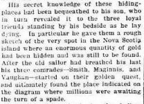
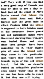
You sort of get it that with multiple copies of the treasure map being passed around different islands were searched? Even the friggin reporter below 'gets it' here.


alltogether.png


Having now learnt it's already known that yes, they had a treasure map from the beginning, yes, searchers were using it to plot the ONE location to look on Oak Island (you know, in scale by marking datum rocks) and, yes, there were many copies in existence in many hands that were matched to other islands, not just Oak Island, you do then appreciate what this discloses about the substance of your diagrammatic theory of how the treasure maybe at some other location on Oak Island?

You get it now why the Laginas keep returning and do the main work at the 'Money Pit' site?

So now you are up to the 21st century instead of going round and round in circles trying to figure out something already known please save the typing and tell is something we don't know.

(And just don't go 'Oak island looks like the way Juan Fernandez was drawn on old naval charts' either, you know 21st century now, not 1970)
 

Attachments

  • Century of seraching crop.jpg
    Century of seraching crop.jpg
    29.5 KB · Views: 57
  • hands abroad.png
    hands abroad.png
    17 KB · Views: 46
  • he gave them a map.jpg
    he gave them a map.jpg
    30.5 KB · Views: 57
  • old parchment maps.png
    old parchment maps.png
    68.9 KB · Views: 55
Last edited:
OP
OP
G

gjb

Sr. Member
Apr 21, 2016
255
323
UK
Detector(s) used
Garrett Ace 300i
Garrett EuroAce
Primary Interest:
All Treasure Hunting
Interesting that the maps don't indicate the island is 500 feet from the HUGE mainland . . . like Oak Island is. And also the compass rose in those three "maps" is tilted in very different orientations.


The same Harold Wilkins who insisted that we are under attack from hostile UFOs, the Earth is hollow, and that survivors of Atlantis took up residence in tunnels under Brazil? Gorsh! We've been living in lies!

That no accredited historian or archeologist ever believed in to begin with.
Wacky writers often take genuine information and misuse and misdirect it, which is exactly what Wilkins did. That doesn’t mean that the original information they used is necessarily false. That’s why it’s important to research the subject and get behind the wild stories and the misinformation in order to reveal the actual state of affairs.

Wilkins got hold of information from a file of papers from the 18th and 19th centuries and used it for his own purposes having no idea what it might actually mean or to where it pertained. Furthermore, some unscrupulous individuals also used some of the same leaked information in a scam that produced the Palmer-Kidd Maps.

Thereafter, Wilkins wrote Captain Kidd and His Skeleton Island creating a fantasy out of genuine extracts from an old file that purported to pertain to the burial of a treasure on an island that had not been identified. This produced the Wilkins-Kidd Maps.

However, the file in question clearly also contained a map of Oak Island which is not to say that this is necessarily the island to which the papers applied, though assuming that it is then makes sense of the five sets of instructions that were taken from the same file.

Wilkins’ obvious eccentricity need not have had anything to do with the validity of the information he obtained other than in the way he chose to misrepresent it. There’s a good chance that he left the information exactly as it was.
 

OP
OP
G

gjb

Sr. Member
Apr 21, 2016
255
323
UK
Detector(s) used
Garrett Ace 300i
Garrett EuroAce
Primary Interest:
All Treasure Hunting
Honestly, this guy is so far behind the 8 ball as to what is known he needs some help or it's going to be him just flooding the thread out.

It's already known now there was a treasure map used on Oak Island.

It's been known from the start, it's been published many times and it's known on the island today.


View attachment 2010316 View attachment 2010331

It's known that those used there were all copies of the multiple copies that are in existence. It's no mystery then why they all appear to mark the same position or carry the same 'directions'. Exactly how this remains some unfathomable puzzle that needs detailed examination to discover the answer I don't know except if your research is based on material from the 1970s.


View attachment 2010317
If you could sort of get your head around that it's also known how different features from different islands crept in to produce 'generic' shaped treasure maps we won't have to endure more of you trying to explain in lengthy and wondrous terms how this all could possibly be.

View attachment 2010326 View attachment 2010328

You sort of get it that with multiple copies of the treasure map being passed around different islands were searched? Even the friggin reporter below 'gets it' here.


View attachment 2010318


Having now learnt it's already known that yes, they had a treasure map from the beginning, yes, searchers were using it to plot the ONE location to look on Oak Island (you know, in scale by marking datum rocks) and, yes, there were many copies in existence in many hands that were matched to other islands, not just Oak Island, you do then appreciate what this discloses about the substance of your diagrammatic theory of how the treasure maybe at some other location on Oak Island?

You get it now why the Laginas keep returning and do the main work at the 'Money Pit' site?

So now you are up to the 21st century instead of going round and round in circles trying to figure out something already known please save the typing and tell is something we don't know.
It would really help a huge amount if you’d just do some genuine research for a change before declaring that you know all the answers. It would also be pertinent to consider the following:

1. The maps would relate to a period at least some 250 to 400 years ago.
2. They purport to be treasure maps.
3. They are highly likely to be copies.

Each has implications. The first is that the further back one goes the less accurate the maps. Zena Halpern’s map of Oak Island is far too accurate to date to the period that she claimed.

The second point is that, as treasure maps, they are likely to be aimed at avoiding giving too much away. The fictional map of Treasure Island was effectively a failure because it made no attempt to render recovery difficult for anyone but the person intended to do so.

The third point means that something could have been lost in transcription and that the copier may have elaborated upon the original content for their own purposes.

Wilkins’ files reveal that his maps are drawn from 17th century charts of Juan Fernandez simply because this is the island to which the owners believed the instructions applied. His maps look nothing like modern maps of the island because the 17th century originals look nothing like the island either.

It’s that simple, as actually bothering to do some proper research on the subject would show. I happen to know the actual source and location because I have Wilkins’ files, but anyone should be able to work it out.

JF Ringrose side.gif

At left above is the 17th century original with Wilkins’ creation to the right. If the mention of ‘Goat Hills’ on the promontory of both maps doesn’t give it away then the similarity of ‘Falβ Bay’ and ‘Falβ Anchoring’ or the depictions of the mountains and woods should do so. There are other indicators, the locations of Hunters’ Gulley and Death Valley being one and of the siting of the anchor and anchorage another. Furthermore, Wilkins has the same inlet at ‘Oister River’ as on the original.

The map at left below is from a mid-18th century chart of the same island which looks far different from the above but is still no more accurate. To its right is the Palmer-Kidd Map D.

Juan Fernandez Map D.jpg

The owners of the map instructions believed them to pertain to Juan Fernandez - I was not told why but I believe I may know - and, consequently, the instructions were transferred to outlines of that island. Wilkins did exactly the same thing, irrespective of what you decide to believe and what you keep telling everybody you know.

Why not stop simply guessing, and do some research instead of declaring that you know all the answers with no foundation whatsoever.
 

Singlestack Wonder

Bronze Member
Mar 28, 2014
1,711
2,627
Detector(s) used
Garrett AT Pro
Primary Interest:
All Treasure Hunting
It would really help a huge amount if you’d just do some genuine research for a change before declaring that you know all the answers. It would also be pertinent to consider the following:

1. The maps would relate to a period at least some 250 to 400 years ago.
2. They purport to be treasure maps.
3. They are highly likely to be copies.

Each has implications. The first is that the further back one goes the less accurate the maps. Zena Halpern’s map of Oak Island is far too accurate to date to the period that she claimed.

The second point is that, as treasure maps, they are likely to be aimed at avoiding giving too much away. The fictional map of Treasure Island was effectively a failure because it made no attempt to render recovery difficult for anyone but the person intended to do so.

The third point means that something could have been lost in transcription and that the copier may have elaborated upon the original content for their own purposes.

Wilkins’ files reveal that his maps are drawn from 17th century charts of Juan Fernandez simply because this is the island to which the owners believed the instructions applied. His maps look nothing like modern maps of the island because the 17th century originals look nothing like the island either.

It’s that simple, as actually bothering to do some proper research on the subject would show. I happen to know the actual source and location because I have Wilkins’ files, but anyone should be able to work it out.

View attachment 2010413
At left above is the 17th century original with Wilkins’ creation to the right. If the mention of ‘Goat Hills’ on the promontory of both maps doesn’t give it away then the similarity of ‘Falβ Bay’ and ‘Falβ Anchoring’ or the depictions of the mountains and woods should do so. There are other indicators, the locations of Hunters’ Gulley and Death Valley being one and of the siting of the anchor and anchorage another. Furthermore, Wilkins has the same inlet at ‘Oister River’ as on the original.

The map at left below is from a mid-18th century chart of the same island which looks far different from the above but is still no more accurate. To its right is the Palmer-Kidd Map D.

View attachment 2010414
The owners of the map instructions believed them to pertain to Juan Fernandez - I was not told why but I believe I may know - and, consequently, the instructions were transferred to outlines of that island. Wilkins did exactly the same thing, irrespective of what you decide to believe and what you keep telling everybody you know.

Why not stop simply guessing, and do some research instead of declaring that you know all the answers with no foundation whatsoever.
Actually, you should do some actual research vs. reading fiction from Harold Wilkins.
 

Top Member Reactions

Users who are viewing this thread

Top