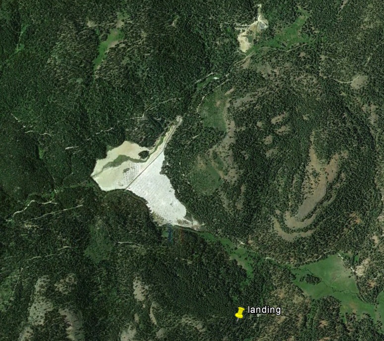
THE WALKER MINE

63bkpkr

Silver Member
Aug 9, 2007
4,069
4,618
Southern California
Detector(s) used
XLT, GMT, 6000D Coinmaster
Primary Interest:
All Treasure Hunting
Not been at That Walker Mine, thank you for the video. The Walker Mine I've been to in NorCal one can only hike in to it, it does have tracks and an ore care at the mine opening though it only goes in for a 100' or so. It is in Beautiful Sierra country but it is a rough hike in and out.

169_6953.JPG 170_7010.JPG 170_7094.JPG Lovely country even if it is mostly Boots to the Ground...........63bkpkr
 

Hefty1

Bronze Member
Dec 5, 2010
1,702
1,477
Hey ghostminer, got any videos of your operations?

In response to your PM to me, on what this question has to do with this thread. Maybe nothing to you, but as far as videos, it has a lot to do with you and a lot of your other threads. As i was just curious if you had any? A simple YES or NO would have been fine. Have a good day. :laughing7:
 

Rail Dawg

Sr. Member
Oct 11, 2015
491
890
Northern Nevada
Detector(s) used
MineLab GPZ 7000
Garrett ATX Pro
Primary Interest:
Prospecting
I for one like your updates ghostminer.

We’re all prospectors don’t let the rocks from those in the gallery take away from you and your team in the arena.
 

OP
OP
G

ghostminer

Guest
Thanks for those kind words.
 

Last edited:

jeff of pa

Super Moderator
Staff member
Dec 19, 2003
85,899
59,692
🥇 Banner finds
1
🏆 Honorable Mentions:
1
Primary Interest:
All Treasure Hunting
Ghostminer.. I wont be sad to see ya go.. You are as transparent as glass.. As far as I'm concerned this forum is better off without your discovery channel mining education.. You got something better to do then partake on social media then I suggest you do it.. I'm sure your investors would appreciate you getting some actual results instead of trolling for more investors..

MadMarshall is on a 30 day break for an Attitude Adjustment .
 

Last edited:

Laz7777

Sr. Member
Dec 19, 2015
255
494
South Fork Yuba River, Motherlode
Detector(s) used
GoldBug II
Primary Interest:
Prospecting
Attitude Adjustment? used to call that an AA meeting in my younger days...

hi I'm Laz and I'm an alco...wait a minute, I'm addicted to gold...no, I've gotta face I'm addicted to love....oh boy, I'm tired....
 

jeff of pa

Super Moderator
Staff member
Dec 19, 2003
85,899
59,692
🥇 Banner finds
1
🏆 Honorable Mentions:
1
Primary Interest:
All Treasure Hunting
at the Moment " If you've posted something, and it disappears, don't make a big deal out of it in another post! (You've probably violated some rule below!) "

Thread is about the Walker Mine, Not about Members . Moderators or Forum Rules
.
Let's get back on Topic !
 

Hefty1

Bronze Member
Dec 5, 2010
1,702
1,477
The Walker Mine is an 800-acre inactive underground copper mine in east-central Plumas County about 15 miles northeast of Quincy. The mine is at an 
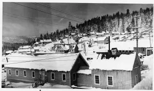
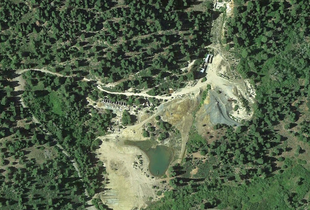
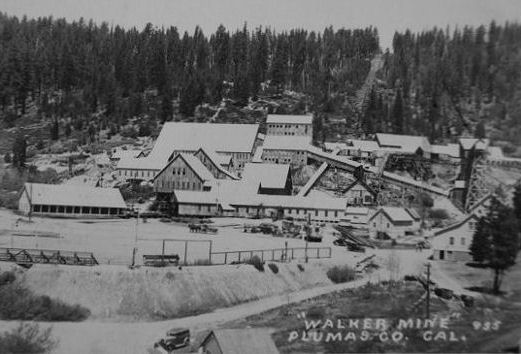
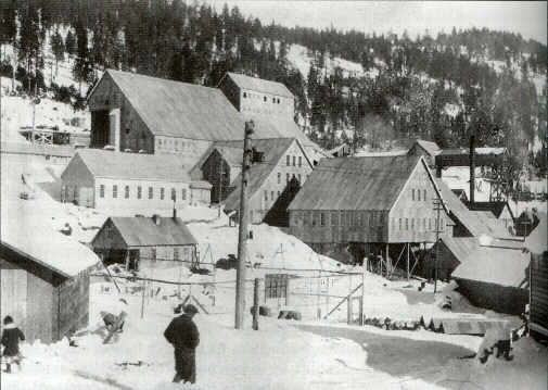
elevation of about 6,180 feet. The mine is estimated to contain about 13 miles of tunnels and 3,500 feet of vertical shafts. The Walker Mine was discovered in 1904, put into operation in 1915, and active mining took place until 1941. Since closure of the mine in 1941, the site has discharged acid mine drainage and heavy metals directly into Dolly Creek and Little Grizzly Creek.Ownership of Walker Mine has changed throughout the years. From 1915 through 1941 it was owned and operated by Walker Mining Company and International Smelting and Refining Company (ISRC). ISRC was a subsidiary of the Anaconda Copper Mining Company which was purchased by Atlantic Richfield Company (ARCO) in 1977. In 2000 ARCO became a subsidiary of British Petroleum. From the mid 1940s until the early 1990s, Walker Mine was controlled by Calicopia Corporation and Robert R. Barry. Cedar Point Properties Inc., bought the Walker Mine at a Plumas County tax sale in 1997 and abandoned it a few years later after the Regional Board issued a Cleanup and Abatement Order requiring Cedar Point Properties to comply with the Operations and Maintenance Procedures developed by the Regional Board 
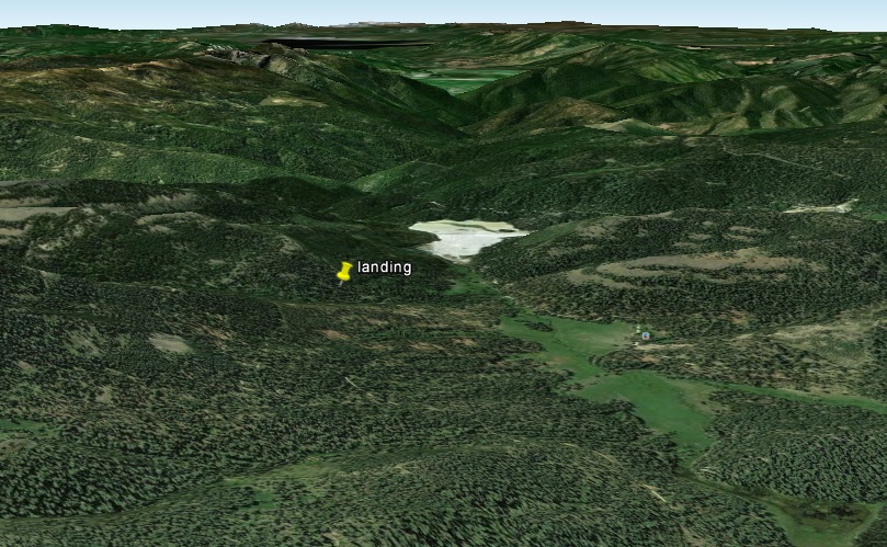
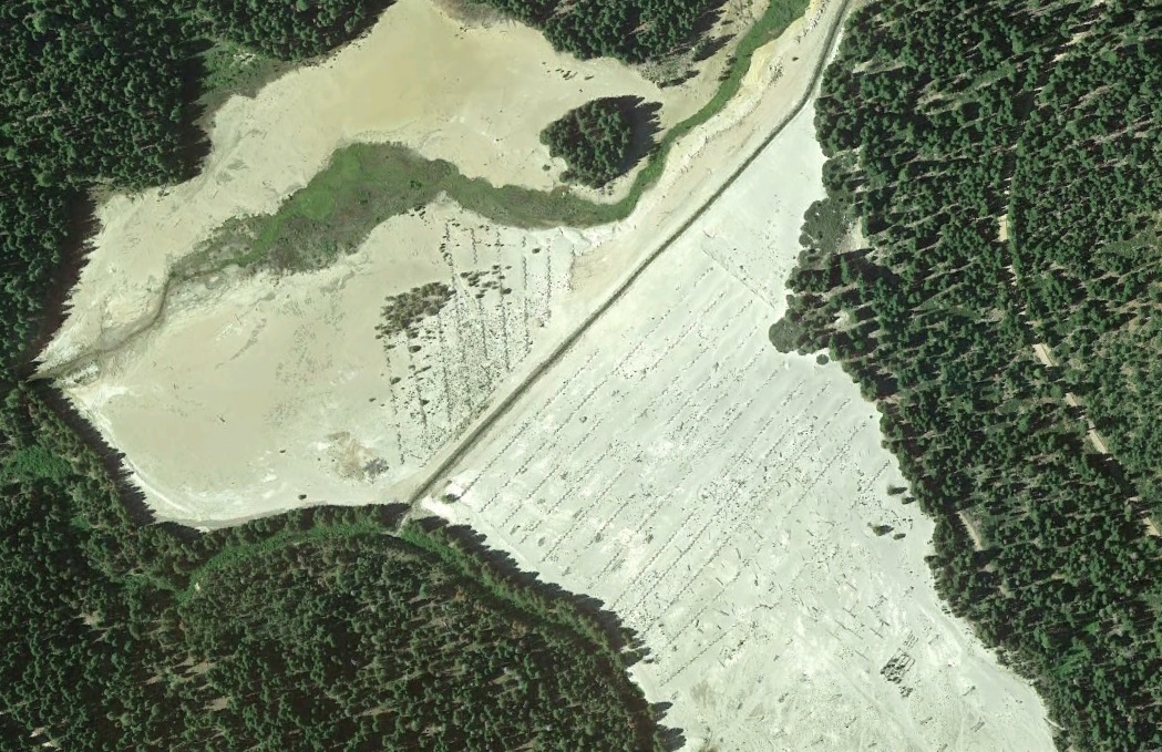
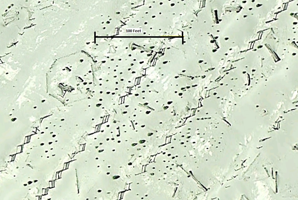
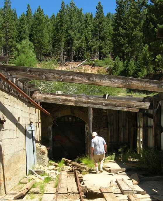
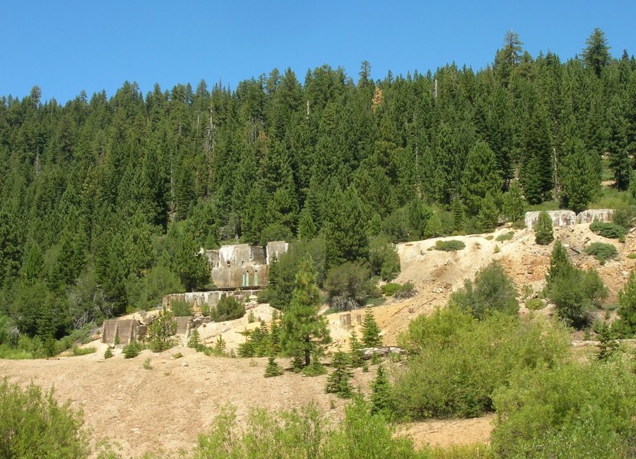
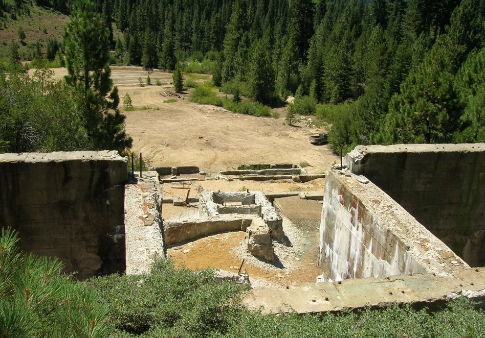
for the Walker Mine site. In November 1987, the Regional Board installed an engineered concrete mine seal 2,675 feet from the 700-level portal of the Walker Mine. This seal was installed to prevent direct discharge of acid mine drainage from the underground ore zone to the surface waters of Dolly Creek.Water coming out of the mine had low pH and high concentrations of copper. The mine fills with water from infiltration of rain water and snow melt through varies sink holes and surface fractures. Copper concentrations in the mine discharge prior to installation of the mine seal were 280 ug/L. Mine water discharged into a small settling pond, which then discharged to Dolly Creek. The pH in the settling pond varied between 2.5-5. To solve the problem of acid mine drainage water flowing out of the mine, the Regional Board installed an engineered concrete seal in the 700 level adit of the Walker Mine. The mine seal has significantly reduced acid mine drainage from the mine. Cleanup and remediation activities have also been initiated by the US Department of Agriculture(US Forest Service) at the adjacent 70-acre Walker Mine Tailings facility located on land managed by the US Forest Service. Both Dolly Creek and Little Grizzly Creek run through the tailings facility site. Copper concentrations in Little Grizzly Creek downstream of the tailings site were around 288-691ug/L. Dolly Creek also had increased levels of zinc. The U.S. Forest Service has addressed this problem by diverting a portion of Dolly Creek into a lined channel that prevents contact with the tailings which then discharges directly to Little Grizzly Creek. Doing this has effectively reduced the level of copper and zinc in both creeks but has not eliminated it. Both projects have helped reduce the amount of metals entering Dolly Creek and Little Grizzly Creek. The mine seal has reduced the amount of metals being discharged from the Walker Mine. . Diverting Dolly Creek into the lined channel has helped reduce the concentration of metals in the both creeks closer to background levels but has not reached background levels.
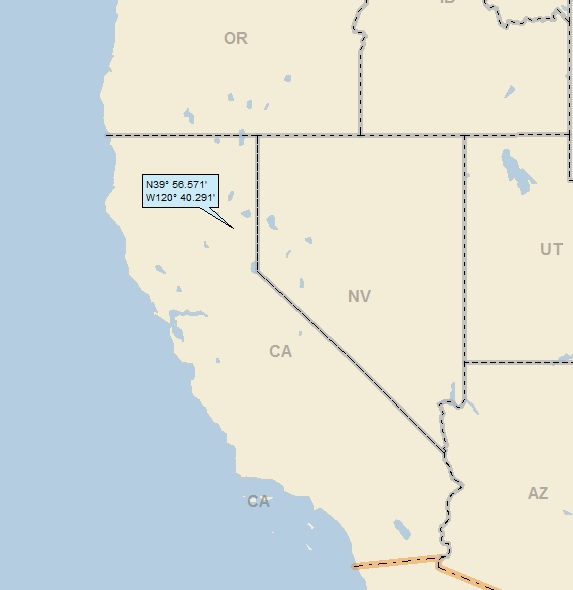
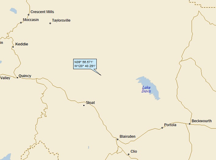
 

Hefty1

Bronze Member
Dec 5, 2010
1,702
1,477
[h=1]Walker Mine (Walker Brothers Mine; Walker Copper Mine; Native Son Mine [?]), Argentine Rock, Genesee Valley District (Genesee District), Plumas Copper Belt, Plumas Co., California, USA[/h]
This page is currently not sponsored. Click here to sponsor this page.
DisplayPhotosMapsSearch


icon_error.png

Oops! Something went wrong.
This page didn't load Google Maps correctly. See the JavaScript console for technical details.


Latitude & Longitude (WGS84): 39° 57' 37'' North , 120° 40' 3'' West
Latitude & Longitude (decimal): 39.96028,-120.66750
Köppen climate type:Csb : Warm-summer Mediterranean climate


A former lode Cu-Au-Ag-Zn-Pb mine located in secs. 5-8, T24N, R12E, and in secs. 29-32, T25N, R12E, MDM, 8.2 km (5.1 miles) E of Argentine Rock, 9.4 km (5.9 miles) NE of Greenhorn, about 2 miles SW of Mount Ingalls, about 8 miles SSE of Genesee, and 12 miles SE of Taylorville, in the headwaters area of Dolly Creek, on private property (patented claim). Land status: ownership category mixed. Owned by American Metals (1975); by AMAX, Inc. (50%), Nevada (1978); and the Continental Oil Co (CONOCO) (50%), Nevada (1978). Owned by the Calicopia Corp., Robert Barry, President, Beverly Hills, California (100.00%) (1978). Discovered in 1844 (MRDS file #10286027) or 1904 (MRDS file #10077104). Development did not begin until 1915. The mine was shut down 1932 - 1935. In 1935 it began treating 500 - 600 tons/day, which had increased by 1937 to 1200 tons/day. No known Pb or Zn were recovered. First year of production 1916. MRDS database stated accuracy for this location is 10 meters.

Mineralization is a vein deposit hosted in diorite, schist and hornfels. The ore body strikes N20-30W and dips 55-75E, at 15 meters thick, 36.58 meters wide and 304.8 meters long. It has a depth to, top, of 10 meters. It is a tabular/lenticular & massive-shaped replacement ore body with disseminated and massive ore. The primary mode of origin was contact metasomatism and the secondary mode was metamorphism. Primary ore control was lithology and folding was the secondary mode. Wallrock alteration is moderate including intermediate argillic and silicification. Chalcopyrite is the most prominent copper mineral in the ore. It carries considerable bornite, and in the richest streaks, pyrite is plentiful. Sphalerite, garnet, stibnite, cubanite, tetrahedrite, gold and jamesonite together comprise 0.59 weight percent of the total minerals present. Feldspar, biotite, pyroxene, actinolite, and tourmaline together comprise 5.0 weight percent of the total minerals present. The total mineral breakdown is as follows: 3.02 wt% chalcopyrite; 0.20 wt% chalcocite; 75.00 wt% quartz tourmaline; 2.50 wt% chlorite; 7.47 wt% magnetite, 0.98 wt% pyrite; 0.24 wt% pyrrhotite; 0.59 wt% sphalerite+galena+stibnite+cubanite+gold+tetrahedrite+jamesonite; 5.00 wt% feldspar+biotite+pyroxene+actinolite+tourmaline - 100.00 wt% total matrix. Local rocks include Mesozoic granitic rocks, unit 3 (Sierra Nevada, Death Valley area, Northern Mojave Desert and Transverse Ranges).

Local structures include faults with a maximum displacement of 20 feet, which cuts the veins. A quartz-diorite dike is found to displace the veins 10 feet.

The mine was discovered in 1909; mining efforts were not begun until 1911. Controlling interest in the mine was acquired by International Smelting and Refining Co, a subsidiary of Anaconda Copper Mining Co. By 1916 an extensive program of diamond drill coring proved enough ore on property to justify a flotation plant of 85 tons/day capacity; the plant was enlarged to handle 160 tons/day in 1918. The mine closed circa 1941.

The adjacent mining community established by Anaconda Copper was called Walkermine (one word) and is now demolished.

The oldest formation in the area is a pre-Silurian metarhyolite on Little Grizzly Creek. Overlying this are: the Peale Formation (Carboniferous), composed of sandstones, shales and some cherts; the Taylor meta-andesite; the Robinson Formation (Carboniferous, of sandstones and shales with few limestone lenses, and conglomerate beds; the Kettle meta-andesite; and the Trail Formation (Lower Jurassic), of slaty shales with some interbedded sandstones and conglomerates. These formations strike N30W in belts ½ to 1 mile wide, extending southeasterly from Genesee to the Walker Mine. The Trail Formation is altered in part to hornfels by intrusion of granodiorite. Alteration is intense. Little remains to indicate the original composition. The country rock is a fine-grained dark schist or hornfels formed by action of igneous intrusions on the sedimentary series.

Production data: continuous production from 1916-1932 was 2,876,000 metric tons mined. The period 1935-1941 continuous production realized 1,955,000 metric tons mined. Production data are found in: Averill (1937).

Bedrock sampling was conducted by the Bureau of Mines in 1978. There has been no mining activity at the Walker since 1978. In 1983; however, an unspecified company did some limited geological mapping. (John Burnett (1984), California Division of Mines and Geology, personal communication with the U.S. Bureau of Mines, WFOC, April 4, 1984.

Comments on the reserve resource information:

90% probability represents ore blocked out as of 1941 when production ceased - Anaconda company data. 75% probability represents combined probable and possible ore as proposed by Anaconda in 1941. 50% probability is assumed on the basis of favorable geologic conditions. Additional tonnages may be present based on exploration by CONOCO (Continental Oil Company) and American Metals Climax was conducted. Work was ongoing since 1975.

The mining method was filled stopes - horizontal cut and fill with tailings. Milling method was flotation.

Workings included extensive underground openings. They totaled 118,150 meters total length and an overall depth of 274.32 meters. An adit was 1,800 meters long.

The main haulage tunnel is the 7th level adit, 10,000 feet long. A raise was being driven from the Piute ore body to the surface in 1924. A winze had been sunk 500 feet on the South ore body, from the 7th level to the 10th level, and 150 feet of drifting done on the latter. A 350 foot winze was sunk on the C ore body from the 7th to the 9th level, 900 feet of drifting done here. On the 8th level, 600 feet of drifting was done on the S ore bnody and 400 feet on the C ore body. All stoping was above the 7th level.
[h=2]Mineral List[/h][h=2]Regional Geology[/h]
This geological map and associated information on rock units at or nearby to the coordinates given for this locality is based on relatively small scale geological maps provided by various national Geological Surveys. This does not necessarily represent the complete geology at this locality but it gives a background for the region in which it is found.Click on geological units on the map for more information. Click here to view full-screen map on Macrostrat.org
Tertiary - Lopingian2.588 - 259.9 Ma


ID: 2941043
Mesozoic granitic rocks, unit 3 (Sierra Nevada, Death Valley area, Northern Mojave Desert and Transverse Ranges)Age: Phanerozoic (2.588 - 259.9 Ma)
Stratigraphic Name: Atolia Quartz Monzonite; Coxcomb Granodiorite; Holcomb Quartz Monzonite; Lar Quartz Diorite; Liebre Quartz Monzonite; Mount Pinos Granite; Palms Granite; Sands Granite; Teutonia Quartz Monzonite; White Tank Quartz Monzonite; Vermont Quartz Diorite; Cadiz Valley Batholith; Barcroft Granodiorite; Bass Lake Tonalite; Big Baldy Granite; Boundary Peak Granite; Bridalveil Granite; Burnside Lake Adamellite; Cabin Granodiorite; Cactus Point Granite; Carson Pass Tonalite; Cathedral Peak Granite; Clover Creek Granodiorite; Cottonwood Adamellite; Cow Creek Granodiorite; Dinkey Creek Granodiorite; Ebbetts Pass Granodiorite; El Capitan Granite; Evolution Basin Alaskite; Giant Forest Granodiorite; Half Dome Quartz Monzonite; Hunter Mountain Quartz Monzonite; Inconsolable Granodiorite; Isabella Granodiorite; Johnson Granite Porphyry; Knowles Granodiorite; Lake Edison Granodiorite; Lamarck Granodiorite; Leaning Tower Quartz Monzonite; Lebec Quartz Monzonite; Leidy Adamellite; Lodgepole Granite; Lookout Peak Tonalite; McAfee Adamellite; Mitchell Peak Granodiorite; Mono Creek Granite; Mount Clark Granite; Mount Givens Granodiorite; Pear Lake Quartz Monzonite; Paradise Granodiorite; Pellesier Granite; Pohono Granodiorite; Potwisha Quartz Diorite; Round Valley Peak Granodiorite; Sacatar Quartz Diorite; Sage Hen Adamellite; Sentinel Granodiorite; Stanislaus Meadow Adamellite; Taft Granite; Tamarack Leuco-Adamellite; Tejon Lookout Granite; Tinemaha Granodiorite; Tungsten Hills Quartz Monzonite; Ward Mountain Trondhjemite; Weaver Lake Quartz Monzonite; Wheeler Crest Quartz Monzonite; Whitney Granodiorite. Hunter Mountain Batholith; Inyo Batholith; Sierra Nevada Batholith. Bald Rock Pluton; Bucks Lake Pluton; Bullfrog Pluton; Cartridge Pass Pluton; Cascade Pluton; Dragon Pluton; Grizzly Pluton; Independence Pluton; Merrimac Pluton; Paiute Monument Pluton; Papoose Flat Pluton; Pat Keyes Pluton; Sage Hen Flat Pluton; Santa Rita Flat Pluton; Swedes Flat Pluton; Tuolumne Intrusive Suite; John Muir Intrusive Suite; Shaver Intrusive Suite; Palisade Crest Intrusive Suite; Scheelite Intrusive Suite; Fine Gold Intrusive Suite; Soldier Pass Intrusive Suite; Mount Whitney Intrusive Suite
Description: Mesozoic granite, quartz monzonite, granodiorite, and quartz diorite
Comments: Sierra Nevada, Death Valley area, Transverse Ranges and Mojave Desert. Primarily granodiorite, tonalite, quartz monzonite, and granite ranging in age from Late Triassic to Late Cretaceous. Includes some rocks as old as Permian and possibly a few as young as Tertiary. Three main periods of emplacement (Triassic, Jurassic, and Cretaceous); wide variety of rock types
Lithology: Major:{granodiorite}, Minor:{granite,tonalite,quartz diorite,quartz monzonite}, Incidental:{diorite, quartz syenite, quartz monzodiorite, gabbro, trondhjemite, monzonite, monzodiorite, pegmatite, alaskite, aplite}
Reference: Horton, J.D., C.A. San Juan, and D.B. Stoeser. The State Geologic Map Compilation (SGMC) geodatabase of the conterminous United States. doi: 10.3133/ds1052. U.S. Geological Survey Data Series 1052. [133]

Data and map coding provided by Macrostrat.org, used under Creative Commons Attribution 4.0 License

This page contains all mineral locality references listed on mindat.org. This does not claim to be a complete list. If you know of more minerals from this site, please register so you can add to our database. This locality information is for reference purposes only. You should never attempt to visit any sites listed in mindat.org without first ensuring that you have the permission of the land and/or mineral rights holders for access and that you are aware of all safety precautions necessary.
[h=2]References[/h]
Hanks, Henry Garber (1884), Fourth report of the State Mineralogist: California Mining Bureau. Report 4, 410 pp. (includes catalog of minerals of California pp. 63-410), and miscellaneous observations on mineral products): 94.

Diller, J.S. (1905), Mineral resources of the Indian Valley region, California, USGS Bulletin 260: 45-49.

Diller, J.S. (1908), Geology of the Taylorsville region, California: USGS Bulletin 353: 115.

Turner, Henry Ward & A.F. Rogers (1914), A geologic and microscopic study of a magmatic copper sulphide deposit in Plumas County, California, and its modification by ascending secondary enrichment: Economic Geology: 9: 359-391.

Hamilton, Fletcher (1921) 17th Report of the State Mineralogist - Mining in California During 1920; California State Mining Bureau, January, 1921.

Logan, Clarence August (1921), Auburn field division: California Mining Bureau. Report 17: 471-473.

Young, George J. (1924), Anaconda's Walker Mine and Mill, Engineering and Mining Journal Press: 117(18): 725.

Averill, Charles V. (1928), Redding field division, Tehema and Plumas counties: California Division Mines & Mining Report 24: 280-285.

Knopf, Adolf (1935), Copper resources of the world; Plumas County copper belt, California: 16th. International Geol. Cong., I: 241-245.

Averill, Charles V. (1937), Mineral resources of Plumas County: California Journal of Mines and Geology, California Division Mines (Report 33): 33(2): 95-103, 113.

U.S. Bureau of Mines (1938), Copper Mining in North America, Bulletin 405: 61.

Eric, J.C. (1948), Copper in California: California Division of Mines Bulletin 144: 290.

Goodwin, Joseph Grant (1957) Lead and zinc in California. California Journal of Mines and Geology, Division of Mines: 53(3&4): 599.

Murdoch, Joseph & Robert W. Webb (1966), Minerals of California, Centennial Volume (1866-1966): California Division Mines & Geology Bulletin 189: 133, 163.

Smith, A.R. (1970) Trace elements in the Plumas Copper Belt, Plumas County, California. California Division of Mines and Geology Special Report 103: 3-26.

Wetzel, N. (1978), The Walker Copper Mine, Plumas County, Caifornia; U.S. Bureau of Mines MAS Report (July, 1978), 34 pp.

Pemberton, H. Earl (1983), Minerals of California; Van Nostrand Reinholt Press: 69, 85, 88 (map 3-3), 90, 93, 95 (map 3-5), 103, 134, 150.

University of California, Berkeley (1988), Mining Waste Study, Final Report (July, 1988), 416 pp.: 231-235.

USGS (2005), Mineral Resources Data System (MRDS): U.S. Geological Survey, Reston, Virginia, loc. file ID #10286027 & 10077104.

U.S. Bureau of Mines, Minerals Availability System (MAS) file ID #0060630556.


Hefty1

Bronze Member
Dec 5, 2010
1,702
1,477
Walker%20Mine%20Winter.jpg
newreply.php
Walker Mine


During the 1920s and 1930s, Plumas County was Number One
in state copper production. Engels Mine on Lights Creek in northern
Indian Valley produced $25 million over its lifetime. Walker Mine,
15 miles south, put out $23 million. Walker Mine competed with
Engels Mine as the most productive copper operation in the state
during the 1920s, achieving this status in 1929. Situated at a
6,500-foot elevation in central PlumasCounty, the mine is about 12
air miles east of Quincy. During its two-and-a-half decades of
operations, Walker Mine had more than 1,000 employees and 3,000
residents during its peak years.

George Bemis made his discovery at Walker Mine with
local assistance in 1904. However, mining operations did not begin
until 1911. Initial yields by 1914 were sufficient to warrant
construction of a bunkhouse and three cabins for workers.
High-grade ore assaying 12 percent copper was struck during October
1915. A new flotation plant was completed in 1916 with a daily
capacity of 85 tons. The mine’s sawmill, run by Charles
Campbell, was capable of cutting 7,000 feet daily. Electricity
arrived in 1917, when a power line was brought from Indian Valley
to the mine by the Great Western Power Company.

A unique feature of the Walker Mine operation was its
9-mile tramway, completed in 1919. It was built to transport copper
ore in 3-foot- by-4-foot buckets from the mine to the Western
Pacific Railroad (WPRR) siding at Spring Garden. There, the copper
ore was loaded into gondola carts and freighted to Tooele, Utah for
smelting. Also transported by the tram during winter periods were
food, freight, mail, and occasionally people. During winter, the
company town was cut off from the outside world, except for the
tramway. The line ran on wooden towers, each from 20 to 60 feet in
height. In winter, when the snow was extraordinarily deep,
crewswere employed near the summit of Grizzly Ridge to shovel the
snow out of the line of travel of the buckets.


The Boca & Loyalton Railroad (B&L) was built in
1901. The first B&L feeder track into Plumas County was laid in
1902, northwesterly through Sierra Valley and on to Beckwourth. In
about 1907, a 2-mile spur was builtnorth along Grizzly Creek in
order to haul logs. Five years later, in 1912, ice from Charles
Gulling’s 14-acre ice pond became another commodity to haul.
The Walker Mine Copper Company also used the Grizzly spur for a
brief period. Copper concentrates from the company’s mine on
the slopes of Mt. Ingalls were hauled by wagon to the Grizzly spur
and the B&L for shipment to the Southern Pacific Railroad
(SPRR), then eastward to Utah.

During Walker Mine’s most productive years, it was
operated by the Anaconda Copper Mining Company. The company town of
Walkermine was built to support work crews and their families
during that period. The town supported a hospital, a movie theater,
a school, a library, dining facilities, a store, a tavern, a post
office, a service station, a baseball field, and a ski hill.
Occupants of Walkermine lived in 132 company-constructed homes, 4
bunkhouses of three stories each, and 68 private homes. During its
heyday, 75 students attended the school at Walkermine and were
taught by just three teachers. Walkermine officially became a
defunct settlement in 1941, when Walker Mine closed permanently.
The mine and the town were sold at auction in 1945. The beginning
of the end for Walker Mine and its company town occurred when
copper prices and yields began dropping and the company suffered a
loss of $300,000 in 1939. The monthly payroll in 1940 for the 325
remaining employees was $75,000. Now, nothing but scars and a
logged-over bit of rubble remain of this once-flourishing
area.


Today all that remains is part of the building that were on the side of the mountian and other foundations. The town itself is long gone. If you have pictures of this from before please post so that all can see
 

Hefty1

Bronze Member
Dec 5, 2010
1,702
1,477
[h=2]Walkermine, Plumas County, California[/h]
Posted by graywacke on June 8, 2013 First timer? In this formerly once-a-day blog (and now pretty much an every-third-day blog), I have my computer select a random latitude and longitude that puts me somewhere in the continental United States (the lower 48). I call this “landing.” I keep track of the watersheds I land in, as well as the town I land near. I do some internet research to hopefully find something of interest about my landing location. To find out more about A Landing A Day (like who “Dan” is and what the various numbers and abbreviations mean in the first paragraph), please see “About Landing,” (and “Abbreviations” and “Cryptic Numbers”) above.
Landing number 2021; A Landing A Day blog post number 439.
Dan – A pretty good string of USers going on (6/7), with this landing in . . . CA; 94/108; 7/10; 5; 150.4. This was my fourth 2013 CA landing. Well, I mentioned it last post, and I’ll mention it again. I’m getting awfully close to breaking through the mythical 150 barrier. Stay tuned. Anyway, here’s my regional landing map:

My closer-in landing map shows that I landed in the boonies, in the midst of many small (mostly very small) towns.

I landed in the watershed of Emigrant Creek; on to Little Grizzly Creek; on to Indian Creek, and then on to two new rivers (my 1118th and 1119th rivers): first the East Branch of the North Fork of the Feather River and then on to the North Fork of the Feather River; on to the Feather itself (2nd hit); on to the Sacramento (25th hit).
What you’re seeing right now is a unique ALAD happening. Never before have I named a post after a location that’s not on a StreetAtlas map. Well, there’s a first time for everything. So, where does “Walkermine” come from? Well, I’ll start with my Google Earth shot, which has no clue about Walkermine. In fact, it looks like I’ve landed in a pristine mountain wilderness setting:

OK, now I’m zooming out a little, and something rather suspicious comes into view:

Huh. A big, Africa-shaped white patch, out here in the wilderness, with some other disturbed areas off to the northeast. Very peculiar . . .
Before investigating the white patch, I’ll zoom back and share this oblique GE shot to give you an overall feel for the landscape:

If not for “Africa,” it would be lovely! Zooming in a little, here’s a closer view of Africa, which measures about 3,000 feet “north to south”, which makes it nearly 100 acres in size.

And what the heck, let’s zoom way in and see what we can see:

Wow. I don’t have a clue what I’m looking at (well, anyway, I didn’t when I was first perusing GE).
I then zoomed into to the other disturbed area:

Hmmm. Looks like some old industrial facility of some sort. . .
My first indication of what might be going on was when I activated Panoramio photos on GE and saw a bunch of photos posted right at the above area. Several of the photos referenced “Walker Mine.” The search was on: the former town of Walkermine was discovered, and my post title was soon selected.
From CaGenWeb.com:
George Bemis made his discovery at Walker Mine in 1904. Initial yields by 1914 were sufficient to warrant construction of a bunkhouse and three cabins for workers. High-grade ore assaying 12 percent copper was struck during October 1915. A new flotation plant (for ore processing) was completed in 1916. Electricity arrived in 1917, when a power line was brought from Indian Valley.
That’s enough background – now make sure you read this part:
During Walker Mine’s most productive years (1920 – 1930), it was operated by the Anaconda Copper Mining Company. The company town of Walkermine was built to support work crews and their families during that period (1,000 workers and 3,000 Walkermine residents). The town supported a hospital, a movie theater, a school, a library, dining facilities, a store, a tavern, a post office, a service station, a baseball field, and a ski hill.
Occupants of Walkermine lived in 132 company-constructed homes, 4 bunkhouses of three stories each, and 68 private homes. During its heyday, 75 students attended the school at Walkermine and were taught by just three teachers. Walkermine officially became a defunct settlement in 1941, when Walker Mine closed permanently.
Wow. There was a whole town, and now it’s all gone. A really strange aspect of this town was that in the winter, it was totally isolated because of massive snowfalls typical for the region. But the mining went on (with ore being shipped out), and supplies were needed. How did they do this when the roads were impassable? Read on . . .
A unique feature of the Walker Mine operation was its 9-mile tramway, completed in 1919. It was built to transport copper ore in 3-foot- by-4-foot buckets from the mine to a railroad siding at Spring Garden. There, the copper ore was loaded into gondola carts and freighted to Tooele, Utah for smelting. Also transported by the tram during winter periods were food, freight, mail, and occasionally people. During winter, the company town was cut off from the outside world, except for the tramway. The line ran on wooden towers, each from 20 to 60 feet in height. In winter, when the snow was extraordinarily deep, crews were employed near the summit of Grizzly Ridge to shovel the snow out of the line of travel of the buckets.
Oh my! Amazing. Here’s a GE Panoramio shot (by Drafter) of one of the tramway wooden towers:

Here’s a GE shot showing the path the tramway took from the mine to Spring Garden:

From MiningArtifacts.org, here’s a shot of the old mine & town:

From Plumas County WebGen, here’s another old picture:

“Drafter” posted a bunch of Panoramio pictures of the mine site now. Here’s the old mine entrance:

Here are the ruins of the ore processing building:

Here are some more ruins . . .

I couldn’t find any information about the one hundred-acre Africa, except that it’s an old tailings pond, meaning a pond that used to receive wastes from ore processing. Such wastes are typically highly acidic (or lowly acidic, from a pH point of view), which is probably why, after all this time, that it’s a blight on the countryside, just sitting there. One might think that the State of California could cough up a few bucks to clean it up . . .
Moving right along . . . you’ll notice “Davis Lake” on my landing map east of my landing. I’ll close with this shot of a stream, just before it flows into the lake (Panoramio by The Utiman):


That’ll do it.
 

mikep691

Hero Member
Aug 6, 2015
858
1,759
Northeastern Sierra's
Primary Interest:
All Treasure Hunting
I too have been there. I also prospected the heavily claimed Little Grizzly Creek as well as Red Clover Creek to the north and east. Surrounding area is gold rich and full of mining history.
 

Top Member Reactions

Users who are viewing this thread

Top