Why do I care about a Quaternary map?

A#1

Hero Member
Feb 18, 2018
532
657
Traverse City, Michigan
Primary Interest:
Other
I found a few things that said to get a Quaternary map of my state.

That's easy enough. This is my Oh-Zee, northern Michigan.

Now what?

I can find what all the different stuff means, that's easy too

But I can't seem to find a decent explanation of how these pretty colors apply to a person looking for gold.

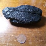
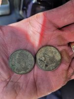
I guess I'm looking for alluvial gold.....So i would assume the purple with postglacial alluvium would be a start. I happen to live there, and I have found local gold.

But what about the others? Why not yellow dune sand? Or blue or green? Whats good, better, or best?

quarternary map.jpg

quaternary key.jpg
 

Last edited:
Upvote 0

Rail Dawg

Sr. Member
Oct 11, 2015
491
890
Northern Nevada
Detector(s) used
MineLab GPZ 7000
Garrett ATX Pro
Primary Interest:
Prospecting
Shooting from the hip it appears those maps are good for determining the transport of placer gold.

It doesn't seem the map describes in any way the faulting necessary for lode gold to get to the surface.

Find a geologic map for the area that indicates where the faults are (along with possible gold from past discoveries) then use the quaternary map to determine how that gold was transported.

I'm only up-to-speed with the geology of the western states so perhaps others here can show where I might be mistaken.

Cool map though! Every bit helps in solving the puzzle.
 

OP
OP
A#1

A#1

Hero Member
Feb 18, 2018
532
657
Traverse City, Michigan
Primary Interest:
Other
A map like this?

Pretty cool, I have three homes, and two of them are right on the lines of the Midcontinental Rift System. Does than mean I win something?

All the fault lines are 200 miles south of me.

fd95c2a8db6af589272c96553f2680b0.jpeg
 

Last edited:

winners58

Bronze Member
Apr 4, 2013
1,729
4,058
Oregon
Primary Interest:
All Treasure Hunting
you have to use a bunch of different maps, even study where the gold pushed down from Canada
comes into play Glacial Geomorphology, magnetic anomaly maps, and even the age of the rocks.
Great Lakes Geology
https://pubs.usgs.gov/ds/ds411/mi_boug.htm
then it comes down to boots of the ground, get out and check these places out for values.
some areas may just have barren rock, good or bad moraines, some should have gold...
aren't there some rich gold mines in the Michigan's upper Peninsula
 

Last edited:
OP
OP
A#1

A#1

Hero Member
Feb 18, 2018
532
657
Traverse City, Michigan
Primary Interest:
Other
Yeh, there was gold in the upper, but thats kind of like a different workd up there, and out of my range for nornal playtime.

Looks like i hot more reading to do.

The problem for me is actually finding a legal place to play. I found gold.....then I foind the law, OOPS. Most of the water within a hundred miles is a protected trout stream, or scenic or something.

The legal places are all spring drainage, or deep swamp.

The only decent looking one one.....yellow on the quaternary, dune sand. midcontinent drift line right thru it. Going there saturday to give it a look, maybe sample it.
 

Last edited:

arizau

Bronze Member
May 2, 2014
2,485
3,871
AZ
Detector(s) used
Beach High Banker, Sweep Jig, Whippet Dry Washer, Lobo ST, 1/2 width 2 tray Gold Cube, numerous pans, rocker box, and home made fluid bed and stream sluices.
Primary Interest:
Prospecting
Yeh, there was gold in the upper, but thats kind of like a different workd up there, and out of my range for nornal playtime.

Looks like i hot more reading to do.

The problem for me is actually finding a legal place to play. I found gold.....then I foind the law, OOPS. Most of the water within a hundred miles is a protected trout stream, or scenic or something.

The legal places are all spring drainage, or deep swamp.

The only decent looking one one.....yellow on the quaternary, dune sand. midcontinent drift line right thru it. Going there saturday to give it a look, maybe sample it.

Have you thought about gravel pits? Some folks have reported positive results from them. Their best results were from cleaning out existing sand screws in an active plant but they also looked for and prospected exposed seams of black sand around the perimeter of the pit wall. If there are any streams crossing the dune area you are talking about then look for black sand concentrations on the sand bars in or next to them. They may be small and thin but if there is any gold to be found then they are where you will most likely find some.

Good luck.
 

freeqgirl

Tenderfoot
Jul 31, 2018
9
9
Upper Peninsula of Michigan
Detector(s) used
Bounty Hunter - QuickSilver
Bounty Hunter - TreasureHunter
Primary Interest:
Metal Detecting
Yeh, there was gold in the upper, but thats kind of like a different workd up there, and out of my range for nornal playtime.

Looks like i hot more reading to do.

The problem for me is actually finding a legal place to play. I found gold.....then I foind the law, OOPS. Most of the water within a hundred miles is a protected trout stream, or scenic or something.

The legal places are all spring drainage, or deep swamp.

The only decent looking one one.....yellow on the quaternary, dune sand. midcontinent drift line right thru it. Going there saturday to give it a look, maybe sample it.

Being from the Upper, we are definitely a different world up here. LOL! As for your gold, in complete "newbie-ist" terms you are looking for the iron oxides and black sands depending on where you are (shoreline or inland.) I believe there is a river not far from Grand Rapids that yields some decent finds, but Michigan is VERY picky about the gold and most is in the trout streams which are off limits.....if you do find a good spot, you're only allowed a 1/4 oz per person per year......... DNR=DoNothingRight
 

Top Member Reactions

Users who are viewing this thread

Latest Discussions

Top