Cochetopa
Jr. Member
- Joined
- May 2, 2009
- Messages
- 65
- Reaction score
- 23
- Golden Thread
- 0
- Location
- Galt's Gulch, Colorado
- Detector(s) used
- Minelab Eureka Gold
- Primary Interest:
- Prospecting
- #1
Thread Owner
Hi,
I want to share with everyone a map dowsing process I am using. It may sound convoluted to you, but it helps me avoid becoming emotionally entangled in a project to the detriment of my objectivity.
A) Create a numbered list (Excel) of targets for which I would like to map dowse. For this specific project my list was:
1. ore deposit
2. nugget shooting
3. coin shooting
4. coins
5. mineral deposit
6. dore
7. meteorite
8. historical artifacts
9. Indian artifacts
10. cash
11. cave
12. gemstone
13. fossils
14. petrified wood
15. booty
16. contraband
17. hoard
B) Make 5 or 6 versions of this list, but in different sequences. Print a hardcopy of each list, fold each list in two, with eyes closed shuffle the pile of lists to where I no longer know which is which, and select one of the lists to use, but don’t look at its contents. The chosen list becomes my list of potential targets. I hold this list in one hand during steps C through F.
C) I placed a pile of folded, closed maps in front of me and asked, “Is there a TARGET from the list in my hand that is located on one of these maps which you want me to have now?” My dowsed answer was, “Yes”, so I continued.
D). Divide the map pile into two smaller piles, and ask, “Which map has the location of the TARGET you want me to have now?” Observe my instrument react to one of the two piles and eliminate the other. Divide the selected map pile into two smaller piles, etc. and iterate the process until a single map is identified. (This map pile technique isn’t my idea; it was my dowsing mentor’s, Sam Wolfe.)
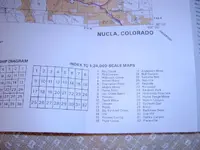
E) Open up the chosen map and dowse the TARGET location. The map in this project was a US Forest Service map, which had too coarse a scale for my skill level. So, I dowsed an approximate location from it, and then purchased a more detailed 1:24,000 scale USGS topographic map that covered the area in question. (You can order USGS maps here, The USGS Store - One stop shop for all your maps, world, United States, state, wall decor, historic, planetary, topographic, trail, hiking, foreign, satellite, digital ) I dowsed the specific TARGET location on this topographic map.
F) At this point I finally dowsed asking the question, “What is the number of the TARGET on this list in my hand which you want me to have now?” The answer I determined using a simple numerical chart I drew on a white board, was “9”, for Indian artifacts. Until now, I had been dowsing only for the TARGET for which I had asked back in step C. In fact, I had been envisioning only the word, “TARGET”, in my mind during steps D and E. In this way I was prevented from polluting my search project with mental implants, past personal history, known geographic place names, and treasure stories from books and magazines.
F) A few weeks later, I drove to the TARGET location that was outside the town of Nucla in southwestern Colorado.
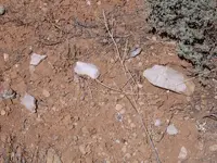
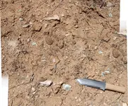
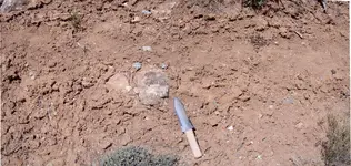
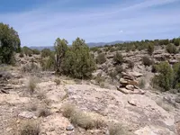
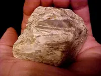
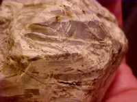
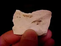
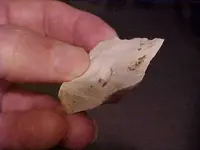
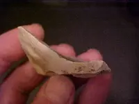
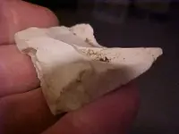
G) After driving as far as I could, I hiked to the location indicated on my topographic map and started looking on the ground for anything “unusual”. After about 10 minutes, I noticed a small, beige-colored rock that was out of place visually; it didn’t belong with the eroding mud and sandstone mesa material that was everywhere. I picked it up and identified it as flint, the material Indians made into knives, scrapers, arrowheads and spear points. (You can read about the Anasazi culture here, Ancient Pueblo Peoples - Wikipedia, the free encyclopedia ). So, I decided I needed to look for more flint, and 5 minutes later located my first loose agglomeration of flint shards left behind 100s of years ago by someone fabricating stone tools chip-by-chip-by-chip... I found 3 or 4 more similar sites in the next half-hour just walking around.
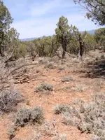
I have attached a couple of close-up photos of what the ground looked like where scattered flint chips could be observed. Also, I’ve included a portrait snapshot of one of the flint sites, the foreground light colored rocks are the flint debris left behind by Indian craftsmen from centuries past. Remember that these artifacts are protected by the Antiquities Act, so take only pictures and leave only foot prints.
There you have it, a complete map dowsing project. I hope you have enjoyed something from it, and feel free to adopt the technique for your own, or ignore it, as you choose.
Sincerely,
-C


