diggemall
Hero Member
- Joined
- Apr 19, 2006
- Messages
- 887
- Reaction score
- 24
- Golden Thread
- 0
- Location
- northeast Wisconsin
- Detector(s) used
- Fisher CZ3D, BH Discovery 3300
- #1
Thread Owner
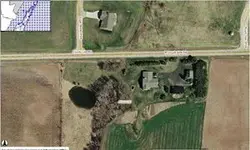
As mentioned in a previous post, not all areas are available in high-res format with Google Earth. However, there is a system called GIS mapping that is being implemented in many areas that allows for much higher res images. The first example below is a shot from Wisconsin's Door County GIS mapping service. The second shot is the same area from Google Earth.
Do a Google search for state, county, & GIS mapping to see if the service is available for the area you are interested in.
Do a Google search for state, county, & GIS mapping to see if the service is available for the area you are interested in.