Arent datums great! When using these different sources, it is very important to understand the datum, how it works, and also how your GPS works.
When using Google Earth, the foundation of what you see is WGS84 horizontally and Vertically. Most of what you see, the terrain DEM is based from SRTM data (Shuttle data) and again is based on the WGS84 Horizontal and the WGS84 ellipsoid for vertical.
Virtually all GPS internal engines use the WGS84 datum for horizontal and the WGS84 ellipsoid for vertical. How the horizontal and vertical information is determined is be particular to your unit. Some have the ellipsoid converted to a grid and use a lookup function, while others calculate with the Vincenty algorithm, or other method. What is important to know is when converting between datums, there will always be an error with the conversion factors. The most accurate methods are to look at what your unit has as the foundation, and use that.
The earth is curved in 2 directions, ie a sphere. If using a GPS to navigate a course, the navigation results will be very accurate when using a straight leg. (ie start at this point and go straight forward at this bearing for a distance) TF or tangent fix. This is because it is easy to calculate this on a single great circle calculation algorithm, the plane being curved in one direction.
When a curved leg is added, RF or radial fix, the calculations become very difficult, in reality, virtually impossible to calculate accurately, as the system is trying to look at the plane bent in 2 directions (ie begin at this point, and calculate the end of a 12nm radius curve that ends going at this bearing)
This solution will vary between manufacturers, and even when iterating multiple times on the same unit. An easy way to check is look at the beginning point of the curve, the distance to the radial point (center of the curve) the radius will be the 12nm entered. Now go to the end of the curve, and review the distance to that same radial point, you will find it can be off significantly, depending on the units built in calculator.
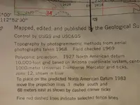
UTM:

When using UTM, it equally important to understand how the zones work, and make sure you have the correct information entered. Each zone begins on the map right side and works left. Measurements and data are the most accurate on the right, and will get less accurate (relatively) as you move left through the zone.
More than a few base maps have been significantly off by using the incorrect zone.
In regards to NAD83 vs WGS84, vertical datums,
WGS84 is a fixed global reference frame (i.e., datum):
http://www.wgs84.com/wgs84/wgs84.htm It uses the WGS84 spheroid. (The datum and the spheroid have the same name.)
there are maps that show the errors between the calculations, around a 2 meter difference, but they are pretty close for GP,
Well, thats probably enough gray matter stimulation for now! Good luck and enjoy!