utah hunter
Hero Member
- Joined
- Jul 30, 2007
- Messages
- 724
- Reaction score
- 11
- Golden Thread
- 0
- Location
- Utah county, Utah
- Detector(s) used
- Minelab x-terra 70, Fisher F75, eyes, brain
- #1
Thread Owner
I went to a not so well searched location where a Spanish cache exists(unless it has been removed of course). There was a mine nearby and there is a map showing some good detail but a few of the symbols on the map seem to have been made for the map maker to understand alone. The First trip to the site yielded some interesting information to decipher.
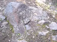
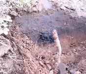
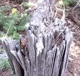
First the rock in the picture and the charcoal. Could the rock have been part of a smelter? It is not any I have seen before, but the charcoal was next to it at 6 inches, and the only reason I found the charcoal is that it set my detector off giving a penny/dime signal. With my 2 box detector I got a signal 5 feet from the rock that I didn't get from my standard coil, so it is deep. I didn't dig as it was more of an information gathering mission and the ground is very rocky and mineralized. The rock and signals are along what seems to be a trail. Within 100 feet are several hand hewn trees, I have also added a picture of one of these trees, does the age seem right(175 years)?
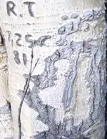
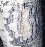
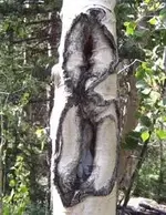
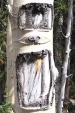
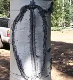
Next to these is the first tree symbol I have posted. I have no clue what it is. I have then posted several tree symbols I have found in the area. Some may be too recent, but I will leave it up to the experts here on tnet.
The area is 10,000 feet in elevation, so trees grow very slowly. Winters are long and very harsh. The map is pretty amazing in its detail for its age, and matching it up with google earth is pretty fascinating. The goal is 500 Spanish gold bars of unknown weight from a mine in the same area. Let me know what you think...Ryan
Attachments
-
 kennedy\'s 210.webp43.1 KB · Views: 1,166
 -
 kennedy\'s 209.webp28.2 KB · Views: 1,204
 -
 kennedy\'s 205.webp26.2 KB · Views: 1,211
 -
 kennedy\'s 212.webp20.6 KB · Views: 1,162
 -
 kennedy\'s 202.webp19.9 KB · Views: 1,166
 -
 kennedy\'s 203.webp15.8 KB · Views: 1,156
 -
 kennedy\'s 201.webp17.6 KB · Views: 1,170


