- #1
Thread Owner
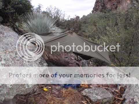
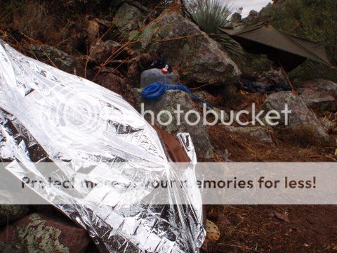
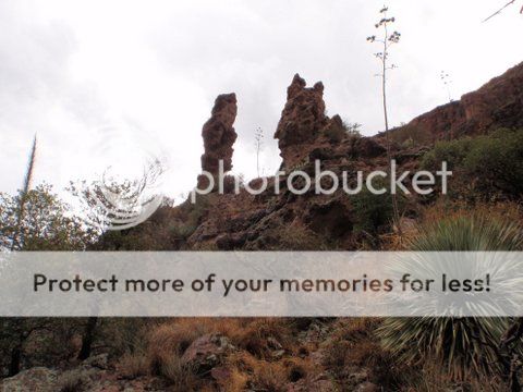
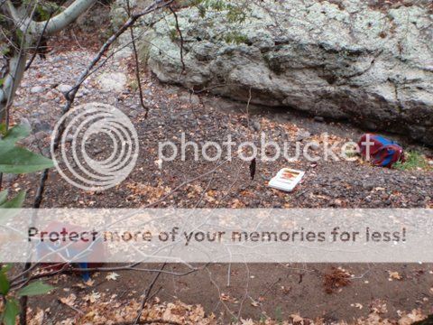
First I want to say a big THANK YOU to Phil from the Lost Dutchman Museum for hearing me out and sharing his theories with me, and covering my back as I went in to the Supes. And Mark for gettting me to the trailhead in his Jeep and coming back to pick me up. This all started in June when I came across the Peralta Stones and the stories behind them.. I figured that I would try my hand at finding where they lead, and I believe that I have. I started by using google earth. I know that everyone says that you can`t rely on it to be accurate and I see their point.But it is a good tool to use to start with. It helps to have a HD monitor and high speed internet. What I did was make a copy of the close-up photo of the Trail Map that Jim Hatt had posted and I noticed the arrow on the knife. I figured that meant north.So I started looking or an upsidedown heart. Right next to where it says Superstition Mountains was an upsidedown heart shape within a oval shaped mountain, so that`s where I started. That mountain I found out is White Mountain. So I started looking and searching.I thought that the white lines,the wash`s in the bottom of the canyons would be a trail but it did not fit exactly. I found a corral for animals and thought that was the begining of the trail but the cross over or X wasn`t right.I then started looking and found a shape that matched the square with two lines in the middle with a backeted cross on the east end of Cimeron Mt. wich is east of White Mt..Thats when I realized that the wavy line on the bottom of the Trail Map is the top of Cimeron Mt. as you would see it from the ground looking up. The bend in the starter arrow is a small ridge that leads to the top with a triangle pointing to a boulder near the top. This Is why no-one could find the trail,because it is not a trail per say. Take a copy of the Trail Map and fold it above the wavy line and get on GE and you can see all the marks on the map right on the side of the mountain.Then on top of Cimeron Mt. is the rest of the trail and all the markings. The trail goes from boulder to boulder or significant rock outcroppings all the way down into Rough Canyon then back up White Mt. into the heart. What You are doing is following the boulders not a trail per say.All of the markings,the symbols and numbers are all natural features that one could see from the a certain vantage point.As you pan out away from the heart looking straight down you will see in the natural formations of the ground 1847 and 1435 just as on the stones.Just below that is the 10.You can change the date on GE to see it better sometimes.You have to have an artistic eye to visualize what the guy who made the maps was seeing,open that mind.The Don Stone. This was the one I was trying to reach to get photos of because I believe this to be the ace in the hole. Over in Rough Canyon to the east of the heart at the bottom of a ravine is a white rock outcropping that has several rectangular shapes like the ones on the bottom of the heart stone insert. Above is the Don, upsidedown just like the picture of the stone. You can see a lot of simularities if you look for them.The Horse map.. Is on the west side of White Mt. on it`s southern end. If you pan away from the Mt. you will see a shape that resembles a pig or a Rhino,then look farther south,there is a smaller shape that resembles a horse,does this match up or what? Then if you look, you will be able to see the 5 with five boulders sticking out around it.Below that you can see RIO in the rocks.The Priest map is south. Pan out and look for the rocks to come to a point. There is where I see the priest`s face and the cross in his hands.8-N-P...8 Northern Points,the angled markings on the bottom of the Priest Map and the square blocks.I noticed that six of the lines converge to one location and two run parallel.The blocks are the green boundry lines on GE of the designated wildlife refuge designated in 1939 I believe, to the south.You have to turn on boundries/borders for it to show.I just roughed it in and the lines point to the bullseye in the heart,and the two parellel lines run to the Don rock and the cave just next to it. ...Anyway I did go there as far as I could.I recruted a good fellow by the name of Mark to drive me to Rodgers Trough Trailhesd in his 4x4 Jeep.By the time we broke an axle,overheated the engine,scrounged for water,etc. I started in around 15:30.I hiked till dark and then the storm began.I spent the night and travled on,but I was running out of time,and I lost service on my phone.It`s weird that I found that someone was there on the Mt. right where I wanted to go.When I yelled and they did not reply, or maybe they where too far in a mine to hear me.I found their saddle and cargo containers strown amoungst all the trash they left behind down in the wash. After I hiked out and got phone service again I called Mark to come get me ,then my phone`s battery was dead.I made it .I went as far as I could and I did it.I just wish I could have stayed longer.Maybe next time.


Last edited: