You are using an out of date browser. It may not display this or other websites correctly.
You should upgrade or use an alternative browser.
You should upgrade or use an alternative browser.
Need help
- Thread starter dc80
- Start date

Historical Maps of Pennsylvania
Pennsylvania Classic County Atlases
http://www.mapsofpa.com/atlaslist.htm
Penn Pilot Photo Centers
http://www.pennpilot.psu.edu/
Pennsylvania Dauphin County 1875 Everts & Stewart, 1875 Image Quality: High Quality High
Dauphin County 1875 Pennsylvania Historical Atlas
Dauphin County 1875 Pennsylvania Historical Atlas
Same Maps, Different Source in case one goes down
PA State Archives - MG-11 - 1875 Dauphin County Atlas Interface
[SIZE=+1]Map #795 - Atlas of Dauphin County, Pennsylvania, 1875[/SIZE]
Compiled, Drawn and Published from Personal Examinations and Surveys, by Everts & Stewart, Philadelphia
Compiled, Drawn and Published from Personal Examinations and Surveys, by Everts & Stewart, Philadelphia
PA State Archives - MG-11 - 1875 Dauphin County Atlas Interface
lookingharder
Sr. Member
I have used old census maps. Some of them go WAY back and were used by the people taking the census to be able to find houses off the beaten path. My mother in law showed me one for Mercer County KY. that was from 1860. She has work doing the census since the early 40's until a couple years before she died.
1941 Pendot Map
Some of the Many Codes to look for
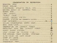
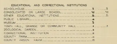

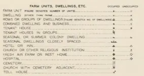
Dauphin County Map
http://www.dot7.state.pa.us/BPR_PDF_FILES/MAPS/Type_10_GHS_Historical_Scans/Dauphin_1941.pdf
Other Counties & years
County Type 10 Maps (Historic)
County Type 10 Historic
Some of the Many Codes to look for


Dauphin County Map
http://www.dot7.state.pa.us/BPR_PDF_FILES/MAPS/Type_10_GHS_Historical_Scans/Dauphin_1941.pdf
Other Counties & years
County Type 10 Maps (Historic)
County Type 10 Historic
Last edited:
Dauphin County Property AGE VIEWER
For this Building.

example:
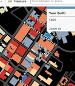
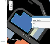
I believe this is still under construction.
only the Bottom Half of county appears complete
view the age of Buildings Through Out Dauphin County PA
http://www.arcgis.com/home/webmap/viewer.html?webmap=5be5249b03494eb0a95e31286ffc9d88
For this Building.

example:


I believe this is still under construction.
only the Bottom Half of county appears complete
view the age of Buildings Through Out Dauphin County PA
http://www.arcgis.com/home/webmap/viewer.html?webmap=5be5249b03494eb0a95e31286ffc9d88
Last edited:
if you need to know who owns a particular Property,
& their Mailing Address along with see a Photograph of the property, an aerial View ,
and General Property Lines , Past Owners, Age of Property, Use Etc.
Examples:
Censored by Me to Protect from Making things too Easy
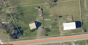
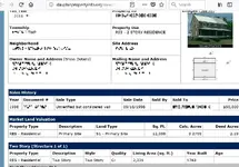
https://gis.dauphincounty.org/dauphincountyparcelviewer/
& their Mailing Address along with see a Photograph of the property, an aerial View ,
and General Property Lines , Past Owners, Age of Property, Use Etc.
Examples:
Censored by Me to Protect from Making things too Easy


https://gis.dauphincounty.org/dauphincountyparcelviewer/
Last edited:
nwpa
Jr. Member
- Joined
- Jul 6, 2017
- Messages
- 99
- Reaction score
- 124
- Golden Thread
- 0
- Location
- Northwest PA
- Detector(s) used
- T2 classic
X-terra pro
- Primary Interest:
- All Treasure Hunting
Also check out your local historical society.
Similar threads
- Replies
- 8
- Views
- 462
Users who are viewing this thread
Total: 1 (members: 0, guests: 1)


