Old Maps

I really like the older USGS maps with the aerial photos on the other side
 

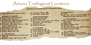
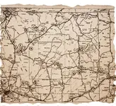
Arizona Tradingpost List 700.webpAZ tradeing post locations. Some were used for stage stops.
I like the ones that show the actual locations like this one.

The insert image is acting up again. I will try to post the map and list HERE later. Frank

Arizona 700 map.webp Click on map or list to inlarge. Click again to inlarge more. thats it.

hand print-2_edited-6.webp
 

Last edited:
Hope you realize that most old maps are free to copy at Arizona State University, Special Collections. May be some there you missed.
 

Top Member Reactions

Users who are viewing this thread

Latest Discussions

Back
Top Bottom