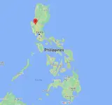
You can easily find Malasiqui on a map. It’s in Pangasinan province, north of Manila:

The ‘Malasiqui Ring’ was first suggested as a possible impact crater around 15 years ago I think, having been spotted in Google Earth images. However it was subsequently pointed out that, viewing at ‘ground level’ using the 3D features in Google Earth shows it to be a vast mound with undulating hills, rather than what looks like a depression when viewed ‘overhead’. That makes it really unlikely to be impact-related.
A commentator called ‘Rocel Pereira’, saying he was a remote sensing specialist, broadly agreed with that assessment of the Google Earth images and suggested that the way to confirm the area inside the ring is of higher elevation than the land outside would be by purchasing topographic maps from the National Mapping and Resource Information Agency (NAMRIA).
That proved not to be necessary when another commentator called ‘Alfredo Sarmiento Centeno’ said that his family owns a piece of land in the centre of the ring and confirmed that there is no depression. It’s a mound with undulating hills.
As far as I know, nobody has provided any geological findings to support an impact hypothesis (no shatter cones, planar deformation features in minerals, high pressure mineral polymorphs, impact melt sheets or dikes, pseudotachylytes, or impact breccias). As such, it doesn’t meet any of the criteria for inclusion in the Earth Impact Database.


