easttexasdigger
Jr. Member
- #1
Thread Owner
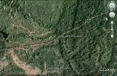
Hey here is an area that is said to have been the site of a Spanish fort at one time. It was located on the creek where the old road (El Camino Real) crossed the stream. Anyone with dowsing skills or advanced mapping skills want to try and help me pinpoint this one? Any help would be greatly appreciated.