St. Marys River Florida Map?

archer48

Greenie
Joined
Nov 13, 2009
Messages
15
Reaction score
8
Golden Thread
0
Location
Boulogne Florida
Detector(s) used
Garrett GTI 2500.. AT PRO
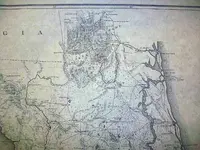
Anybody know where I can get a map of the St. Marys River on the Florida/Georgia border....all I can find is the area close to the ocean. I'm looking for a map on up the river towards Trader Hill, Boulogne, Kings Ferry, White Oak Plantation....... a map with water depths and such.

Thanks for the help
 

Might try the Army Corps of Engineers website.
 

Thats a fairly Remote area of Swamp lands.. not too much reason to map the depths in those days..
The 1839 Seat of War map by General Z.Taylor shows some locations of Forts along the river..
A larger size shot of that area is at

http://sunkentreasure.com/maps/stmary.jpg
 

Attachments

  • smmary.webp
    smmary.webp
    33 KB · Views: 1,290
not the river it self --but a interesting map of where you live is at -- the state of georgia's virtual vault website . -- try it you will like it , Ivan
 

I can tell you from diving there in the 90's that most of the mid channel dept runs around 30 feet. The bottom is a limestone type rock. Up around Woodstock Mills a ghost town on the Fla side is also that deep. Most of the ST Marys has a deep drop of it like you get in about 6-9 ft and it drops fast to 30.
 

Top Member Reactions

Users who are viewing this thread

Back
Top Bottom