-Ki-
Hero Member
- Joined
- Feb 12, 2009
- Messages
- 642
- Reaction score
- 583
- Golden Thread
- 0
- Location
- EASTERN KENTUCKY
- Detector(s) used
- MD & Handwand "CaveHunter"Hiker" SonyDigital SLR
- #1
Thread Owner


 This IS interesting... as I drink my "high-test" coffee (regular), the MANY journals... the MANY maps with "similar" features, reminds me of the various copies of the OLD, MOSTLY NEW TESTAMENT GOSPELS, from the


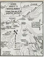
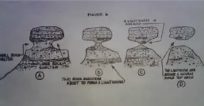
Swift was talking about standing on a overlook and looking west, from there he seen a hole in the cliff and could see the sky beyond....2Shoes said:"Lighthouse" Was that used for rock formations or anything other than regular lighthouses?
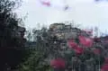
Diffrent names, same meaning......"lighthouse, needle-eye, and sometimes called window". These are not arches....swiftsearcher said:Ki, some of the older copied Swift Journals refer to the "Lighthouse Rock" as the "Needle's Eye" rock and, you are correct, it is West of the Rich Mine and the Buffalo and Table Top rocks (and the sinking creeks). There is one in my area that fits this EXACTLY, and is a rock jutting up high on a clift that looks EXACTLY like a needle with a hole near the top (hence, Needle's Eye Rock). I have several pics of it. The only bad thing is that the leaves were still on the trees when I took them, but you can still make out the rock nicely.
Its late i may be getting it confused with another place Ive been studying about today...aww yes the monument rocks..


 (WASSAIL!)
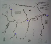
  "Symbols" on the map "could be"... Square with "stick man" figure (if, that is the one...); a LADDER... 3rd degree FreeMason (Master Mason), with "hands" on 4th "rung" to become involved with ROYAL ARCH FREEMASONRY... SEVEN RUNGS... SEVEN "dergrees". Royal Arch
rhoodphoto said:Ki,
Do you think your lighthouse (pictured above) is the same one I posted? Looks a lot alike I think.

 I am thinking, it is near a KING SOLOMON MINE; "on proper trail" sign May mean, nearby; read Knights Templar excavation of King Solomon's Temple ("google" it...). They were "camped" in the horse stables area... dug around; found SOMETHING! For you, it MAY mean near a "camp" area; POSSIBLY "very common area"... POSSIBLY be in a "stinky" (?!?) area... OFTEN avoided by others... DUNNO.