Alex Burke
Hero Member
I had the day off so I spent some time trying to find one of the 112 probable undiscovered gold deposits of Alaska
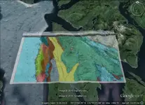
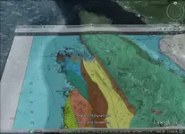
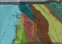
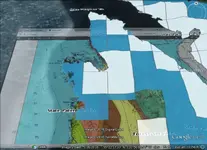
A couple of times I've seen Gravina Island mentioned as a probable deposit area and reading a couple of papers on it I thought it looked interesting. I realized it's not the kind of deposit I am hoping to find someday but I thought I'd look it up anyways as to me it's fun and you never know... The geologists put lots of question marks with (Au?) on the map of the area which I usually don't see too much, there wasn't much mining, claim history or sampling done there so the probability is based on what they consider a permissive tract and suitable geo I think. I layered a geo map over the area in GE and the areas where the (Au?) symbols appear are closed to mineral entry or private property once I turned on PLSS layers and looked at the Alaska land management site But there are 111 more left out there and I will try again next week
I'm interested if the GE overlay I saved works on your guy's computer with the map layered on top as I'm not too good with GE and haven't tried layering maps before. Is there a way to just turn on a layer with geo information on rather than going through layering the map like this? It isn't too hard but it takes too much time to do it and it seems like there might be a dataset layer for this I'm maybe missing somewhere on the web. Here are a couple of kmz files I saved and some pics.
View attachment Gravinawidekmlorz.kmz
View attachment GravinaB.kmz


A couple of times I've seen Gravina Island mentioned as a probable deposit area and reading a couple of papers on it I thought it looked interesting. I realized it's not the kind of deposit I am hoping to find someday but I thought I'd look it up anyways as to me it's fun and you never know... The geologists put lots of question marks with (Au?) on the map of the area which I usually don't see too much, there wasn't much mining, claim history or sampling done there so the probability is based on what they consider a permissive tract and suitable geo I think. I layered a geo map over the area in GE and the areas where the (Au?) symbols appear are closed to mineral entry or private property once I turned on PLSS layers and looked at the Alaska land management site
 But there are 111 more left out there and I will try again next week
I'm interested if the GE overlay I saved works on your guy's computer with the map layered on top as I'm not too good with GE and haven't tried layering maps before. Is there a way to just turn on a layer with geo information on rather than going through layering the map like this? It isn't too hard but it takes too much time to do it and it seems like there might be a dataset layer for this I'm maybe missing somewhere on the web. Here are a couple of kmz files I saved and some pics.
View attachment Gravinawidekmlorz.kmz
View attachment GravinaB.kmz


Amazon Forum Fav 👍
Upvote
0


