Just Another Clues Thread

Hal Croves

Silver Member
Sep 25, 2010
2,659
2,695
Hal,

Apparently, Waltz DIDN'T...if we're to believe the Holmes Manuscript deathbed directions, Waltz never told Holmes to go back to TC where he almost shot him...He tells Dick to go to first water, then second water...probably heavily modified from what Waltz actually said...but who knows...

It appears to be Brownie that relates the story of Waltz and Dick Holmes in TC...not Waltz...

My question was more about the location name.
Was the name TC being used when Waltz was alive?
The USGS states that it was a new name in 1917 but that's inaccurate.
Its found on the 1912 Roosevelt topo which is an amended 1907 survey.

I havn't been able to find the original 1906/7 topo. If TC is on that map, there is a decent chance that TC was a name familiar to Waltz.
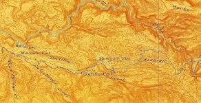
1912.jpg
 

Last edited:

Hal Croves

Silver Member
Sep 25, 2010
2,659
2,695
My question was more about the location name.
Was the name TC being used when Waltz was alive?
The USGS states that it was a new name in 1917 but that's inaccurate.
Its found on the 1912 Roosevelt topo which is an amended 1907 survey.

I havn't been able to find the original 1906/7 topo. If TC is on that map, there is a decent chance that TC was a name familiar to Waltz.
View attachment 1724844

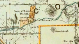
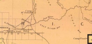
Not on the 1879 but Weavers is there.
1879.jpg
 

PotBelly Jim

Hero Member
Dec 8, 2017
900
2,992
Primary Interest:
Other
Hal,

Keep in mind that back then, Tortilla and LaBarge would appear to be the same canyon at the junction of the Salt. It's under water now, but it was one canyon that quickly branched into Tortilla and LaBarge if heading south from the river. Back when Waltz was first in the mountains, it was possibly known locally as "Lennan Canyon" after Cyrus Lennan. I'll take a look and see if I can find when it was first called Tortilla.

EDIT: Here's the 1907 Roosevelt Topo, which is the earliest USGS map of the area according to the USGS. Looks like not much changed in the 1912 version you posted above.

View attachment 1724890
 

Last edited:

deducer

Bronze Member
Jan 7, 2014
2,281
4,360
Primary Interest:
Other
My question was more about the location name.
Was the name TC being used when Waltz was alive?
The USGS states that it was a new name in 1917 but that's inaccurate.
Its found on the 1912 Roosevelt topo which is an amended 1907 survey.

I havn't been able to find the original 1906/7 topo. If TC is on that map, there is a decent chance that TC was a name familiar to Waltz.

Hal,

Since Tortilla Flat is said to have received its name as early as 1867, from John Cline when he and his cowboys got drunk and stranded on the flat with only flour from which they made endless tortillas, it is likely that the creek received its name around the same time and was probably known by the time Waltz came around.
 

PotBelly Jim

Hero Member
Dec 8, 2017
900
2,992
Primary Interest:
Other
I did a cursory search of newspapers, 1904 was earliest reference I could find there...I think it was nothing more than a rancher's name for the creek until the pencil-pushers showed up while building the Roosevelt Rd. That tank we all see there was apparently built in 1904 along with a windmill. Deducer, I think you may have nailed it, as they would have needed a name for the creek that contained the Flats where the Great Tortilla Diet occurred.
 

Hal Croves

Silver Member
Sep 25, 2010
2,659
2,695
Hal,

Keep in mind that back then, Tortilla and LaBarge would appear to be the same canyon at the junction of the Salt. It's under water now, but it was one canyon that quickly branched into Tortilla and LaBarge if heading south from the river. Back when Waltz was first in the mountains, it was possibly known locally as "Lennan Canyon" after Cyrus Lennan. I'll take a look and see if I can find when it was first called Tortilla.

EDIT: Here's the 1907 Roosevelt Topo, which is the earliest USGS map of the area according to the USGS. Looks like not much changed in the 1912 version you posted above.

View attachment 1724890
Please check the lower right corner of this map.

It can not be the original 1906/7.
 

PotBelly Jim

Hero Member
Dec 8, 2017
900
2,992
Primary Interest:
Other
I can't explain why...but it is definitely the 1907 version...here's the date from the marginal info:

View attachment 1724891

EDIT: It's in a different font...so perhaps this was a 1907 edition map, printed much later with updated place names??? This particular map MUST have been printed after 1927, as there is a reference to the 1927 NAD. So that probably explains it. There is no other date I can find on it. I can hang it on my Google drive if you want to take a look at this particular map.
 

Last edited:

Hal Croves

Silver Member
Sep 25, 2010
2,659
2,695
I did a cursory search of newspapers, 1904 was earliest reference I could find there...I think it was nothing more than a rancher's name for the creek until the pencil-pushers showed up while building the Roosevelt Rd. That tank we all see there was apparently built in 1904 along with a windmill. Deducer, I think you may have nailed it, as they would have needed a name for the creek that contained the Flats where the Great Tortilla Diet occurred.

Tortilla Campo 1904 Apace / Pima roadworkers camp.
 

markmar

Silver Member
Oct 17, 2012
4,117
6,259
Primary Interest:
All Treasure Hunting
Jim

I believe Waltz didn't told the clue of the incident at TC to Dick Holmes, because he told different clues, of a different route at his deathbed confession.

IMHO, the lookout at the junction of TC with LBC was a place from where Waltz could see down in the flat if someone would track him, but that place was not the real route to his mine.
The route that Waltz told to D. Holmes was " go to the first water and after to the second water ", clue which compared with the German clues, reveals how the first water was Verde River and the second water was Salt River.

The next clue Waltz told was " take the Military Trail to San Carlos " which was the MT that went straight south from the Rocky Shallow to what we know today as First Water region. We have to mix the German clues with the clues Waltz told to D. Holmes at his deathbed ( which are almost identical ), to have a better image of the route that leads to the LDM.
 

Last edited:

Hal Croves

Silver Member
Sep 25, 2010
2,659
2,695
I can't explain why...but it is definitely the 1907 version...here's the date from the marginal info:

View attachment 1724891

EDIT: It's in a different font...so perhaps this was a 1907 edition map, printed much later with updated place names??? This particular map MUST have been printed after 1927, as there is a reference to the 1927 NAD. So that probably explains it. There is no other date I can find on it. I can hang it on my Google drive if you want to take a look at this particular map.

Thank you for checking the dates.
The 1907 is not an easy one to find.

The Cyrus Lennan name is a new one and honestly fascinating.
I can only find one in Maine 1829 -1864.
 

Hal Croves

Silver Member
Sep 25, 2010
2,659
2,695
Thank you for checking the dates.
The 1907 is not an easy one to find.

The Cyrus Lennan name is a new one and honestly fascinating.
I can only find one in Maine 1829 -1864.
Just read the Cyrus Lennan story at Fish Creek.
Woolsey’s expedition was 1864, the same year the above Cyrus died.
24 Feb 1864
 

PotBelly Jim

Hero Member
Dec 8, 2017
900
2,992
Primary Interest:
Other
Hal, unable to open attachment.

Many folks think he was killed in Fish Creek. I happen to believe it was more likely Tortilla or LaBarge. Here are the best accounts I've found of his death. Conner says he was there, but his version of events is a bit off, to say the least...I'm not a big fan of his work...anyway, here's two letters written during, and just after the expedition by an actual member:

View attachment 1724912

And here's one by J. Ross Browne, who talked to expedition members right after the event:

View attachment 1724913
 

Last edited:

Top Member Reactions

Users who are viewing this thread

Latest Discussions

Top