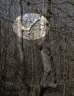
Spanish & KGC in the ozark mountains.

OP
OP
O

orangeman

Hero Member
Jan 15, 2014
792
1,394
Why would some use a shadow sign in the wilderness. Back in the day this area was not very inhabited by white people. If you did want to hide some it would be fairly easier task. They could've just left it under a over hang and it would have more than likely still been there years later.
 

PROSPECTORMIKEL

Silver Member
Mar 31, 2011
2,624
9,424
N/W ARKANSAS
Detector(s) used
FISHER
Primary Interest:
All Treasure Hunting
Question. Does a shadow sign still look kinda like what it's supposed to when the sun ain't right above it. And has any one heard of shadow signs made for different times of the day.


IMHO. Most can be spotted by those trained eyes that made them.

For those, like me, that aren't trained, they can be easily be missed.

When you take into consideration that most sculpting in stone would take days or weeks to create such a symbol as these would need to be started before their time of use, which indicates that these were intended for another party with a map to return on a specific date to find them.

I have seen a few on my site that are best seen between 8 and 10 am but can be seen later in the day, once found.

#/;0{>~
 

PROSPECTORMIKEL

Silver Member
Mar 31, 2011
2,624
9,424
N/W ARKANSAS
Detector(s) used
FISHER
Primary Interest:
All Treasure Hunting
Why would some use a shadow sign in the wilderness. Back in the day this area was not very inhabited by white people. If you did want to hide some it would be fairly easier task. They could've just left it under a over hang and it would have more than likely still been there years later.


IMHO, the larger the treasure, the more elaborate the signs need to be.

Think about this. If you had a few thousand dollars that you wanted to hide for your children, or their grandchildren, would you simply hide it under an unmarked rock in a forest.

The more difficult the combination, the safer the treasure.

#/;0{>:~
 

OP
OP
O

orangeman

Hero Member
Jan 15, 2014
792
1,394
ImageUploadedByTreasureNet.com1471446322.063344.jpg . This a pretty good sized tree.
 

OP
OP
O

orangeman

Hero Member
Jan 15, 2014
792
1,394
I'll get a better picture when the leaves are gone. I'll also get pictures of the trail to a stash stop and pictures of what they done to hide it. It's a long walk and don't want to fight with the seed ticks.
 

OP
OP
O

orangeman

Hero Member
Jan 15, 2014
792
1,394
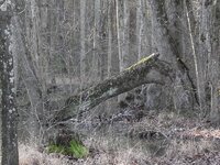
Don't know how the trees work but have found a bunch of them. I need to go back and get pictures of the and mark where they are on a map.
 

tinhorn

Full Member
Jul 28, 2011
220
228
Orangeman, American history teaches you that it was an uninhabited land... boots on the ground will teach you a very different story.
 

dsty

Bronze Member
Dec 2, 2007
1,300
736
Randal County
I agree with tinhorn, boot leather will teach more than classrooms, I know that there's LOT'S of folks out there that don't agree with me BUT have you ever seen a tree after its been hit by lightening, forest fire, wood for a fire, logs for a house, I rather follow a carving in stone, KGC, outlaw, cut a limb off a tree and you have a marker that will serve for many years to show the direction and usually the distance will be shown from the limb to the ground or just walk the direction it shows until you come to a flat rock or something, Who knows to could be a Spanish settlers ( aprox ) 110 troy oz ( 454 grams ) The limb may look like an old broke off limb or ax will do a pretty good job and may only be 12 ft high one horse and 1 man = 12 /15 ft
 

Chadeaux

Gold Member
Sep 13, 2011
5,512
6,408
Southeast Arkansas
Detector(s) used
Ace 250
Primary Interest:
Cache Hunting
Don't know how the trees work but have found a bunch of them. I need to go back and get pictures of the and mark where they are on a map.

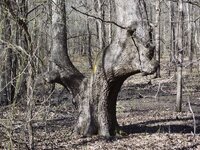
... Just dom't get the idea that all, or even "most" bent trees are treasure related. Native Americans used them to mark paths and locations. Think of our interstate signs today, those were the exit signs on the old paths. Some marked places to camp, places to hunt, places to find water, medicinal herbs and more.

This one marks a spring ... the nose is under water now because someone dammed up the stream bed.

002b.jpg

This one marks a low water crossing on the Ouachita river (on left) and the direction to the trail that led back to the Mississippi River (on right) near present day Eudora, AR. Likely used by John Murrell ... but are Native American in origin.

double-01.jpg

This tree was also joined together again a few feet off the ground:

holding_hands.jpg

I did, however, find one that was not Native American in origin, and likely one of John's trees located along the old Wheeler Trace in Southeast Arkansas.
 

Last edited:
OP
OP
O

orangeman

Hero Member
Jan 15, 2014
792
1,394
I know where there are lots of trees that look like they've been shaped or cut to grow in different than normal way. The frost gets here I'll get a lot of pictures of trees to post for y'all to look at and see what y'all make of them.
 

PROSPECTORMIKEL

Silver Member
Mar 31, 2011
2,624
9,424
N/W ARKANSAS
Detector(s) used
FISHER
Primary Interest:
All Treasure Hunting
I know where there are lots of trees that look like they've been shaped or cut to grow in different than normal way. The frost gets here I'll get a lot of pictures of trees to post for y'all to look at and see what y'all make of them.


When you do that, can you follow the trail and photograph the markers as you come to each of them?

Seeing each and the distance between them could be a great teaching tool,
Or it could debunk the myths that can perpetuate from naturally deformed trees, as caused by storms or long harsh winters or long dry summers.

Keep good notes about slopes and azimuths and distance as well as water sources etc...

Yeah, that's a lot, but it could be a valuable tool.

#/;0{>~
 

OP
OP
O

orangeman

Hero Member
Jan 15, 2014
792
1,394
If I put them on a topo map withe the stone markers it should show a pattern to what's going on maybe. I know there is a wagon trail that winds up a mountain that has many a bent tree a long it for a mile and a half more or less. There's six old home steads a long it.
 

OP
OP
O

orangeman

Hero Member
Jan 15, 2014
792
1,394
ImageUploadedByTreasureNet.com1471614750.483549.jpg there's a depression in the ground about 30 steps away in lint with 300 NW.
 

OP
OP
O

orangeman

Hero Member
Jan 15, 2014
792
1,394
There's a little to think on till frost. Then I'll get out and see if there is more to find.
 

Top Member Reactions

Users who are viewing this thread

Top