After 25 years, Im finally seeking outside help with this one.

Stroover

Full Member
Mar 28, 2006
119
1
Canadian East Coast
After 25 years, I'm finally seeking outside help with this one.

:-\ Ok, I give up. I've tried everything I can think of. I won't tell you what I've tried, in the hopes that I don't influence or taint any of your potentially "Eureka!" ideas. Here goes nothing:
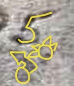
Translated into English, it reads: "1822 May 3, to the north 1505".
 

Attachments

  • Nord.jpg
    Nord.jpg
    60 KB · Views: 4,224
OP
OP
Stroover

Stroover

Full Member
Mar 28, 2006
119
1
Canadian East Coast
Re: After 25 years, I'm finally seeking outside help with this one.

Thanks Judy, but wrong part of Canada. I guess I should have mentionned approximately where it is. Without divulging too much information (ya bunch of pirates! Yarrr!) it's about 100 Km as the crow flies from Oak Island on the Bay of Fundy.
 

OP
OP
Stroover

Stroover

Full Member
Mar 28, 2006
119
1
Canadian East Coast
Re: After 25 years, I'm finally seeking outside help with this one.

Does anybody have any thoughts as to why they carved the year first, instead of after May 3? I'm thinking I need to be reading it in the reverse order. Does anybody know if in the 1800's they used to write the date with the year first?
 

Gypsy Heart

Gold Member
Nov 29, 2005
12,686
339
Ozarks
Re: After 25 years, I'm finally seeking outside help with this one.

Common practice during those times to write the year first. Alot of old letters will show that along with day before the month.
 

OP
OP
Stroover

Stroover

Full Member
Mar 28, 2006
119
1
Canadian East Coast
Re: After 25 years, I'm finally seeking outside help with this one.

gypsyheart said:
Common practice during those times to write the year first. Alot of old letters will show that along with day before the month.

Thanks! I've been inquireing about this, and nobody seems to know the answer. This narrows it down a lot, then.
 

Monk

Sr. Member
Sep 10, 2004
270
19
Where ever my coffee cup lands
Detector(s) used
Fisher 1280X
Re: After 25 years, I'm finally seeking outside help with this one.

Stroover, Can't say I'm not all wet! But might be worth a try.
= The date = The flag or spot? So the 1505 will tell you the next move?
1505= 11 degrees North? And again 15=6 0=nothing 5=5. = 65?
Try= 11% North, 65 Feet, Paces,Ect. distance?
Other then that I'm at a loss. Have fun.
 

The Beep Goes On

Silver Member
Jan 11, 2006
3,403
207
Houston, TX
Detector(s) used
CTX3030, Excalibur II, V3i, TRX
Primary Interest:
Metal Detecting
Re: After 25 years, I'm finally seeking outside help with this one.

What is there at 1505 feet and/or yards/meters to the North?

Did they use military time back then...maybe if you look north at 3:05PM...sounds dumb.

Maybe something happened in the year 1505 that is a clue to the distance...

Just throwing things out there.

HH!
TBGO
 

OP
OP
Stroover

Stroover

Full Member
Mar 28, 2006
119
1
Canadian East Coast
Re: After 25 years, I'm finally seeking outside help with this one.

The Beep Goes On said:
What is there at 1505 feet and/or yards/meters to the North?

Did they use military time back then...maybe if you look north at 3:05PM...sounds dumb.

Maybe something happened in the year 1505 that is a clue to the distance...

Just throwing things out there.

HH!
TBGO

The site is actually quite difficult to get to: 10 Km hike one-way in rough terrain in the woods (can't follow the beach, unless you want to sink in muck up to your elbows until you get to the point), and you must plan your trip according to the tides as to not be stuck there over night (Highest tides in the world, rising incredibly high then incredibly low due to a kind of funnel effect). Directly north of the stone takes you out in the sea, or mud flats at low tide. We're planning another trip there on, you guessed it, May 3rd. We're going to check out various things, including being on the other side of the point at low tide to see if another marker becomes visible. I've mapped out the tide schedule, and on or around that date the low tide is lower then usual every year. We also want to be there at 3:05 PM to see, among other things, if the sun may have anything to do with making another marker become visible. I also want to take a closer look at the holes below and around the date which, at first appeared to be due to water wear, but after much pondering I'm wondering if they might not also be man-made to represent stars or something like a constellation.

Monk, thanks for your input. I hadn't thought of that kind of mathematical possibility. This opens up a whole new can of worms!
Thanks, guys! And please keep the ideas comming. I have only 1 month left until I can test out all the possibilities, then it'll be another year before I go back, unless something remarkeable drives me to go back sooner.
 

Siegfried Schlagrule

Bronze Member
Mar 19, 2003
1,579
66
Indiana
Detector(s) used
All types of BFOs owned. Especially want White's Arrow; White's Oremaster; Exanimo Spartan Little Monster; Garrett contract Little Monster.
Re: After 25 years, I'm finally seeking outside help with this one.

One of the most overlooked problems with time directions is that folks think the pioneers and explorers used modern crap like daylight savings time. They were on god's time or for the heathens solar time. Calculate that and check it too. You will determine a window and can be there the whole time to see what they saw. A scientist could tell you what day this year would have the exact same conditions as that date that year. exanimo, ss
 

OP
OP
Stroover

Stroover

Full Member
Mar 28, 2006
119
1
Canadian East Coast
Re: After 25 years, I'm finally seeking outside help with this one.

Siegfried Schlagrule said:
One of the most overlooked problems with time directions is that folks think the pioneers and explorers used modern crap like daylight savings time. They were on god's time or for the heathens solar time. Calculate that and check it too. You will determine a window and can be there the whole time to see what they saw. A scientist could tell you what day this year would have the exact same conditions as that date that year. exanimo, ss

I concur, however the number "1505" troubles me considerably, as it is a precise number (not 1500, but 1505). I have been collecting various data on that date, and as I have mentioned the tide on that day was considerably lower then at other times. We have an expedition planned for May 3rd with various experiments in store, and it so happens that the low tide will be lower on this day also. A dive might be in order, as caves are throughout the area, and we suspect one might only be visible at lower tides. Did I mention this is kind of making me feel like Indiana Jones? Lol!
 

arkobnrs

Jr. Member
Feb 8, 2006
56
0
Re: After 25 years, I'm finally seeking outside help with this one.

LOL Stroover, my 19 y/o nephew asked me the other day if he could go th'ing with me and he said he wanted to be like indiana jones too.
 

gldhntr

Bronze Member
Dec 6, 2004
1,382
79
Re: After 25 years, I'm finally seeking outside help with this one.

possibly 150 + 5.....155 degrees
 

arkobnrs

Jr. Member
Feb 8, 2006
56
0
Re: After 25 years, I'm finally seeking outside help with this one.

Why isn't it AU (gold) north? AU is latin is it not?

and how about 150/5? 150 degrees 5 distances or vice versa?
 

gollum

Gold Member
Jan 2, 2006
6,729
7,596
Arizona Vagrant
Detector(s) used
Minelab SD2200D (Modded)/ Whites GMT 24k / Fisher FX-3 / Fisher Gold Bug II / Fisher Gemini / Schiebel MIMID / Falcon MD-20
Primary Interest:
All Treasure Hunting
Re: After 25 years, I'm finally seeking outside help with this one.

I notice on the rock there are several small holes. Have you checked out alignments of these holes to see if any point toward something else? The two under the inscription might be a guide to another clue or the entrance to a cave or tunnel.

Good Luck-Mike
 

gollum

Gold Member
Jan 2, 2006
6,729
7,596
Arizona Vagrant
Detector(s) used
Minelab SD2200D (Modded)/ Whites GMT 24k / Fisher FX-3 / Fisher Gold Bug II / Fisher Gemini / Schiebel MIMID / Falcon MD-20
Primary Interest:
All Treasure Hunting
Re: After 25 years, I'm finally seeking outside help with this one.

Maybe the 1505 is a code to tell which of the holes to use for alignment. Maybe if you could get a pic of the entire surface of the rock, we may be able to figure it out. I would tend to narrow my decryption efforts to four main ideas:

1. 1505 is the distance. If the holes are man made, guess at different alignments with different sets of holes.

2. 1505 is clue to which holes to use for alignment. Distance markers may not be necessary, as the proper hole alignment might point directly at where you want to go.

3. 1505 are degree clues. 15 deg up, and 5 deg left or right. I don't think this is the best as there is no break between the 15 and the 05 in the carving.

4. Something nobody has thought of yet! ;D You always have to keep an open mind! I have seen a lot of people get totally invested in one idea, refusing to hear anything else, and someone with a fresh pair of eyes swoops in and captures the flag! The funniest of these are people who see Death Traps in every rock formation, and think that the Spanish made signs that are meant to be viewed from the air! Check out this website:

http://users.commspeed.net/tbabbitt/toomb1.htm

Best of Luck-Mike
 

gollum

Gold Member
Jan 2, 2006
6,729
7,596
Arizona Vagrant
Detector(s) used
Minelab SD2200D (Modded)/ Whites GMT 24k / Fisher FX-3 / Fisher Gold Bug II / Fisher Gemini / Schiebel MIMID / Falcon MD-20
Primary Interest:
All Treasure Hunting
Re: After 25 years, I'm finally seeking outside help with this one.

Oh, and one other thing; this carving was made by a French or French-Canadian group. This info is mainly for everybody but Stroover. Mai is French for May, and Nord is French for North. I wouldn't look to 1505 to be a date. This is more than likely a cypher. Also, the "AU" 99% suredly does not mean gold as the periodic table wasn't in wide use until the 1860s.

Here is some info I found:

In 1822 England started the process for uniting Upper Canada (English) and Lower Canada (French). Neither side wanted to unite with the other as they spoke different languages, had different customs, and different religions. One thing I haven't been able to find out was if they had separate economies. If they did, they may not have wanted to give their money to a united bank. If this is true, there may have been money hidden by the Lower Canadians (French. The carving is in French) so they could keep it hidden from England.

I have NO FACTS to back up this theory, but it is vary plausible. One thing I have found is that if you know what was happening at the time a clue was left, it sometimes leads the way!

Mike
 

gollum

Gold Member
Jan 2, 2006
6,729
7,596
Arizona Vagrant
Detector(s) used
Minelab SD2200D (Modded)/ Whites GMT 24k / Fisher FX-3 / Fisher Gold Bug II / Fisher Gemini / Schiebel MIMID / Falcon MD-20
Primary Interest:
All Treasure Hunting
Re: After 25 years, I'm finally seeking outside help with this one.

Hey,

I just found something else in the picture. Look closely at the last 5 in the carving. Look just below and to the right of the 5. There is what looks like a sun or flower that is very faded. I Photoshopped it and include a closeup and drawing for reference. Also, in the main circle, there looks like a small hole at the bottom right.

Also, look at the letters and numbers in the carving. It looks like there are alignment holes hidden in the carving itself! Maybe the 1505 is telling you which letters to use for alignment. Just another thought. ???
 

Attachments

  • Canada 5a.jpg
    Canada 5a.jpg
    42.2 KB · Views: 3,851
  • Canada 5.jpg
    Canada 5.jpg
    36.8 KB · Views: 3,870
  • Canada 5.jpg
    Canada 5.jpg
    36.8 KB · Views: 3,871
  • Canada 5a.jpg
    Canada 5a.jpg
    42.2 KB · Views: 3,861

DW

Tenderfoot
Mar 8, 2006
7
0
N 43 09.445 W 098 32.395
Re: After 25 years, I'm finally seeking outside help with this one.

I posted your question to the geocaching community in the Benchmark forums and Kewaneh responded with which I give full credit and thanks for his input, I will copy and paste his response instead of using a link. I would map out some data using his theory and see where that land you, hope that helps in the quest, sorry about the late response as I've been busy with me own treasures! Arr

"A monument like this would not have been a benchmark, but a cadastral monument for the purpose of measuring a land boundary or area. The scribed date is obvious, but the call '...to the north 1505' could mean a couple of things. It could be a call to the next survey monument, such as 'go 1505 (units) to the next monument', or it could be an offset monument, such as 'go 1505 (units) to the true position of ...'.

As the monument is scribed in French, the units are most likely meters, however, the English survey units of chains and rods could have been in use as well.

- Kewaneh"
 

OP
OP
Stroover

Stroover

Full Member
Mar 28, 2006
119
1
Canadian East Coast
Re: After 25 years, I'm finally seeking outside help with this one.

A cadastral monument had crossed my mind at first, many moons ago, but having done research on the subject I realized there had been no French settlers in the area. In fact, around 1820's there were brittish loyalists settled nearby, and the French and English didn't tend to live nearby each other for obvious reasons. What I have figured out so far, is that one or more Acadians had fled the Brittish during the time of the expulsion in present-day Halifax (which began in 1755-1763 for the most part, then continued on to a lesser extent until the 1800's) and in doing so ended up on the shore where lies the stone. The message either directs would-be subsequent deportation escapees to a possible "safe place" which would point toward a present-day french village further to the north, or (preferably) leads the way to one such escapee's family fortune cache, with the hopes to returning to it at a later date when the dust settles (it wasn't practical to burry your cache on your land in this scenario, since your land was taken away from you and you very well may never return). If it's the latter, I'm hoping they didn't make it back to the cache...I know; that sounds mean, doesn't it? Hopefully in less then two weeks I will have discovered more clues... :-\
 

gollum

Gold Member
Jan 2, 2006
6,729
7,596
Arizona Vagrant
Detector(s) used
Minelab SD2200D (Modded)/ Whites GMT 24k / Fisher FX-3 / Fisher Gold Bug II / Fisher Gemini / Schiebel MIMID / Falcon MD-20
Primary Interest:
All Treasure Hunting
Re: After 25 years, I'm finally seeking outside help with this one.

Hey,

One more thing I just found. Can't believe I missed it before! ::) !

Just below the Sun/Flower Symbol is what looks like a pointer. I have included the closeup and the drawing for reference.

Mike
 

Attachments

  • Canada 5.jpg
    Canada 5.jpg
    36.8 KB · Views: 3,761
  • Canada 5a.jpg
    Canada 5a.jpg
    42.2 KB · Views: 3,735
  • Canada 5.jpg
    Canada 5.jpg
    36.8 KB · Views: 3,774
  • Canada 5a.jpg
    Canada 5a.jpg
    42.2 KB · Views: 3,739
  • Canada 5b.jpg
    Canada 5b.jpg
    45.2 KB · Views: 3,723

Top Member Reactions

Users who are viewing this thread

Top