Carving

sciflyer25

Full Member
Nov 22, 2011
221
110
Montco, PA
Detector(s) used
Silver Umax
Primary Interest:
All Treasure Hunting
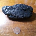
I am not including a picture since there is probably location information embedded in the image. This is the best I could draw the carving. SE corner of rectangular gray rock. The pic is sideways - It looks like a B---S with a line through the S.
Any opinions?
Jim

20130919_200032.jpg
 

Last edited:

Shortstack

Silver Member
Jan 22, 2007
4,305
416
Detector(s) used
Tesoro Bandido II and DeLeon. also a Detector Pro Headhunter Diver, and a Garrett BFO called The Hunter & a Garrett Ace 250.
Primary Interest:
All Treasure Hunting
Going with just what you've shown here, there are several possible letters here:

B, S, T, M, E, D, I, & J just to name a few things. There's a lot more information you need to find or find OUT.
Good luck.
 

mdog

Bronze Member
Mar 22, 2011
2,354
4,406
Can you describe the terrain the rectangular rock is on? Are there any other carvings that could be associated with this carving.
 

OP
OP
S

sciflyer25

Full Member
Nov 22, 2011
221
110
Montco, PA
Detector(s) used
Silver Umax
Primary Interest:
All Treasure Hunting
Can you describe the terrain the rectangular rock is on? Are there any other carvings that could be associated with this carving.

Terrain is pretty much flat. I will say one more thing about the rock - it is actually a flat gravestone. Not in a cemetary. I can't really give anymore info out. It is just odd. I don't know if they are letters, or the "B" is supposed to be 2 headstones touching with the line extending from it having significance.
 

dsty

Bronze Member
Dec 2, 2007
1,300
736
Randal County
Looks like a B T S to me, It may be 2nd book of the Bible 20th chapter verse 19. I'll check when I get home, It is one of the things thats methods they used Letters change to numbers / numbers change to letters. I also have seen letters that touch can also be section numbers, in your case section 2 township 20 range 19
 

Last edited:

dsty

Bronze Member
Dec 2, 2007
1,300
736
Randal County
Welll my theory didn't work about the Bible, but it could reference a location somewhere else away from there, go to the location as described for furthur information
 

Jan 16, 2011
5,010
5,037
By, By Have fun.
Detector(s) used
Time to move on. Good luck everyone .
Primary Interest:
All Treasure Hunting
I see a yin/yang set up, mirrored images off of the center line, opposite = good stuff. the opposing forces, the scale is balanced.
 

mdog

Bronze Member
Mar 22, 2011
2,354
4,406
Terrain is pretty much flat. I will say one more thing about the rock - it is actually a flat gravestone. Not in a cemetary. I can't really give anymore info out. It is just odd. I don't know if they are letters, or the "B" is supposed to be 2 headstones touching with the line extending from it having significance.

Is there anything else on the gravestone and if not, how did you identify it as a gravestone? Just for something to do the next time you're out there, check for a formed boulder or rock face with carvings on it about 175-200 yards SW and 475-500 yards S. I've seen something similar but if you don't find anything at these spots, I can't help. Good luck.
 

dsty

Bronze Member
Dec 2, 2007
1,300
736
Randal County
Went back and looked agin, D T S seems to work as D = 4th Book ,19 /20 references 377 which may be 2 cordels, I've seen a Cemetery at Spanish Fort Texas and at Sacred Heart at Konawa Ok, both were if I remember right about 377 feet which fits for the Bible verse and maybe the size of the cemetery, 377 ft square. If so there's a chance that there's interesting things nearby
 

Shortstack

Silver Member
Jan 22, 2007
4,305
416
Detector(s) used
Tesoro Bandido II and DeLeon. also a Detector Pro Headhunter Diver, and a Garrett BFO called The Hunter & a Garrett Ace 250.
Primary Interest:
All Treasure Hunting
dsty:
A cemetery that's about 377 square feet is less than 20 feet on a side. Sounds like a family burial plot. OR if you're meaning 377 feet on a side, then that's a community or town's cemetery. Which are you thinking about?
 

dsty

Bronze Member
Dec 2, 2007
1,300
736
Randal County
377 feet X 377 feet X 377 feet X 377 feet, would be a small cemetery, if you had a place of worship at each league square would indicate 25 famlies + a league square for the Church, most of the time I would believe that most would be able to do the math,
 

Shortstack

Silver Member
Jan 22, 2007
4,305
416
Detector(s) used
Tesoro Bandido II and DeLeon. also a Detector Pro Headhunter Diver, and a Garrett BFO called The Hunter & a Garrett Ace 250.
Primary Interest:
All Treasure Hunting
377 feet X 377 feet X 377 feet X 377 feet, would be a small cemetery, if you had a place of worship at each league square would indicate 25 famlies + a league square for the Church, most of the time I would believe that most would be able to do the math,

Was there a favored corner to place the church building? Also, is there anything that would indicate how many of these locations would be in the protectorate of a presidio? Or would it be at a "common" corner for, say 4 of the league squares? I'm trying to picture the layout as it might have been in OK., or the Texas Panhandle, or New Mexico.
 

Last edited:
OP
OP
S

sciflyer25

Full Member
Nov 22, 2011
221
110
Montco, PA
Detector(s) used
Silver Umax
Primary Interest:
All Treasure Hunting
I see a yin/yang set up, mirrored images off of the center line, opposite = good stuff. the opposing forces, the scale is balanced.

Thing is, it's not a perfect mirror image. The corners of the "B" I'll call is - have tiny carved lines extending out in opposite directions.
 

OP
OP
S

sciflyer25

Full Member
Nov 22, 2011
221
110
Montco, PA
Detector(s) used
Silver Umax
Primary Interest:
All Treasure Hunting
Is there anything else on the gravestone and if not, how did you identify it as a gravestone? Just for something to do the next time you're out there, check for a formed boulder or rock face with carvings on it about 175-200 yards SW and 475-500 yards S. I've seen something similar but if you don't find anything at these spots, I can't help. Good luck.

Definitely a gravestone as there is a name on it. That's the kicker - I cannot reveal name at this point. This is not in an actual cemetary, but is on land of one of the ancestors of the dead person.
 

dsty

Bronze Member
Dec 2, 2007
1,300
736
Randal County
SS It would be a tremndious help if you with your math ability, understanding of angles could start a Thread of your own and help others with understanding how / if / proof, of a site that has a corner markers / trail markers / monuments, perhaps where there was a lot of baren ground to work with and Google Earth I believe has a site that really does ZOOM in on objects of interest, to me knowledge of proof and understanding using degrees, distance and it would help a lot of folks. I do believe that the surveyed the North Americian and Mexico and left markers Thanks for your help. dsty
 

Shortstack

Silver Member
Jan 22, 2007
4,305
416
Detector(s) used
Tesoro Bandido II and DeLeon. also a Detector Pro Headhunter Diver, and a Garrett BFO called The Hunter & a Garrett Ace 250.
Primary Interest:
All Treasure Hunting
LOL, dsty, my old math teachers would get a good laugh at the idea of me having great math abilities, but to heck with them.. LMAO

The math involved with surveying is all basically plane geometry. I'll try to put something together for a thread, though. In the mean time, a book on basic plane geometry will contain all the info needed for working with angles, triangles, squares, etc. A high school text book will work fine and I'm sure that info is available on the web, too.
 

dsty

Bronze Member
Dec 2, 2007
1,300
736
Randal County
Thanks SS, I know that it would help me GREATLY for yourself or others to verify what the orginal explorers had in mind when they placed the markers that we are chaseing around then and only then we will really start to understand. The "wings off of the B may show the two corners at 2 cordel's If its 2 cordel's in those directions it may be 4 cordel's square which would fit better at a larger platt, finding the 2 points one can find the others to see if they fit the compass degrees. Thanks 25 please keep us informed with what you find,
 

Last edited:
OP
OP
S

sciflyer25

Full Member
Nov 22, 2011
221
110
Montco, PA
Detector(s) used
Silver Umax
Primary Interest:
All Treasure Hunting
ts.jpeg

I should have done this to begin with. Here is a photo of the picture of the carved symbol on the stone.
Thoughts?
 

rangler

Bronze Member
Jul 12, 2004
1,320
200
The Land Of The Free Because Of The Brave!
Detector(s) used
for solutions to the jesuit code -email pics to: [email protected]


;[email protected] locations needed! oro bro!
Primary Interest:
Other
trackers
the letter B on the drawing hid the clue for me. on the photo you see the B is a little strange..a small straight line between the top and bottom of the B is an very old symbol of the Omega...not Spanish for sure, but could be some savvy dudes from the kgc..plus the Spanish did use the Letter B to show the hidden number 13 meaning the Owl of Minerva.. or the ears of the owl or cache site..so the letter T has been used in Spanish code for X's the last distance..
if S is 19 then Xx19 go to the left to measure...take compass heading too.pm for missing data.
oro bro
rangler
 

Top Member Reactions

Users who are viewing this thread

Top