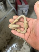
Cave of gold bars

audigger53

Hero Member
Mar 27, 2004
909
3,210
Severn, Maryland
Detector(s) used
None
Primary Interest:
Cache Hunting
Won't tell us? Why not? Does it mention a Royal Engineer?
Nope the locals that live there know of 5 times locals have "come into money" and left since 1900. We learned of a 6th one that also found the cache and was upset because it looked like 1/3 of it was missing. It was in 1982 when we heard about it. Went and looked a couple times from the beginning spot to go looking. We never found the cave.
 

audigger53

Hero Member
Mar 27, 2004
909
3,210
Severn, Maryland
Detector(s) used
None
Primary Interest:
Cache Hunting
BTW ever wonder why El Paso was such a jumping off point for the Spanish? Not only was there food grown there but the mountain on the North side had/has Glena being pushed out of the rock layers for Lead, at the bottom west side of the mountain is an old Sulphur mine. Charcoal, Sulphur, and Potassium Nitrate for making gunpowder and the Galena for bullets. They could make sure that they had enough ammo for Indians and hunting going to the Rockies mining.
 

EarnieP

Hero Member
Jul 20, 2015
526
1,062
Primary Interest:
All Treasure Hunting
BTW ever wonder why El Paso was such a jumping off point for the Spanish? Not only was there food grown there but the mountain on the North side had/has Glena being pushed out of the rock layers for Lead, at the bottom west side of the mountain is an old Sulphur mine. Charcoal, Sulphur, and Potassium Nitrate for making gunpowder and the Galena for bullets. They could make sure that they had enough ammo for Indians and hunting going to the Rockies mining.


When you look at the first old maps of that area, you'll see a symbol for a river crossing at El Paso.
Don't find another such symbol along the length of the Rio Grande.

Sheep, horses, wagons, people, bare footed Friars,...must have been a good place to cross.
That, and of course it is where the river turns north, and north is where they were going.

(The river is actually 'flowing' south and the flow turnes east there.
But they were going against the flow so the river route (for them) turned north at El Paso.)

They did cross back and forth across the river at different places as they went, depending on the best terrain for travel and safest route from attacking 'Pre-Existing' Americans.

BTW, for those interested, using Google Earth you can still follow parts of the old Camino Real at several places along the river. Try the east side of the river around the San Antonio NM area (below Socorro), for one example. No telling what you metal detector guys could find.
(Give it to the El Camino Real International Heritage Museum just south of there please.)
 

Riverbum

Sr. Member
Jul 13, 2011
297
577
Colorado
Detector(s) used
Whites
Primary Interest:
All Treasure Hunting
There were no dams or levees during those times on the Rio Grande . The river ran wild from Albuquerque to El Paso, meandering any way that water flowed easiest. Sometimes the trusted River Crossings were not crossable at all, mostly during spring run off. The Mtns. around El Paso served as a channel too, as the river continued south-south east. To AUDIGGER53 maybe you'll find this interesting or you already know, but bauxite is also found in the Franklin Mtns. in El Paso....Aluminum....but not enough to get ALCOA excited. There's even stories of "lost" mines , gold or silver, in those hills .
 

audigger53

Hero Member
Mar 27, 2004
909
3,210
Severn, Maryland
Detector(s) used
None
Primary Interest:
Cache Hunting
There were no dams or levees during those times on the Rio Grande . The river ran wild from Albuquerque to El Paso, meandering any way that water flowed easiest. Sometimes the trusted River Crossings were not crossable at all, mostly during spring run off. The Mtns. around El Paso served as a channel too, as the river continued south-south east. To AUDIGGER53 maybe you'll find this interesting or you already know, but bauxite is also found in the Franklin Mtns. in El Paso....Aluminum....but not enough to get ALCOA excited. There's even stories of "lost" mines , gold or silver, in those hills .

I forgot to mention that you can still see the Galena coming out of the rocks if you stop on the road over the Franklin's, but don't go far off it. the North side is part of Fort Bliss. As for the Sulphur mine we went to the park and started exploring and found the mine shaft and went inside. The sides and the back are yellow with sulphur, less on the sides and better at the back. No shoring in the shaft but it was solid at the time, 1980's.
 

EarnieP

Hero Member
Jul 20, 2015
526
1,062
Primary Interest:
All Treasure Hunting
Yep, great area for some of our country's oldest history (from before Jamestown).

Here's a link to old maps with the El Paso river crossing symbol;

https://www.raremaps.com/gallery/enlarge/42684

https://www.raremaps.com/gallery/de..._Terres_Angloises_et_des_Isles/De L'Isle.html

Here's a site with a simplified version of the explorations through El Paso;

https://www.texasbeyondhistory.net/paso/history.html

Quote from site;

"The Mansos (Pre-Existing Americans (('Indians')) led the company (Onate) to a ford on the river that they commonly used and helped them to cross it. The entrada then continued up the river until it reached present-day El Paso. Here, the river flowed through a break in the mountains. Termed "El Paso del Río del Norte—the pass of the north—it would serve as the Spanish gateway to the West."

---
To keep it about treasure hunting, there is this;

http://www.legendsofamerica.com/nm-treasures4.html
 

Last edited:

Real of Tayopa

Bronze Member
Sep 4, 2016
1,942
9,101
Mexico
Primary Interest:
All Treasure Hunting
Gracias SDC, a marvelous report. I know that part of the country like the palm of my hand.

Incidentally Cibola is in Sinaloa in the valley of the Conajaqui.It was entered by LIFE magazine photographers just before WW II.Long story there. No, they did not discover it. It had been a Patrimonial of Mexico for years.

Again thanks, it ws fascinating reading.
 

sdcfia

Silver Member
Sep 28, 2014
3,663
8,899
Primary Interest:
Other
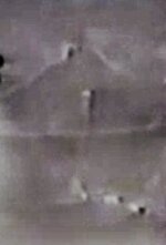
Speaking of caves, here's a pretty good story. Is the cave in Arizona or New Mexico? The map showed a hat-shaped mountain. Terry shows a hill at 11:00 that he thinks deserves investigating. I know exactly where that hill is and might have to go look around it a bit (hint: if you've driven I-10, you've likely seen it too).


nmth

Sr. Member
Oct 11, 2012
251
567
NM/AZ
Detector(s) used
V3(i), ATX, uMax, Gold Bug, TM808, Custom
Speaking of caves, here's a pretty good story. Is the cave in Arizona or New Mexico? The map showed a hat-shaped mountain. Terry shows a hill at 11:00 that he thinks deserves investigating. I know exactly where that hill is and might have to go look around it a bit (hint: if you've driven I-10, you've likely seen it too).

Per the all treasure stories have to be tied together under one grand design theory, then this must certainly be Davis Mountain!

JK.

Nice video.
 

sdcfia

Silver Member
Sep 28, 2014
3,663
8,899
Primary Interest:
Other
Per the all treasure stories have to be tied together under one grand design theory, then this must certainly be Davis Mountain!

JK.

Nice video.

Which Davis Mountain? Ha ha.
 

EarnieP

Hero Member
Jul 20, 2015
526
1,062
Primary Interest:
All Treasure Hunting
Lot of 'holes' in that video story besides the treasure cave. ;)
 

markmar

Silver Member
Oct 17, 2012
4,119
6,260
Primary Interest:
All Treasure Hunting
If you believe how a native Indian who knows where a treasure is located , would ever told you the truth of where the treasure is , then you are very very mistaken . They swore to take the secret to their grave . They told the secret only to some kids , innocent souls who would forget quickly the details of the story or the details of the terrain .
 

Last edited:

somehiker

Silver Member
May 1, 2007
4,365
6,426
Primary Interest:
All Treasure Hunting
Speaking of caves, here's a pretty good story. Is the cave in Arizona or New Mexico? The map showed a hat-shaped mountain. Terry shows a hill at 11:00 that he thinks deserves investigating. I know exactly where that hill is and might have to go look around it a bit (hint: if you've driven I-10, you've likely seen it too).


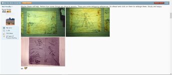
Tony's story sounded like a composition of details from several other treasure tales. And his drawing reminded me of one of the ones first posted by NP back in Apr. 2014.

NP cm2.jpg
 

markmar

Silver Member
Oct 17, 2012
4,119
6,260
Primary Interest:
All Treasure Hunting
Wayne

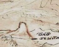
To me , the Tony's map seems like the WN from a west view , or the specific landmark from DeGrazia's treasure map painting .

Tony's map.jpg DeGraziaJesuitTreasureMap.jpg
 

audigger53

Hero Member
Mar 27, 2004
909
3,210
Severn, Maryland
Detector(s) used
None
Primary Interest:
Cache Hunting
AuDigger Was that Tom Mayes Park west side of Franklins???
I believe that was it. Talking about over 30 years ago. LOL There were places where I could walk standing up, I'm 6'1". Most mine shafts I have been in were not high enough for me to walking without being crouched over or crawling.
 

markmar

Silver Member
Oct 17, 2012
4,119
6,260
Primary Interest:
All Treasure Hunting
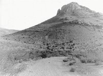
I see it as resembling Victorio Peak rather than Weavers Needle with it's steeper slopes.
And there is also the mention of "white sands" to consider as well.

View attachment 1483151

Wayne

Victorio Peak is about 5500 ft high , and is surrounded by mountains which are at least 400 ft higher than it . How could been possible to see it from any side of the mountain range ?
Tony said how would been easy to recognize it from the the path . If they were going from the White Sands , then for sure they would lose the spot , without having the info where to enter in the range to reach the site .

But these are only logical speculations .
 

Last edited:

somehiker

Silver Member
May 1, 2007
4,365
6,426
Primary Interest:
All Treasure Hunting
Wayne

Victorio Peak is about 5500 ft high , and is surrounded by mountains which are at least 400 ft higher than it . How could been possible to see it from any side of the mountain range ?
Tony said how would been easy to recognize it from the the path . If they were going from the White Sands , then for sure they would lose the spot , without having the info where to enter in the range to reach the site .

Marius:

But these are only logical speculations .

So, you think it's logical that the treasure cave he's talking about can be found at the base of Weavers Needle ?
Who knows, maybe that's what DeGrazia's Yaqui companions told him ?
After all, both they and the "Yaqui" in the story were likely "Pascua Yaqui".
 

Last edited:

Top Member Reactions

Users who are viewing this thread

Top