Claim Jumpers are everywhere Overfiling claims

dredgeman

Sr. Member
Feb 14, 2013
340
249
Primary Interest:
All Treasure Hunting
A good guy has had two claims in Mojave forever. He works them every year.

Someone filed over his claims and immediately sold the claims to a Club. The club went out and worked their new claim and got really good gold.

Now the good guy has to give up or go to court with the club, that thinks they are on the up and up

Every claim owner should be aware that BLM does not screen overfiling of claims and it can happen to almost any claim.

Someone is actively overfiling and selling existing claims. :BangHead:
 

Upvote 0

GarretDiggingAz

Hero Member
Dec 5, 2012
850
243
Mesa, AZ
Detector(s) used
Garrett ATG and thinking about another nugget hunter
Primary Interest:
Prospecting
I know we can't fence the claim and can't add any structures to the claim, so how can we constantly maintain our claims to make sure no jumpers? Hell, I think it's nationwide that we aren't supposed to camp for more than 2 weeks on blm land.
Then if we are going to buy a claim, if we go to the blm and verify. How do we know that they aren't filing over an existing claim.
I'm sure that the people buying a claim had to go to the office to file anyway, right? Or is that all done through the mail?
I know I check the LR2000 regularly in areas I want to prospect on.
I don't know how reliable it is though. I've been trying to find out about a claim, and everytime I try to find it on active or closed (used claim name and also used the T,R, and S), the name never comes up. So I'm assuming it was abandoned. Is there another way to verify this claim? Should I just contact the claim owner on the post to verify?
 

UncleMatt

Bronze Member
Jul 14, 2012
2,389
2,530
Albuqerque, NM / Durango, CO
Detector(s) used
Garrett Infinium & Gold Bug II, Bazooka Super Prospector Sluice
Primary Interest:
All Treasure Hunting
Are some of you really arguing for bigger government? Really?

I don't think using GPS tags to mark mining claims is making government bigger, just smarter and more efficient. Which should make those happy that criticize the government for being the opposite most of the time.
 

UncleMatt

Bronze Member
Jul 14, 2012
2,389
2,530
Albuqerque, NM / Durango, CO
Detector(s) used
Garrett Infinium & Gold Bug II, Bazooka Super Prospector Sluice
Primary Interest:
All Treasure Hunting
This is where your theories go out the door Matt. The BLM does not give out licenses to mine mineral claims. It's very well established law for more than 140 years with Federal Statutes, 100's of Supreme Court decisions and 1,000s of District court decisions that the government has granted the right of the people to locate valuable mineral deposits for their exclusive use. That same body of law insists that the locator alone define and make public his location and that it is his duty alone to defend his location from all who would infringe his rights.

What you are proposing would overturn more than a century of established law and land decisions. The very status of the land you live on would more than likely be subject to attack once those mineral grants become subject to review. The only group I know of who have ever seriously suggested screwing up the legal system that made this country rich are the "greenies" that have sprung up in California over the last 35 years.

I suggest you study the simple legal system behind mineral claims. Once you understand the rights and duties of the claimants I'm sure you will understand why the BLM has been specifically restricted by Congress from doing what you propose.

On the other hand the BLM does issue licenses for non-locatable non-claimable common minerals. There is a very detailed system involved there that ensures that no two parcels of land will ever be licensed to more than one entity. That system has been in effect for 101 years, long before GPS was even dreamed of.

I am certainly not trying to overturn anything, but simply add GPS technology to the situation to make it better. Please forgive any ignorance on my part about the mining claim system and BLM, I am merely addressing the need for an update to marker location means, nothing more.
 

UncleMatt

Bronze Member
Jul 14, 2012
2,389
2,530
Albuqerque, NM / Durango, CO
Detector(s) used
Garrett Infinium & Gold Bug II, Bazooka Super Prospector Sluice
Primary Interest:
All Treasure Hunting
How would one know what the gps locations of the claim are correct without going out there and verify. Doing reasearch through all of the claims on the location going back before they used markers when they used things like tree buildings naturally formations that change over time ect. Also if they where to estblish such a system taking on responisabilty saying this is correct they most likely would aslo want to establish the said owner is also the owner I would think. Now with the employees they have they couldn't do this they would have to hire more. The govt shut down cost 24 billion for 16 days wasn't it? I'm not sure how much of that was national parks dept workers ect. Millions to verify land across this country for minerals rights claims ect.? Plus the cost would be multiplied by the years it would take to do it. Maybe I'm wrong but having been in this exact field for a year now doing this such thing over farm land my experience would leave me belive it would cost billions
See, this is part of the problem: not being familiar with current GPS technologies. You can go out and buy GPS tags to place on everything you own today, and each one costs only a few dollars. When hit with the appropriate radio signal, the tags respond by giving their exact GPS location. This would make it much more easy to identify mine claim markers, and do so cheaply and efficiently. You could literally use a smartphone app to verify for the appropriate agency that all of your markers were correctly placed, and send that verification file to a main server over your smartphone in a very secure way. I have these GPS tags on all my expensive, big ticket items. If they are ever stolen I can then locate them easily and turn that information over to the police. I even have one on my car keys in case I lose them...
 

Hoser John

Gold Member
Mar 22, 2003
5,854
6,721
Redding,Calif.
Primary Interest:
All Treasure Hunting
Too ez for big brother to track you with all your little tags. I disabled gps on phone and cameras as who,what and where is nobodies business but my own. BIG BROTHER of the orwellian kind is here NOW and even heads of countries NOT safe from our lousy stinkn' governments prying illegal electronic eyes-John
 

Clay Diggins

Silver Member
Nov 14, 2010
4,901
14,287
The Great Southwest
Primary Interest:
Prospecting
The answer to all of it - is the 1872 mining law. You have the responsibility to know where you are, and what is open for claim, and what isn't. If you file over someone else's claim, the BLM will not give you your money back, and you can be sued for anything you took off the claim, and frankly, you can be sued anyway, and win. (been there, done that - it happens all the time) Awhile back, someone "claimed" up dozens of claims in Quartzsite, and immediately started posting it, saying you couldn't pan - or md. Well, there is a main area in Quartzsite that is public land and NOT open to claim - within a couple of weeks, several people complained about the "harassment" by the supposed claim owners, and the government came and took every sign down, and the people who filed all those claims lost every dime. You have to know the whole deal - if its public, if its open to claim, if there are any restrictions, which government entity has the land, and if there are any other claims. Bottom line, the law says, (1) you MUST be on claimable land, (open to claim) (2) no other claims on it (3) you have a discovery that will pass the "prudent man test". Many claims that the GPAA has had, had their claims invalidated because there IS no discovery that meets that test. Just because 100 people work a claim, doesn't mean its a valid claim. (and other clubs, too, by the way). And, for me, personally, I want the mining law just like it is, because, in reality, it is THE ONLY law that guarantees your right to enter public land.

The 1872 Mining Law does not protect recreational mining (you can prospect if the land is open and not already claimed). Recreational mining does not meet the prudent man test, and is not protected by the law.

Mrs.O

Very well said!

Three cheers and a beer for the lady in gold! :occasion14:
 

Clay Diggins

Silver Member
Nov 14, 2010
4,901
14,287
The Great Southwest
Primary Interest:
Prospecting
See, this is part of the problem: not being familiar with current GPS technologies... You could literally use a smartphone app to verify for the appropriate agency that all of your markers were correctly placed, and send that verification file to a main server over your smartphone in a very secure way.

Spoken like a true non-miner.

I don't have a single location I mine that you could get a data connection for your "smartphone" app. The whole world isn't covered by cell towers Matt and if you believe your smartphone is capable of a secure connection you haven't been reading the news lately.
 

preshrunkmilk

Jr. Member
Jan 27, 2013
67
41
Primary Interest:
All Treasure Hunting
See, this is part of the problem: not being familiar with current GPS technologies. You can go out and buy GPS tags to place on everything you own today, and each one costs only a few dollars. When hit with the appropriate radio signal, the tags respond by giving their exact GPS location. This would make it much more easy to identify mine claim markers, and do so cheaply and efficiently. You could literally use a smartphone app to verify for the appropriate agency that all of your markers were correctly placed, and send that verification file to a main server over your smartphone in a very secure way. I have these GPS tags on all my expensive, big ticket items. If they are ever stolen I can then locate them easily and turn that information over to the police. I even have one on my car keys in case I lose them...

I know how to use and am very uptodate with all gps technologies. I am retried army and work using gps everyday. I don't think I am explaining myself well enough for you. It would be very cost effectI've to use gps. However to go from current methods to gps would not be easy or cheap. When verfy land now gps is used. To do so for track of land it takes a few weeks with the number of employees at hand now. That is for one plot. It is exact and it will be the new lines. There will be disputes I have run into several where farmers lost acreage. So I had to go to the court or moderator explain the whys and how's of it.

My point was it will cost a lot of money and time. Ontop of that my fear with the green movment lots of land will be closed off for minning when govt employees go out to do the work and find some bird or plant or moss whatever out there that could be harms way from humans.

Another point I'd like to make is that minus a few select areas a smart phone doesn't work where I have prospected for gold not everyone has satellite phones either. Many gps becons you speak of... the low jacks... will not work in areas like this either. Rf transmitters are used in areas like this to find animals for that suck reason.

I really wasn't trying to start an argument or anything I was tryi g to add my first hand knowledge to the discussion.
 

Floating_Adrift

Jr. Member
Oct 10, 2013
33
7
Idaho City
Detector(s) used
White's Eagle II, Gold Bug 2, DetectorPro Uniprobe, XP Deus (love it!), Minelab ProFind.
Primary Interest:
All Treasure Hunting
Spoken like a true non-miner.

I don't have a single location I mine that you could get a data connection for your "smartphone" app. The whole world isn't covered by cell towers Matt and if you believe your smartphone is capable of a secure connection you haven't been reading the news lately.

You can still get GPS signal anywhere with a cellphone (EDIT: smartphone), similar to a GPS unit. I use the Backpacker GPS Pro app - it's pretty cool for only $5.

Unless I'm missing something, it seems that the current system is easily taken advantage of. These claim jumping posts and stories about people selling the same claim multiple times make that pretty clear. Digitizing the database would be simple and would disallow claim jumping. It would make it easy for even the novice to search. It would not cost 'billions' to implement and it wouldn't have to be complicated by any means.

A map overlay would be simple to implement with a short data form to define the claim. This could even be entered and paid for online by the claimant and save the time of the county clerk.

It would also be relatively inexpensive and seemingly very useful to create a 'Mining Claim App' that would be installed before going out which could tell you if you are standing on land that has been claimed using GPS coords - would that not be handy??
 

Last edited:

Floating_Adrift

Jr. Member
Oct 10, 2013
33
7
Idaho City
Detector(s) used
White's Eagle II, Gold Bug 2, DetectorPro Uniprobe, XP Deus (love it!), Minelab ProFind.
Primary Interest:
All Treasure Hunting
I know how to use and am very uptodate with all gps technologies. I am retried army and work using gps everyday. I don't think I am explaining myself well enough for you. It would be very cost effectI've to use gps. However to go from current methods to gps would not be easy or cheap. When verfy land now gps is used. To do so for track of land it takes a few weeks with the number of employees at hand now. That is for one plot. It is exact and it will be the new lines. There will be disputes I have run into several where farmers lost acreage. So I had to go to the court or moderator explain the whys and how's of it.

My point was it will cost a lot of money and time. Ontop of that my fear with the green movment lots of land will be closed off for minning when govt employees go out to do the work and find some bird or plant or moss whatever out there that could be harms way from humans.

Another point I'd like to make is that minus a few select areas a smart phone doesn't work where I have prospected for gold not everyone has satellite phones either. Many gps becons you speak of... the low jacks... will not work in areas like this either. Rf transmitters are used in areas like this to find animals for that suck reason.

I really wasn't trying to start an argument or anything I was tryi g to add my first hand knowledge to the discussion.

Why would anyone need to go out into the field in the first place? Isn't all the information needed on the paperwork? Grab the paperwork and enter the information, sorted by date, and it would preclude any need to go outside the building. The computer would tell you if anything overlapped. It seems to me you would never need to leave the desk to get this data entered and could quickly identify any improper claims easily. There wouldn't be the problem of farmer disputes since it's all on BLM land, right?

I don't think GPS tags are a good solution either, too easy to be moved and/or destroyed.
 

preshrunkmilk

Jr. Member
Jan 27, 2013
67
41
Primary Interest:
All Treasure Hunting
Why would anyone need to go out into the field in the first place? Isn't all the information needed on the paperwork? Grab the paperwork and enter the information, sorted by date, and it would preclude any need to go outside the building. The computer would tell you if anything overlapped. It seems to me you would never need to leave the desk to get this data entered and could quickly identify any improper claims easily. There wouldn't be the problem of farmer disputes since it's all on BLM land, right?

I don't think GPS tags are a good solution either, too easy to be moved and/or destroyed.

I used the farmer refrance because that what I've been doing the past year. I go into the field to verify what I have done in the office from paperwork. As I said earlier in this thread markers used over a hu dred years ago are no longer there in the field and over time what some people think the lines are differ greatly to what they really are. Think of a 2 degree diffrance in the bearing because some one may have plotted it wrong years ago. Over a 80 acre parcel that 2 degrees can gain or loose one lots of land.

If you wanted to just know if somone is trying to claim land allready claimed the gis websites can give you that information. I was only speaking of verfiying all lines on parcels which if the govt where to take on the burden of this from the minner they would want to do. It is ussally all or nothing when dealing with govt on a federal level.
 

Hoser John

Gold Member
Mar 22, 2003
5,854
6,721
Redding,Calif.
Primary Interest:
All Treasure Hunting
FOR A CLAIM TO BE LEGAL IT'S MANDATORY TO MAKE A DISCOVERY IN THE FIELD AND NOT ON A BLOODY COMPUTER :skullflag: As the cancer of paper claiming kills the industry with this illegal bs....John
 

Nov 8, 2004
14,582
11,942
Alamos,Sonora,Mexico
Primary Interest:
All Treasure Hunting
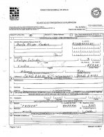
G'd morning Ladies (Beth) :coffee2::coffee2::coffee2:, Oro, and my other friends. In Ole Mexico one files on a piece of land, then if the request for filing is accepted, 'must' have the claim surveyed by a authorized Surveyor within '60' days, (no 1 - 2)

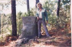
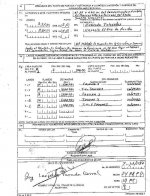
This survey data is accompanied by proof of payment for the labor for the office evaluation, along with a clearly posted photograph showing a prominent identifying background, if one is available, but especially the monument with your identifying data and boundry mesurements on it, it must also show the Surveyot.. (no 3 - 5 )

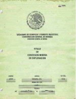
One then is issued a title good for 50 years. Copies are available if it is destroyed or lost, with no hassle..

if there are any other claims in the area still valid, the new claim is adjusted to cover only the 'free' areas.

Any transfers of rights must be accompanied again by an authorized surveyor , etc..and notices posted in the Federal news paper ( Diario Official ) allowing time for any counter claims to be made.

All claim boundaries now must run N/S E/W

So you see in Ol eMexico you have multiple proofs of your claim and it's validity.. The Gov't is paid to verify this. No futher hassle if you have your boundries right.

Don Jose de La Mancha

Priliminary request  pp1.jpg Preliminary request for a clain  boundries pp2.jpg .Proof.jpg Title  contains all f the boundry details pp1 - 4.jpg Mining monument and surveyor  required.jpg
 

Last edited:

Clay Diggins

Silver Member
Nov 14, 2010
4,901
14,287
The Great Southwest
Primary Interest:
Prospecting
FOR A CLAIM TO BE LEGAL IT'S MANDATORY TO MAKE A DISCOVERY IN THE FIELD AND NOT ON A BLOODY COMPUTER :skullflag: As the cancer of paper claiming kills the industry with this illegal bs....John
Aw come on Hoser - don't you want to be able to sit at home and make claims with your smartphone app? You could make paper gold off all the kiddies who can't afford the app or the cellphone!

Just pick an open claim and buy a license to mine by filling out the online application. Life would be so wonderful! Nobody would have to actually carry gear around all those steep hills and get their hands dirty digging in that horrid rocky stuff. Heck we could make all the money we need just selling each other claims!

Then we could buy all the metal we need for "smartphones" and stuff from the Chinese and Pakis and all those poor people in that Africa place where they are so primitive they don't have smartphone apps so they still have to dig for their metals. Hey we could even use Bitcoins so we don't need real money and all that wasted metal involved in plated zinc tokens!

The new world is coming and it's all based on modern communication with walkie talkies (made in China "smart"?) and a modern(?) 40 year old positioning system - and electricity to run it all from modern(?) windmills! America will rise again! We'll all be rich! :hello2::hello2:


For those of you who recognize sarcasm when they read it I should add that Hoser is exactly right - no discovery and your claim is worth just about the paper it was written on - as all those "recreational" miners in California are being told over and over by the courts.

For those of you who make your claims by GPS, Degrees, minutes and seconds, UTM meters, tax assessor parcels, by description or by fun drawings you should also be aware that ALL those methods are illegal and automatically invalidate your claim. The ONLY legal methods of declaring your claim location are by aliquot part and/or by metes and bounds. If you don't know what aliquot part or metes and bounds mean you better learn or you can't make a valid claim. Prospecting isn't, and never has been, all about carrying a pick while leading your donkey with a floppy hat.

For those of you who would like to change the mining laws before you even read them or understand their history or what they mean - everyone is entitled to an opinion. That makes about 320 million opinions in this country alone, good luck trying to sell yours.

Or you could move to Mexico. :laughing7:
 

Floating_Adrift

Jr. Member
Oct 10, 2013
33
7
Idaho City
Detector(s) used
White's Eagle II, Gold Bug 2, DetectorPro Uniprobe, XP Deus (love it!), Minelab ProFind.
Primary Interest:
All Treasure Hunting
Hey thanks for the sarcasm, I'm just trying to have a rational discussion here. I'm sorry if I'm stepping on any luddite toes.

Discovery is a given - I don't think anyone is suggesting that you sit at your computer all day and type in random coordinates and lay claim to the western United States. Of course you have to meet the requirements of making the claim. I am simply suggesting what seems to be a natural extension of the current claim process.

"Claim Jumpers Everywhere Overfiling Claims" Is it not apparent that there are some things that could be fixed based on the very title of this thread? I honestly don't understand how some sort of GIS information applied to this problem wouldn't make sense. Are you arguing against it simply due to the government oversight, or because it wouldn't work as well as the current system?

For those of you who make your claims by GPS, Degrees, minutes and seconds,
You do realize that the metes and bounds system uses degrees and minutes, right? I've been using metes and bound as part of my job for the past 15 years, I'm very familiar with it. I deal with property boundaries, zoning and civil drawings nearly every day. What I'm suggesting here isn't rocket science and would be simple to implement.
 

Last edited:

Clay Diggins

Silver Member
Nov 14, 2010
4,901
14,287
The Great Southwest
Primary Interest:
Prospecting
Claim Jumpers as you call them have been a fact of life for thousands of years. The courts and long established law have dealt with thieves and fraudulent activities relating to mining rights for nearly as long. Thus my previous solution to overclaimers. There is a system in place that works very well and quickly in dealing with this particular variety of fraud. GPS or "modern" technology will never stop thieves and con men from doing what they do. Governments are particularly and demonstrably incapable of preventing fraud perpetrated upon the ignorant. The only cure for ignorance is education. As this thread demonstrates you can lead the horse to water, but you can't make him drink.

Using terms like "luddite" when you are proposing using a 40 year old locational system to bring all us ignorant miners into the modern world amounts to no more than an ad hominem attack - childish tactics for some one proposing a rational discussion.

Sometimes when people post things on the internet they have more interest in proving their point of view valid than in ascertaining the facts. Your statements about smartphone GPS capabilities, the nature of metes and bounds descriptions and your obvious ignorance of the laws of mining claim location and the function of government in claiming the rights inherent in the grant of valuable minerals lead me to suspect you may just fit into the above description. I hope you prove me wrong.

If you have a real interest in understanding the nature and purpose of the grant of rights associated with mining claims I would be glad to help educate you when I have the time. If your intent is to "win" a patently silly argument I'm done with this "discussion" whether you consider it rational or not.

You might also learn to consider just who you are accusing of being a "luddite" when on the internet. Your fellow humans are a varied group and some of us might just have a little more technical knowledge on this subject than you ever envisioned. :laughing7:
 

Last edited:

smokeythecat

Gold Member
Nov 22, 2012
20,724
40,808
Maryland
🥇 Banner finds
10
🏆 Honorable Mentions:
1
Detector(s) used
XP Deus II
Primary Interest:
All Treasure Hunting
Responding to a notation on the first page, government workers, checking out a claim before accepting a fee and taking in new paperwork? Oh, come on.....enough fantasy.
 

Floating_Adrift

Jr. Member
Oct 10, 2013
33
7
Idaho City
Detector(s) used
White's Eagle II, Gold Bug 2, DetectorPro Uniprobe, XP Deus (love it!), Minelab ProFind.
Primary Interest:
All Treasure Hunting
Happy Hunting....
 

Last edited:

mxer47

Sr. Member
Jul 28, 2013
315
297
I harvest a dozen or so cords of firewood a year on BLM land. I have seen many claims marked and unworked. I have seen many mines unmarked. I always look around as someone who is curious. I have never seen someone working a claim I have however seen mines that have been recently worked (this is where I turn because curiosity culled the cat and I don't want to be in a gun fight). The claims registered with the county are vague about there current status. I have not claimed and if I have a discovery worth working I may or may not claim based on the location. I will only deal with the county because they can be held to account for there actions. I will tell you that after some research I still find all of this confusing and convoluted with overlapping standards and rules. So I choose to follow the authority closest to me as the founders intended. See ya in jail lol
 

Top Member Reactions

Users who are viewing this thread

Top