Finding shallow water ( less than 100ft) shipwrecks with google earth, BS or not?

SADS 669

Bronze Member
Jan 20, 2013
2,454
3,737
Long Island, Bahamas
Detector(s) used
Tesoro Sand Shark....Aqua pulse 1B....Equinox ll
Primary Interest:
Shipwrecks
Finding shallow water ( less than 100ft) shipwrecks with google earth, BS or ...

Having just got back from the cookout where I learned from an extremely reliable source that shipwrecks can be spotted up to 100 foot depth with Google earth and special technology I wonder if it really works

I am looking for a 200 ft long steel wreck in 70 ft depth of clear tropical water

Does anyone know anyone who can help without me having to fly them around the world first class??

Thanks in anticipation?
 

treasurediver

Full Member
Mar 13, 2005
176
263
Having just got back from the cookout where I learned from an extremely reliable source that shipwrecks can be spotted up to 100 foot depth with Google earth and special technology I wonder if it really works

I am looking for a 200 ft long steel wreck in 70 ft depth of clear tropical water

Does anyone know anyone who can help without me having to fly them around the world first class??

Thanks in anticipation?

30 years ago, I found a virgin shipwreck (a passenger liner of around 1870, forgot the exact date) in the Bahamas in about 50 feet of water. Knowing the location you could look it up on Google Earth. It would give you an idea of how such a shipwreck looks like.
 

ARC

Gold Member
Aug 19, 2014
37,293
131,829
Tarpon Springs
Detector(s) used
JW 8X-ML X2-VP 585
Primary Interest:
All Treasure Hunting
Sadds... not BS...
Many have been found using this.
Whenever GE releases new image updates... tis a flurry of a few... like me... who study them hard.
If you had access to live satellite imagery on a daily basis... and picked a region/area...
And studied it daily...
At some point...
Water conditions...
Bottom conditions...
Coincide...
And bam...
Thar she be.
;)

Also the way the sun is striking the water at that "moment" is a factor as well... lots of factors actually.
 

Last edited:
OP
OP
SADS 669

SADS 669

Bronze Member
Jan 20, 2013
2,454
3,737
Long Island, Bahamas
Detector(s) used
Tesoro Sand Shark....Aqua pulse 1B....Equinox ll
Primary Interest:
Shipwrecks
Thanks TD I'll await the PM with the numbers ha ha....50'ft is a good comparison....
 

OP
OP
SADS 669

SADS 669

Bronze Member
Jan 20, 2013
2,454
3,737
Long Island, Bahamas
Detector(s) used
Tesoro Sand Shark....Aqua pulse 1B....Equinox ll
Primary Interest:
Shipwrecks
Archie, if you know a person who has such access I'll send you the area of interest. Thanks..
 

ARC

Gold Member
Aug 19, 2014
37,293
131,829
Tarpon Springs
Detector(s) used
JW 8X-ML X2-VP 585
Primary Interest:
All Treasure Hunting
Ok Sadds...
Quick Tutorial...
Download and install GE...
Open up and zoom into area of interest...
Then click on "View"...
Click "historical Imagery"...
Use slider that appears on screen to "go back in time" to years of archival shots...
One of them MAY "expose" your "object/site"...
Conditions on "A day"... may have been "right".
 

ARC

Gold Member
Aug 19, 2014
37,293
131,829
Tarpon Springs
Detector(s) used
JW 8X-ML X2-VP 585
Primary Interest:
All Treasure Hunting
I cannot do anything with the "spots" I have found over the years...
Cept dive em from time to time...
Which "reveals" nothing but bottom sand and black lumps...
My hands are tied...
I will not dig them for fear of trouble...
So I gave up looking for more.

Tis a very sad situation... because I know.
All know...
And no go.

Blah blah blah.
 

OP
OP
SADS 669

SADS 669

Bronze Member
Jan 20, 2013
2,454
3,737
Long Island, Bahamas
Detector(s) used
Tesoro Sand Shark....Aqua pulse 1B....Equinox ll
Primary Interest:
Shipwrecks
I'll try that on my big screen TV from the laptop and let you know,

I don't care what Old Man says,...your OK!!
 

ARC

Gold Member
Aug 19, 2014
37,293
131,829
Tarpon Springs
Detector(s) used
JW 8X-ML X2-VP 585
Primary Interest:
All Treasure Hunting
I'll try that on my big screen TV from the laptop and let you know,

I don't care what Old Man says,...your OK!!

Oh geez... welp he prolly is not the first not to like me here... and prolly not the last... heh.

Cant please em all. :)
 

ivan salis

Gold Member
Feb 5, 2007
16,794
3,809
callahan,fl
🏆 Honorable Mentions:
1
Detector(s) used
delta 4000 / ace 250 - used BH and many others too
uh yes it works ---(and this is the how and why of it) --- remember this most shipwrecks pre about 1750 occurred because the vessels used "dead reckoning" to navigate by --this required them to sail close to land to spot "known landmarks" which by their pilots then used their sea charts to know their locations * when bad storms occurred often these vessels got trapped by strong winds and waves and where driven into shore / shallow waters where they were pounded to death -- by bottom bouncing on their hulls till they split , or hitting reefs

so many wrecks are in fairly shallow waters * that fact being known ---how does one use google earth to find them? easy one uses it to go to the seashore area and scans the shallow waters --often the sea bed sand is light colored and will reflect the sunlight --however the shipwrecks will be dark colored "blobs" and will stand out -- like a dark rock on a white sheet would -- by inspection of its size and general shape one can in many cases sort out shipwrecks from other dark items like reefs

the same ideal will work with your "modern steel hull wreck" if you got a good ideal of the general area and the waters are both fairly shallow and clear , when the sun hits the area just right it should "backlight" the bottom -- revealing the wreck site to you ..saves a butt load of gas ,time and effort and can be done on bad weather days ,seating at home..

oh by the way ---what I just told you above --is indeed valuable info --good luck my friend ..


now that you got possible wreck sites --you match up known to be lost vessels in that area by the records --to find "valuable wreck sites" ---or my way is to find the data about "valuable wrecks" lost in a general area and then scan that area --looking for the wreck sites to check out ..
 

Last edited:

old man

Bronze Member
Aug 12, 2003
1,773
1,709
East Coast
I'll try that on my big screen TV from the laptop and let you know,

I don't care what Old Man says,...your OK!!
There we go with the Sea Stories again ( lies ) When I was in the military we knew a sea story from the truth. A Sea Story usually started with these words, when someone told a story. "Now this ain't No Sh t"
I never met ARRC, but he's got to be a good guy with a good woman if they both Laugh at your posts.
 

Last edited:

ARC

Gold Member
Aug 19, 2014
37,293
131,829
Tarpon Springs
Detector(s) used
JW 8X-ML X2-VP 585
Primary Interest:
All Treasure Hunting
BUT... any wrecks of serious age...
Are buried...
AND deteriorated to nothing but piles that have collapsed and dispersed...
NON visible...
UNLESS... there has been a change in bottom sands...
for one reason or another... that briefly exposes the remnants...
Storms are the best "sand sweepers" and "exposers"...

But !... keep this in mind...
the bottom in areas with currents and tide currents... ARE moving all the time...
Like a desert... the sands are constantly shifting and moving...

One day... there she lay...
Another day... she has gone away.
 

ivan salis

Gold Member
Feb 5, 2007
16,794
3,809
callahan,fl
🏆 Honorable Mentions:
1
Detector(s) used
delta 4000 / ace 250 - used BH and many others too
that's why you "recheck " the areas often --- the ocean covers and uncovers wrecks any good sea salt knows this fact * the oceans they give and take as they please..
 

MPH200

Sr. Member
Oct 26, 2012
425
677
Austin, Texas
Detector(s) used
Minelab Explorer SE
Primary Interest:
Shipwrecks
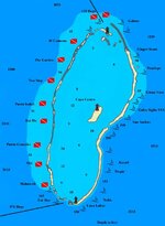
I have looked repeatedly at Banco Chinchorro where there are plenty of wrecks, but haven't seen one yet.
Maybe like has been said above, I need the right conditions for them to appear.
bancochinchorromap.jpg
 

treasurediver

Full Member
Mar 13, 2005
176
263
Thanks TD I'll await the PM with the numbers ha ha....50'ft is a good comparison....

Checked the location on Google Earth on the 24" high resolution screen. There is not enough resolution in that area. I will mark the spot on a map for you.
The funny thing about this steel shipwreck, is that there are some iron cannon lying about it that are at least 100 years older. There are just so many shipwrecks in that area, that some have to lie on top of others.

I mentioned that it was a "virgin shipwreck". How can I make such a statement? Well, there were several beautiful brass portholes that had fallen off because the steel of the hull had rusted so much. Just lying there, begging to be picked up.
 

OP
OP
SADS 669

SADS 669

Bronze Member
Jan 20, 2013
2,454
3,737
Long Island, Bahamas
Detector(s) used
Tesoro Sand Shark....Aqua pulse 1B....Equinox ll
Primary Interest:
Shipwrecks
I am sitting here reading the Buccaneers of America ( at page 52) you kindly sent me and cannot wait for the map to come through the electronic equivalent of a letter box.

I will send you video of the liner.......and of course the brass portholes ha ha....
 

treasurediver

Full Member
Mar 13, 2005
176
263
I am sitting here reading the Buccaneers of America ( at page 52) you kindly sent me and cannot wait for the map to come through the electronic equivalent of a letter box.

I will send you video of the liner.......and of course the brass portholes ha ha....

At the time, I had been contracted to locate shipwrecks for an outfit with a big boat and divers to salvage them. So I only spent enough time with each shipwreck, to date and identify it as accurately as possible. Of course, with all these portholes lying around, I had to pick them up and pull out the easiest ones so that they did not get lost. If I remember right I handed over 22 complete portholes. The glass looked beautiful as it had been sandblasted by the sand and corroded, so it had this fantastic rainbow sheen that old glass gets.

Sadly, that outfit that was supposed to do the salvage was incapable of anything, so the only goodies recovered were the ones I picked up for means of identification.
 

OP
OP
SADS 669

SADS 669

Bronze Member
Jan 20, 2013
2,454
3,737
Long Island, Bahamas
Detector(s) used
Tesoro Sand Shark....Aqua pulse 1B....Equinox ll
Primary Interest:
Shipwrecks
Looking forward to the location ha ha. It may be the one a few miles north of Clarence town on the East coast......
 

Au_Dreamers

Hero Member
Dec 15, 2010
988
669
back on the 1715!!
Primary Interest:
All Treasure Hunting
I'm not saying it can't be done... but with GPS numbers on all of the known 1715 wreck sites debris fields....specifically cannons, cannon piles, I cannot see any of them on Goggle Earth. These would be from the beach line to out to 30 ft water depth.

Maybe it's just me:dontknow:
 

OP
OP
SADS 669

SADS 669

Bronze Member
Jan 20, 2013
2,454
3,737
Long Island, Bahamas
Detector(s) used
Tesoro Sand Shark....Aqua pulse 1B....Equinox ll
Primary Interest:
Shipwrecks
Finding shallow water ( less than 100ft) shipwrecks with google earth, BS or ...

Got it Chris, thanks.....sent you an email after the cookout, got kicked back by postmaster. Just to say it was great to meet you, have a great season....
 

Last edited:

Top Member Reactions

Users who are viewing this thread

Top