Found something

gold4us

Jr. Member
Aug 6, 2012
54
37
Kingsland, TX
Detector(s) used
Excalibur II
Excalibur 800
Minelab SD2200
Minelab E-Trac
Garrett AT Gold
Primary Interest:
All Treasure Hunting
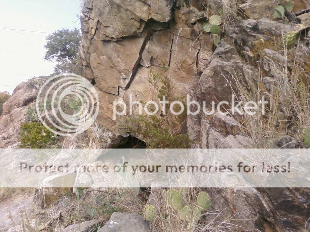
I am a gold prospetor, but I dont know much about treasure hunting. I found these symbols next to a creek. Anybody got any ideas. The pics are not that great but you can make out the symbols. The 2 glifs are on a rock face facing East. The mine shaft in a rock face facing North. If you are standing 15' in front of the mine facing the entrance the glifs are just on your right. I visited this site 3 times before I saw the glifs.
goldmine015.jpg

goldmine014.jpg

goldmine016.jpg
 

charliejr

Full Member
Jan 30, 2012
217
45
Primary Interest:
All Treasure Hunting
Wow, thank you for sharing! Old Indian land maybe? Holy moly look at those symbols,!!! Your plumb smack dab on top of tha booty! If you go up in those, BE CAREFUL, don't breath no dust, look out for TRAPS!!! You need to map out that area real good incase stuff was moved from the mines to an area 'around or from the mines.
 

Last edited:

charliejr

Full Member
Jan 30, 2012
217
45
Primary Interest:
All Treasure Hunting
Eagle, steps, measurement, symbols symbols symbols like they always are marking somethin. HOLY TOLEDO!!!!

Now THAT is a classic Spanish Jesuit mine! OMG OMG OMG!!!

Those rocks with the glyphs have a bunch of smaller symbols ---like a map!

Sir, you seriously ---I mean, if you want --- should really look at those rocks, map it all out glyphs and all --- I am not an expert but have studied this, and explored enough to know you might be on to somethin! (POUNDING HEART!!!)

Those top pics just about look like the map out the whole area.

Hmm, if you didn't make those other marks on those maps -someone else has, I can see someone marked out the map and everything. Did you do that??? 
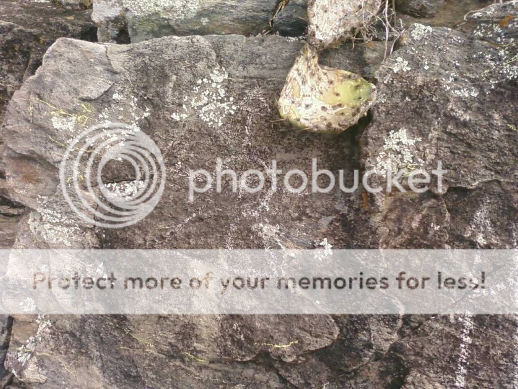
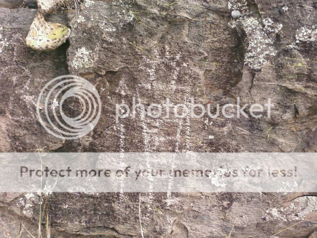
Cause if you say you don't know the symbols, but have managed to mark'em out, excuse me for askin?
 

Last edited:

leprechaun

Bronze Member
Feb 20, 2012
1,996
606
🏆 Honorable Mentions:
1
Detector(s) used
CTX 3030; The only metal detector I'll ever need
Primary Interest:
All Treasure Hunting
awesome find, I hope you find something great in there.:icon_thumleft:
 

OP
OP
gold4us

gold4us

Jr. Member
Aug 6, 2012
54
37
Kingsland, TX
Detector(s) used
Excalibur II
Excalibur 800
Minelab SD2200
Minelab E-Trac
Garrett AT Gold
Primary Interest:
All Treasure Hunting
I didnt do anything to them. I dont have a clue about symbols. Is there a book you could recomend. I will tell you that an archeologist looked at the pics and he rough aged it by the lychen growth. He said the glifs were over 200 years old. There are other small marks on the rocks that dont show up in pics. There are several small mines in this area, most are under water now in a lake. This whole area has a forgotten history.
 

charliejr

Full Member
Jan 30, 2012
217
45
Primary Interest:
All Treasure Hunting
If you didn't mark'em, and I could only guess the archi didn't(?), then another hunter definitely did cause I can tell by the way they marked those rocks. I would suggest -for starters- anything by Charles Kenworthy, Mary Carson, read all the threads by 'Old Dog', 'dsty', 'Gollum', 'ShortStack' and a few others.

I have no doubt about the ages and I could tell by the marks, the patina, and the rock forms. Just be careful buddy, please. No tellin who else might be huntin, and if they are hunt'n, they might be pack'n. Most Thunters are not bad, but hell if there aren't plenty who are. Just be careful Mr. and I pray the Almighty on your side.

Take pictures -goodones- keep a notebook, MD around if you can, lay out on a map those symbols even if hand drawn. Don't be jaded if other hunters tell you there is nothing cause in my searches, there is always somethin. Good luck, talk to some forum members here 'ShortStack' is mighty smart and there are others, keep diggin, studin, and look'n. You are damn close. Heck, there are some symbols there that a majority of Thunters on this site have never seen I betcha. I have, just don't speak about it much.
 

Last edited:
OP
OP
gold4us

gold4us

Jr. Member
Aug 6, 2012
54
37
Kingsland, TX
Detector(s) used
Excalibur II
Excalibur 800
Minelab SD2200
Minelab E-Trac
Garrett AT Gold
Primary Interest:
All Treasure Hunting
This is what I know about the area. There is a mine shaft, under water, about a mile to the east. The arrows almost point the way. To the north about a mile away is a series of trenches 5 to 6' deep about the same width and maybe 30' long. We found 5 of them in a row on a quartz stringer. The tailings were ground down very fine. There is a smeltor up on the highest hill in the area about 5 miles away to the west.
The mine in the pic was reworked by somebody in the late 1800 to early 1900, they carved their name above the shaft. Just above the shaft on top of the bluff is a small mortered wall about 16" high and 8' long.
The shaft is not big. I went in about 20' and it started narrowing down. It looked like once you got past that narrow part it looks like it takes a turn and maybe opens up again.
 

charliejr

Full Member
Jan 30, 2012
217
45
Primary Interest:
All Treasure Hunting
Yep. Someone has searched that area. Whether they found anything, aside from what they smelted is a good question. At any rate, be careful. Heck, document those signs and let us know what ya found. Good luck. BE CAREFUL.
 

usernotfound

Sr. Member
Sep 7, 2011
495
148
Detector(s) used
T-2
Primary Interest:
All Treasure Hunting
Yep. Someone has searched that area. Whether they found anything, aside from what they smelted is a good question. At any rate, be careful. Heck, document those signs and let us know what ya found. Good luck. BE CAREFUL.

When the gold was there is was guarded, but what do I know. Good luck.
 

charliejr

Full Member
Jan 30, 2012
217
45
Primary Interest:
All Treasure Hunting
Yep, I completely agree usernotfound. You hit the bulls-eye cause I was look'n, but I could'n make hide or hair

Hey gold4us, Mr. If you wouldn't mind, would you PLEASE get a picture of that lovely bird on the left side of that mine. It is one of the best ones I have seen of that particular style. I would be much obliged. Share it here, email, either way.

We can tag it for you if you wish. Put a title on it and give you discovery status for your amazing discovery. This way you become a part of the vast history of treasure hunting. A high honor in itself.

You seriously have something to be proud of because your journey and your finds are a sacred part of your life.
That is a good thing. And definitely thank you for sharing with us.

....and if it leads to gold I want 5% ***holds out hands smiling***:D
 

Last edited:
OP
OP
gold4us

gold4us

Jr. Member
Aug 6, 2012
54
37
Kingsland, TX
Detector(s) used
Excalibur II
Excalibur 800
Minelab SD2200
Minelab E-Trac
Garrett AT Gold
Primary Interest:
All Treasure Hunting
charliejr
If you can highlight the area of the pic or desribe it to me and I will see if I have other pics. This place is off limits for a little while because deer season has started and the mine is on private property. I plan to go back sometime in the spring and do some prospecting. I wish I would have been a little more interested in this a few years back. I had acess to a place that had symbols everywhere. I worked cattle on a 2200 acre ranch that was rough. It was Granite and cedars with lots of canyons and odd trails. We found crosses, circles, wavy lines lightning bolts, stacked rocks and other signs. We were running cattle out of one of the many draws between granite domes when we first started seeing the glifs on the Granite walls. In one of these draws it seemed the pics were 100 yards apart . The smooth granite walls would go up 20 to 30' high on both sides and these grassy paths were 20 to 50 yards wide. Once we started seeing them we seemed to notice them everywhere. We found one flat Granite area next to a small creek that had 4 grooves dug out. They were 3 or 4' long by 2" or 3" wide. At the time I didnt know what they were but now I think they were molds for pouring silver or gold(just my guess). That was 15 years ago and this ranch has been sold and cut up into little ranchets. I also found a single stack of rocks on top of a sandstone hill. We were on foot going up this hill to try and drive some goats off to the other side. It was thick with with brush but we found a narrow path up it. At the top sitting in the middle of all this brush was this pillar of rocks about 6' tall. It was made out of Granite boulders that looked like they had been flatened so they would stack(like a snowman). We new it was a marker just didnt know for what.
OK looks like I am going to have to start another hobbie.
 

charliejr

Full Member
Jan 30, 2012
217
45
Primary Interest:
All Treasure Hunting
Yep, that all makes perfect sense. The divides of 100 yards equals a nice set in the idea of 'varas'. The wide paths are good for travel routes especially moving wagon or mule trains. Many of the stacked rocks are called 'cairns'. They are used to make a trail. Sometimes they are stacked so you can view through a 'hoyo' or basically a hole to sight up other markers or signs. Yes, those cut outs can be used for sights, measurement, and sometimes to outline other symbols. Most of the time, the markers are just used for the regular travel routes. At other times, the trail can lead to what some treasure hunters call a 'cache', or some place a valuable or mineral deposit was located.

Sounds like you have access to some interesting symbols. I did attempt to do a 'markup' of your pictures, but bad weather -I think- has made it difficult for me to upload things, but I always have that problem with Tnet.

That bird or eagle is in your 'second picture from the top'. It is on the 'left side' of the mine entrance.

I will try to upload if I can. Until then good luck.
 

Shortstack

Silver Member
Jan 22, 2007
4,305
416
Detector(s) used
Tesoro Bandido II and DeLeon. also a Detector Pro Headhunter Diver, and a Garrett BFO called The Hunter & a Garrett Ace 250.
Primary Interest:
All Treasure Hunting
charliejr
If you can highlight the area of the pic or desribe it to me and I will see if I have other pics. This place is off limits for a little while because deer season has started and the mine is on private property. I plan to go back sometime in the spring and do some prospecting. I wish I would have been a little more interested in this a few years back. I had acess to a place that had symbols everywhere. I worked cattle on a 2200 acre ranch that was rough. It was Granite and cedars with lots of canyons and odd trails. We found crosses, circles, wavy lines lightning bolts, stacked rocks and other signs. We were running cattle out of one of the many draws between granite domes when we first started seeing the glifs on the Granite walls. In one of these draws it seemed the pics were 100 yards apart . The smooth granite walls would go up 20 to 30' high on both sides and these grassy paths were 20 to 50 yards wide. Once we started seeing them we seemed to notice them everywhere. We found one flat Granite area next to a small creek that had 4 grooves dug out. They were 3 or 4' long by 2" or 3" wide. At the time I didnt know what they were but now I think they were molds for pouring silver or gold(just my guess). That was 15 years ago and this ranch has been sold and cut up into little ranchets. I also found a single stack of rocks on top of a sandstone hill. We were on foot going up this hill to try and drive some goats off to the other side. It was thick with with brush but we found a narrow path up it. At the top sitting in the middle of all this brush was this pillar of rocks about 6' tall. It was made out of Granite boulders that looked like they had been flatened so they would stack(like a snowman). We new it was a marker just didnt know for what.
OK looks like I am going to have to start another hobbie.

gold4us:
Perhaps you can use Google Earth or bing maps to look over the area of the old ranch and spot some of those markings and "work" them from the satellite views. Bing Maps has a tool called "birdseye view" that gets right down to about 200 feet above the ground. It's not available over EVERY area of the country, but is in a surprisingly large portion. Sometimes I use the birdseye view to explore the Superstition Mountain area around Weavers Needle and some other areas.
 

Last edited:

charliejr

Full Member
Jan 30, 2012
217
45
Primary Interest:
All Treasure Hunting
I have to agree with SS. Many old timers frown upon Google Earth, and Bing, but, if you are supposed to see some markers up to 8 leagues away, I have no doubts you say see them with satellites. You might not see every detail, but I do know they are good enough to read a licence plate as I have looked at my own house and car from the satellite images. Plus, it might help you see a trail. SS is right, you might wanna try that.
 

desertmoons

Bronze Member
Apr 16, 2008
1,067
168
Thanks for posting. I believe twistedfork posted a clockwork map that may be of interest to you.
 

Top Member Reactions

Users who are viewing this thread

Latest Discussions

Top