sheiswe
Jr. Member
- Oct 5, 2015
- 97
- 265
- Detector(s) used
- Tracker IV,ace 250, garret AT PRO. Equinox 800
- Primary Interest:
- All Treasure Hunting
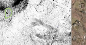
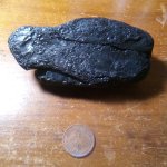
had someone do a reading of my land and they saw this indent right off one of my trails and said it could be a cellar hole. I went to the spot and theres nothing but flat land there. And I ran my detector over it and nothing.
Any thoughts? Also..how does someone do this type of map of the land?
Any thoughts? Also..how does someone do this type of map of the land?