roadrunner
Bronze Member
- Jan 28, 2012
- 1,230
- 520
- Detector(s) used
-
Garrett Groundhog-2012-1st MD.
White's Goldmaster V/Sat-2nd-MD-2013
Tesoro Lobo-2015-3rd
- Primary Interest:
- Prospecting
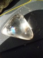
My wife and I went out for a hike.
Prospecting a little.
. .
.
 160 feet above the wash.
 Wall on top of hill.
 Another shot.
 Don't know where wall came from. Probably new.
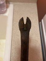
Caves or cutouts. Horseshoe in front of opening at wall.
 Picket Post to left of this.

Prospecting a little.
.
.
160 feet above the wash.
Wall on top of hill.
Another shot.
Don't know where wall came from. Probably new.Caves or cutouts.
Horseshoe in front of opening at wall.
Picket Post to left of this.


")