aquanut
Bronze Member
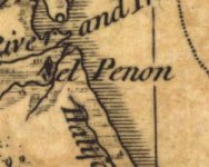
Re: Historian Says New Smyrna Is State's Oldest City
Did anybody pay attention to what Fisheye had to say? You should...
Aquanut
Did anybody pay attention to what Fisheye had to say? You should...
Aquanut