I find gold in your area

Jason in Enid

Gold Member
Oct 10, 2009
9,593
9,229
Primary Interest:
All Treasure Hunting
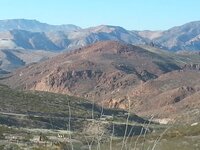
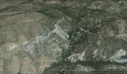
I do not need to go for the rock samples that would find gold. you did not know but the satellite image is primary, even in relation to the samples. the fact that you have not found a metal detector and gold does not mean it is not there, it is not necessarily there placer, mining it, and to be deeper than the metal detector can find. your company if there is her secret that the only one in the north with a geodynamic setting Morenci mine gold deposits formed equivalent to reserves, and I understand where it is.

Silly children scribbling circles on google-earth maps is NOT a method of finding gold. LOL
 

ARC

Gold Member
Aug 19, 2014
37,307
131,897
Tarpon Springs
Detector(s) used
JW 8X-ML X2-VP 585
Primary Interest:
All Treasure Hunting
Yep...
During the gold rush...
The guys who made the most money...

Sold the picks and shovels.
 

OP
OP
U

userkc

Jr. Member
Nov 18, 2015
21
5
Novosibirsk
Primary Interest:
All Treasure Hunting
It reminded the history of oil exploration in Israel. in the 60s they used conventional search technique in the world at 500 meters drilled the well and did not find any fields. they calculated that the cost of the search in this way, even if they find the oil is higher than the profit from its sale. Then they gathered their scholars and they have developed their own ideas geologists and series and storage environment. their maps usually geologist without training can not understand. because Jews found oil at offshore and at the Dead Sea, it is clear that there are more, but these are minor conditions that need to thoroughly understand and monitor the processes of their formation.
 

Last edited:

nh.nugget

Hero Member
Sep 3, 2013
861
1,401
e.rochester nh.
🥇 Banner finds
1
Detector(s) used
whites, KEENE A52 sluice, 3" dredge
Primary Interest:
All Treasure Hunting
I think some thing get's lost in translation? Wait for it, wait for it. Mojo get your crayons we need some more pictures! :sign10:
 

ARC

Gold Member
Aug 19, 2014
37,307
131,897
Tarpon Springs
Detector(s) used
JW 8X-ML X2-VP 585
Primary Interest:
All Treasure Hunting
HEY ! we have something in common...
We both want to find gold in each others areas.

Whaddaya know.
 

pat-tekker-cat

Gold Member
Feb 23, 2011
6,335
8,486
S. Fl.
🏆 Honorable Mentions:
1
Detector(s) used
Minelab Excal II, Garrett, Tesoro
Primary Interest:
All Treasure Hunting
But.....he find gold in your area. :laughing7:
That just slays me every time! :laughing7:

Yeah, the translator is worse than auto-correct. :dontknow:

demotivational-posters-in-soviet-russia1.jpg
 

Mad Machinist

Silver Member
Aug 18, 2010
3,147
4,686
Southeast Arizona
Primary Interest:
Prospecting
It reminded the history of oil exploration in Israel. in the 60s they used conventional search technique in the world at 500 meters drilled the well and did not find any fields. they calculated that the cost of the search in this way, even if they find the oil is higher than the profit from its sale. Then they gathered their scholars and they have developed their own ideas geologists and series and storage environment. their maps usually geologist without training can not understand. because Jews found oil at offshore and at the Dead Sea, it is clear that there are more, but these are minor conditions that need to thoroughly understand and monitor the processes of their formation.

So you understand, this is what I did there. A little over 30,000 meters during a course of 5 years.


These don't lie. Some of the cores where taken less the 3 meters apart. And drilled down to a depth of 450 meters. The earlier cores were drilled down to 1000+ meters. THERE IS NOTHING THERE.

Now the property I own and am trying to develop was explored by "electronic" means much like you are trying to do and they said nothing was there. Core drilling showed something very different.
 

Mad Machinist

Silver Member
Aug 18, 2010
3,147
4,686
Southeast Arizona
Primary Interest:
Prospecting
Tell you what, just to satisfy my morbid curiosity, send me the process of doing this. I'll compare it to several areas I know and see what comes up. Won't do me any good to use this as the people I deal with want solid evidence of the resource not pictures on a map, but I'll play none the less.
 

OP
OP
U

userkc

Jr. Member
Nov 18, 2015
21
5
Novosibirsk
Primary Interest:
All Treasure Hunting
I think of the area and gold. there are regional geology which originated Morenci mine and it was the interaction with the neighboring blocks. usually always large deposits genetically associated with a major geodynamic conditions.
image.jpeg
in this picture with black line represents the portion of the geodynamic situation in which the mine is formed Morenci. and also designated a difference in the movement by which
Fluid in the supergene processes were very active in the Neogene when formed stibnite and had postponed the gold placer designated exclamation point(!) on the second image. the gold thanks to fluid activity went deeper into the array.
image.jpeg
In the second picture the south is a place indicated by a yellow marker, here is a look at gold ore, its presence. start from a place where there is a point to walk along the yellow line, and keep in mind when searching the entire area indicated by yellow border. this gold came in a geodynamic setting is indicated by the fact that the exclamation mark(!). but what is the situation yesterday draws secondary to those events.
 

Last edited:

Mad Machinist

Silver Member
Aug 18, 2010
3,147
4,686
Southeast Arizona
Primary Interest:
Prospecting
Okay, I see what your trying to do. This is similar to a process I use and to what a lot of the big mining companies are using. HOWEVER, it is not 100% accurate. It's more like 50/50 and it is backed up with core sampling to prove resource. As a geologist friend told me long ago, Mother Nature did some unexplainable things here in Arizona and she will not give up her treasures easily.

We are not exactly sure why many of the methods used today DO NOT work here in Arizona or the Desert Southwest. I am starting to believe that it has to do with soil alkalinity.

With the Basin and Rift geology here in Arizona, many of the ideas on how geology works are changing. Morenci is considered a geological anomaly as there are no other indications of the deposit for many miles around. And they have found that part of the deposit here at Morenci has shifted to the North by several miles. In fact a lot of the rock is just that, barren rock. To the south of me is Ash Peak. One of the richest silver mines ever discovered. There is nothing else around. To the Southwest, is the Steeple Rock Mining District. There are a lot of mines around here, but the rock strata surrounding them is barren.

At best what you are doing is providing a guideline and it may well prove to be a good one yet. Keep working on it and you may yet find the secret to making it work.

One thing to remember about this area is that it is primarily of igneous nature with metamorphic intrusions. Keep that in mind along with the past and current seismic activity here. Those two things can change just about every geological outcome I can think of.
 

Nov 8, 2004
14,582
11,942
Alamos,Sonora,Mexico
Primary Interest:
All Treasure Hunting
Gentle men relax and give USERKC a chance, no method is 100%, including core driling. I'll give him a crack at it on my Propety. It is basically in a Basalt over burden of some 800 - 900 ft, and considered by 'geolgists as basically incapable of having a commercialy viable deposit., Yet ???
I also experimented with dowsing with remarkable results - not 100 %, , but damn close :coffee2::coffee2::coffee2::coffee2:


.
 

Mad Machinist

Silver Member
Aug 18, 2010
3,147
4,686
Southeast Arizona
Primary Interest:
Prospecting
Mad, you posted --- they said nothing was there. Core drilling showed something very different.Clarify please .

Hello my friend. Pull up a chair and grab some coffee. This is going to get interesting.

There is nothing on the property I posted. It has been beat to death.

Now on the "core drilling showed something very different" thing. Well, it is on property I now own. A little over 1000 acres. The property was explored with a process I do not fully understand. They used a form of seismic mapping to see what was there. They either misinterpreted the readings or they believed they were false as rare earth metals are NOT supposed to exist in Arizona. Supposedly the geology is "all wrong" here. The core samples showed something very different. The deposit is open at depth and it looks like it gets richer the deeper I go. It has only been cored down to 200 meters as that was the max we could drill with the converted water rig I rebuilt. We need to core deeper and see what is there. If a couple of investments pay off, I'll be back in there drilling in about 2 years.
 

Mad Machinist

Silver Member
Aug 18, 2010
3,147
4,686
Southeast Arizona
Primary Interest:
Prospecting
userkc,

I'll show you why what you are proposing doesn't always work.

Here's a pic of a local gossan. This is just part of a system of gossans in the area.

Now one thing that doesn't show up on Google Earth is the fractures and fissures in the rock due to tectonic activity and through the supergene process itself dissolving the minerals. Water will always follow the path of least resistance.

All the fissures and fractures are at about a 70° angle to horizontal leading onto the washes. The water table in that area is not all that deep either leading to the water flushing out rather quickly into the local river system.

While the supergene process may have enriched the area way back in the past, tectonic activity has lifted the area thus subjecting it to large scale erosion over millions of years. So all the minerals deposited through the supergene process have been eroded away to be placed in a placer deposit somewhere else or moved thousands of miles down river and flushed out to sea over millions of years.

Tectonic activity and erosion ALWAYS have to be kept in mind when using a process like this. Those two things are "wild cards" and change everything. If these two things are figured into the equation, you have a better chance of success. Tectonic plates move at a relatively constant rate and typically in the same direction. Erosion rates are fairly constant for each type of rock.

When all of this is added into to the "exploration equation" you start to gain the ability to find "likely areas" for mineral concentrations.

Are you starting to understand why many of us are saying this doesn't always work?
 

Attachments

  • gossan 023.jpg
    gossan 023.jpg
    561.1 KB · Views: 73

Mad Machinist

Silver Member
Aug 18, 2010
3,147
4,686
Southeast Arizona
Primary Interest:
Prospecting
Here's another example of what I am talking about. This area is just south of me. This mountain was literally split in half by tectonic activity. If this area was enriched by supergene activity, it is gone now. Wash down stream by erosion like I said.

Stay with this. With the thousands upon thousands of years experience on this site, if this could be made to work, it would happen here.

The pic:
 

Attachments

  • rift on 78.jpg
    rift on 78.jpg
    180.1 KB · Views: 88

Mad Machinist

Silver Member
Aug 18, 2010
3,147
4,686
Southeast Arizona
Primary Interest:
Prospecting
Something has to be done. According to "conventional geology" we are running out of resources. I know there was a MAJOR porphyry copper and gold deposit discovered in Serbia not long ago that "conventional" geology said should not exist. By "conventional" geology, the deposit I am into should not exist either.

I am beginning to think that "conventional" geology is full of bull excrement. I know they are looking at Guerrero in Mexico as the next big mining area. That should play out rather interestingly considering the drug violence there.

I shouldn't have been so hard on userkc but how any times have we seen this pop up and when that person is asked for an explanation they disappear. His idea has a lot of merit but is still very rough around the edges.

I may be gone for a few days as I was asked to write a paper on what I see coming as far as investment opportunities on small miners. I am seeing more and more that makes this a viable option.
 

OP
OP
U

userkc

Jr. Member
Nov 18, 2015
21
5
Novosibirsk
Primary Interest:
All Treasure Hunting
I agree with you, everything you said describes in detail what happened and I understand the scale of the mistake that can be reached. about the scale and intensity of the supergene, apparently by 30-50% degraded arrays. rich tectonic history. If Arizona is not pursing the continent and these units remained at the level of California would be a familiar sight.
This geological mystery to me what happened to the gold?
 

Mad Machinist

Silver Member
Aug 18, 2010
3,147
4,686
Southeast Arizona
Primary Interest:
Prospecting
Glad I didn't scare you away. This is a subject that I think should be explored in depth.

Basically the gold that was there eroded away and moved into the river system here. From there it was deposited in a placer deposit, which was mined with limited success back in the earlier 1900's. This is basically how gold moves.

I've been thinking about this a lot and have come up with an idea. Take your predictions on where the gold might be and follow the low points like a river or a wash below the predicted deposits, I think you would have a better success rate than you do now. Find the lowest point and starting working to the high points. Remember gold will drop out anywhere the water slows down.

Arizona geology is one giant anomaly. None of the standard laws of geology work here. We still have a somewhat active volcano field here. The San Francisco Volcanic Field, Arizona | USGS Fact Sheet 017-01 and we are still seismically active. 5.2 Earthquake Shakes Up Arizona and New Mexico - NBC News
The epicenter was only about 25 miles south of me.

If you have questions or want input, let me know. I'll try and help you any way I can.
 

Mad Machinist

Silver Member
Aug 18, 2010
3,147
4,686
Southeast Arizona
Primary Interest:
Prospecting
The pic of the rift I posted is at 33°02'59.87"N, 109°05'03.77"W on Google Earth. Now follow that wash to 32°56'15.42"N, 109°13'47.00"W and you'll see a fairly new bridge over that wash. That bridge was knocked of it's foundation during one of Arizona's legendary monsoons and had to be replaced.

Continue following that wash to 32°56'32.44"N, 109°14'28.22"W and you will find where the wash joins one of the local rivers here. The gold that was eroded away from the rift and placed near this spot.

Take a look at the angle of the vegetation and tell me what you see in relation to the wash.
 

Top Member Reactions

Users who are viewing this thread

Top