usinadi
Full Member
- Mar 9, 2015
- 100
- 143
- Detector(s) used
- Garrett Ace 350; Garrett AT Gold, Minelab Equinox 800
- Primary Interest:
- All Treasure Hunting
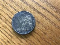
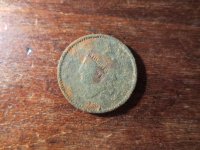
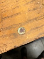
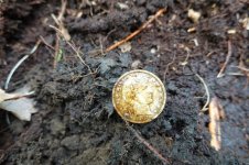
I mainly hunt coin shoot and I have several older home sites near my house. My dad once had a map that he found that listed a lot of old house sites but now I have no idea what became of it and since Dad passed away six years ago I cannot ask him. I have been metal detecting with my uncle who is my Dad's twin brother which helps us in a way keep my fathers memory alive because both of them metal detected together in the 70's, 80's, and 90's. I have searched the on the deeper web but have not found much of anything. I live in the Cherokee Nation jurisdictional area of Oklahoma so my land along with many in this area is allotment land from long ago. I have talked with a friend of mine who is a surveyor and he told me that if I knew the township, range, and section of a place then I could find Game Land Office (GLO) notes to find the exact locations of old home sites. I need help with knowing what particular person do I need to go see in the County or Cherokee Nation office to find the maps with the old house places. I research on the internet but unless you know the right place to look it can be maddening so any tips to researching the internet would be greatly appreciated! I know that since there are two entities, the County and Cherokee Nation, that have to do with the land it can be confusing. I have permission froma landowner at one site but determining if the place is the house site I think it is or another one altogether has been a chore! Thank you all for any tips that you can give me!