Indian Burial

irishmick

Greenie
Aug 3, 2005
18
0
MN
Detector(s) used
ace 250
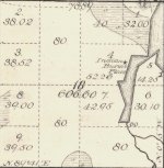
Well I normally just lurk on here but I found this today off of the old minnesota survey maps and couldn't resist posting. I assure all who would believe otherwise that I have no intent to go digging here. It's all privately owned now anyways. But I am trying to find where their village was located nearby. I'm thinking what within 20 miles? Less? Any thoughts anyone?
 

Attachments

  • Indian Burial.JPG
    Indian Burial.JPG
    158 KB · Views: 1,518
Upvote 0
I'm heading there in a half hour with a friend. It's on up on top of a pretty decent bluff/hill. Surrounding land is roughly 1600-1700 feet with the sugar camp marked just shy of 1900 feet. Only the land to the east is a somewhat gentle slope. Otherwise every other side drops 2-3 hundred feet in roughly a hundred yards or so.

Pretty Exciting! ;o)
 

Not much to be found, at least to my naked eye. Entire surroundings are solid Maple with a few pine mixed in, which supports the notation sugar camp. I cross referenced the old survey map with current topo and came to the spot indicated, but other than a few hot iron rocks nothing popped at least on the detector. I looked for any indication of teepee rings, but I zeroed out there also. The ground cover is minimal as far as small plants, but there is at least 3-4 inches of leaf litter. I kicked moss off of every protruding rock I could find looking for any fire marks, but didn't see anything. As far as looking for flint chips and such there is no way with the existing leaf litter. I did read Marc's infrared camera post but that's a little out of my price range at the moment. Any other advice on how to locate the exact area where the camp would have been? I know we didn't even cover half of the hill as my buddy had to get back to the wife and kids.
Continued thanks everyone for your advice.
Irishmick.
 

They had to be close to water, look just out of the flood plain probably not more than a couple of hundred yards, the old maps just give the general area stay with the water you'll find it. They may have had a spring farther from the river but it still wouldnt be that far.
 

dave45 is right,should be within 1/2 mile. thats usually about right in my neck of the woods.
 

I found some historical references to the ojibway "sugar camps" and apparently the women and children went to the sugar camps for 2-4 weeks and the men went to a spring hunting camp for the most part. Also I've seen some pictures of them actually drinking the sap as it comes out of the tree out of birch bark cups or bowls. Wouldn't that negate the need for a spring or lake nearby? I read somewhere that a camp of 4-6 families would tap around 2000 trees. More than enough sap to use for cooking and drinking if needed I would imagine. The nearest lake/water to this camp is about a little more than a half mile away except for a swampy water runoff area. I think I'll have to just keep looking for the actual summer or winter village. It's pretty hard to metal detect up in that area as it is pretty much the iron range and every other rock seems to have high iron content. I'll probably make one more hike out to that lake and check the shore area closest to the camp indicated but other than that I'll armchair hunt ;o)
Thanks again everyone.
 

I'm trying to figure out how much "Indian Artifacts" you are going to find with a detector. I'm in Michigan and I do know that there was trade silver and the use of copper for many things, but I would think taking a shovel and a sifter would be a better thing to use. I would go around and try some test areas to see if I could find a any clues link flint chips, oyster shells, animals bones, etc.. Another thing you may want to use it a GPS to compare the old map to the new map and you maybe able to zero right into the area. Just my opinion. Good luck and keep us informed.

Your Friend,

Steve in Michigan
 

In Southern Ill., The villages are always on the high ground nearest water. As for the village being close to burial ground, at Millstone Bluff the village was just a few yards from several box burials. Wickliffe KY. is another example of the natives living alongside their dead.
 

Top Member Reactions

Users who are viewing this thread

Back
Top