Is the Pit Mine really the Lost Dutchman mine?

Azquester

Bronze Member
Dec 15, 2006
1,736
2,596
Primary Interest:
All Treasure Hunting
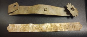
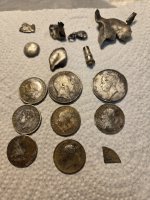
When I go there again it'll be for a few days. I'll establish a base camp. Nice area just below the main range for camping it looks like someone took a quad up there some time ago and did just that. On the way along the road in I stopped and right beside me was a recent small rock slide from rain it looked like. There was some quartz and small amounts of ore stood out so I sampled it because it looked to be showing visible gold and silver. Real nice area not one for Wilderness it has good potential for mining.


View attachment 1325055
 

OP
OP
Oroblanco

Oroblanco

Gold Member
Jan 21, 2005
7,838
9,830
DAKOTA TERRITORY
Detector(s) used
Tesoro Lobo Supertraq, (95%) Garrett Scorpion (5%)
Real de Tayopa wrote
Yet you turned down the Tayopa complex

Can you point me to where I said that? Thanks in advance. Also, there is a rather major problem there, as it is already under claim and owned by a guy notorious for his highly accurate shooting. I am not that great at dodging flying lead.

Cactusjumper wrote
Roy,

I suppose it's possible, but how did 230' shrink down to 80'?

I know I'm a bit dense, but that doesn't compute for me.


Hi Joe and I hope all is well with you and yours. As an old sourdough I am sure you are quite familiar with the underground mining method known as "stope and backfill". In other words, ore and country rock are mined out, and backfilled in tunnels already mined. Another possibility is that of a cave in, although from the photos posted I did not see evidence of any major cave in. One other possibility (besides the fact that we are working with estimated measurements, not actual measurements) is that the Silver Chief had a number of workings, not just one shaft and tunnel. Did you catch the article which mentioned one extension with a 70 foot shaft and 40 feet of drift tunnel? What makes the Pit mine absolutely NOT the Silver Chief or one of its extensions? Thanks in advance.

 
AZDave35 wrote
read the article..especially where it says:
these mines are located 8 miles north east of reymert and 10 miles north of the silver king....


I would not take newspaper article estimated distances etc literally. It is 100% certain that they did NOT measure those distances, or for that matter may not have the exact cardinal directions correct.

 
Old wrote
My apologizes for boring you guys. I'm just answering Oro's question.

Why does an old mine matter?, what historic difference can a pile of old timber and a hole in the ground make?

It matters when the current sovereign says you were never there. That's why.

I'm just musing but..........Lets say.......... 200 years from now folks are mining on the moon. China has colonized the area and controls all the rights. They claim the area by discovery, conquest and purchase. One day you are out prospecting and run across remnants of an what looks like an old flag. Its tattered and crumbles in your hands but you can see its a patch of white stars on a field of blue cornered on a blanket of red and white strips. You can see its old and you can tell by the way its made its don't come from a recent era. You have heard rumors of those pesky Americans saying they were the first to travel to the moon. But the current sovereign denies such talk saying no such thing ever happened. They never landed, never took soil samples and never left their mark behind here. Maybe somewhere else but not here.

Is that an important find, or just a table cloth from a rather recent Chinese dinner party and of no real importance to anything? Just put it in the trash bin and forget about it.

I say it matters and I'd say its particularly important to the real history of Tranquility Bay.


Thank you again, for taking the time to explain. I just fail to see the Rogers mining district, or the Pit, or Silver Chief mine as having anywhere near the same level of significance as a Lunar landing. Remember, of all those published newspaper articles that reported the discovery and development of the Rogers/Randolph district, there is NO mention of finding any old Spanish or Mexican workings or any other earlier mining activity of any kind. Yet in other mining districts, there ARE such mentions, as in the Goldfield district when some old Mexican mining tools were discovered, at the Mormon Stope if memory serves. In the Black Hills (of AZ not SD) Anglo miners broke into a much older mine tunnel which had Spanish armor, skeletons and mining tools. Yet for the Rogers district, nothing. It is true that some historians are today denying that Spanish and or Mexican miners did as much as they really did, and outright denial that the padres were ever involved, such has not always been the case. History, especially American history, is strongly affected by political correctness and popular culture, and NOT with an eye to accuracy by any means. What has convinced you that in the Pit mine, and/or that district, we have strong evidence of pre-Anglo mining activity? Why is that more important than the American mining activity, of the late 1870s/1880s? Thanks in advance.

 
Just personal opinion but I don't think that we should be 'protecting' too many old mines. There are many thousands of them yes, and if you start closing them off permanently you are also closing off the mineral resources they represent. Our nation requires minerals including gold and silver and it would be very unwise to import all of our needs. I can see making a few very outstanding mines into some kind of national monument, BUT only a very limited number. America is a big country but already we have lost many millions of acres that are today in effect sealed off, and our right to enter onto those public lands (which belong to all of us) is nullified. You have the right to enter onto public lands under the 1872 Mining Act, not a privilege but a right, and when any area is made into a Monument or Wilderness it is automatically closed to that right forever. Barring a successful lawsuit that is. Just how much public lands do you want to have closed off forever, for the use of hikers and birdwatchers only? What about liberty and the pursuit of happiness? Oh well just personal opinion.

 
Good luck and good hunting to you all, I hope you find the treasures that you seek.
Oroblanco

:coffee2: :coffee2:


azdave35

Silver Member
Dec 19, 2008
3,606
8,104
My apologizes for boring you guys. I'm just answering Oro's question.

Why does an old mine matter?, what historic difference can a pile of old timber and a hole in the ground make?

It matters when the current sovereign says you were never there. That's why.

I'm just musing but..........Lets say.......... 200 years from now folks are mining on the moon. China has colonized the area and controls all the rights. They claim the area by discovery, conquest and purchase. One day you are out prospecting and run across remnants of an what looks like an old flag. Its tattered and crumbles in your hands but you can see its a patch of white stars on a field of blue cornered on a blanket of red and white strips. You can see its old and you can tell by the way its made its don't come from a recent era. You have heard rumors of those pesky Americans saying they were the first to travel to the moon. But the current sovereign denies such talk saying no such thing ever happened. They never landed, never took soil samples and never left their mark behind here. Maybe somewhere else but not here.

Is that an important find, or just a table cloth from a rather recent Chinese dinner party and of no real importance to anything? Just put it in the trash bin and forget about it.

I say it matters and I'd say its particularly important to the real history of Tranquility Bay.

there is no question that spanish and mexican miners were in rogers district before white men..too many artifacts have been found in the area to prove it
 

azdave35

Silver Member
Dec 19, 2008
3,606
8,104
roy wrote:
I would not take newspaper article estimated distances etc literally. It is 100% certain that they did NOT measure those distances, or for that matter may not have the exact cardinal directions correct.

roy go check a topo map..this isnt just a slight discrepancy ...10 or 20 miles is a pretty big mistake...anyway my point is you cant believe everything you read.....this is one of the main reasons why lost mines are still lost...some people think everything they read in old publications is unquestionable....
 

Old

Hero Member
Feb 25, 2015
656
1,409
Virginia
Detector(s) used
Whites
Primary Interest:
All Treasure Hunting
>>>What has convinced you that in the Pit mine, and/or that district, we have strong evidence of pre-Anglo mining activity? Why is that more important than the American mining activity, of the late 1870s/1880s? Thanks in advance.<<<

I knew <g> you were going to make me drag that disc out and copy the archeology report. I'll do that this evening. LOL.

Didn't say it was more important. In fact, I think I said it would be interesting to document each phase of the mining activity to current to show how it progressed over time.

I actually have no problem with reopening and extracting any left over minerals. Assuming there is a reclamation plan in place. I'd just like to document and get out at least samples of what existed in the form of artifacts from prior eras and make a photographic record of what was there. I think the site(s) need "protecting" until that's accomplished. Then you (collective you) can have at it.

Lynda
 

azdave35

Silver Member
Dec 19, 2008
3,606
8,104
>>>What has convinced you that in the Pit mine, and/or that district, we have strong evidence of pre-Anglo mining activity? Why is that more important than the American mining activity, of the late 1870s/1880s? Thanks in advance.<<<

I knew <g> you were going to make me drag that disc out and copy the archeology report. I'll do that this evening. LOL.

Didn't say it was more important. In fact, I think I said it would be interesting to document each phase of the mining activity to current to show how it progressed over time.

I actually have no problem with reopening and extracting any left over minerals. Assuming there is a reclamation plan in place. I'd just like to document and get out at least samples of what existed in the form of artifacts from prior eras and make a photographic record of what was there. I think the site(s) need "protecting" until that's accomplished. Then you (collective you) can have at it.

Lynda

old...i think people here are exaggerating the mess left at the pit mine....it really isnt anywhere near as bad as it looks (compared to some of the other messes i've seen left at abandoned mines)...i would say it could be cleaned up in half a day..if it hasn't already been.....some of the sites i have been to took months of clean up to reclamate..supposedly the forest service has closed the mine...if they didn't clean up what little mess was there while they closed the mine they should be fired
 

cactusjumper

Gold Member
Dec 10, 2005
7,754
5,388
Arizona
Roy,


"Hi Joe and I hope all is well with you and yours. As an old sourdough I am sure you are quite familiar with the underground mining method known as "stope and backfill". In other words, ore and country rock are mined out, and backfilled in tunnels already mined. Another possibility is that of a cave in, although from the photos posted I did not see evidence of any major cave in. One other possibility (besides the fact that we are working with estimated measurements, not actual measurements) is that the Silver Chief had a number of workings, not just one shaft and tunnel. Did you catch the article which mentioned one extension with a 70 foot shaft and 40 feet of drift tunnel? What makes the Pit mine absolutely NOT the Silver Chief or one of its extensions? Thanks in advance."

I have no problem with trying to imagine what the meaning is of written words, but what ifs that change 120" into 70" requires too much imagination for me. For too many years people have been reading meaning into my own posts that have nothing to do with what I wrote. I believe the same thing happens to you. I prefer to not twist words to fit my preconceived conclusions. I just reads them as they are written.

Once you go down that road, there are countless ways to explain the 120' to 70'......countless.

I don't believe the map I posted is identical to what Matthew Roberts posted. Despite his naming the mines he believes adjoins the Silver Chief, they do not match up with the names of the mines on the map I posted. Am I wrong?:icon_scratch:

Take care,

Joe[SUB][SUP]
[/SUP][/SUB]
 

azdave35

Silver Member
Dec 19, 2008
3,606
8,104
Roy,


"Hi Joe and I hope all is well with you and yours. As an old sourdough I am sure you are quite familiar with the underground mining method known as "stope and backfill". In other words, ore and country rock are mined out, and backfilled in tunnels already mined. Another possibility is that of a cave in, although from the photos posted I did not see evidence of any major cave in. One other possibility (besides the fact that we are working with estimated measurements, not actual measurements) is that the Silver Chief had a number of workings, not just one shaft and tunnel. Did you catch the article which mentioned one extension with a 70 foot shaft and 40 feet of drift tunnel? What makes the Pit mine absolutely NOT the Silver Chief or one of its extensions? Thanks in advance."

I have no problem with trying to imagine what the meaning is of written words, but what ifs that change 120" into 70" requires too much imagination for me. For too many years people have been reading meaning into my own posts that have nothing to do with what I wrote. I believe the same thing happens to you. I prefer to not twist words to fit my preconceived conclusions. I just reads them as they are written.

Once you go down that road, there are countless ways to explain the 120' to 70'......countless.

I don't believe the map I posted is identical to what Matthew Roberts posted. Despite his naming the mines he believes adjoins the Silver Chief, they do not match up with the names of the mines on the map I posted. Am I wrong?:icon_scratch:

Take care,

Joe[SUB][/SUB]
it's been so long and the area has been claimed over so many times i think its going to be hard to prove..they didnt have computers or gps to lay these maps out with either...these old maps with claims drawn on them couldn't have been very accurate...guesswork mostly
 

sdcfia

Silver Member
Sep 28, 2014
3,663
8,899
Primary Interest:
Other
My apologizes for boring you guys. I'm just answering Oro's question.

Why does an old mine matter?, what historic difference can a pile of old timber and a hole in the ground make?

It matters when the current sovereign says you were never there. That's why.

I'm just musing but..........Lets say.......... 200 years from now folks are mining on the moon. China has colonized the area and controls all the rights. They claim the area by discovery, conquest and purchase. One day you are out prospecting and run across remnants of an what looks like an old flag. Its tattered and crumbles in your hands but you can see its a patch of white stars on a field of blue cornered on a blanket of red and white strips. You can see its old and you can tell by the way its made its don't come from a recent era. You have heard rumors of those pesky Americans saying they were the first to travel to the moon. But the current sovereign denies such talk saying no such thing ever happened. They never landed, never took soil samples and never left their mark behind here. Maybe somewhere else but not here.

Is that an important find, or just a table cloth from a rather recent Chinese dinner party and of no real importance to anything? Just put it in the trash bin and forget about it.

I say it matters and I'd say its particularly important to the real history of Tranquility Bay.

The current sovereign is always in charge of history. History is largely propaganda.

I agree with Oro here - this old mine is just one of thousands of old holes in the ground. IMO, its singular history is likely only important to those who have some sort of a stake in it. Speculative testing of old timbers may be used to bolster a particular historic argument, but indisputable evidence - acceptable to all - is what will help establish "a history." If it's proven beyond a doubt that Mexicans did some mining in the American Southwest prior to American seizure, fine - it won't be much of a surprise to anyone interested in these things. Heck, it's already proven. So what? Unless there's a personal benefit, most humans ignore history and just try to keep moving forward. I doubt the Chinese will worry much about some obscure OOPA.
 

Matthew Roberts

Bronze Member
Apr 27, 2013
1,131
4,955
Paradise Valley, Arizona
Primary Interest:
All Treasure Hunting
Roy,


"Hi Joe and I hope all is well with you and yours. As an old sourdough I am sure you are quite familiar with the underground mining method known as "stope and backfill". In other words, ore and country rock are mined out, and backfilled in tunnels already mined. Another possibility is that of a cave in, although from the photos posted I did not see evidence of any major cave in. One other possibility (besides the fact that we are working with estimated measurements, not actual measurements) is that the Silver Chief had a number of workings, not just one shaft and tunnel. Did you catch the article which mentioned one extension with a 70 foot shaft and 40 feet of drift tunnel? What makes the Pit mine absolutely NOT the Silver Chief or one of its extensions? Thanks in advance."

I have no problem with trying to imagine what the meaning is of written words, but what ifs that change 120" into 70" requires too much imagination for me. For too many years people have been reading meaning into my own posts that have nothing to do with what I wrote. I believe the same thing happens to you. I prefer to not twist words to fit my preconceived conclusions. I just reads them as they are written.

Once you go down that road, there are countless ways to explain the 120' to 70'......countless.

I don't believe the map I posted is identical to what Matthew Roberts posted. Despite his naming the mines he believes adjoins the Silver Chief, they do not match up with the names of the mines on the map I posted. Am I wrong?:icon_scratch:

Take care,

Joe[SUB][SUP]
[/SUP][/SUB]


cactusjumper,

Here is the proper quote from the 1906 Arizona mining report. Somewhere along the line the distances and tunnel/shaft designations have gotten scrambled by TNET posters.

Proper Quote: The Silver Chief is another mine of this company. It has a shaft of 40 feet another of 70 feet and a tunnel connecting below of 230 feet, ore is splendid the assay value is said to be from $60 to $1,300 ton. It is generally a carbonate and there is also galena. A drift 18 feet long which from the bottom of the shaft shows 2 feet of very rich metal is in white quartz. The Silver Chief looks better now than has done before.

That is very different from a 70 foot shaft with a 40 foot drift tunnel.

The two shafts with a connecting tunnel is exactly what we have at the Pit mine (Silver Chief) but you have to understand the quote is from the year 1906 and a lot of mining went on that changed the depth and distances of the Silver Chief up until the 1979-1980 time period and allegedly the 1997-1999 time period. You can't take that 1906 report and think that is how the mine would look today 110 years later.

The same is with the Gustav Cox 1882 map of mining claims and the map Jack Carlson compiled a few years ago. Mining claims change hands and names change so naturally the names of the claims on a 1882 map will not match exactly what can be found today 1n 2016. The World Beater claim was on the 1882 map and Jack Carlson found it when he researched the claims in this time period. Jack also found the Silver Chief claim and both the Silver Chief and World Beater match the 1882 map perfectly.

The site of todays Pit Mine is the site of the Silver Chief as shown on both the 1882 map and Jack Carlson's recent map.

Matthew
 

Old

Hero Member
Feb 25, 2015
656
1,409
Virginia
Detector(s) used
Whites
Primary Interest:
All Treasure Hunting
Here ya go Roy........

Excerpts from independent Archaeological report regarding the Roger's Spring site. The Roger's site and the Pit site are in the same general area. The Pit site, to me, exhibits even earlier timbering. Here's what the archeologist had to say. And; the State Archeologist was non too happy about it either.

Page 24………..
The most plausible conclusion on the age of the (reference name deleted to protect the innocent)____ mine is that it dates to the era of Mexican influence in the American Southwest, prior to 1860. A technological comparison of the ___mine to Anglo-American mines that were excavated in the same area following the 1860s demonstrates that the adit documented by ____ mine was not excavated by Anglo-American miners in the period following AD. 1860. The only alternative is that it was excavated prior to A.D. 1860.

Page 30……………..

The mine very likely pre-dates the Gadsden Purchase with which the United States gained control of the Arizona Territory. The exclusive use of hand hewn rather than milled timbers for shoring in the mine, and the absence of a mining claim in Government documents suggests the mine does not date to the period between A.D. 1860 and 1900 of active Anglo-American mining in the Superstition Wilderness. The one remaining alternative is that it pre-dates A.D. 1860 and the entry of Anglo-American influence. The mine could date to the Mexican Period (AD. 1810 to 1853) or the Spanish Period (A.D. 1700 to 1810) of European influence in the American Southwest.

Page 30………….

The mine site is eligible for inclusion on the National Register of Historic P1aces as an example of the mining technology that played an important role in the early entry of both Mexican and United States citizens into the arid Southwest. Local trees were used as shoring materials inside the mine, and hand-held metal tools were used in its excavation. All timbers were either hand sawn or cut with an axe. The bark was left on in most cases and some of the smaller samples were sharpened at one end, possibly so they could be hammered into place.

page 30..........

Although ____ found no gold in the mine (and indeed, no artifacts other than the support beams), the investigation has documented a type of mine that on the basis of technology and archival research must pre-date 1860, and is thus very likely to be an example of a mine excavated during the Mexican period of influence in the Arizona Territory. The documentation of this adit provides an historic basis to the stories and traditions concerning Mexican-era mines in the Superstition Wilderness, and contradicts the general consensus in the historic literature that there were no Mexican mining ventures in the Superstition Wilderness.
 

azdave35

Silver Member
Dec 19, 2008
3,606
8,104
Here ya go Roy........

Excerpts from independent Archaeological report regarding the Roger's Spring site. The Roger's site and the Pit site are in the same general area. The Pit site, to me, exhibits even earlier timbering. Here's what the archeologist had to say. And; the State Archeologist was non too happy about it either.

Page 24………..
The most plausible conclusion on the age of the (reference name deleted to protect the innocent)____ mine is that it dates to the era of Mexican influence in the American Southwest, prior to 1860. A technological comparison of the ___mine to Anglo-American mines that were excavated in the same area following the 1860s demonstrates that the adit documented by ____ mine was not excavated by Anglo-American miners in the period following AD. 1860. The only alternative is that it was excavated prior to A.D. 1860.

Page 30……………..

The mine very likely pre-dates the Gadsden Purchase with which the United States gained control of the Arizona Territory. The exclusive use of hand hewn rather than milled timbers for shoring in the mine, and the absence of a mining claim in Government documents suggests the mine does not date to the period between A.D. 1860 and 1900 of active Anglo-American mining in the Superstition Wilderness. The one remaining alternative is that it pre-dates A.D. 1860 and the entry of Anglo-American influence. The mine could date to the Mexican Period (AD. 1810 to 1853) or the Spanish Period (A.D. 1700 to 1810) of European influence in the American Southwest.

Page 30………….

The mine site is eligible for inclusion on the National Register of Historic P1aces as an example of the mining technology that played an important role in the early entry of both Mexican and United States citizens into the arid Southwest. Local trees were used as shoring materials inside the mine, and hand-held metal tools were used in its excavation. All timbers were either hand sawn or cut with an axe. The bark was left on in most cases and some of the smaller samples were sharpened at one end, possibly so they could be hammered into place.

page 30..........

Although ____ found no gold in the mine (and indeed, no artifacts other than the support beams), the investigation has documented a type of mine that on the basis of technology and archival research must pre-date 1860, and is thus very likely to be an example of a mine excavated during the Mexican period of influence in the Arizona Territory. The documentation of this adit provides an historic basis to the stories and traditions concerning Mexican-era mines in the Superstition Wilderness, and contradicts the general consensus in the historic literature that there were no Mexican mining ventures in the Superstition Wilderness.

thanks...great post
 

cactusjumper

Gold Member
Dec 10, 2005
7,754
5,388
Arizona
cactusjumper,

Here is the proper quote from the 1906 Arizona mining report. Somewhere along the line the distances and tunnel/shaft designations have gotten scrambled by TNET posters.

Proper Quote: The Silver Chief is another mine of this company. It has a shaft of 40 feet another of 70 feet and a tunnel connecting below of 230 feet, ore is splendid the assay value is said to be from $60 to $1,300 ton. It is generally a carbonate and there is also galena. A drift 18 feet long which from the bottom of the shaft shows 2 feet of very rich metal is in white quartz. The Silver Chief looks better now than has done before.

That is very different from a 70 foot shaft with a 40 foot drift tunnel.

The two shafts with a connecting tunnel is exactly what we have at the Pit mine (Silver Chief) but you have to understand the quote is from the year 1906 and a lot of mining went on that changed the depth and distances of the Silver Chief up until the 1979-1980 time period and allegedly the 1997-1999 time period. You can't take that 1906 report and think that is how the mine would look today 110 years later.

The same is with the Gustav Cox 1882 map of mining claims and the map Jack Carlson compiled a few years ago. Mining claims change hands and names change so naturally the names of the claims on a 1882 map will not match exactly what can be found today 1n 2016. The World Beater claim was on the 1882 map and Jack Carlson found it when he researched the claims in this time period. Jack also found the Silver Chief claim and both the Silver Chief and World Beater match the 1882 map perfectly.

The site of todays Pit Mine is the site of the Silver Chief as shown on both the 1882 map and Jack Carlson's recent map.

Matthew

Matthew,

Good post. I can't argue your facts. As I have said all along, I don't really see how the name of the mine is important to the story. The mine was sealed and no one had been in it for many years.

Good luck,

Joe Ribaudo
 

Army of 1

Hero Member
Jun 22, 2013
663
347
Dundee Northern Australia
Detector(s) used
Whites MXT Pro , Tesora Bandito 2 , Minelab GPX 4000
Primary Interest:
All Treasure Hunting
Thanks for the post . Old . If totally correct seems to lean towards it being maybe Spanish/Mexican or Peralta mine , the only questions remaining is what was excavated in the 1997-9 period and how and who rediscovered the Pit mine ..cheers Mick
 

azdave35

Silver Member
Dec 19, 2008
3,606
8,104
Thanks for the post . Old . If totally correct seems to lean towards it being maybe Spanish/Mexican or Peralta mine , the only questions remaining is what was excavated in the 1997-9 period and how and who rediscovered the Pit mine ..cheers Mick

two different digs here...just pretty same district
 

Azquester

Bronze Member
Dec 15, 2006
1,736
2,596
Primary Interest:
All Treasure Hunting
Good thing I never went all the way with my trip. You Guys sure know how to spoil a party!

It seems the whole hillside is old shafts and drifts which could be very dangerous. Just my cup of tea! A very good place to claim a rich mine was located after the fact just to keep people out. Someone had to call the Archies down so the whole shebang gets put on the register of historic wood shavings. If it was so special why did they cover it up?

Ain't no laws against looking!

I'll leave the mining stuff back at the ranch and do it the old fashion way. That metal rod may come in handy for any back filled shafts not visible. I'll tell you though I'm taking more than a 45 auto in there. It's going to be to hot again here by this week end so time may have ran out for cooler days anyway. That would put this thing on this fall's ticket of fun rides.

The weather has been a bit whacky. We may just get a few more cooler days.
 

azdave35

Silver Member
Dec 19, 2008
3,606
8,104
Good thing I never went all the way with my trip. You Guys sure know how to spoil a party!

It seems the whole hillside is old shafts and drifts which could be very dangerous. Just my cup of tea! A very good place to claim a rich mine was located after the fact just to keep people out. Someone had to call the Archies down so the whole shebang gets put on the register of historic wood shavings. If it was so special why did they cover it up?

Ain't no laws against looking!

I'll leave the mining stuff back at the ranch and do it the old fashion way. That metal rod may come in handy for any back filled shafts not visible. I'll tell you though I'm taking more than a 45 auto in there. It's going to be to hot again here by this week end so time may have ran out for cooler days anyway. That would put this thing on this fall's ticket of fun rides.

The weather has been a bit whacky. We may just get a few more cooler days.

bill..you seriously need to be careful walking around up there,,,alot of open shafts with no fences around them ...the brush is so thick you wont see them until your right on it...not a good idea to go alone up there
 

cactusjumper

Gold Member
Dec 10, 2005
7,754
5,388
Arizona
Thanks for the post . Old . If totally correct seems to lean towards it being maybe Spanish/Mexican or Peralta mine , the only questions remaining is what was excavated in the 1997-9 period and how and who rediscovered the Pit mine ..cheers Mick

Mick,

The man who rediscovered the Pit Mine, did not do any of the excavation.

Good luck,

Joe Ribaudo
 

OP
OP
Oroblanco

Oroblanco

Gold Member
Jan 21, 2005
7,838
9,830
DAKOTA TERRITORY
Detector(s) used
Tesoro Lobo Supertraq, (95%) Garrett Scorpion (5%)
roy wrote:
I would not take newspaper article estimated distances etc literally. It is 100% certain that they did NOT measure those distances, or for that matter may not have the exact cardinal directions correct.

roy go check a topo map..this isnt just a slight discrepancy ...10 or 20 miles is a pretty big mistake...anyway my point is you cant believe everything you read.....this is one of the main reasons why lost mines are still lost...some people think everything they read in old publications is unquestionable....

Make of it what you like, it was posted only for anyone that is interested. I doubt that the newspaper man that wrote that article, ever set foot at the Silver Chief and probably was making his own guesses. That does not automatically make the report utterly worthless either. But the article itself does not matter in any way, it was posted for anyone interested. There are a number of others online, anyone can pull them up if they like. Side point but I have seen newspaper articles with even greater errors than those.

Old, thank you for taking the time to write up your answer. Very well done.

Joe, it appears that you may be taking things very literally when that is probably not warranted. Have to agree with Dave and Matthew that there has been a lot of activity there, it is not entirely a matter of record, there were no GPS or even good maps available until relatively recently. So what makes the Pit mine NOT the Silver Chief, or perhaps one of the other 31 named silver mines that had some work done on them in that district? Thanks in advance.

I would like to see a piece of the ore. To me, only the ore is going to settle the question in a scientific way. Will the ore match the famous matchbox ore?

:coffee2: :coffee: :coffee2:
 

Top Member Reactions

Users who are viewing this thread

Latest Discussions

Top