Just Drill Holes

UncleMatt

Bronze Member
Jul 14, 2012
2,389
2,530
Albuqerque, NM / Durango, CO
Detector(s) used
Garrett Infinium & Gold Bug II, Bazooka Super Prospector Sluice
Primary Interest:
All Treasure Hunting
oh Uncle Matt Wish You Where Here:BangHead:

I'm around Eve, what do you need?

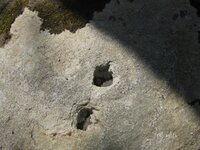
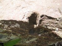
I also want to point out that while I am an enamored with drill holes as anyone here, many larger holes may have been drilled in the rock by natural erosion processes. I have found many almost perfectly round holes in sold granite all over the mountains around Durango. But they are produced by rocks spinning in place in water currents, not by man's efforts. I think small drill holes that have obviously been produced by a steel tool are always worth noticing, but often when I see larger holes that could never have been made by a drill, I recognize they are probably naturally produced. You also have situations where fairly round stones are trapped in a sediment matrix and then compressed into a new rock. When the rock inside erodes out of that matrix, it will often leave a fairly round hole behind that can often look man made. Even on stone where the holes are not vertical, geological processes often turn strata and rock on its side. So the hole get produced in the rock in a river or creek bed, and then the stone is moved to a new location, or into a new orientation, by natural geological processes. Just my two cents.
 

Last edited:

DocBeav

Bronze Member
Jul 8, 2012
1,697
3,157
SE Va
🥇 Banner finds
1
🏆 Honorable Mentions:
6
Detector(s) used
Minelab Equinox 800, Minelab CTX 3030 (17", 11", 6" coils), Minelab Excalibur 800, Minelab Excalibur 1000 (w/OBN's Remote Pinpoint mod and CTX headphone connector)
Primary Interest:
All Treasure Hunting
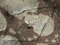
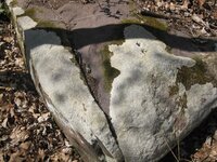
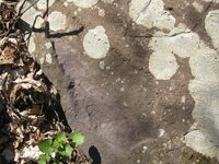
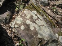
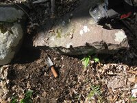
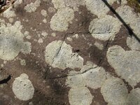
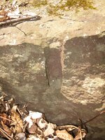
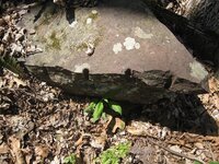
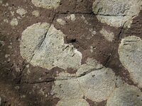
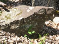
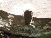
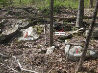
Here are some bore/drill holes I found on a friend's property in Pennsylvania. The property I found it on used to be an Inn in the 1700-1800's and has an old road passing through, though not near the bore holes or the rock carving I found. I know in the pictures it looks like a "12" in the center of the diamond shape with "fringe" bit it is really just a "hash mark" or something. The "2" is actually a piece of mold/lichen on the rock. Here is the link to the hunt and finds:
http://www.treasurenet.com/forums/today-s-finds/351545-old-colonial-road-inn-25-26-apr-2013-pennsylvania-part-1-a.html
and some of the pictures of the rocks:
IMG_1422.JPG IMG_1434.JPG IMG_1423.JPG IMG_1433.JPG IMG_1419.JPG IMG_1432.JPG IMG_1420.JPG IMG_1429.JPG IMG_1425.JPG IMG_1421.JPG IMG_1424.JPG IMG_1426.JPG IMG_1427.JPG IMG_1435.JPG
Any thoughts? Some were posted on the thread, possible quarry site. Not sure about the diamond shape though. I didn't spend as much time around the rock as I would have liked but will be heading back at the end of the month and will try to get more photos and a more concentrated search. I also wonder if It could have anything to do with the Walking Purchase as I know it passed through the area and they were supposedly following up with surveyors or people to mark the route (before) and others after for the land claim.
 

UncleMatt

Bronze Member
Jul 14, 2012
2,389
2,530
Albuqerque, NM / Durango, CO
Detector(s) used
Garrett Infinium & Gold Bug II, Bazooka Super Prospector Sluice
Primary Interest:
All Treasure Hunting
Doc, whenever you see holes drilled along a break like that in a line, you know they were splitting large stones, so probably a quarry.
 

DocBeav

Bronze Member
Jul 8, 2012
1,697
3,157
SE Va
🥇 Banner finds
1
🏆 Honorable Mentions:
6
Detector(s) used
Minelab Equinox 800, Minelab CTX 3030 (17", 11", 6" coils), Minelab Excalibur 800, Minelab Excalibur 1000 (w/OBN's Remote Pinpoint mod and CTX headphone connector)
Primary Interest:
All Treasure Hunting
Doc, whenever you see holes drilled along a break like that in a line, you know they were splitting large stones, so probably a quarry.

Makes sense to me Matt but what about the diamond shape? Can't quite figure that one out. Direction marker? Property Marker? Native American?
 

OP
OP
D

dsty

Bronze Member
Dec 2, 2007
1,300
736
Randal County
Good call on the Quary note Matt, the diamond generally stands for a league or 2.5 miles and is sometimes associated with the 4 directions much like a + plus sign, N S E W, I have seen them inside of a yard. I sure would like to see the bottom on the rock just to the left that has the intersting shape to it, I have seen maps carved on some. Be sure and put it back in the same spot for future reference
 

Last edited:

UncleMatt

Bronze Member
Jul 14, 2012
2,389
2,530
Albuqerque, NM / Durango, CO
Detector(s) used
Garrett Infinium & Gold Bug II, Bazooka Super Prospector Sluice
Primary Interest:
All Treasure Hunting
Makes sense to me Matt but what about the diamond shape? Can't quite figure that one out. Direction marker? Property Marker? Native American?

While it may have meaning, it may also just been someone killing time scratching on a rock. Not every marker placed on a rock or tree indicate hidden treasure.
 

tinhorn

Full Member
Jul 28, 2011
220
228
Dsty, here's a corner for you.

attachment.php


That hole is squared. 14X18 and about 10" deep if I remember correctly. Anyway... Mother Nature don't do that. Also on the right side is the same symbol that is on unclematts cave rock. Neat stuff.
 

Attachments

  • square hole resized.jpg
    square hole resized.jpg
    213.4 KB · Views: 758

tinhorn

Full Member
Jul 28, 2011
220
228
DocBeav,

I would clean off the diamond rock and photo from every direction as well. It may be pointing out more than one trail. Fun!
 

desertmoons

Bronze Member
Apr 16, 2008
1,067
168
Doc, whenever you see holes drilled along a break like that in a line, you know they were splitting large stones, so probably a quarry.

That makes good sense and makes the odd boulder you may find in the middle of nowhere all the more puzzling! And why split them nicely place one half atop the other, all lined up. I do not know.
 

OP
OP
D

dsty

Bronze Member
Dec 2, 2007
1,300
736
Randal County
That is a very good hideyhole, I would sure check the area for a yard and no doubt about it its a corner marker if it shows the 4 directions. Really looks like two that was found south of red river
 

UncleMatt

Bronze Member
Jul 14, 2012
2,389
2,530
Albuqerque, NM / Durango, CO
Detector(s) used
Garrett Infinium & Gold Bug II, Bazooka Super Prospector Sluice
Primary Interest:
All Treasure Hunting
Dsty, here's a corner for you.

attachment.php


That hole is squared. 14X18 and about 10" deep if I remember correctly. Anyway... Mother Nature don't do that. Also on the right side is the same symbol that is on unclematts cave rock. Neat stuff.

Which cave rock symbol are you referring to exactly?
 

Hoofer

Jr. Member
Jan 25, 2012
74
71
Detector(s) used
Between ears
Primary Interest:
All Treasure Hunting
mdog, in reply to your #14 post. I had a site that had only the origanal panel. then drill holes and one stop, turn around
sign.
 

OP
OP
D

dsty

Bronze Member
Dec 2, 2007
1,300
736
Randal County
Recently I have been working on a theory that that because the number of drill holes on a site ( cache ) may after you have found and identified the windrose that has all the information such as degrees and distances may indicate the direction and distance from there to the other part of the windrose that only have two of the degrees / distances that match the 1st and you find the old hand dug hole at the top of the triangle, corner of the square / rectangle, then you may have to take the number of the drill holes and use them to flip them as you would a gate hinge to find the real cache site. So Far that theory has worked on a total of 0ne, which there was another ( deleted word ) hand dug hole.
 

Last edited:

widomanmx

Banned
Dec 6, 2013
300
97
Chihuahua (mx)
Detector(s) used
Gemini 3
Deepers
Primary Interest:
Cache Hunting
Another one ...

j7i1.jpg


width = 1-5/8"
height= 1-5/8"
depth = 7-1/2"

* coin sample = 1 silver ounce = onza plata libertad
 

Last edited:

Shortstack

Silver Member
Jan 22, 2007
4,305
416
Detector(s) used
Tesoro Bandido II and DeLeon. also a Detector Pro Headhunter Diver, and a Garrett BFO called The Hunter & a Garrett Ace 250.
Primary Interest:
All Treasure Hunting
widomanmx:
First off, dsty is "the man" when it comes to drill holes. That other individual is parroting what he's read from dsty's comments and perhaps some phone calls. Trouble is, he does not bother to give credit where credit is due.

Dsty, will have to give you the help on doing the figuring with the measurements, but there is one other thing that might play in here. Seems like there were posts in the past that indicated sometimes there are pointer shapes put into the holes. For instance, in this hole, notice that at the top of the opening, as you photographed it, there is a slight bulge in the edge.......about the 11:30 to 12:00 position......that might be a pointer. If this hole is on top of the stone, also look for compass lines carved on the top somewhere. If it is on the SIDE of the stone, there might be compass lines, too, but in either case, that small chip / bulge in the rim of the hole could be your only indicator of direction to start.

Again, get dsty's ideas on this.
 

OP
OP
D

dsty

Bronze Member
Dec 2, 2007
1,300
736
Randal County
Thank's Bill, Most if not all drill holes have a directional indicator attached either in the form of, a V thats chipped out on the edge, watch this one, the open part of the V consider the Heart symbol where the where the lines come together at the bottom is where you place the arrow, most recent was the diamond shape that indicate 4 AND a league, a bear paw follow it foward, a Deer track follow where it comes from, if it has dew claws its danger
 

Top Member Reactions

Users who are viewing this thread

Top