Red_desert
Gold Member
- Feb 21, 2008
- 6,869
- 3,521
- Detector(s) used
- Garrett Ace 250/GTA 1,000; Fisher Gold Bug-2; Gemini-3; Unique Design L-Rods
- Primary Interest:
- All Treasure Hunting

This area south of Key West, is very interesting to take a good look at. You can place a coordinate grid by clicking grid, from the Google Earth menu. Once the map is zoomed in or out the right amount, adding a place mark will in Google Earth side panel create a link to this map position. When returning to the map, double-clicking the link will automatically zoom you into place again. Click the place mark button of GE for your position and name it (Key West). Double-clicking anywhere on the map ads a new place and will zoom in some. Click the place mark button, name it, move back into position again by double-clicking in the side panel your Key West link. When marking a spot, I prefer a yellow stickpin...you can select what icon to use by clicking the tab on the place mark dialog box.
Key West had not only been used by the Spaniards, but also served as a place for pirates, Ft Taylor during the Spanish-American war, both Mexican and Civil wars, WWI, WWII. The Spanish treasure galleon Santa Rosa carrying the Aztec ransom of jewels, gold, silver, sank in 200 ft of water south of Key West. This same location may hold the wrecks of at least 14 more Spanish treasure galleons. In 1846 another 20 shipwrecks happened during a hurricane, bringing some in very close to the south shore of Key West. Also the San Antonio wrecked on a reef in 1768. A ship got torpedoed by the Germans during the war in 200 ft of water carrying a large gold payment to the US. It was found, but some divers have died trying to work on the wreck. There is a lot of treasure to be found in the waters here.
Now in this area between shoreline and the bottom map edge, only about 6 1/2 miles distance from shore is shown here. For those who enjoy Doodlebugging, Google Earth maps usually print out rather dark. What I do is use in my software program, 6% increase in lightness plus 12% contrast. this has proven to be a winning combination for normal printing on inkjet paper. Now if I was to use maximum dpi resolution printing on thick glossy photo paper, using my big inkjet printer...I would lighten it another 12 %. But for Internet use and normal inkjet paper printing 6% is the most you should lighten it...add contrast to bring out any detail lost during lightening it. Programs that offer hue shift, saturation, lightness, with 3 easy sliders and box for numbers make it nice for increasing color saturation. Leave hue number at default red setting, just add 12% saturation increase...don't mess with lightness here or hue. I often use the sharpen feature if needed in Paint Shop Pro. Other programs offer instant fix balancing, that often is good for digital photos also but haven't tried it with Google Earth maps yet.
Converting the map to greyscale (B&W) is better for marking with your ink pen after printing it out. But make it B&W after sharpening, making lighter. Here is what the map will look like...

As you can see, shallow water, sand bars become more visible. For Doodlebugging the B&W map, change the resolution number in your program sizing box until print size is about 8" wide and click save. Rotate it 90 degrees so prints out ok on injet paper. To use on the Internet, I convert it to a resolution of 98, size to a maximum of 825 X 720 pixels. This means the height will be about 709-720 pixels, depending on how many images you post.
Once the B&W is marked out with a black pen, use Google Earth place marks in your computer and number each one. I draw lines from the grid lines of the B&W into the blank white area around the map and number the spaces between the grid lines. Makes it easier to know where to put the place marks in Google Earth. Do the best you can to place mark all your Doodlebugging.

Zooming in later might let you actually see what was Doodlebugged. After just getting started adding place marks, couldn't resist zooming down to take a look. I didn't really expect to see the bottom like this in Google Earth. Nor did I think my place marks could be close enough for a discovery. My intentions were to place mark everything first...then divide the south part of the map where wrecks are into 2 sections. The sections were to be printed out B&W and Doodlebugged again to add a second set of place marks. I had no idea the first time should turn out close enough.
In a little closer here...

Kind of looks like a mound doesn't it?

If you look close there seems to be some markings made, a circle line around the hump.

I used hot edges effect from one of my programs to bring out what appears to be numbers.

Near one of the place marks, signs of maybe someone has been digging there.

In closer...sure looks like plenty of holes...whether they are there legally or it is illegal activity, the holes were not filled in very well.

Anyway, this ought to help get your Google maps set up properly for a post. Happy THunting...
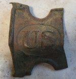
I'm adding some of the results here...
As it turned out, the area was about twice the size you should be working with to add place marks in GE. So, I would suggest starting out with a smaller section for Doodlebugging.

The stickpin icon leans to the right...had to work right to left because they can get in the way, which means it would be deleted and added again.
Zooming in real close will look like this...

The upper left corner, I cropped it...how do you like the color? The program was MICROGRAFX Picture Publisher using the shadow/midrange balancer...easy sliders with a graph results over them, move the first slider (deep shadow) to the start edge graph, it adjusts the midrange (middle) automatically. Tone balance is the menu name for it.

")