My theory on the Peralta Stone Maps and my quest to prove it.

OP
OP
393stroker

393stroker

Hero Member
Jun 27, 2012
505
789
HOUSTON
Detector(s) used
Garrett pro-something
Primary Interest:
All Treasure Hunting

Dirty Dutchman

Sr. Member
Dec 27, 2010
324
72
Arizona
Detector(s) used
My Brain
Primary Interest:
All Treasure Hunting
I feel fortunate...... On one of my trips I got to hear the "Thunder Gods".... Rocks ffell somewhere and all we heard was ....."Boom... boom...Boom"... It was my friends FIRST time I'm the Supes... I told him he was the luckiest ******* in the world to hear that because some people spend their entire lives in those hills and never hear that.

Thanks
Travis
 

somehiker

Silver Member
May 1, 2007
4,365
6,426
Primary Interest:
All Treasure Hunting
In my 17 years of hiking in the Sups I've heard this louder booming (louder than the more frequent sound of small arms gunfire) on about a half dozen occasions.
Twice, I was able to discover the source, once being caused by two gentlemen with a Barret 50 cal. down in a canyon. The other time was when there seemed to be some major work being done at Horse Mesa Dam. I had observed two large steel tunnel-forms being hauled down to the dam by tractor trailers one morning and later that week heard a number of loud explosions coming from that area of the mountains. I assume they were blasting. The other thundering noises have all been different, and louder though. They seemed to echo much longer as well, sometimes sounding more like a train crossing a big steel bridge directly overhead. I wonder if these have some geological cause.

Regards:SH.
 

cactusjumper

Gold Member
Dec 10, 2005
7,754
5,388
Arizona
In my 17 years of hiking in the Sups I've heard this louder booming (louder than the more frequent sound of small arms gunfire) on about a half dozen occasions.
Twice, I was able to discover the source, once being caused by two gentlemen with a Barret 50 cal. down in a canyon. The other time was when there seemed to be some major work being done at Horse Mesa Dam. I had observed two large steel tunnel-forms being hauled down to the dam by tractor trailers one morning and later that week heard a number of loud explosions coming from that area of the mountains. I assume they were blasting. The other thundering noises have all been different, and louder though. They seemed to echo much longer as well, sometimes sounding more like a train crossing a big steel bridge directly overhead. I wonder if these have some geological cause.

Regards:SH.

Wayne,

I can't imagine that anyone who has spent any time in the range has not heard those booms. Don't really recall hearing them in my early days. Seems like they have increased greatly in the last 20-years or so. Believe it's the Thunder Gods....:laughing9:

Take care,

Joe
 

OP
OP
393stroker

393stroker

Hero Member
Jun 27, 2012
505
789
HOUSTON
Detector(s) used
Garrett pro-something
Primary Interest:
All Treasure Hunting
It`s strange that the first night I was out there, that it stormed, with big time lightning and thunder. I guess the Thunder Gods were making their presence known. I must have checked out OK, because they eventually left me alone.
 

somehiker

Silver Member
May 1, 2007
4,365
6,426
Primary Interest:
All Treasure Hunting
Wayne,

I can't imagine that anyone who has spent any time in the range has not heard those booms. Don't really recall hearing them in my early days. Seems like they have increased greatly in the last 20-years or so. Believe it's the Thunder Gods....:laughing9:

Take care,

Joe

Who knows
Could be something like this.....
 

cactusjumper

Gold Member
Dec 10, 2005
7,754
5,388
Arizona
SORRY, I couldn`t resist. Seems kind a quiet since the moderators chewed on us. It was my small victory to get out from behind a computer and actually go out into the Supes., and see it with my own two eyes. I encourage everyone that is thinking about going there to do it at some point in their lives. Take it easy, Chuck


Chuck,

I don't think the forum has gone quiet because of what the moderators may have said. Many of the members are just tired of the........strange theories and claims. Getting tired of it myself, but hate to think that these folks can stop the intelligent conversations about the LDM or the Stone Maps.

Take care,

Joe
 

Nov 8, 2004
14,582
11,942
Alamos,Sonora,Mexico
Primary Interest:
All Treasure Hunting
Oiric, here is mi empty cup,:coffee2: fill er up and keep posting , or I will demonstrate just how mean the fickle finger of fate can be

Remember, I have a pH D in Caribbean Voo Doo, and plenty of dull, rusty pins..

Don Jose de La Mancha ( el maestro de Voo Doo and sore butts )

p.s. It doesn't work on cactus jumper, he has fallen into so mamy cholla that one more pin, wouldn't make any difference. which is why he is sooo mean and insults my lovely mule and ate my steak.
 

OP
OP
393stroker

393stroker

Hero Member
Jun 27, 2012
505
789
HOUSTON
Detector(s) used
Garrett pro-something
Primary Interest:
All Treasure Hunting
HIDDEN IN MATHEMATICS ?

Random thoughts: (1). I was looking up the Omega symbol the other day and noticed that there was reference to it`s use in topos. Math, algebra, geometry, all that stuff that I slept through in high school. I noticed that some of the symbols are on the Trail Maps, and was thinking that these things are some kind of mathematical puzzle. Perhaps made by an artist to show the area where he hid his paintings, for someone to find long after he was gone. Burning your paintings is like killing your kids, so I don`t think he burned them. (2). The 2=3-(o)-18=7 could mean the scale to be used. Like maybe the 2nd dot from the end is 3 mi. away from the bulls eye, and the first dot at the beginning is 7 mi. away. Anyway it might be a clue on how big or small to make the scale. (3). Drill holes: What are they for? If you draw straight lines from one to the other you can see that some sort of plotting is taking place. If only I knew where Hu Kun Kim is, I would ask him to look at this. He was a South Korean exchange student living with us for awhile way back when. He was a professor of economics and had ten years of college. http://en.wikipedia.org/wiki/Omega, Topos - Wikipedia, the free encyclopedia , Subobject classifier - Wikipedia, the free encyclopedia
 

Last edited:
OP
OP
393stroker

393stroker

Hero Member
Jun 27, 2012
505
789
HOUSTON
Detector(s) used
Garrett pro-something
Primary Interest:
All Treasure Hunting
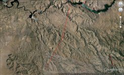
1847.jpg If you plot 18.47 degrees from Weavers Needle, it intersects on top of Tortilla Mt. where 4 Peaks look as one.
 

Last edited:

arctodus

Greenie
Aug 17, 2013
12
14
Arizona
Detector(s) used
Goldbug, garrett
Primary Interest:
All Treasure Hunting
Hi all-

I'm a long time lurker here and at other forums and rarely post. I'm a professional archaeologist and GIS specialist here in Arizona and thought i could contribute a couple things here. I'm also a prospector, treasure hunter, LDM hunter, etc. etc. First, I've seen the stones and based on my experience portions of them appear to be authentic with actual patina from being buried. However, it should be noted that this can be faked, though I kind of doubt the folks who found them would know how to do that. It's pretty tough to fool people who look at ancient crap all day long every day of their lives. Portions of them appear to have been added, and have no patina. The jury is still out and always will be, but I'm thinking there is something to them.

Second, there is no way any of the numbers on the stone maps refer to Lat/Long coordinates. Granted, Lat/Long has been around for a couple thousand years but the current standard (AKA Google Earth, topos, everything else) wasn't established until the 1880's- well after the time of the Spanish. So, if they do match lat/long somebody is going to have to refer to the lat/long the Spanish were using in the 17 and early 1800's (NOT the current coordinates)- and that is one hell of a task and may even be impossible.

Third, using aerials is kind of ridiculous too since, well, the Spanish didn't have planes/balloons/helicopters/hover craft/hang gliders/jet packs and probably not even flying saucers. Some of the best early maps known were done by the American GLO, and they even got it wrong sometimes. Certainly, if these are indeed stone maps leading somewhere in the Supes, they are only meant as a general guide and are not going to be exact, and they sure as hell aren't going to exactly match an aerial. I'm in the camp that believes they are probably fairly good maps, but you need a little more information to figure out what you are looking for and where it actually is. That being said, these maps may actually be just that- maps. Think about it- what are 99.99% of all the maps ever created used for? Finding your way around- they don't lead to treasure and as Indiana Jones says "X never marks the spot".

Cornelius
 

OP
OP
393stroker

393stroker

Hero Member
Jun 27, 2012
505
789
HOUSTON
Detector(s) used
Garrett pro-something
Primary Interest:
All Treasure Hunting
Welcome to TreasureNet and thanks for your input Cornelius. It`s anybody`s guess what they mean and where they lead.
 

coazon de oro

Bronze Member
May 7, 2010
1,623
3,858
texas
Primary Interest:
All Treasure Hunting
Hi all-

I'm a long time lurker here and at other forums and rarely post. I'm a professional archaeologist and GIS specialist here in Arizona and thought i could contribute a couple things here. I'm also a prospector, treasure hunter, LDM hunter, etc. etc. First, I've seen the stones and based on my experience portions of them appear to be authentic with actual patina from being buried. However, it should be noted that this can be faked, though I kind of doubt the folks who found them would know how to do that. It's pretty tough to fool people who look at ancient crap all day long every day of their lives. Portions of them appear to have been added, and have no patina. The jury is still out and always will be, but I'm thinking there is something to them.

Second, there is no way any of the numbers on the stone maps refer to Lat/Long coordinates. Granted, Lat/Long has been around for a couple thousand years but the current standard (AKA Google Earth, topos, everything else) wasn't established until the 1880's- well after the time of the Spanish. So, if they do match lat/long somebody is going to have to refer to the lat/long the Spanish were using in the 17 and early 1800's (NOT the current coordinates)- and that is one hell of a task and may even be impossible.

Third, using aerials is kind of ridiculous too since, well, the Spanish didn't have planes/balloons/helicopters/hover craft/hang gliders/jet packs and probably not even flying saucers. Some of the best early maps known were done by the American GLO, and they even got it wrong sometimes. Certainly, if these are indeed stone maps leading somewhere in the Supes, they are only meant as a general guide and are not going to be exact, and they sure as hell aren't going to exactly match an aerial. I'm in the camp that believes they are probably fairly good maps, but you need a little more information to figure out what you are looking for and where it actually is. That being said, these maps may actually be just that- maps. Think about it- what are 99.99% of all the maps ever created used for? Finding your way around- they don't lead to treasure and as Indiana Jones says "X never marks the spot".

Cornelius

Howdy arctodus, and welcome to TreasureNet.

Could you let us in more into which portions you believe to be "added" based on your professional experience? Thanks in advance.

Homar P. Olivarez
 

markmar

Silver Member
Oct 17, 2012
4,119
6,260
Primary Interest:
All Treasure Hunting
Hi all-

I'm a long time lurker here and at other forums and rarely post. I'm a professional archaeologist and GIS specialist here in Arizona and thought i could contribute a couple things here. I'm also a prospector, treasure hunter, LDM hunter, etc. etc. First, I've seen the stones and based on my experience portions of them appear to be authentic with actual patina from being buried. However, it should be noted that this can be faked, though I kind of doubt the folks who found them would know how to do that. It's pretty tough to fool people who look at ancient crap all day long every day of their lives. Portions of them appear to have been added, and have no patina. The jury is still out and always will be, but I'm thinking there is something to them.

Second, there is no way any of the numbers on the stone maps refer to Lat/Long coordinates. Granted, Lat/Long has been around for a couple thousand years but the current standard (AKA Google Earth, topos, everything else) wasn't established until the 1880's- well after the time of the Spanish. So, if they do match lat/long somebody is going to have to refer to the lat/long the Spanish were using in the 17 and early 1800's (NOT the current coordinates)- and that is one hell of a task and may even be impossible.

Third, using aerials is kind of ridiculous too since, well, the Spanish didn't have planes/balloons/helicopters/hover craft/hang gliders/jet packs and probably not even flying saucers. Some of the best early maps known were done by the American GLO, and they even got it wrong sometimes. Certainly, if these are indeed stone maps leading somewhere in the Supes, they are only meant as a general guide and are not going to be exact, and they sure as hell aren't going to exactly match an aerial. I'm in the camp that believes they are probably fairly good maps, but you need a little more information to figure out what you are looking for and where it actually is. That being said, these maps may actually be just that- maps. Think about it- what are 99.99% of all the maps ever created used for? Finding your way around- they don't lead to treasure and as Indiana Jones says "X never marks the spot".

Cornelius

Nobody said how they had any aerial type of flying . But , the Spanish , made the maps on the ground , piece by piece , and with the triangulation method they were able to give the correct distance between the landmarks .
If the landmarks in the maps are in the correct place and match with the ground shapes in a specific area , I don't see the reason to be rediculous an aerial view .
This is my opinion , but seems logic .

And about the Xs , I agree with you . If you read here http://www.mineralseducationcoalition.org/pdfs/legends.pdf , the meaning of the X is " Trail or line to treasure " or " May designate landmark " .
 

Last edited:

arctodus

Greenie
Aug 17, 2013
12
14
Arizona
Detector(s) used
Goldbug, garrett
Primary Interest:
All Treasure Hunting
Hi Homar and all-

What I was referring to was some of the writing/markings on the stone maps do not have the same patina as the majority of the stones have. There are only a couple of possibilities for why this is.

1. The stone maps are fakes and the creator of them did not fake the patina in these areas as well as in other areas.
2. The stone maps are real and these markings were added at a later date, say the original markings were made in the 1760's and the later in the 1840's or along those lines.
3. The stone maps are real and the later markings were added to confuse anyone looking for whatever they lead to.

Those are the only possibilites as to how you could have different patinas right next to each other on the stones as far as I see it.


Thanks!
 

arctodus

Greenie
Aug 17, 2013
12
14
Arizona
Detector(s) used
Goldbug, garrett
Primary Interest:
All Treasure Hunting
Hi sgtfda-

At the AZ Mining and Minerals Museum back when it was in operation a few years back. I was in there doing some research on an archaeological project I was doing and new some of the folks.

Speaking of which- if you need any mine info you can still get it all from them through the Arizona State Geological Office... all of the records and artifacts from the AZMMM were transferred there.
 

Top Member Reactions

Users who are viewing this thread

Top