meMiner
Bronze Member
- Jul 22, 2014
- 1,047
- 1,176
- Detector(s) used
-
Minelab 800,
Fisher CZ21, F75SE, Gold Bug 2.9 & Minelab GPX 5000
- Primary Interest:
- Metal Detecting
This is a quick story about a visit last year to a new claim in Northern BC. I had researched the area and was able to acquire a claim on a tributary to one of the main gold creeks in the area. The tributary had some history and it looked really nice on the topo map and Google Earth. Access to the bottom of the claim looked reasonable, with a road on the topo and claim map that extended to just below my claim. It was purely on spec on my part and at least I had a place to go and explore.
I found out that the road I wanted to take had a chain across it marked "private". Noted later, it crossed private property and I had no desire to bother anybody, so started to look for an alternative route.
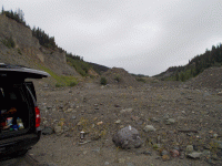
Decided to drive up part way on other side of creek and then walk to mouth of the tributary. This was on somebody else's claim, so I made sure to park out of the way in case they needed to get by. Stopped for a fast coffee by the truck, packed some sniping tools and made sure my pack contained some snacks.
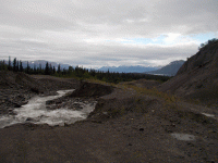
The main creek had been mined almost continuously since 1897. First the hand miners, then drifting and hydraulic. There was no other way to get at the gold, which was close to or within bedrock. Huge amounts of barren overburden (80'-120')of loose unsorted gravel overtop. The gold was with clay and had to be washed twice. Records indicate that the first time got 70% of the gold. Second wash was usually the next year (after the clay oxidized after being exposed to the air) whereby they recovered almost 50% of the first run (the remaining 30% of the gold). My guess is they did not really get 100%, as the same gravels have been processed a few more times which would not have been done if they got it all. Much of the gold was fine, but larger nuggets up to $80 (gold at $20 oz), were not uncommon. The last hydraulic was shut down in the 1950's (relatively late compared to many other areas). It has been mined since with excavators/cats and the few daring souls by drifting. Drifting on this creek prematurely ended some lives.


I left a note with date/time and destination on my dash board and started to hike up to my claim. Using the GPS, I picked the right tributary and started up it. In old pictures of this area, there was a mass of tents for prospectors. Now it is all overgrown and there is very little evidence of the busy camp a short distance away from the main creek.
I did find an old metal gold pan at the base of a large tree. I had no need for it and put it back where I found it. It made me wonder the story? I bet somebody put it down and wandered too far to retrace their steps. Or maybe, it simply fell out of an open backpack? I also discovered on the side of the mountain, was a fallen down wooden ditch that ran for about a mile. I am guessing this was a water source for the hydraulic monitors. The amount of work to build it was astounding.
The walk up the creek was not easy. There was no path and most of the game trails were perpendicular to my line of travel. I crossed a couple of spots that had evidence of recent (last 20 years) work. Somehow, somebody got a machine into here, so I was eager to find their road. Before I got to where the GPS confirmed my claim started, it rained. Hard to believe that one minute I was hot and sweaty and within 5 minutes was uncomfortably cold. A nasty cold front must have descended on the area. I stopped for a snack and to pan some creek gravels to see if there was any color - the sample pan was a bust.
Just then, I saw some branches shake. I had trouble seeing much at ground level further than maybe 10 yards and this was about 40 yards away. I discounted that it was the wind (there was none). I could hear nothing on the damp ground, with the light rain falling and the noise of the creek. Whatever it was got closer as the next tree in line also shook. I grabbed my rock pick and bear spray, feeling very exposed. Next, I saw some movement at ground level but still could not make out a shape. To my relief, out stepped a female moose and not the grizzly I was expecting.
I wandered a bit further up the creek testing some of the gravels as I went, but getting poor results. There was no obvious bedrock, so my sniping tools were just along for the ride. The rain picked up substantially, so I was soaked head to toe. I stopped to eat some tuna and crackers (snack pack) and could hardly enjoy it because I was shaking so much. I could not tell if it was getting dark because of the storm clouds or if I had stayed longer than anticipated. In northern BC at that time of year, it gets dark quite late in the evening and never really goes pitch black.
As such, I decided it was dumb to hang out any longer with the risk of hyperthermia and the prospect of no good gold, fully intending to give the area another try later. Remembering the road on the map, I was hopeful for an easy way off the mountain. I cut through the bush and did not find anything remotely looking like a road. I did cross a well used game trail and decided to follow that. After all, how difficult can it be to find the way off a mountain (don't cross the creek and keep walking down). hahaha. I followed that trail until it petered out and found a few more to follow, fully getting myself completely lost and in most up and down areas I could not tell which way was "generally" down. To make matters worse, there was much evidence of bear where I was walking.
However, on the edge of one flat, was a spot that had obviously been mined by old timers. Thinking back, I suspect the whole area was open because of mining. They had piled cobbles here and there. Narrow trenches were cut. It was off my claim, but I had no idea if it was on somebody else's claim, because I did not know where exactly I was. I took out my GPS and of course the battery was dead. I did have a compass. At that point, I am pretty sure hypothermia was setting in because I had trouble remembering if I wanted to go north or east. Anyway, to make a long story short, I made my decision and cut a line as best I could considering the hills and valleys and finally crossed a fairly good ATV trail. I followed that trail, thinking it would eventually come out at the private road. In fact, it came out and stated to parallel the top of the cliff on the main creek. I was able to see my truck parked below, knowing it was full of food, dry clothes and a heater.
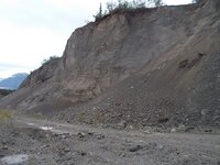
Unable to see an easy route down, I just decided to find an area where there were some trees and shrubs on the side of the cliff and use those to descend to the bottom. The first one that I grabbed snapped, sending me down the steep slope on my butt. It was not the most elegant dance I have ever performed but it sure got me where I wanted to go in a hurry.
I never got back into that spot and let the claim forfeit.
I found out that the road I wanted to take had a chain across it marked "private". Noted later, it crossed private property and I had no desire to bother anybody, so started to look for an alternative route.
Decided to drive up part way on other side of creek and then walk to mouth of the tributary. This was on somebody else's claim, so I made sure to park out of the way in case they needed to get by. Stopped for a fast coffee by the truck, packed some sniping tools and made sure my pack contained some snacks.
The main creek had been mined almost continuously since 1897. First the hand miners, then drifting and hydraulic. There was no other way to get at the gold, which was close to or within bedrock. Huge amounts of barren overburden (80'-120')of loose unsorted gravel overtop. The gold was with clay and had to be washed twice. Records indicate that the first time got 70% of the gold. Second wash was usually the next year (after the clay oxidized after being exposed to the air) whereby they recovered almost 50% of the first run (the remaining 30% of the gold). My guess is they did not really get 100%, as the same gravels have been processed a few more times which would not have been done if they got it all. Much of the gold was fine, but larger nuggets up to $80 (gold at $20 oz), were not uncommon. The last hydraulic was shut down in the 1950's (relatively late compared to many other areas). It has been mined since with excavators/cats and the few daring souls by drifting. Drifting on this creek prematurely ended some lives.


I left a note with date/time and destination on my dash board and started to hike up to my claim. Using the GPS, I picked the right tributary and started up it. In old pictures of this area, there was a mass of tents for prospectors. Now it is all overgrown and there is very little evidence of the busy camp a short distance away from the main creek.
I did find an old metal gold pan at the base of a large tree. I had no need for it and put it back where I found it. It made me wonder the story? I bet somebody put it down and wandered too far to retrace their steps. Or maybe, it simply fell out of an open backpack? I also discovered on the side of the mountain, was a fallen down wooden ditch that ran for about a mile. I am guessing this was a water source for the hydraulic monitors. The amount of work to build it was astounding.
The walk up the creek was not easy. There was no path and most of the game trails were perpendicular to my line of travel. I crossed a couple of spots that had evidence of recent (last 20 years) work. Somehow, somebody got a machine into here, so I was eager to find their road. Before I got to where the GPS confirmed my claim started, it rained. Hard to believe that one minute I was hot and sweaty and within 5 minutes was uncomfortably cold. A nasty cold front must have descended on the area. I stopped for a snack and to pan some creek gravels to see if there was any color - the sample pan was a bust.
Just then, I saw some branches shake. I had trouble seeing much at ground level further than maybe 10 yards and this was about 40 yards away. I discounted that it was the wind (there was none). I could hear nothing on the damp ground, with the light rain falling and the noise of the creek. Whatever it was got closer as the next tree in line also shook. I grabbed my rock pick and bear spray, feeling very exposed. Next, I saw some movement at ground level but still could not make out a shape. To my relief, out stepped a female moose and not the grizzly I was expecting.
I wandered a bit further up the creek testing some of the gravels as I went, but getting poor results. There was no obvious bedrock, so my sniping tools were just along for the ride. The rain picked up substantially, so I was soaked head to toe. I stopped to eat some tuna and crackers (snack pack) and could hardly enjoy it because I was shaking so much. I could not tell if it was getting dark because of the storm clouds or if I had stayed longer than anticipated. In northern BC at that time of year, it gets dark quite late in the evening and never really goes pitch black.
As such, I decided it was dumb to hang out any longer with the risk of hyperthermia and the prospect of no good gold, fully intending to give the area another try later. Remembering the road on the map, I was hopeful for an easy way off the mountain. I cut through the bush and did not find anything remotely looking like a road. I did cross a well used game trail and decided to follow that. After all, how difficult can it be to find the way off a mountain (don't cross the creek and keep walking down). hahaha. I followed that trail until it petered out and found a few more to follow, fully getting myself completely lost and in most up and down areas I could not tell which way was "generally" down. To make matters worse, there was much evidence of bear where I was walking.
However, on the edge of one flat, was a spot that had obviously been mined by old timers. Thinking back, I suspect the whole area was open because of mining. They had piled cobbles here and there. Narrow trenches were cut. It was off my claim, but I had no idea if it was on somebody else's claim, because I did not know where exactly I was. I took out my GPS and of course the battery was dead. I did have a compass. At that point, I am pretty sure hypothermia was setting in because I had trouble remembering if I wanted to go north or east. Anyway, to make a long story short, I made my decision and cut a line as best I could considering the hills and valleys and finally crossed a fairly good ATV trail. I followed that trail, thinking it would eventually come out at the private road. In fact, it came out and stated to parallel the top of the cliff on the main creek. I was able to see my truck parked below, knowing it was full of food, dry clothes and a heater.
Unable to see an easy route down, I just decided to find an area where there were some trees and shrubs on the side of the cliff and use those to descend to the bottom. The first one that I grabbed snapped, sending me down the steep slope on my butt. It was not the most elegant dance I have ever performed but it sure got me where I wanted to go in a hurry.
I never got back into that spot and let the claim forfeit.


