question about gold claims

rob95610

Newbie
Jul 14, 2015
3
1
Citrus Heights, CA (Sacramento)
Detector(s) used
Tesoro Compadre
Primary Interest:
All Treasure Hunting
question about gold claim date stamp

I was out exploring the mountains with my son and we came across a mining claim. We are in California. The date stamped was 1994 but the papers looked like they were stapled to the tree fairly recently, sometime this year I assume. The plastic sleeve and paper were in very good condition and barely weathered at all.

What is the deal with this? Should the papers be date stamped this year to be a valid claim?

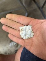
I must be doing something right. Our first trip out prospecting and we find a mining claim within minutes of arriving! We went downstream a ways and panned out some flakes. Pretty good day hiking. We saw a fox and some salamanders. The gold we got looked like more in the pan. Now it's in the vial and it is barely anything LOL!

Anyhow, the dirt on this supposed claim looks pretty good and I want to dig some. But I want to make sure that I won't be claim jumping. I suspect that this claim paperwork is fake just to scare off the greenhorns like me!
 

Last edited:
Upvote 0

DizzyDigger

Gold Member
Dec 9, 2012
5,851
11,602
Concrete, WA
Detector(s) used
Nokta FoRs Gold, a Gold Cube, 2 Keene Sluices and Lord only knows how many pans....not to mention a load of other gear my wife still doesn't know about!
Primary Interest:
Prospecting
Rob, I'm not a claim expert, but will take a shot at this.

It's my understanding that the claim owner doesn't even have
to post the notice, so any date on the ppwk you saw is likely
irrelevant.

It is the responsibility of the prospector to do the homework and
make sure you're not poaching someones claim. There are numerous
sites you can do that research on current and abandoned claims.

Here is a good spot to start: Welcome to Land Matters
 

bobw53

Hero Member
Oct 23, 2014
522
1,132
Hatch, New Mexico
Primary Interest:
All Treasure Hunting
But I want to make sure that I won't be claim jumping. I suspect that this claim paperwork is fake just to scare off the greenhorns like me!

I've been told that "claim jumping" is over filing a claim... What you are possibly doing is "high grading"... Digging on somebody else's claim... There is a thread active right now
about "high graders"....

As a miner or prospector or some guy looking for a little bit of color, it is YOUR responsibility to do your due diligence and research the area ahead of time.... You literally have
to do everything you would do before filing your own claim except bang the stakes in the ground and filing a few pieces of paper.

In all honesty, you should have known if there where any claims there, and EXACTLY where they were BEFORE!!! you even left the house.. The Due Diligence thing...

I'll also tell you, as somebody that has recently learned all about the claim thing... You are going to get answers that you don't like, you are going to get answers that
seem vague, and not to the point.. Clay Diggins (the MyLandMatters guy), a very knowledgeable guy, and he knows what he is talking about... I couldn't understand
what he was trying to hide, why couldn't he just answer the question? I wanted to choke him, it was frustrating.. Looking back, he was giving a straight answer, the
best answer he could have given, it just wasn't what I wanted to hear..... You probably don't like what I'm saying right now.. A whole lot of words, and all you want is
an answer to what seems like a simple question.

Having just learned all this stuff recently, its not simple and straight forward. The whole system is confusing at first. There is NO place you can go and get a map
of claims, it would be so nice if there was such a place, but there isn't.. The research you need to do is not that hard, the hard part is figuring out WHAT to research,
and then HOW to do the research.

First you need to understand the PLSS system.. Public Land Survey something or another. This is the imaginary grid used to locate claims, Meridian, Township, Range, Section...
Then you need to understand what "N2NE4NW4S33T15SR6WNM23" means.. North half of the NE 1/4 of the NW 1/4, Section 33, Township 15S, Range 6W on the NM23 meridian.

Now we can go to MyLandMatters and look at mining claim maps. This data is the same data that the BLM has on their LR2000 system. The LR2000 does not have maps,
and is a bassackwards system.. There are tutorial vids on Youtube, once you know how to use it, its not bad. There is also the Geocommunicator, that is a map, but
you can turn on the PLSS grid....

Now we know what claims are where we want to dig, BUT we only know a very vague approximate spot that they are in. The LR2000 *should* give you a book and page # for
each claim. Now we head our selves down to the county clerks office. This isn't really an option, the OFFICIAL place of recording is the county clerks office... They don't
have a map either, they don't know a mining claim from a restraining order, their job is to record paperwork, and help people look up paperwork, what is on those papers doesn't
matter to them....

Hopefully you have some nice folks down there, or even better, the records are on line. If you are lucky, the paperwork you pull will have a map of the individual claim... There
are placer claims, those follow the PLSS grid, and there are Lode claims, those are by metes and bounds... From the NW corner of SE 1/4 of the NW 1/4 of Section 13 Township
?? Range ?? Due west 140 feet to the first corner, 37 degrees east of north, 1500 feet etc etc etc etc....

Now you know where peoples claims are... Sort of... You have 90 days from staking a claim to filing the paperwork, so you still have to look for stakes on the ground....


All those words, for such a simple question.... You still have to make sure of the status of the land and the laws... Are there no claims there because its private land, an old
homestead with mineral rights possibly (I ran into this one recently)..

It can be a lot of fun, but its a bit intimidating at first... Once you figure all this out, you are only a few pieces of paper and a couple of stakes away from filing your own claim.

Good luck, and where is a pic of the shiny stuff???
 

KevinInColorado

Gold Member
Jan 9, 2012
7,037
11,370
Summit County, Colorado
Detector(s) used
Grizzly Goldtrap Explorer & Motherlode, Gold Cube with trommel or Banker on top, Angus Mackirk Expedition, Gold-n-Sand Xtream Hand pump
Primary Interest:
Prospecting
First, congrats on finding a little gold on your hike! Fun stuff :)

Taking gold from a valid mining claim (which you can bet that spot is) is theft...just the same as walking onto someone's front yard to take the flowers, pink flamingo or their dog...not cool...so I'm glad you walked away.

As BobW says, prospecting out in the hills comes with a lot of prep work if you are on claimable federal lands. The good news is there are lots of places in your beautiful state that have gold and are set aside for you to prospect on without worries about such things.

Here are a bunch, have fun! Google them to find websites with rules, maps and such...
PG & E Recreation Area Electra Rd
County:*Amador
Watershed:*Mokelumne River
Restrictions:*Unknown
Additional Info: Public area starts about 2.7 miles from highway 49 when you reach the first restroom in the recreation area. Watch out for private property and existing mining claims.

New Hogan Fishing Access
County:*Calaveras
Watershed:*Calaveras River, Tributary
Restrictions:*Hand trowels, pans and sluice boxes only. Prospecting is allowed in the main creek bed. No digging up creek shore. Metal detectors not allowed.
Additional Info: Creek typically dry in summer.

Bear River Campground
County:*Placer
Watershed:*Bear River
Restrictions:*No power equipment. Prospecting is allowed in the main creek bed. No digging up creek shore or around tree roots.
Additional Info: Free parking at day use area.

goldenmojo said:
You can park on the North end near the bathrooms, no fee.* Do not cross over the river to the left bank - private land.* Go upstream at least a half mile or better to find bigger gold and more. Plenty of exposed bedrock.* Easy trail hike.* Good luck.* Most gold is fine .

Knights Ferry
County:*Stanislaus
Watershed:*Stanislaus River
Restrictions:*Pans and hand trowels only. No metal detecting.

It's a hands and pans only area, but if you check out a place called Knights Ferry just East of Oakdale, there is still some really good places to dig, bedrock all over the places, beautiful hikes, an old wood covered bridge, and just a really cool place to check out with the family![

Goodwin Dam Recreation Area
County:*Stanislaus
Watershed:*Stanislaus River
Restrictions:*Pans and hand trowels only. No metal detecting.

Campgrounds At Italian Bar
County:*Tuolumne
Watershed:*South Fork Stanislaus River
Restrictions:*This is BLM property. Most legal mining*methods seem to be allowed.
Additional Info:*The public area starts*after you cross the 5 mile creek bridge and goes on for about a mile. Watch out for*claims. This road is a windy*steep forestry road.

Auburn State Recreation Area
County:*Placer
Watershed:*American River
Restrictions:*Panning, detecting and rock hounding*are allowed. Please read the Auburn SRA brochure available in pdf format for additional information.

Keysville*Recreational Mining*Area
County:*Kern
Watershed:*Kern River
Restrictions:*Panning, sluicing seems to be allowed

Merced River Recreation Area At Briceburg
County:*Mariposa
Watershed:*Merced River
Restrictions:*Panning, sluicing and metal detecting. No power equipment.
Additional Info:*Watch for existing mining claims. There is a brochure at the BLM website that shows existing claims along the river.
 

Last edited:

Hoser John

Gold Member
Mar 22, 2003
5,854
6,721
Redding,Calif.
Primary Interest:
All Treasure Hunting
South Fork Yuba Recreation BLM area north of Nevada City is a great place to mine as best gold in the motherlode most of the time. Upriver rom the paking lot and work all rivers this year as close to the low water mark as dryer than a popcorn fart and much new ground exposed. LOTS of snakes and critters as all must have water and predators follow them with gusto-John
 

Goldwasher

Gold Member
May 26, 2009
6,077
13,225
Sailor Flat, Ca.
🥇 Banner finds
1
Detector(s) used
SDC2300, Gold Bug 2 Burlap, fish oil, .35 gallons of water per minute.
Primary Interest:
All Treasure Hunting
paperwork means nothing and in California only a discovery monument is required. Ours only has the original filing date.....my file at home has the more recent assesment paperwork....Our claim is valid regardless of the paper in the monument tube.....There is a very good chance you hi graded someones claim...especially if you were in the vicinity of a claim posting....claims are typically 20 acres or more. You should be absolutely sure before you dig.... ALWAYS!!!!!

A little geography Geology fact..
The true MOTHERLODE ends in Georgetown. The areas around Grass Valley...Nevada City and Auburn can be called The Motherlode but, They Technically aren't different fault zones and geology....https://en.wikipedia.org/wiki/Mother_lode

Check Welcome to Land Matters for land/claim status...but, also make sure to check the county recorder for recent filings....Your best bet until your more experienced at land status issues is to hit the open public areas given above!!!!

If I come across a hi-grader on our claim I frankly won't believe any story they give or will I have any kind of " understanding" of their situation....they will be reported to the sheriff!!
 

Last edited:

goldenIrishman

Silver Member
Feb 28, 2013
3,465
6,152
Golden Valley Arid-Zona
Detector(s) used
Fisher / Gold Bug AND the MK-VII eyeballs
Primary Interest:
Other
Requirements for claim marking vary from state to state. Here in Arizona corner posts are required but in California they're not. Be sure to do your research before you head out and make sure you're in open ground before you start digging. If you know what area you will be hiking in, a quick trip to the recorders office with a fist full of notes on your planned route can show you where you can dig along the way.

Many a claim has been in place for years and the only paperwork required is the original filing notice and a copy of a map showing the boundaries of the claim. These can be in place for years and if protected from weather can last a long time. While out researching new areas a short time ago I came across some paperwork that had been dated 1994 and it was in great shape. The claim is still valid according to the LR2000.
 

utah mason

Hero Member
Jul 10, 2015
545
935
utah
Primary Interest:
Prospecting
Good to know about old paperwork being still valid. I watched this guy on utube who said if paperwork on claim marker is not proprerly filled out or out of date its void and not a valid claim. I always check lr2000 before we go out to see what area there are claims in . But like mentioned above they only gives you a vague idea where they are. I'm the type of guy that ask other people when in doubt, but be careful who you ask as they might be full of sh!t and trying to lead you away from "their spot". Before I figured out the lr2000 my son and I were out and this guy told us the area was his claim, but he lets people mine his claim for a small fee. I decided not to pay the fee and went up further, where he said there no claims( did find a few specks of color). After using lr2000 figured out this clown didn't have claim, there hasn't been a claim in that section since 2010. Thought about putting in a claim there just to mess with him, but figured I would going to go back up there and dig around. If it looks promising maybe I'll spent the couple hundred to claim it. Then I can charge him ; )
 

ratled

Hero Member
Feb 18, 2014
950
2,396
Primary Interest:
All Treasure Hunting
There are some good answers and some wrong info posted here - what where you expecting form the internet. Find someone local, who knows what they are talking about and learn from there. You could also join a club, get chance to use their claims and learn as you ago about prospecting, claims and gear. Might I suggest Gold Hounds or UPI

ratled
 

Anduril

Bronze Member
Aug 31, 2015
1,239
1,602
South Florida
Detector(s) used
Garrett GTI-2500
Primary Interest:
Metal Detecting
Thanks Bob.
Your write-up is actually quite helpful.
A friend of mine is a retired county surveyor. I think I'll ask him out to lunch next week for more on this.

BTW: The LR2000 system sounds a lot like the US Patent Office.
Government run. Inefficient. Needlessly complex. Lots of mistakes.
 

2cmorau

Bronze Member
Nov 8, 2010
1,608
1,294
Camptonville, CA
Detector(s) used
GMT&GM3 Whites MXT Pro, Shadow X5, Fisher 1280, OMG and the TDI
Primary Interest:
Prospecting
i always replace my paper work because it has the location date and the current date stamped on it, also laminated is the copy of the location paper work, but best is post a zillion signs mining claim signs , it never fails you will find someone on your claim with a pan saying i was looking for chow man
 

richter

Greenie
Apr 16, 2013
14
5
Primary Interest:
All Treasure Hunting
In NC that = shot and burred in an old well............. Just saying
 

mikep691

Hero Member
Aug 6, 2015
858
1,759
Northeastern Sierra's
Primary Interest:
All Treasure Hunting
While in California, placer claims may not need corner markers, you need to watch for lode claim markers. Areas around the Moke river on both sides are loaded with markers, some old and a few new. Lode claims require center posts, 1500 feet apart. The actual width of a lode claim is 300 feet either side of the marker. This makes a lode claim 600 feet wide by 1500 feet long. All told it's 20.66 acres. But lode claims are underground and still have to be treated as ownership on the surface as well. No one can file a placer claim over an existing lode claim, and no one can file a lode claim beneath an existing placer claim. The holder of a placer claim is the only person that can file a lode claim within the boundry of his existing placer claim. Your county recorder office has maps of all the claims in their county, it is a requirement when filing. These can be copied for a few bucks in the area you want to travel/hike/prospect. LR2000 will give you a general area, without maps (they used to provide them) to the quadrant of a section. Common sense says if there is a creek or river in that quad, you can pretty much bet that's where the placer claim is.
 

ratled

Hero Member
Feb 18, 2014
950
2,396
Primary Interest:
All Treasure Hunting
Not trying to high jack the thread but since it has been since it has been mentioned more than once.... mining claims are federal not state, a federal mining claim requires corner posts. Does not having them make your claim invalid, that's between you and the paperhanger who files over your claim.

Now I routinely have mine destroyed so checking them, and replacing them often gets to be a chore.

Sorry I just had to say something

ratled
 

bobw53

Hero Member
Oct 23, 2014
522
1,132
Hatch, New Mexico
Primary Interest:
All Treasure Hunting
Not trying to high jack the thread but since it has been since it has been mentioned more than once.... mining claims are federal not state, a federal mining claim requires corner posts. Does not having them make your claim invalid, that's between you and the paperhanger who files over your claim.

Now that is where the whole thing gets confusing and stupid... FEDERAL claim, on federal land... Recorded at the county, and governed by STATE laws... and Federal.

Discovery monuments... STATE law.
Corner posts.. STATE law...

An example. In Nevada your corner posts have to be 3 feet tall, in New Mexico, they have to be 4 feet tall.
 

ratled

Hero Member
Feb 18, 2014
950
2,396
Primary Interest:
All Treasure Hunting
Now that is where the whole thing gets confusing and stupid... FEDERAL claim, on federal land... Recorded at the county, and governed by STATE laws... and Federal.

Discovery monuments... STATE law.
Corner posts.. STATE law...
Claim boundaries must be distinctly and clearly marked to be readily identifiable..........Federal law

An example. In Nevada your corner posts have to be 3 feet tall, in New Mexico, they have to be 4 feet tall.

I fixed it for you :thumbsup:

ratled
 

mikep691

Hero Member
Aug 6, 2015
858
1,759
Northeastern Sierra's
Primary Interest:
All Treasure Hunting
While I may be incorrect in stating "NOT REQUIRED", allow me to correct it: Initially, all placer claims must be corner marked. While it's strongly advised,, they do not need to maintained in some states. after the initial recording, and subsequent BLM filing, it's the paperwork thing that keeps it valid. An FYI: Plumas County, Ca. Will now tax all claims as real property, whether filed with BLM or not. In my opinion, this eliminates the BLM from control within this county. It however does not protect the claimee from over filing as the county does not map the claims. They still rely on BLM for the mapping of claims (and we know what kind of job they actually do here). It remains extremely important (and required) that you record your maps as well as the NOL.
 

mikep691

Hero Member
Aug 6, 2015
858
1,759
Northeastern Sierra's
Primary Interest:
All Treasure Hunting
An example. In Nevada your corner posts have to be 3 feet tall... Also, in Nevada they allow PVC pipe for markings. It's said PVC in Nevada is the new state flower. Just sayin'
 

SLNugget

Sr. Member
Sep 25, 2013
262
232
Morristown, AZ
Detector(s) used
Gold Bug Pro
Primary Interest:
Prospecting
While I may be incorrect in stating "NOT REQUIRED", allow me to correct it: Initially, all placer claims must be corner marked. While it's strongly advised,, they do not need to maintained in some states. after the initial recording, and subsequent BLM filing, it's the paperwork thing that keeps it valid. An FYI: Plumas County, Ca. Will now tax all claims as real property, whether filed with BLM or not. In my opinion, this eliminates the BLM from control within this county. It however does not protect the claimee from over filing as the county does not map the claims. They still rely on BLM for the mapping of claims (and we know what kind of job they actually do here). It remains extremely important (and required) that you record your maps as well as the NOL.

Where doe the BLM record the claim maps? The only legal entity for recording a claim is the County and the County does record the Notice of Location that includes a map of the claim right?
 

Top Member Reactions

Users who are viewing this thread

Latest Discussions

Top