The "Peralta" Stone Maps --- On Their Own

Hal Croves

Silver Member
Sep 25, 2010
2,659
2,695
I captured this image on my last trip to the museum. It is almost impossible to see without very special equipment (Fisher Price Micro Explorer Set Microscope by StrangeBeauty) and is what I believe to be the "missing symbol". Its ther, ya just hafta to squint.

View attachment 804790

Yes, only a joke...

But, a closer look at the inscriptions might reveal which (if any) bit in this set may have been used to carve the stones. I am guessing a cone shape was involved as some of the marks are tapered. I see the lines on the horse map as much more refined (smooth without breaks) than those on the padre map. These were mail ordered... a record might exist if Tumlinson or some other familiar name purchased one.


Last edited:

somehiker

Silver Member
May 1, 2007
4,365
6,427
Primary Interest:
All Treasure Hunting
somehiker,
If the artist was observing what was before him, why the differences in what you are comparing? It is similar, yes, but no match. Why not inscribe the stones exactly the way we see things in your photograph as opposed to just something similar?


If he had reason to do so, he likely would have included all of the various cracks,holes, and other irregularities surrounding this and all of the other markings shown on the stones. But by the time he he had finished doing so, he probably would have, due to old age and Alzheimer's, forgotten why he was making them.
You might be on to something though. After all, nobody has ever come forward to claim them as their property.

Regards:SH.
 

sgtfda

Bronze Member
Feb 5, 2004
2,351
3,889
Mesa Arizona
Wayne notice the position of the stones on Markmar's photo. That's the position I used in my overlay. Markmar did you place a camera in my house? I'm going to look around
 

sgtfda

Bronze Member
Feb 5, 2004
2,351
3,889
Mesa Arizona
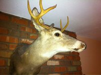
Found it. Was behind the deers glass eye. Got to be more careful.

image-1358786592.jpg
 

somehiker

Silver Member
May 1, 2007
4,365
6,427
Primary Interest:
All Treasure Hunting
Wayne notice the position of the stones on Markmar's photo. That's the position I used in my overlay. Markmar did you place a camera in my house? I'm going to look around

Yes I did, Frank. Right off.
If that's the trail, it's all either gone or on private property.
Unless you're supposed to go in the opposite direction, starting where all that gold was found ?
 

sgtfda

Bronze Member
Feb 5, 2004
2,351
3,889
Mesa Arizona
Wayne check your email I found the heart. Sent you the information. I see now what threw everyone off with the stones. You see two brains are better than one. No this is not on private property.
 

sgtfda

Bronze Member
Feb 5, 2004
2,351
3,889
Mesa Arizona
Well I guess it's official. I'm now a stoner. I took a different approach to the stone issue and with Wayne's discovery believe I may have solved the location of the heart. Perhaps there is something to that holy stone I planted next to my bedroom window after all. Wish I could post it but that would not be to smart.
 

somehiker

Silver Member
May 1, 2007
4,365
6,427
Primary Interest:
All Treasure Hunting
Got it !!!
Did you get what I sent this morning ?

Facepalm.... I think I sent it to your phone by mistake.
I'll re-send to your other address in a bit, so you can look at them on your computer monitor.
I need to go out for a couple of hours.
 

Last edited:

sgtfda

Bronze Member
Feb 5, 2004
2,351
3,889
Mesa Arizona
Received it Wayne. Interesting. Now we have 2 places to hike. You must admit the last two things I sent make sense in relation to your site and are right on. We have the end and the beginning or the beginning and the end. We will see. I have a old topo map program that uses the old Az maps. Came in handy.
 

sgtfda

Bronze Member
Feb 5, 2004
2,351
3,889
Mesa Arizona
Wayne the info I sent you proves without a doubt your priest, horse site is the correct area. Can be no other. Upon reflection the heart is the map starting point not the end. The existence of the horse, priest map tells me that is the target location. That's why they were made. Everyone had it backwards looking for the heart as a target. It's also why the big arrow on the heart stone points to the path direction which ends at your site as you can see on my overlay. It was your discovery that made it possible line everything up.
 

wrmickel1

Bronze Member
Nov 7, 2011
1,854
1,392
Jamestown ND
Detector(s) used
Garrett 2500
Primary Interest:
Other
Wayne the info I sent you proves without a doubt your priest, horse site is the correct area. Can be no other. Upon reflection the heart is the map starting point not the end. The existence of the horse, priest map tells me that is the target location. That's why they were made. Everyone had it backwards looking for the heart as a target. It's also why the big arrow on the heart stone points to the path direction which ends at your site as you can see on my overlay. It was your discovery that made it possible line everything up.

Sgtfda

Why I believe I told Joe the heart was the start a couple years ago. Now what you say Joe!

Goodluck there guys

Wrmickel1
 

somehiker

Silver Member
May 1, 2007
4,365
6,427
Primary Interest:
All Treasure Hunting
Frank:
Stoner, huh ?
Didn't I say it was like getting too close to a black hole ?....maybe that's what the big hole in the Trail Map means.
The little hole is us....8-)
There are a few who think the stones are star maps, or at least have celestial symbolism incorporated within the carvings.
Maybe it's a clue .
Seriously though. It's usually dry out there. But when it does rain, it pours. I've seen what can happen when it fills a depression with no visible outlet.
I was looking at the bubbles rising near the center of a smaller one, when all of a sudden it was like someone had pulled the plug.
Turned out that sand and gravel had plugged up the drain, and all it took was enough water to flush it down.
This might be the same on a much grander scale. All that water would have to go somewhere. Through the rock to the canyon below.
If it had a fault line to follow, over a few million years, it could create something useful for someone looking to hide what they had.
They didn't have to dig it themselves. They only had to build a levee to make most of the water go around, so it couldn't flush no more.
Good thing batteries are cheaper by the dozen.

Best:Wayne
 

Last edited:

somehiker

Silver Member
May 1, 2007
4,365
6,427
Primary Interest:
All Treasure Hunting
Part of the levee can be seen in the photo I sent you. It's that straight line of rocks at the left hand side.
The other half is the same, and together they make a chevron across the top of the depression.
You should also be able to see the edge of a drainage ditch angling across the lower half of the shot.
It's the closest one of several which fan out from top to bottom, starting at the bottom of the blackened channel which I labled "drainage".
They are big enough to see on G/E as well, where you can see the pattern.
These might be what's represented by the fold lines shown on the Priest's frock.
The hem matches the lip of the cliff below.
 

Last edited:

sgtfda

Bronze Member
Feb 5, 2004
2,351
3,889
Mesa Arizona
Wayne I see some of what you point out in the photo looking at it on my IPhone. As we have seen all natural formations were used. Why make something that's already there. As you said the same could apply to the target location. In the mountain side or in the ground. As with the map stones we need to take a new look at the priest and horse stone. The answer is there. Now that we know how the map stones work the same may apply to the other two. Perhaps in the same position. On their sides. (That damn holly stone, that thought just popped into my head)
 

sgtfda

Bronze Member
Feb 5, 2004
2,351
3,889
Mesa Arizona
Wrmickel1

Wayne did all the work on this site. I only found a missing piece. Could not have done so without that information. What i discovered is a gift for him to do with as he wishes. We all have our talents. Sometime it only takes hooking up with the right person. I'm a independent thinker. If the crowd all runs one way and find no exit I look for a door in a new direction. Usually they miss the sign. EXIT. I can't show what I found without giving away Wayne's site. I'm sure Joe would find it very interesting. However until the target is located we all have our own target site. The first one to find the target wins and all others were wrong
 

sgtfda

Bronze Member
Feb 5, 2004
2,351
3,889
Mesa Arizona
Wayne turn the priest map in the same position. Priest end down. Follow the trail from the heart to the cross the priest is holding. Notice the position of the cross stone half way up the trail. That tells us the stone should be in the same position as the map stones were. The direction the bottom of the cross in the priest hand is pointing is the direction we need to look. That's all for now the holy stone stopped talking. Ops or the point of the priest hat. Horse stone not doing anything for me yet.
 

coazon de oro

Bronze Member
May 7, 2010
1,625
3,863
texas
Primary Interest:
All Treasure Hunting
So Frank, are you and Wayne going to be doing the moonwalk in the Sups? That had also been suggested by MoonGod, claimed the stones should be read in reverse, found Phil Reinhardt to check it out for him. I think the hat had something to do with that pick.

Homar
 

Top Member Reactions

Users who are viewing this thread

Latest Discussions

Top