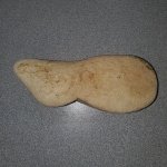
The "Peralta" Stone Maps --- On Their Own

Nov 8, 2004
14,582
11,942
Alamos,Sonora,Mexico
Primary Interest:
All Treasure Hunting
Sheesh, I have no-one on ignore, not even Cactus or Cubber :laughing7: (I wanna know just what :censored: they are saying about me, prob. true, but what the heck. Just do not read their post.

Old doctrine that I had beat into my training to become an Officer --- "Know thy enemy".

Coffee all around? fresh pot.

Don Jose de La Mancha
 

Last edited:

Somero

Hero Member
Sep 10, 2012
680
498
Primary Interest:
All Treasure Hunting
Don Jose

I think some folks are interested in your Beautiful Mule, got any pictures :laughing7:
 

cactusjumper

Gold Member
Dec 10, 2005
7,754
5,388
Arizona
Sheesh, I have no-one on ignore, not even Cactus or Cubber :laughing7: (I wanna know just what :censored: they are saying about me, prob. true, but what the heck. Just do not read their post.

Old doctrine that I had beat into my training to become an Officer --- "Know thy enemy".

Coffee all around? fresh pot.

Don Jose de La Mancha

Don Jose,

After a few posts, many of these birds are pretty transparent. Wouldn't want to stick around to long. Some of their droppings could accidentally get on ya.:walk:Might even ruin a fine pair of boots.:dontknow: For sure they could foul up yer coffee.:coffee2:

Take care,

Joe
 

Last edited:

Dirty Dutchman

Sr. Member
Dec 27, 2010
324
72
Arizona
Detector(s) used
My Brain
Primary Interest:
All Treasure Hunting
You have to watch out for those self proclaimed "lone loonies" too.... They seem to only want to discount the opinions and thoughts of the people they don't agree with.

But I'm with my amigo Don Trampy... Don't put anyone on ignore, you never know when a "nugget" will show up that will help your search.

Travis
 

markmar

Silver Member
Oct 17, 2012
4,117
6,259
Primary Interest:
All Treasure Hunting
Ellie Baba

What about Sara ? Tell us your news . Your famous team have found the cipher of the stone tablets ?
 

cactusjumper

Gold Member
Dec 10, 2005
7,754
5,388
Arizona
Sheesh, I have no-one on ignore, not even Cactus or Cubber :laughing7: (I wanna know just what :censored: they are saying about me, prob. true, but what the heck. Just do not read their post.

Old doctrine that I had beat into my training to become an Officer --- "Know thy enemy".

Coffee all around? fresh pot.

Don Jose de La Mancha

Don Jose,

"Know thy enemy" has been an oft' voiced adage for Carolyn and myself for a number of years now. We usually say that when we listen to Liberals.

For some of these posters, it doesn't take long to realize they have nothing to say......worth listening to. At that point, it's like reading the print on your cereal box at the breakfast table.:BangHead: On the other hand, folks like bb used to, at least, make historical statements that made worthwhile fodder for further research, now and again.
Take care,

Joe
 

markmar

Silver Member
Oct 17, 2012
4,117
6,259
Primary Interest:
All Treasure Hunting
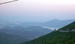
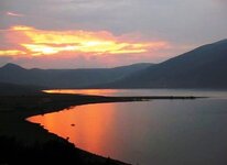
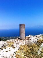
I owe few pictures from the vicinity of my home . Enjoy these

1.jpg 2.jpg Survey pillar about 1800 ft high.jpg
 

roadrunner

Bronze Member
Jan 28, 2012
1,230
520
Pinal Mountains,Arizona
Detector(s) used
Garrett Groundhog-2012-1st MD.
White's Goldmaster V/Sat-2nd-MD-2013
Tesoro Lobo-2015-3rd
Primary Interest:
Prospecting
Here is something to kick around I just fornd. Cli9ck on the link below and go to this site.
At the bottom of the page,there is a remark from a person that has found markers in Utah.
Now,he saws he found on some rocks different markings.
read the next to the last post at the bottom of page,and look at lower right corner.
2 of these markings he knows.
1- is an 8
2- is an F
Now look at the pic at the bottom of the page and see the mark in the lower right corner.
What does that mark remind you of?
Where did you see it at.
A little hint,it is at the lower right corner of another map.

Here is the info.
 

Nov 8, 2004
14,582
11,942
Alamos,Sonora,Mexico
Primary Interest:
All Treasure Hunting
G'morning peeps, coffee around. My thoughts, "ain't mother Nature grand, she can duplicate whatever you are looking for if you look hard enough, sorta like cloud watching. However to obtain a bit of surety, always go beyond the actual point of interest and see if the anomaly (s) continue, if it does, then thank Mom Nature.. Most searchers don't do this.:dontknow::icon_scratch:

Don Jose de La Mancha
 

markmar

Silver Member
Oct 17, 2012
4,117
6,259
Primary Interest:
All Treasure Hunting
Here are some of my thoughts and lets see if we can chase the crickets away.

I don't think there is an "official" cypher for the Stone Maps. Now if they are a hoax, they are truly brilliant since they can be matched to so many different areas or "markers" and have kept so many searching for the solution. I'm sure some of the "markers" in the Superstitions are fake and others have been destroyed, so it is hard to be sure of whats genuine anymore. Not that true "markers" are not out there still, but you really have to question what your seeing. So if they are a hoax whoever made them really knew the Superstitions so its possible they lead to something, maybe a whole in the ground or a note in a bottle.

As for the Latin Heart and Crosses, I'm not sure they are authentic or even have any ties to the Stone Maps other than similar markings and supposedly being found in the Superstitions, to me they seem like tainted evidence since the originals are no longer available. The Latin Heart contains allot of information for what could be a small area, to me it would seem more logistically sound just to send miners into the area and have your smelting operation in an area less rugged, more of a base of operations with mining parties out in the mountains. Your ore comes out and supplies go in on the return trip instead of sending empty packs back. So I don't give much weight to the Latin Heart. The Stone Crosses, if they are authentic, may just be to a different location altogether and just part of a map with the other pieces missing.

If the Stone Maps are authentic, which I hope they are, are an incomplete set. The piece giving us a location to travel from and to is missing and could have had important information on it. It may be that the "Pillow case map" Tumlinson had was actually a rubbing of this piece and it allowed him to find the maps we have today. Fortunately we have the approximate location they were found which would, despite what other may think, point to the Superstitions as having the end of the map location. If the Jesuits had made these maps what could they possibly lead too, and why bother making the maps? There has to be something there, maybe a whole in the ground or a note in a chalice.

So just a few thoughts to kick around.

And now my thoughts about . From all my modes of investigation , I believe all the stone tablets , include the Latin and Crosses stone maps , are valid and have been carved by Peralta family .
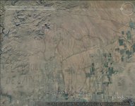
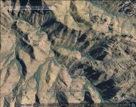
First we start with the horse map . The horse map match in the largest area than the others stone tablets . The horse " grazes " between Gila River ( the tail ) and the SW end of Supersyition Mountains ( the head ) , and his back is to the east . Maybe the author saw the horse image from the top of Hieroglyphic Canyon . We knew how the stone maps lead in the Superstition , because all the Peralta maps include Mesa Negra , Canon Fresca , Picacho , etc. . If the horse grazes north of a river and came from Santa Fe via Gila River , this means how grazes north of Gila River to the Superstition . After a detailed search , I found where match the horse . Because I heard something about the right horse's ear , later I saw how the right ear shows the beginning of the trail in the stones maps . The right ear is the Hieroglyphic Canyon .This is the horse in his place

Horse map.jpg

If you have match the horse well , mark the five dots on your map . This dots are mines . I know the name of two of these . The middle of the three continuous dots , is the LDM or Apache mine , and the top first of the two dots , is " De Cristo " mine .
After the horse will must to use the stones trail maps , which is little smaller than the horse map . How to use ? Match the X in the trail map with the three continuous dots in the horse map , and the other symbols with the ground shapes or points ( peaks ) . If you do correct this , you can see the trail from the start to the end . All the " LUGARES " are hills or tops of mountains .
When you will find the last hill ( the target ) use the Latin heart with the words up , reversed , and look if you are in the correct place . From the top of the last hill you can recognize the Perfil map to the south , and the priest map from north to south at the west of the hill .
The priest map is little bigger than the hill , and his head is carved at the NW from the hill . The mine ( CAVERNA AURUM ) was named " Someo Montana " because the priest hat shape . The priest shows with his cross the place of the mine , which is east from the hill . To find the mine , you must to match the stone cross with the words , from the east side of the hill and in the direction which shows on the priest wear . The Someo Montana mine is a gold cache .
Follow my thoughts , and maybe you will find the target .
 

Last edited:

markmar

Silver Member
Oct 17, 2012
4,117
6,259
Primary Interest:
All Treasure Hunting
Somero

The overlays are the only mode to decrypt the stone maps in this era . You must to approve the modern technology in the maps decrypting . Use the overlays to decrypt the maps and after go out there to ensure your quest . I am sure how on the top of any " lugar " is a monument or a mark . Don't underestimate the survey skills of some folks in that era .
If you want , just try to solve in my mode , and if you will do all correct and you will not find anything , after that maybe I am wrong .
 

roadrunner

Bronze Member
Jan 28, 2012
1,230
520
Pinal Mountains,Arizona
Detector(s) used
Garrett Groundhog-2012-1st MD.
White's Goldmaster V/Sat-2nd-MD-2013
Tesoro Lobo-2015-3rd
Primary Interest:
Prospecting
I was thinking that if the maps are made up. 3 of these signs in Utah,are the same as on the Stone maps.
If made up,some one new markers.Just to make it look authentic.
So,it is a superb job of a fake.
Unless they are real.
I just thought it weird that stone markings in Utah,also had a 8, F, and the tee pee sign or the sign of a military style wall tent. When all 3 have a connection to the P stones.
I was also looking at alchemy symbols. Like the upside down triangle or right side up triangle sometimes used on maps.
These both mean fire or water depending on which way oriented.
Like on the stone maps for instance,the triangle with the tail on it.
Could it mean waterfall?

[h=1][/h]
 

roadrunner

Bronze Member
Jan 28, 2012
1,230
520
Pinal Mountains,Arizona
Detector(s) used
Garrett Groundhog-2012-1st MD.
White's Goldmaster V/Sat-2nd-MD-2013
Tesoro Lobo-2015-3rd
Primary Interest:
Prospecting
@ Markmar,per your sentence here:QUOTE:I am sure how on the top of any " lugar " is a monument or a mark .UNQUOTE.

In this sentence it seems to me that you are using the word "lugar'.to mean the top of something,like a hill or mountain.
Which is what it is,because Lugar,or Lugares means Places, place, or Position. Not a mountain top only.
 

Last edited:

markmar

Silver Member
Oct 17, 2012
4,117
6,259
Primary Interest:
All Treasure Hunting
@ Markmar,per your sentence here:QUOTE:I am sure how on the top of any " lugar " is a monument or a mark .UNQUOTE.

In this sentence it seems to me that you are using the word "lugar'.to mean the top of something,like a hill or mountain.
Which is what it is,because Lugar,or Lugares means Places, place, or Position. Not a mountain top only.

Any " lugar " is a place , that is a hill or a mountain top with the shape around . I post the first three lugares of the stone map to see what I mean .
PS
In this picture you can localize the first down X ( mine ) of the stone map .

Lugares.jpg
 

Last edited:

markmar

Silver Member
Oct 17, 2012
4,117
6,259
Primary Interest:
All Treasure Hunting
RR

If they are fake somebody sure did their homework. The triangle with the tail could be a waterfall, I think some symbols have more than one meaning that is combined with others to get the the answers for directions.

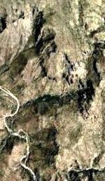
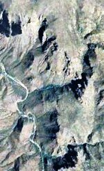
As I wrote , the symbols in the map are ground shapes . The triangle with the tail is about 1 mile long . I post the triangle in two different pictures , to have a better understanding .

arrow 1.jpg arrow 2.jpg
 

johnmark29020

Sr. Member
Oct 8, 2012
322
216
oklahoma
Primary Interest:
All Treasure Hunting
two things i have been wondering. water source and storage. if i were going to send a large team of miners into a area. i would make sure there was plenty of clean water. Also where would i store my gold until it was time to return home. I read about a man whos grandmother told him of a two room cave near weaver needle. one room was full of gold bars and the other was a large pool of clean water.
If that info is correct. The gold could be brought to the cave,and fresh water sent out on the return trip. I also believe theres a hugh clue about this caves location. What do you guys think.
 

johnmark29020

Sr. Member
Oct 8, 2012
322
216
oklahoma
Primary Interest:
All Treasure Hunting
also if there was a cave or dug out near weaver needle. it might explain a few thimgs. 1 the cave may be the start point of the stone map. if they are maps. 2 one version of waltzs directions have him passing weaver needle 3 it might eplain wwhere the mexicans were headed when they were attacked. if your position get over run. Wouldnt it make sense to fall back to a secure location. In this case their headquarters being at weavers needle. 4 The indians sealing the caassumingave so no one else could use it again.
Also waltzs was supposed to have said. I can see the military trail from mine but you cant see my mine from the military trail. Assume he did make that statement. could he have been refering to the trail that led to the fort. The supply trail. and if so. would weavers needle be to the south like he claim. also lining up three holls to look like one. Let say all of the above are right. Where would that place waltz. north west of the needle or Ne
or maybe dead center. What do you guys think.
 

Not Peralta

Bronze Member
Mar 23, 2013
2,167
3,061
Primary Interest:
All Treasure Hunting
exactly what type of google earth did they have in 1847 that would alow them to look down on this stuff, and theres no where in the supes that is high enough for you to see everything that your looking at on google,sorry, just one persons opinion.np
 

Dirty Dutchman

Sr. Member
Dec 27, 2010
324
72
Arizona
Detector(s) used
My Brain
Primary Interest:
All Treasure Hunting
exactly what type of google earth did they have in 1847 that would alow them to look down on this stuff, and theres no where in the supes that is high enough for you to see everything that your looking at on google,sorry, just one persons opinion.np

No, but they did have hot air balloons back then. Which COULD be used to map things from above. There is another gentleman that posts here that has proposed this theory. I don't buy it, but until someone figures it out, his theory is as good as anyone's.

Thanks
Travis
 

Top Member Reactions

Users who are viewing this thread

Top