the priest map or witch map

somehiker

Silver Member
May 1, 2007
4,365
6,426
Primary Interest:
All Treasure Hunting
David:
Although it's true that many map makers do use higher points from which to map an area,and I have done so myself, they do not design the maps so that the user must make near vertical ascents to those elevations in order to read the maps.
While the Stone Maps and Crosses do involve some elevation changes, they are not all that difficult to overcome.
And the Priest,for example,can be seen from points both high and low.
And he stands upright, just like the Priest on the stone. (as does 393's priest incidentally)
But he can't be recognized as such from a satellite view of any kind.
Nor can he be seen from Weavers Needle.
But when I see a photo of you or one of these "so many others" standing on the summit of Weavers Needle,I may be able to take such theories seriously.
Until then...........
Some time back,there was a group working on the needle.
They never mentioned seeing a priest in any direction,but they did believe there was a treasure inside the peak.
Wasted a lot of dynamite.

Regards:SH.
 

Last edited:

vor

Bronze Member
Jun 8, 2012
1,764
453
Primary Interest:
All Treasure Hunting
Well i disagree with you Somehiker. It is well known in these parts, that in the past, if you wanted to explore new regions and get a better view of your surroundings, you would climb the highest point to get a better view. What better place to be, then on top of Weaver's needle?
besides, i think this is the best match for the priest map that is on this forum and so do many others. eveything is there and in it's place. The priest holding the cross, the blocks just in front of him and the cross and heart that are seen easily. I even had one person reply from a post i made awhile back, tell me that he did go there and found "something of interest" but wouldn't say what. So maybe you should take a better look before you try so fast to discredit what someone posts.
As these are obviously naturally occurring features are they just a coincidence or do you think parts could be man made?
 

vor

Bronze Member
Jun 8, 2012
1,764
453
Primary Interest:
All Treasure Hunting
Deletion of double post.
 

releventchair

Gold Member
May 9, 2012
22,419
70,889
Primary Interest:
Other
Somehiker. I gave a book ,(common ,nothing limited) to someone in Arizona who won,t be pokin around superstitions. Had an account of gal run assault on weavers needle. Nothing known to have been found but i like the zipcode.
 

Quinan Bear

Sr. Member
Nov 7, 2008
312
6
Grande Prairie Alberta
I believe that they sat upon Weaver's needle and saw the natural formation that makes up the priest and used that as a referrence. just like someone using a natural stone face as a marker. This priest is indeed natural and because it is so big there is no way for it to be removed easily. Also the fact that you need to be right on weaver's needle to see it makes it ideal for having to know where to be as a starting position to find the priest or the mine.
if you use a tree, cactus or a pill of rocks as markers, then someone can come and remove the tree or cactus or rocks and the map is no longer any use. If you realy want to have a map that can be used, even years after, then you need to use formations and markers that cannot be removed.

A good example of this is the horse with the mouth open and one ear up, the other ear down, that the apaches carved from stone. I believe it was Jacob waltz who commented that one of the ears were removed at one point by someone, but the horse itself is still there because it is so big. It is found on the northern edge of a mountain range and it faces west, just accross from the horse is the three symbols of the cresent,triangle and circle, and between the symbols and horse is the hole that is made through solid rock. you need to be at a certain spot just north of those markers and at the right time of day in order to see them all.

Another example would be one that i saw on an Indiana Jones movie, the holy grail. the canyon of the cresent moon was so big that it would be very difficult to remove it.
 

Quinan Bear

Sr. Member
Nov 7, 2008
312
6
Grande Prairie Alberta
David:
Although it's true that many map makers do use higher points from which to map an area,and I have done so myself, they do not design the maps so that the user must make near vertical ascents to those elevations in order to read the maps.
While the Stone Maps and Crosses do involve some elevation changes, they are not all that difficult to overcome.
And the Priest,for example,can be seen from points both high and low.
And he stands upright, just like the Priest on the stone. (as does 393's priest incidentally)
But he can't be recognized as such from a satellite view of any kind.
Nor can he be seen from Weavers Needle.
But when I see a photo of you or one of these "so many others" standing on the summit of Weavers Needle,I may be able to take such theories seriously.
Until then...........
Some time back,there was a group working on the needle.
They never mentioned seeing a priest in any direction,but they did believe there was a treasure inside the peak.
Wasted a lot of dynamite.

Regards:SH.

Yea i know about that group, they were told by the apaches that "from weaver's needle, the entrance to the cave can be seen". So taking this litteraly, they tried to open the entrance by blasting the top of weaver's needle. But the truth is, that if your on weaver's needle, you can see the cave entrance in the distance. Also i would like to note that because this section of the needle was removed, it is no longer easy to climb the peak as it once was before that happened. There also was a ladder attached to the needle at one time. I believe there is still remnents of it in places.


As far as 393's priest being used a map......you deffinetly would need to be in the sky to see it. as for my priest you just need to be on weave's needle. And mine is exactly like the map....
 

Last edited:

393stroker

Hero Member
Jun 27, 2012
505
789
HOUSTON
Detector(s) used
Garrett pro-something
Primary Interest:
All Treasure Hunting
HORSE MAP.jpg This horse figure is on the east side of White Mt. where I believe the Preist Map is depicted. Take a close look to the left and you can make out several 5`s, take your pick.
 

peralta

Sr. Member
Sep 28, 2011
389
45
oahu hawaii
Detector(s) used
Whites 2-box
Primary Interest:
All Treasure Hunting
Hello, 393stroker,there is someone from this treasurenet that has used my information and I can't say much. What you are looking for is not there but if you stand in the right location and your standing on ground level it can be seen.
 

Quinan Bear

Sr. Member
Nov 7, 2008
312
6
Grande Prairie Alberta
I know that for some of you, it is hard to think that someone would climb the top of weaver's needle just to make maps to show the locations of thier mines. I believe that they did, and for the simple reason that not everyone would think to use that spot to search for the mines. I have shown you the view of the priest and it matches the map from the pointed hat to the cross on the shoulder and the stones in front of him as well as the large cross that he is holding and the heart next to it. I also had someone that was interested in what i showed, go there and tell me that he found a place that had tailings and what very well could be the location of the buried mine with marking on the stones nearby. So either it is by accident or the fact that i am right, that this place has those things there. So in my opinion, you can go look for youself or just deny my findings without really testing my results for yourself, either way i feel 100% that i am onto a good thing and can see ALL the places that the "priest" "lower trail" and "upper trail" maps are showing and will stand by my finding as being right. The location shown by dirty Dutchman, is the same spot that is shown as the trail that is passing through the two trail stone maps.
 

cactusjumper

Gold Member
Dec 10, 2005
7,754
5,388
Arizona
I know that for some of you, it is hard to think that someone would climb the top of weaver's needle just to make maps to show the locations of thier mines. I believe that they did, and for the simple reason that not everyone would think to use that spot to search for the mines. I have shown you the view of the priest and it matches the map from the pointed hat to the cross on the shoulder and the stones in front of him as well as the large cross that he is holding and the heart next to it. I also had someone that was interested in what i showed, go there and tell me that he found a place that had tailings and what very well could be the location of the buried mine with marking on the stones nearby. So either it is by accident or the fact that i am right, that this place has those things there. So in my opinion, you can go look for youself or just deny my findings without really testing my results for yourself, either way i feel 100% that i am onto a good thing and can see ALL the places that the "priest" "lower trail" and "upper trail" maps are showing and will stand by my finding as being right. The location shown by dirty Dutchman, is the same spot that is shown as the trail that is passing through the two trail stone maps.

QB,

Can you tell us, precisely, which marking on the Trail Maps points out Travis' location?

Thanks,

Joe
 

Quinan Bear

Sr. Member
Nov 7, 2008
312
6
Grande Prairie Alberta
I did tell you which marking point to Dirty Dutchman's location...." is the same spot that is shown as the trail that is passing through the two trail stone maps", it is also the same spot shown in the upper left of the horse map, with the 2 mines and the #5 between a line. the top of the mountain and those to the east of there match the outline of the line seen on the Horse map. the lower mine is the one that is reffered to as, the one that has a dangerous foot path leading down to it, and the upper one is the one that is easier to get to. The mine that you see just above the neck of the horse, is what the natives called "the gold vault" and the same one that they say " From the top of weaver's needle, you can see the entrance to the cave/mine". All Dirty Dutchman has to do is look at his pic of the four peaks and the second peak from the left will have the "cross" cut in the cliff and the "Circle, Cresent and triangle" just to the left of that, then from there he will find the upper entrance and southwest from that will be the lower entrance just below the cliff. If he continues up the canyon, he will come to two more mines towards the northern end of the mountain range and if he goes up the canyon just a bit, he will see to the east near the bottom of the other canyon below, a large pile of tailings that was put there from making the Gold Vault.

As i said before, i know how to read the stone maps and have the locations for all the mines listed on them.
 

Dirty Dutchman

Sr. Member
Dec 27, 2010
324
72
Arizona
Detector(s) used
My Brain
Primary Interest:
All Treasure Hunting
I did tell you which marking point to Dirty Dutchman's location...." is the same spot that is shown as the trail that is passing through the two trail stone maps", it is also the same spot shown in the upper left of the horse map, with the 2 mines and the #5 between a line. the top of the mountain and those to the east of there match the outline of the line seen on the Horse map. the lower mine is the one that is reffered to as, the one that has a dangerous foot path leading down to it, and the upper one is the one that is easier to get to. The mine that you see just above the neck of the horse, is what the natives called "the gold vault" and the same one that they say " From the top of weaver's needle, you can see the entrance to the cave/mine". All Dirty Dutchman has to do is look at his pic of the four peaks and the second peak from the left will have the "cross" cut in the cliff and the "Circle, Cresent and triangle" just to the left of that, then from there he will find the upper entrance and southwest from that will be the lower entrance just below the cliff. If he continues up the canyon, he will come to two more mines towards the northern end of the mountain range and if he goes up the canyon just a bit, he will see to the east near the bottom of the other canyon below, a large pile of tailings that was put there from making the Gold Vault.

As i said before, i know how to read the stone maps and have the locations for all the mines listed on them.

LMAO..... Good luck trying to climb anywhere near the "four peaks" shown in my photo. Maybe a skilled climber with equipment... But not a bunch of Mexicans with burros and sandals.... Great story though.... LOL

Travis
 

Quinan Bear

Sr. Member
Nov 7, 2008
312
6
Grande Prairie Alberta
Maybe difficult from where you took the picture from but not if you Come from the side, Remember !!! and i do recall you saying that the mexicans had a camp further up the canyon, maybe the foot path is near there...... If you would like, i could post a better pic from google earth showing the location a little better for the rest to get a better view of the area.
 

Quinan Bear

Sr. Member
Nov 7, 2008
312
6
Grande Prairie Alberta
LMAO..... Good luck trying to climb anywhere near the "four peaks" shown in my photo. Maybe a skilled climber with equipment... But not a bunch of Mexicans with burros and sandals.... Great story though.... LOL

Travis

I would think that a 45 degree slope could be climbed without any equipment. And if you came from the side, then it would be even easier. What makes you think that it would be so difficult ? Maybe you're like the others? trying to deny what i post, but you, like the other will be shown in the end that i know what i'm talking about. I have spent many years looking for the mines shown on the maps, and soon will show the world where they all are. I'm just waiting for my partners to send in all the documentations that they have gathered for me along with my own research to be completed.
You have found one mine out of over a dozen, or at least you are near to finding one mine... That is good, considering that you're the only one that has, or at least has the courage to post about it.
 

Dirty Dutchman

Sr. Member
Dec 27, 2010
324
72
Arizona
Detector(s) used
My Brain
Primary Interest:
All Treasure Hunting
Maybe difficult from where you took the picture from but not if you Come from the side, Remember !!! and i do recall you saying that the mexicans had a camp further up the canyon, maybe the foot path is near there...... If you would like, i could post a better pic from google earth showing the location a little better for the rest to get a better view of the area.

From where I took that pic, you do "Come in from the side". On a very old trail. It's no where near the top of the hill. You can post whatever you like. And I hope the guys you have working for you aren't who I think they are. If it is, I hope you're not paying them....

I mean you no offense, it's just that I get daily messages from people telling me they think I've got it all "figured out", I just need a little help with the final pieces, and they know exactly what I should do. I don't mind getting messages asking for help with things like supplies I suggest, routes, etc. I don't mind helping out. I've spent a Lot of time in there. About 26 trips now in less than two years and I haven't died. Never even been in a jam. I went 21 miles in 10 hours once. With a two hour break in between. These types questions I don't mind.

Enough with the suggestions though. Any questions I have unanswered can probably only be answered by one or two people, and they are most likely never going to tell me. I'm the only one who can answer for me what I need to know, and if this friggin place would just cool off even a little bit, I'd have my answer.

Thanks
Travis
 

Dirty Dutchman

Sr. Member
Dec 27, 2010
324
72
Arizona
Detector(s) used
My Brain
Primary Interest:
All Treasure Hunting
One more thing. The Mexicans weren't camped further up the canyon. They camped "above, on (or up) high" meaning they were OUT of the canyon. That's where I found their camp, and the trail that "comes in from the side"

Thanks
Travis
 

Quinan Bear

Sr. Member
Nov 7, 2008
312
6
Grande Prairie Alberta
Don't mean to get you upset Dirty Dutchman, i was just trying to point out that the cross is seen in your picture of the four peaks (between the middle yellow arrow and the red line). the mine shaft is near that cross in a sunken area covered in vegetation.
As for the people that are helping me gather information. they are just folks that have an interest in what i know and are willing to go to certain places for me, while they are in the superstitions. They are going there for other reasons but are being nice enough to help me out with a few pics of certain areas while they are there. For their help, i will be sure to add them as equal partners in the event that any money may come from all this.
 

Dirty Dutchman

Sr. Member
Dec 27, 2010
324
72
Arizona
Detector(s) used
My Brain
Primary Interest:
All Treasure Hunting
QB

You didn't upset me at all. If the mine is up there where you say it is, then people with wings mined it. What you don't see is, over that hill in front of me in the photo is a massive drop off. There is no physical way to get up to those peaks in my photos. None. It's shear cliff, so there is no where for a trail to be. I'm sure if someone looks hard enough you can find the Easter bunny somewhere in those rocks.

Thanks
Travis
 

Quinan Bear

Sr. Member
Nov 7, 2008
312
6
Grande Prairie Alberta
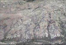
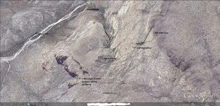
This is a google pic of the area, it shows the locations of the stone house, millitary trail, cliff with cross, the "Y", and the vegetation. This vegetation is the key and to get to it you will need to find the "Dangerous foot path". Where you were was just a trip to the cave. To get to the mine will not be so easy. This is only one of two mines in the immediate area and there are more if you follow the trail north.
dd.jpg

Don't seem to be much of a cliff there to me??? all i see is a crevase that is perhaps a 45 to 55 degree slope, still not a place that a person would need equipment to reach or even people with wings..lmao. Sure i see that there are cliffs in that area but you don't need to go there, all you do is bypass them.
Now! If you head west, past the vegetation and into the next crevase, you will find the waterfall is there below the cliff and up above is a location that you would find very interesting. But i don't expect someone like you to EVER go there....You would need wings. LMAO!!!
 

Last edited:

Top Member Reactions

Users who are viewing this thread

Top