THERE ARE A LOT OF DEAD PEOPLE WATCHING OVER IT.

mdog

Bronze Member
Mar 22, 2011
2,356
4,409
If it is an O.A.K. monument, it will have F.O. Cross carved into it with his street address Wabash Avenue Chicago Illinois. Then I would get excited about one of those oak monuments. Have you ever seen that on one of them Franklin? Rowe orered monuments from Cross when he was in Danville, that is a good sign that they are close by. It is pretty small sometimes and you have to be looking for it. I would love to spend some time down there but my plate is full. Good Luck My Friend, Good to hear from you again!

L.C.

P.S. It will be carved and not poured stone.

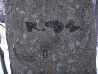
Hey L.C., that F.O. Cross might work in with that number 74 in some way. Cross is 3+18+15+19+19=74. 15+3=18 so you also have two 18s and two 19s. So maybe if you have the F.O. Cross on a monument, you don't need the 19' by 18' plot. Just a thought.
 

mdog

Bronze Member
Mar 22, 2011
2,356
4,409
We have the as above is below or as below is above symbol on one piece mdog and it may mean just what you are talking about in reference to star maps on the ground. :thumbsup:

When you say star maps, are you talking about that link I posted about the arborglyphs?
 

OP
OP
L.C. BAKER

L.C. BAKER

Silver Member
Sep 9, 2012
3,805
4,643
Nebraska City, Nebraska
Primary Interest:
Other
Cross is a common link between all of the monuments the O.A.K. had carved for this trail. I don't know about other trails it is just speculation. he did not sign every monument, but he did sign the special ones.
 

senior deacon

Sr. Member
Jul 3, 2014
432
892
Humboldt, Iowa
Primary Interest:
All Treasure Hunting
Mdog it was dumb luck in my case. I played around with with geometry and angles. This was a stumble across thing on my part. I will tell you that the 20 mile radius would be understandable. In that era people traveled by horse. The 20 mile radius was what a man could travel in a day. In this case the site laid some 16 miles from one of the two points. Which is close enough to 15 miles which is a significant number. Not everything can be exact!!!. Lols.

As I have said here before and it is no secret. Marshall was the headquarters of the western trans-Mississippi confederacy. At the time of the Civil War it was the third largest city in Texas. It was important enough that the exile Missouri capital was located there. It was the home of General Elkanah Greer the Grand Commander of the KGC in 1859. There is a story that a large amount of stamps and money were sent to Marshall towards the end of the war and could not be accounted for after the end of the war. Marshall was the headquarters of the post office of the trans-Mississippi also. On the town square today there is a monument to three people Peter Whetstone the town's founder, Elkanah Greer, and Sam B. Hall U.S. congressman from Marshall.https://en.m.wikipedia.org/wiki/Marshall,_Texas Please note the notable people who hail from this small town. If you read the whole article it alludes to the treasure trail I speak of. No doubt there is treasure in the county. Most likely hidden by the third degree KGC who were the rich planters and merchants that lived in and around Marshall. Marshall also has a rich Masonic heritage. Many of the buildings in and around Marshall have Masonic cornerstones. How many other southern town's are like Marshall I don't know but bet there are more than a few. Find them and treasure is near by.

Senior Deacon
 

Rebel - KGC

Gold Member
Jun 15, 2007
21,680
14,739
Rebel thank you for the shorter version. Chaos is chaos to me. I like to have a reason for why are things like they are. One of the quirks of my personality. Maybe I am crazier than I think of am.

I drove out to take a look at the site. Because of resent rains I am going to have to wait for the dirt road to dry up and out. Either that or get a ATV. The one road in was mud to the hubs of the truck. Joy wonderful joy it started in to rain while I was looking down the road. The weather forecast is for more rain. It is not kept but very old and almost forgotten.

One problem is the amount of cemeteries in Harrison county. Here is a list Harrison County Texas Cemeteries
It is not complete there is still two cemeteries that I know of that are not on the list. Some of these are ten graves or less. Some are 50 to 100 lots a lot are colored and the headstones are home made. Quite job just to put them on a map.

Senior Deacon
VERY interesting... all I remember is that Texas was the HOT-BED of KGC "activity"; Brownville, TX was VERY important... we still have "on-line" By-laws & 2nd Degree "workings" of the KGC CASTLE there, I think. "TX Jay" is the EXPERT on KGC TEXAS... SO! MANY cemeteries in TX, MAY BE "LOADED" with clues... DO NOT dig ANYTHING up!
 

Last edited:

mdog

Bronze Member
Mar 22, 2011
2,356
4,409
Mdog it was dumb luck in my case. I played around with with geometry and angles. This was a stumble across thing on my part. I will tell you that the 20 mile radius would be understandable. In that era people traveled by horse. The 20 mile radius was what a man could travel in a day. In this case the site laid some 16 miles from one of the two points. Which is close enough to 15 miles which is a significant number. Not everything can be exact!!!. Lols.

As I have said here before and it is no secret. Marshall was the headquarters of the western trans-Mississippi confederacy. At the time of the Civil War it was the third largest city in Texas. It was important enough that the exile Missouri capital was located there. It was the home of General Elkanah Greer the Grand Commander of the KGC in 1859. There is a story that a large amount of stamps and money were sent to Marshall towards the end of the war and could not be accounted for after the end of the war. Marshall was the headquarters of the post office of the trans-Mississippi also. On the town square today there is a monument to three people Peter Whetstone the town's founder, Elkanah Greer, and Sam B. Hall U.S. congressman from Marshall.https://en.m.wikipedia.org/wiki/Marshall,_Texas Please note the notable people who hail from this small town. If you read the whole article it alludes to the treasure trail I speak of. No doubt there is treasure in the county. Most likely hidden by the third degree KGC who were the rich planters and merchants that lived in and around Marshall. Marshall also has a rich Masonic heritage. Many of the buildings in and around Marshall have Masonic cornerstones. How many other southern town's are like Marshall I don't know but bet there are more than a few. Find them and treasure is near by.

Senior Deacon

It would be nice to know how many times the signs we study have led to a cache recovery. I'm thinking very few and probably no huge caches, but I don't know. There were probably personal caches that were hidden using Masonic symbols and geometry. This would be a good way to hide money for your family without having your fortune revealed in a will. The other big stuff that covers miles could have been an exercise between Masonic lodges that would demonstrate cooperation, coordination, navigation, surveying, engineering and on and on. Creating such sites across the country would be a terrific learning experience. Who knows.
 

sdcfia

Silver Member
Sep 28, 2014
3,663
8,899
Primary Interest:
Other
It would be nice to know how many times the signs we study have led to a cache recovery. I'm thinking very few and probably no huge caches, but I don't know. There were probably personal caches that were hidden using Masonic symbols and geometry. This would be a good way to hide money for your family without having your fortune revealed in a will. The other big stuff that covers miles could have been an exercise between Masonic lodges that would demonstrate cooperation, coordination, navigation, surveying, engineering and on and on. Creating such sites across the country would be a terrific learning experience. Who knows.

Supposedly, some of the smaller satellite caches ("traveling money", "protection nodes", etc) have been recovered - and maybe too some non-KGC caches that also used complex codes and geometry - but I would say not many. Even if a recovery was made, I can't imagine why it would be disclosed.

mdog, I like your triangle ideas of course. Another factor that may be useful is the 6x6 Township surveying system that Thomas Jefferson devised and that most states use for property legal descriptions and land divisions. 36 square mile blocks with all sorts of numerical coding schemes, permanent corners, "random" control points, marked stones, odd-shaped parcels, parcel ownership possibilities, topo map overlay possibilities, etc. Also, when searching out name associations, pay attention to who the state and county surveyors were too - I'm told some of them were players.
 

OP
OP
L.C. BAKER

L.C. BAKER

Silver Member
Sep 9, 2012
3,805
4,643
Nebraska City, Nebraska
Primary Interest:
Other
It would be nice to know how many times the signs we study have led to a cache recovery. I'm thinking very few and probably no huge caches, but I don't know. There were probably personal caches that were hidden using Masonic symbols and geometry. This would be a good way to hide money for your family without having your fortune revealed in a will. The other big stuff that covers miles could have been an exercise between Masonic lodges that would demonstrate cooperation, coordination, navigation, surveying, engineering and on and on. Creating such sites across the country would be a terrific learning experience. Who knows.

Mdog, it took from sometime in 1881 until 1970 ...that's 89 years of being viewed on a regular basis for the turtle on J.S. Morton's monument to be discovered for what it really was. If the carved symbols are in Yankee territory, it is a safe bet that they will be overlooked regularly. We have the three points of a triangle that lead to a major cache without a doubt, but we lack is the proper manpower and equipment for that search at this time. From what I have read that we are 70% there in three separate places! However, there are at least nine other caches that have not been recovered on this trail before you are supposed to get that far on the trail, if you work it out like you are supposed to. There is only a question of yardage when we get on sight to search. I agree about the shared navigation also, but I am sure the ones we are chasing are not a personal cache or sentinel pay. I won't be surprised if there is a large cache of arms and supplies that may be a part of it that was left by the K.G.C. to the O.A.K. who probably laughed at the black powder weapons when they returned to stash the chosen weapon of the late 1800's and early 1900's which was gold and ca$h. I will say this much about the big one we are in the process of locating with the three points of the triangle that the K.G.C. laid out in Nebraska, I can link the land back to someone that was involved with the O.A.K., and if you have seen the picture I posted of him setting in front of Arbor Lodge with that crowd, then you will know how much we like the area we located. :occasion14:
L.C.
 

Last edited:
OP
OP
L.C. BAKER

L.C. BAKER

Silver Member
Sep 9, 2012
3,805
4,643
Nebraska City, Nebraska
Primary Interest:
Other
Supposedly, some of the smaller satellite caches ("traveling money", "protection nodes", etc) have been recovered - and maybe too some non-KGC caches that also used complex codes and geometry - but I would say not many. Even if a recovery was made, I can't imagine why it would be disclosed.

mdog, I like your triangle ideas of course. Another factor that may be useful is the 6x6 Township surveying system that Thomas Jefferson devised and that most states use for property legal descriptions and land divisions. 36 square mile blocks with all sorts of numerical coding schemes, permanent corners, "random" control points, marked stones, odd-shaped parcels, parcel ownership possibilities, topo map overlay possibilities, etc. Also, when searching out name associations, pay attention to who the state and county surveyors were too - I'm told some of them were players.

Yes I agree 100%, that is all very good info sdcfia! Along this trail we have more than one town that was laid out and lots were divided up accordingly. In one case at Omaha there was a K.G.C. pay off or attempt to bribe with 10 corner lots of a man's choice. The end result was an early death for the double crosser at Omaha who made the bribe attempt to double cross the K.G.C.in land speculation. If you look into the Sulfur Springs land company at Saratoga Nebraska you will find what the secret society was capable of when you double crossed them. It is also a good observation of them bringing in a judicial pawn. In Nebraska City that surveyor theory holds water, and in other places that are under our investigation at this time. Surveyor General's office was in Nebraska City, Nebraska Territory on October 1, 1860. :thumbsup:

Map Showing the Progress of the Public Surveys in the Territories of Kansas and Nebraska | Civil War on the Western Border: The Missouri-Kansas Conflict, 1854-1865


https://www.kshs.org/kansapedia/john-calhoun/15131
 

Last edited:

mdog

Bronze Member
Mar 22, 2011
2,356
4,409
Supposedly, some of the smaller satellite caches ("traveling money", "protection nodes", etc) have been recovered - and maybe too some non-KGC caches that also used complex codes and geometry - but I would say not many. Even if a recovery was made, I can't imagine why it would be disclosed.

mdog, I like your triangle ideas of course. Another factor that may be useful is the 6x6 Township surveying system that Thomas Jefferson devised and that most states use for property legal descriptions and land divisions. 36 square mile blocks with all sorts of numerical coding schemes, permanent corners, "random" control points, marked stones, odd-shaped parcels, parcel ownership possibilities, topo map overlay possibilities, etc. Also, when searching out name associations, pay attention to who the state and county surveyors were too - I'm told some of them were players.

That's a good tip. The place I study is less than a mile from a principal meridian and I have noticed that there have been several places of interest that share the same section number but are in different townships.
 

Jan 14, 2014
44
51
southwest va
Detector(s) used
Garret ADS
Primary Interest:
All Treasure Hunting
Not trying to hijack this thread, but here is the pond I found with a similar shape. Thanks for all the suggestions. I may be able to check it out this week or next. POND.jpg POND2.jpg DSCN3255.JPG
 

Dr. Syn

Sr. Member
Feb 15, 2011
458
700
Lakeland, Florida
Just a straw brained scarecrow but thinking about the "74" bit. Anyone consider it as 7 4, aka July 4th, a pretty important date.

Or maybe reading it backwards it's 47, as in the 47th problem of Euclid?
 

senior deacon

Sr. Member
Jul 3, 2014
432
892
Humboldt, Iowa
Primary Interest:
All Treasure Hunting
Yes I agree 100%, that is all very good info sdcfia! Along this trail we have more than one town that was laid out and lots were divided up accordingly. In one case at Omaha there was a K.G.C. pay off or attempt to bribe with 10 corner lots of a man's choice. The end result was an early death for the double crosser at Omaha who made the bribe attempt to double cross the K.G.C.in land speculation. If you look into the Sulfur Springs land company at Saratoga Nebraska you will find what the secret society was capable of when you double crossed them. It is also a good observation of them bringing in a judicial pawn. In Nebraska City that surveyor theory holds water, and in other places that are under our investigation at this time. Surveyor General's office was in Nebraska City, Nebraska Territory on October 1, 1860. :thumbsup:

Map Showing the Progress of the Public Surveys in the Territories of Kansas and Nebraska | Civil War on the Western Border: The Missouri-Kansas Conflict, 1854-1865


https://www.kshs.org/kansapedia/john-calhoun/15131

L.C. a book that you really need to read that explains this very subject and was written about Nebraska is " Old Jules ". The author was the famous western author Mari Sandoz. Her father was Old Jules. He was one of the last locators in the northwest corner of Nebraska. He worked up in Cherry county in the Sand Hill country. This was the last Trac of land to be offered for homesteading by Teddy Roosevelt. It was what was call the Kinkade Act. She describes how the early surveyors marked corners and established lines and townships. It may be on the other side of the state from you but still the way business was done in Nebraska.


Senior Deacon
 

senior deacon

Sr. Member
Jul 3, 2014
432
892
Humboldt, Iowa
Primary Interest:
All Treasure Hunting
Just a straw brained scarecrow but thinking about the "74" bit. Anyone consider it as 7 4, aka July 4th, a pretty important date.

Or maybe reading it backwards it's 47, as in the 47th problem of Euclid?

Dr.Syn very good points. This is more of the 47th problem of Euclid. This is used for two reasons the first for the Eureka moment. Second as a teaching aid that complex problems can be solved. Which is what one has to do at time to get to that Eureka moment.:thumbsup:

Senior Deacon
 

mdog

Bronze Member
Mar 22, 2011
2,356
4,409
Just a straw brained scarecrow but thinking about the "74" bit. Anyone consider it as 7 4, aka July 4th, a pretty important date.

Or maybe reading it backwards it's 47, as in the 47th problem of Euclid?

Dr. Syn, you might be onto something with the 47th problem of Euclid. Here are the dimensions of the triangle. 4.81 miles, 3.47 miles and 5.88 miles, according to google earth. OK, that makes the squares 23.14, 12.04 and 34.57. 23.14+12.04=35.18 which is pretty close to a 90 degree triangle over such a long distance.

So the first clue from the manuscript put me at the 90 degree corner where I found the 74 clue that led me to the cemetery where I found the 18' by 19' plot and if I knew the 74 clue was associated with the 47th problem of Euclid, then I would know the shape of the triangle to look for and about how far away the final marker would be. Am I wrong anywhere? Good tip Dr. Syn. Thanks.

47th PROBLEM OF EUCLID - What is the meaning of this Masonic Symbol?
 

OP
OP
L.C. BAKER

L.C. BAKER

Silver Member
Sep 9, 2012
3,805
4,643
Nebraska City, Nebraska
Primary Interest:
Other
L.C. a book that you really need to read that explains this very subject and was written about Nebraska is " Old Jules ". The author was the famous western author Mari Sandoz. Her father was Old Jules. He was one of the last locators in the northwest corner of Nebraska. He worked up in Cherry county in the Sand Hill country. This was the last Trac of land to be offered for homesteading by Teddy Roosevelt. It was what was call the Kinkade Act. She describes how the early surveyors marked corners and established lines and townships. It may be on the other side of the state from you but still the way business was done in Nebraska.


Senior Deacon

I just ordered it off ebay, Thanks
 

OP
OP
L.C. BAKER

L.C. BAKER

Silver Member
Sep 9, 2012
3,805
4,643
Nebraska City, Nebraska
Primary Interest:
Other
L.C. a book that you really need to read that explains this very subject and was written about Nebraska is " Old Jules ". The author was the famous western author Mari Sandoz. Her father was Old Jules. He was one of the last locators in the northwest corner of Nebraska. He worked up in Cherry county in the Sand Hill country. This was the last Trac of land to be offered for homesteading by Teddy Roosevelt. It was what was call the Kinkade Act. She describes how the early surveyors marked corners and established lines and townships. It may be on the other side of the state from you but still the way business was done in Nebraska.


Senior Deacon

Old Jules arrived today along with a letter from lodge #153 for the installation of officers for the 2016 year. Just reminded me of you even more S.D. Thank you very much for the heads up on the book and the Freemason morals dogma you have passed along to us. :thumbsup:

L.C.
 

Last edited:
OP
OP
L.C. BAKER

L.C. BAKER

Silver Member
Sep 9, 2012
3,805
4,643
Nebraska City, Nebraska
Primary Interest:
Other
Dr. Syn, you might be onto something with the 47th problem of Euclid. Here are the dimensions of the triangle. 4.81 miles, 3.47 miles and 5.88 miles, according to google earth. OK, that makes the squares 23.14, 12.04 and 34.57. 23.14+12.04=35.18 which is pretty close to a 90 degree triangle over such a long distance.

So the first clue from the manuscript put me at the 90 degree corner where I found the 74 clue that led me to the cemetery where I found the 18' by 19' plot and if I knew the 74 clue was associated with the 47th problem of Euclid, then I would know the shape of the triangle to look for and about how far away the final marker would be. Am I wrong anywhere? Good tip Dr. Syn. Thanks.

47th PROBLEM OF EUCLID - What is the meaning of this Masonic Symbol?

I have often wondered about this starting in the center of the United States. There are some things that will soon unfold and I am not sure where they will lead. There is a triangle that is one thing for sure, and who knows what that will lead to. :thumbsup:
 

Top Member Reactions

Users who are viewing this thread

Top