1shotwade
Full Member
- May 29, 2014
- 189
- 107
- Detector(s) used
- white 4900/d
- Primary Interest:
- All Treasure Hunting
Here's the deal folks. I am studying four old maps of my area.They are,1853,1858,1883 and 1900.All of these maps show roads and homesites that are not in the same location as the other maps.
The property I live on has an old road going up the creek,from one side to the other in different places on each map. The homesites are in different locations.I remember this old abandoned road from the 50's and would like to ID it's actual location along with original homesites along it before all knowledge of them are lost.
I have found at least 20 homesites that no longer exist and would like to ID the actual sites to preserve for the future.I have been all over google earth trying to ID features of roads and sites but am not doing much good.It only goes back to 1998.
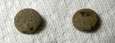
As it stands now I am thinking the only way I can do this is to actually walk the fields swinging the MD until hopefully I hit ald nails,glass,whatever that might give up some info.Is there something else that might help that I'm overlooking?And what about actually ID'ing the old road beds? Would you expect to get metal "hits" on old road beds from 1853 that was still in use in 1900?
I know I'm reaching here but don't know where to go from here.
Thanks for "anything".
Wade
The property I live on has an old road going up the creek,from one side to the other in different places on each map. The homesites are in different locations.I remember this old abandoned road from the 50's and would like to ID it's actual location along with original homesites along it before all knowledge of them are lost.
I have found at least 20 homesites that no longer exist and would like to ID the actual sites to preserve for the future.I have been all over google earth trying to ID features of roads and sites but am not doing much good.It only goes back to 1998.
As it stands now I am thinking the only way I can do this is to actually walk the fields swinging the MD until hopefully I hit ald nails,glass,whatever that might give up some info.Is there something else that might help that I'm overlooking?And what about actually ID'ing the old road beds? Would you expect to get metal "hits" on old road beds from 1853 that was still in use in 1900?
I know I'm reaching here but don't know where to go from here.
Thanks for "anything".
Wade