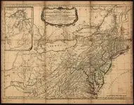
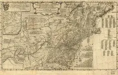
1776 Maps showing Eskippakathiki, etc.

Swifty

Full Member
Joined
Aug 13, 2007
Messages
125
Reaction score
68
Golden Thread
0
Location
Kentucky
Detector(s) used
Whites XLT (E- Series)
Primary Interest:
All Treasure Hunting
Hello all ye Swift Hunters,

Here are some maps I thought I'd turn ya'll on to, they show the Shawnee Village of Eskippakathiki, The Upper and Lower Shawnee Towns, Pict Town, and Chilicothe or The Hocking Hills area in Ohio. The show the War Path, a remarkable rock! as well as the latitudes and longitudes of many places, rivers and routes that were familiar to Christopher Gist, Thomas Walker, John Findley, Alfred Munday, Jonh Swift and Daniel Boone, etc. at that time. Dig in!!!

Sincerely,

Bill N. -aka- "The Swizard on T-net"
 

Attachments

  • 1776 map (2) (300x236).webp
    1776 map (2) (300x236).webp
    25.6 KB · Views: 2,411
  • 1776 map (300x191) (300x191).webp
    1776 map (300x191) (300x191).webp
    21.9 KB · Views: 1,992
Good find there Swizz! Thanks for sharing.
 

Thanks Swiz! I also have a 1750-1770 map showing trails through Kentucky. There is a main path marked that runs from the Lower Shawnee town through Eskippakathiki, and on to the "Big Gap"...One of my thoughts are that Swift used this path, going north 50 miles. Then on to the mines. I'll see if I can find this map, and post it here.. Till then Happy Hunting!

-Swiftfan-
Matt James
 

As usuall you are right on it Swiz! great maps!

Curtis
 

The Swizard said:
Hello all ye Swift Hunters,

Here are some maps I thought I'd turn ya'll on to, they show the Shawnee Village of Eskippakathiki, The Upper and Lower Shawnee Towns, Pict Town, and Chilicothe or The Hocking Hills area in Ohio. The show the War Path, a remarkable rock! as well as the latitudes and longitudes of many places, rivers and routes that were familiar to Christopher Gist, Thomas Walker, John Findley, Alfred Munday, Jonh Swift and Daniel Boone, etc. at that time. Dig in!!!

Sincerely,

Bill N. -aka- "The Swizard on T-net"
 

Hi all...
This is actually a great map, this very map made by the British of early America before the war. A friend had actually posted a link to this map on the facebook Swift page. If you zoom in it goes into alot of detail to the area at that time. Kentucky was still wilderness, Indian territory at that time.
It don't show the exact location of Eskippakithiki in this map. In 1765-66 Eskippakithiki was already abandoned and Burnt at that time. This map shows "Eskippakithikis" which was an Iroquois word meaning "place of blue licks & meadow land". The British were describing the area around the old Shawnee village in Ky by the name they heard it called by their Iroquois allies. Meaning meadowland or place of blue licks.
It also goes into great detail describing a place on the warriors path the Indians called "Ouasioto Pass" this was the only way south that they could ride on horse back. From Ohio this was the only pass south on the warriors path for 300 to 400 miles.
 

Re: 1776 Maps showing Eskippakathiki, etc. (Link to view these Maps)

Hello All,

Here is the link for the maps of the Middle British Colonies in America that I posted.... scroll down to.... 1776.13 and 1776.8, there is a magnification application...just click on map. The maps show the Ouasioto Mountains the Warriors path, the known saltlicks and also a remarkable rock. You can view them and many others at this link.


http://www.mapsofpa.com/antiquemaps27b.htm

Bill N. - aka - (The Swizard on T-net))
 

Re: 1776 Maps showing Eskippakathiki, etc. (Link to view these Maps)

The Swizard said:
Hello All,

Here is the link for the maps of the Middle British Colonies in America that I posted.... scroll down to.... 1776.13 and 1776.8, there is a magnification application...just click on map. The maps show the Ouasioto Mountains the Warriors path, the known saltlicks and also a remarkable rock. You can view them and many others at this link.


http://www.mapsofpa.com/antiquemaps27b.htm

Bill N. - aka - (The Swizard on T-net))
 

Maps
 

Top Member Reactions

Users who are viewing this thread

Latest Discussions

Back
Top Bottom