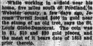
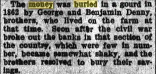
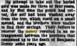
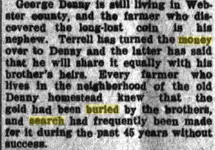
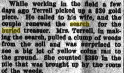
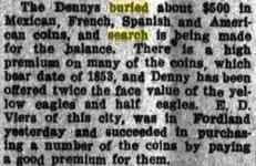
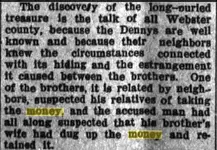
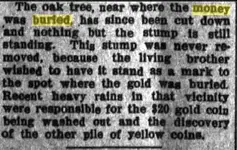
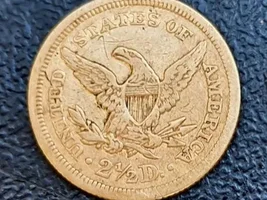
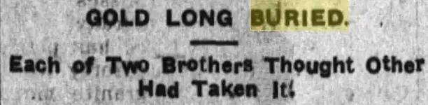
jeff of pa Super Moderator ⛭ Moderator 🥇 Charter Member Joined Dec 19, 2003 Messages 97,033 Reaction score 76,480 Golden Thread 2 🥇 Banner finds 1 Primary Interest: All Treasure Hunting Jan 21, 2020 Thread Owner #1 Pre 1862 Mexican , French, Spanish & American Coins Every Detectorist Knows There is always Something Left. And it Looks like Missouri Is still almost all Open Land all the way Down to Arkansas Last edited: Jan 21, 2020

Pre 1862 Mexican , French, Spanish & American Coins Every Detectorist Knows There is always Something Left. And it Looks like Missouri Is still almost all Open Land all the way Down to Arkansas
ARC Emerald Member Joined Aug 19, 2014 Messages 40,567 Reaction score 151,010 Golden Thread 0 Location Tarpon Springs Detector(s) used JW 8X-ML X2-VP 585 Primary Interest: All Treasure Hunting Jan 21, 2020 #2 That's it... I am buying a plow.
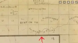
jeff of pa Super Moderator ⛭ Moderator 🥇 Charter Member Joined Dec 19, 2003 Messages 97,033 Reaction score 76,480 Golden Thread 2 🥇 Banner finds 1 Primary Interest: All Treasure Hunting Jan 21, 2020 Thread Owner #3 T.C. Strickland's new sectional map of Webster Co., Missouri.Created / Published [S.I.] : c1877. https://www.loc.gov/resource/g4163w.la000412/?r=0.011,0.792,0.735,0.384,0 Possible Southern End of Benton Twp, If Not under their Name in the 1870's "Father ?" Looks like Jas. Denny {Jason ?} View attachment 1792681 if that is the Twp line, Someone who knows the area Should be able to ID the creek and General Area. where the Farm stood. Though I don't expect them to be as Generous with the Info But a Post with Pics of the Finds, if any would be Cool No Proper Landmarks to Measure 5 Mile south of Fordland here https://www.freemaptools.com/how-far-is-it-between.htm Last edited: Jan 21, 2020
T.C. Strickland's new sectional map of Webster Co., Missouri.Created / Published [S.I.] : c1877. https://www.loc.gov/resource/g4163w.la000412/?r=0.011,0.792,0.735,0.384,0 Possible Southern End of Benton Twp, If Not under their Name in the 1870's "Father ?" Looks like Jas. Denny {Jason ?} View attachment 1792681 if that is the Twp line, Someone who knows the area Should be able to ID the creek and General Area. where the Farm stood. Though I don't expect them to be as Generous with the Info But a Post with Pics of the Finds, if any would be Cool No Proper Landmarks to Measure 5 Mile south of Fordland here https://www.freemaptools.com/how-far-is-it-between.htm